The Industrial Diagonal Highway
The development of the North Clark Road area has always interested me. This includes Clark Road, the Clarke Station neighborhood…
The Industrial Diagonal Highway
The development of the North Clark Road area has always interested me. This includes Clark Road, the Clarke Station neighborhood, Industrial Highway, parts of Brunswick and Ambridge, Tri-City, etc. We’ll start with Industrial Highway.
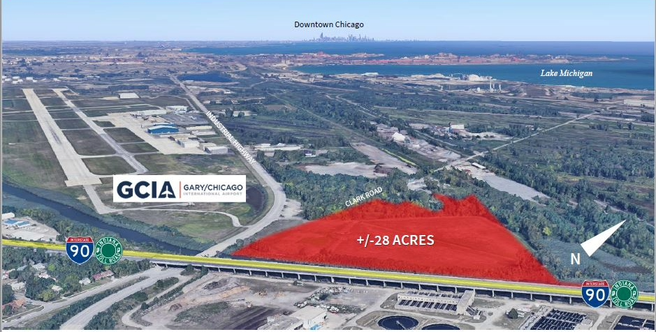
Industrial Highway/Airport Road runs to the right (north) of the airport. Clark Road heads to the right toward Lake Michigan.
Industrial Highway (Airport Road)
Automobile usage exploded after World War I. As expected, this also meant automobile production skyrocketed. This was good news for the steel and concrete business. The Region had a near monopoly on processing raw materials for both industries by 1921. Never before had Americans had the freedom to move around so freely. This meant that municipalities and local governments had to create infrastructure to accommodate not only increased personal-vehicle traffic but also to carve out roads for them.
In 1921, talks were underway to open the Indiana Dunes highway. This project was to pave an already existing road between Michigan City, Indiana, and Chicago, IL, which was the shortest route (about 25 miles). Gary was the largest city between the two, and it was definitely involved. To clear this up, though it was intended as a route for Chicagoans to reach the beaches, the construction zone that Lake County was responsible for lay between Miller (in Gary) and the Porter County line. The plans included constructing a road between Clarke Station and Indiana Harbor (now East Chicago, IN).
This is the birth of the Industrial Diagonal Highway, better known as simply Industrial Highway. It was called the “diagonal” highway because, geographically, the road wouldn’t run due north-south. No, it would run northwest to southeast, paralleling the Pennsylvania Railroad’s Fort Wayne line from Clarke Station to Cline Avenue.
How were people getting to and from East Chicago and Gary before? One route was Buchanan Street in Gary to reach North Clark Road, then take unsanctioned roads to Indiana Harbor through the industrial innards of Gary and East Chicago. The second, more economical way was to bypass Buchanan Street altogether by taking North Clark Road from Clarke Station. This required crossing a rinky-dink bridge over the Grand Calumet River, then crossing four different railroads to reach the point where Buchanan Street and North Clark Road merged. Then head west into East Chicago via the unsanctioned roads. The last was Cline Avenue, which was also precarious because it was extremely narrow and also not lit. Speeders would slide on snow and ice, run into moving trains and other cars, and slide into ditches or embankments. Driving back then was nothing like it is today.
Industrial Highway was to eliminate most of the hazards by helping to shunt traffic from East Chicago and Gary to and from Gary’s Buffington Harbor (where Universal Portland Cement’s gigantic factory was located) and to the industrial corridors adjacent to Guthrie Street and Michigan Avenue in the Harbor. For the first time, a road connecting East Chicago and Gary was built solely for vehicular traffic and did not have to be hindered by streetcars. Lastly, Industrial Highway would eliminate the before-mentioned railroad crossings and shorten the distance between East Chicago and Gary by a mile.
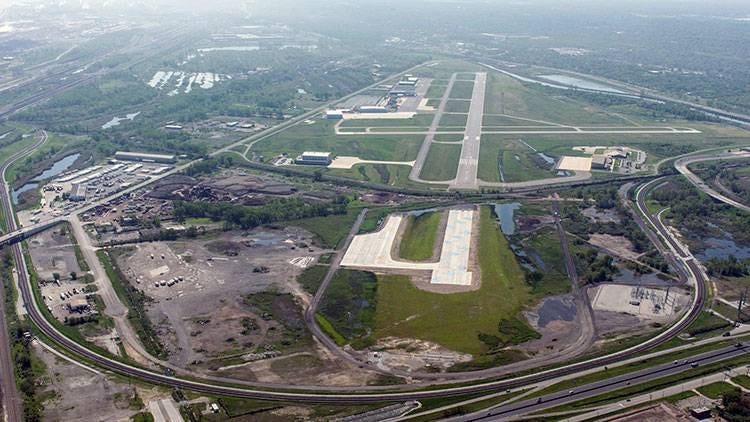
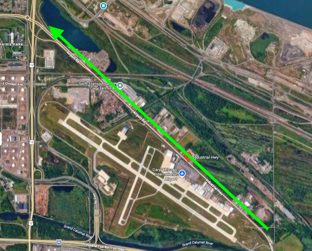
The Gary/Chicago International Airport is seen with Industrial Highway riding to the left (north).
Work began at once. The project was broken up into two parts. The first road was the “Hess Road.” The second road was the “Ridgley Road.” These were the names of the contractors hired to do the work. Hess was the president of the Automobile and Goods Roads Bureau of the Gary Commercial Club. Its contractor, the Illinois Improvement and Construction Company, named their portion of the road for Hess. The Ridgley Road’s name is unknown, but it was contracted by the Heiny and Wheeler Construction Company.
The locations of these separate roads constantly change in the press. However, for the most part, Ridgely Road started at 10th & Chase Street, went north to 5th Avenue, then west on 3rd Avenue, before meeting the Grand Calumet River, where they were responsible for building a brand-new bridge over it. It then continued northwest up Industrial Highway to Cline Avenue. The Hess Road was east of Industrial Highway, on North Clark Road. If you follow North Clark Road on a map, you will see how it goes north, crosses several railroad tracks, then turns west close to Lake Michigan, passing by the mills until reaching Guthrie. Hess Road was also known as the Industrial Highway, as it connected to the main road at two points.
Several subcontractors were involved as well, each responsible for different portions of the road. Hess and Ridgley worked toward each other, meeting at the riverbank. On paper, both roads were combined into what we know as Industrial Highway.
New Projects
By the winter of 1922, the first primordial version of Industrial Highway was ready for traffic, opening with a dedication ceremony that February or March. However, the road was rushed into service. It had not been paved. The highway terminated at what is now 5th & Chase Street. Back in the day, 5th & Chase was 5th & Industrial Highway. It wasn’t until June of 1924 that the Lake County Commissioners’ Office officially declared Industrial Highway to be completed.
It was the opening of Industrial Highway that prompted Gary’s Board of Works to seriously think about developing Chase Street south of 5th Avenue. This meant the city wanted to blow through the earth embankment of the Gary & Western high line between 8th & 9th & Chase Street. The Gary & Western was to design a bridge that would allow traffic to pass under it. The next railroad south of this location, the Michigan Central Railroad crossing at 10th & Chase Street, would be required to build crossing lights and gates, which they attempted to object to. However, this would be required to develop Chase Street beyond that point. The city got what it wanted, and the Industrial Highway project was expanded south from 5th & Chase to 10th & Chase. Work began in the late fall of 1923.
Plans to extend 4th Avenue (Gleason Road №4) west from Bridge Street began in 1924. 4th Avenue stopped at what was then known as 4th & Wabash Avenue. Wabash Avenue is still there, but there is no longer an intersection at 4th Avenue. The Gary Railways streetcars ran on 4th Avenue from Broadway to 4th & Bridge Street, where they turned south to meet back with 5th Avenue. The plan was to extend 4th Avenue from Bridge Street to Wabash Avenue, then to meet the new Industrial Highway. However, 4th Avenue was largely unused by vehicles because large swaths of it were unpaved. Paving coincided with the extension to Industrial Highway. The entire road from 4th Avenue to Industrial Highway (4th & Chase) opened in December 1925.
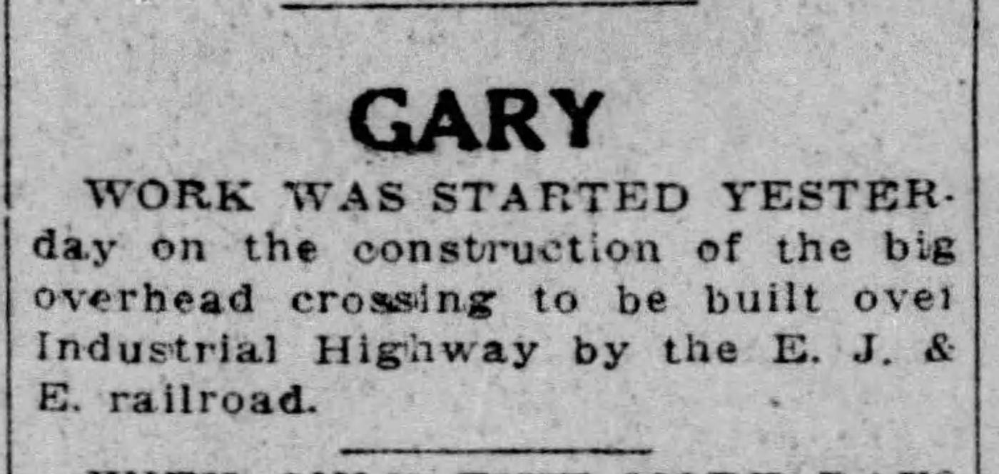
Article about the construction of the EJ&E flyover Industrial Highway, 1924.
Coinciding with the construction of the Chase Street extension project was the building of the Pennsylvania Railroad’s new Ambridge passenger depot, which sat at the terminus of Industrial Highway (5th & Chase). This depot replaced the long-shuttered Tolleston depot and opened in April 1930. The Gary & Western high line bridge over Chast Street was also completed that month.
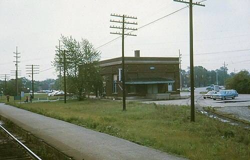
The Pennsylvania Railroad Ambridge Station, 5th & Chase Street, Gary, IN.
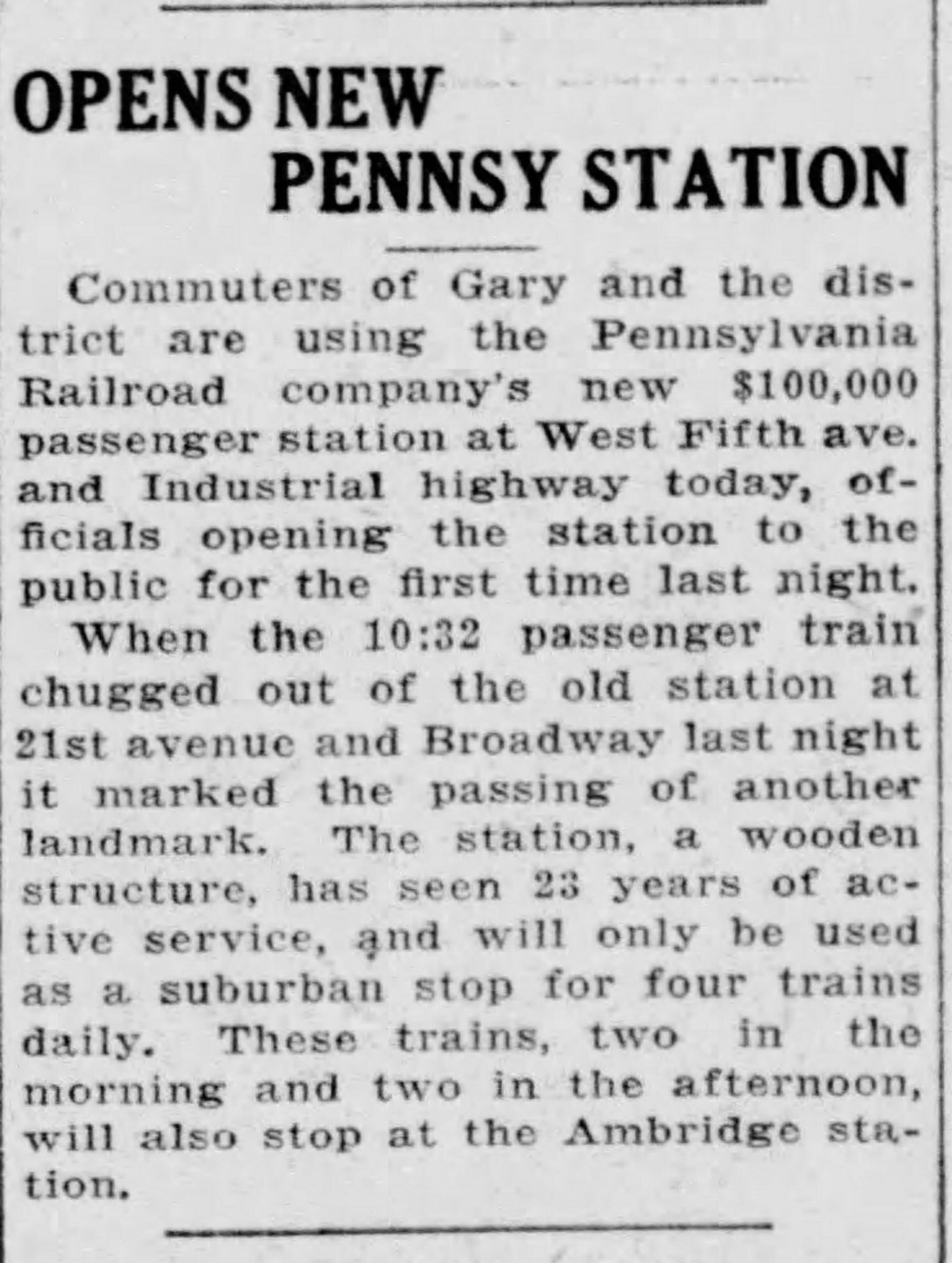
1930 article about the opening of the Ambridge station.
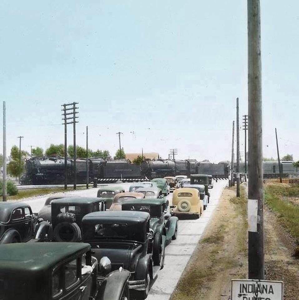
Pennsylvania Railroad stops at Ambridge Station. Traffic waits to pass at 5th & Chase Street, Gary, Indiana.
Immediate Problems
When Industrial Highway opened in 1922, the road was heralded by the public as a much-needed project that had borne much fruit. Yet, it didn’t take long for the lack of paving to become a major public safety hazard.
Almost immediately, Industrial Highway became a hazard. Several dozen wrecks occurred in the first few years. Speeding cars would be launched into the air, crashing violently into ditches and sand banks. A lot of these crashes resulted in severe injuries. Contractors were hired to do some paving, but it is unknown what the quality or the extent of their work actually was. Regardless, the newspaper archives are filled with accident reports.
During my research, I often came across accidents that occurred at Industrial Highway and the EJ&E crossing. This confused me, because there was no EJ&E crossing at Industrial Highwaym just a 200-foot bridge. Then it dawned on me. Perhaps there was no bridge there before Industrial Highway was built. Scrolling through endless searches, I didn’t see anything about an EJ&E bridge over Industrial Highway until 1924, when work began on it! So, the early accident reports I saw regarding this lost EJ&E crossing make more sense.
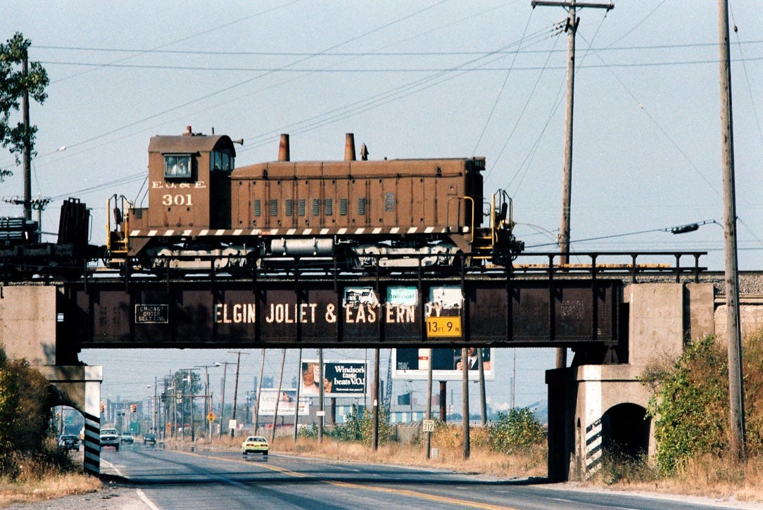
An EJ&E SW1200 №301 crossing at the Industrial Highway flyover. Demolished.
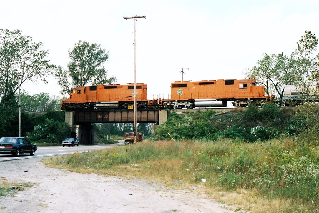
EJ&E №665 and No663 crossing at the Industrial Highway flyover. Demolished.
A major problem was the lack of nighttime lighting. Industrial Highway ran through an extremely desolate and undeveloped tract of land. There were no homes or businesses for large stretches. There were no streetlights. Not only did people speed dangerously down the road, but they did so nearly blind. Motorists were constantly being hit on the side of the road at night by other drivers.
The first reported fatality on Industrial Highway happened in December 1924, when William Kestoff ran into the support column of the EJ&E bridge at night. He was ejected and killed via a broken neck. From there, the injuries and accidents started skyrocketing. There were five accidents on Industrial Highway in one weekend alone. A man, James Skendes, was on the side of the road fixing a tire and was struck by a motorist. He died. Motorists still preferred using North Clark Road. Those who did were not used to the traffic on the new Industrial Highway.
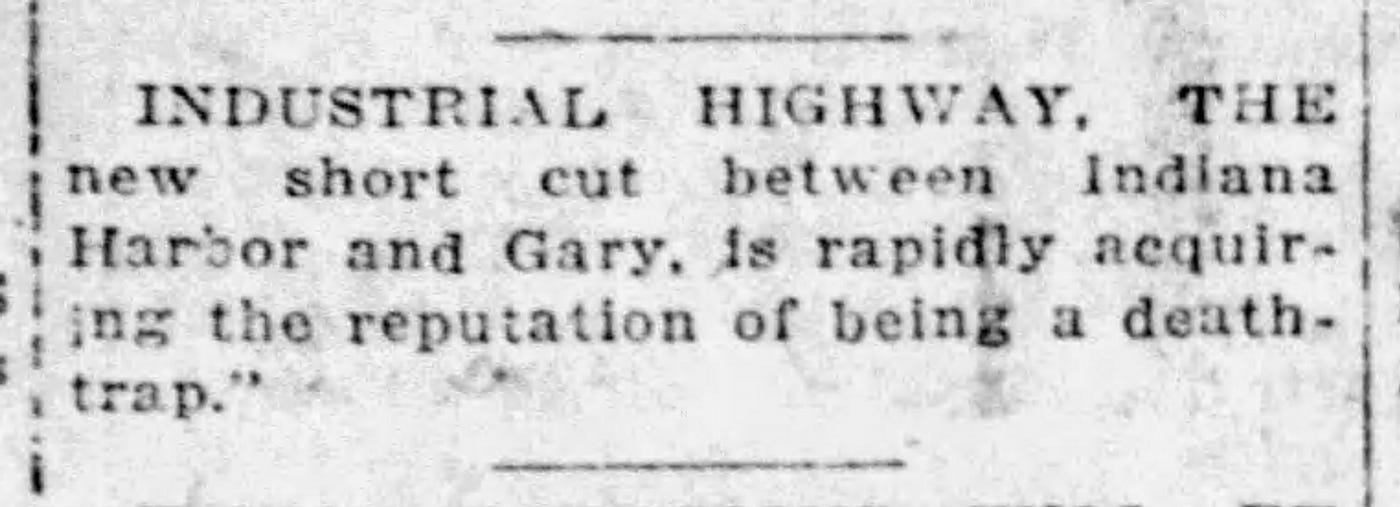
1924, NWI Times.
It took two years after opening for Gary to get the Lake County Commissioners to finally take lighting Industrial Highway seriously. Yet the first lights lit only the area between 5th Avenue and Clark Road. Municipalities started taking ads out in the papers, reminding people to be careful on Industrial Highway. The accidents did not stop; in fact, they increased exponentially throughout the 1930s. I couldn’t get past this era without seeing an article about a horrible accident. Hundreds upon hundreds of accidents! It is ridiculous!
Business and Connected Infrastructure
One notable project was with the South Shore Line. Industrial Highway required blowing through its embankment, where today 3rd Avenue crosses under its tracks. Today, this road is still labeled as Industrial Highway and W. 3rd Avenue. It takes you to the Gary Sanitation District headquarters, where 3rd Avenue is now a private road. This road (the Ridgely Road, as mentioned previously) is the original Industrial Highway route that led from the Grand Calumet River to 5th & Chase Street.
Below is a photo of the completed project, facing northwest. Notice how South Shore prominently advertises itself on the bridge. This bridge blow-through project was completed early on, in 1922.
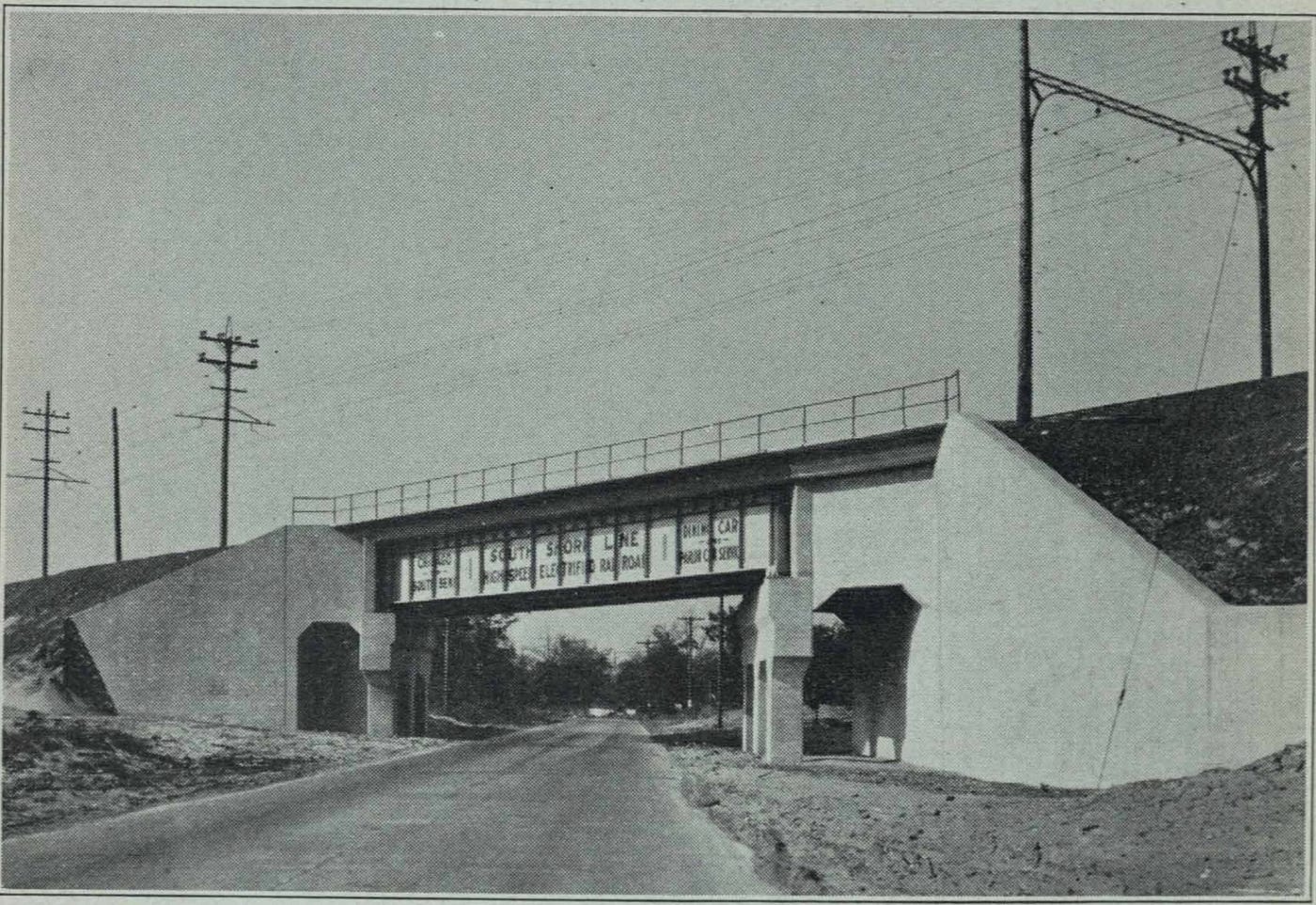
Industrial Highway and South Shore flyover, 1922.
This also allowed South Shore to construct freight interchange tracks with the Pennsylvania Railroad, work that wasn’t done until 1930. The pictures below show the project during initial construction. In the second photo, the Pennsylvania Railroad tracks are barely visible in the center. The old South Shore gauntlet bridge runs over them.
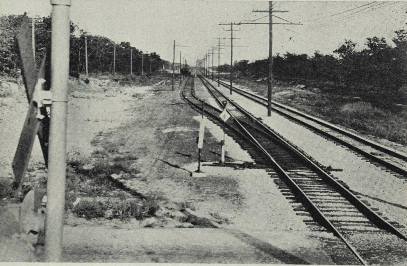
The South Shore/Pennsylvania Railroad freight interchange track was under construction in 1930. Looking east from Clark Road.
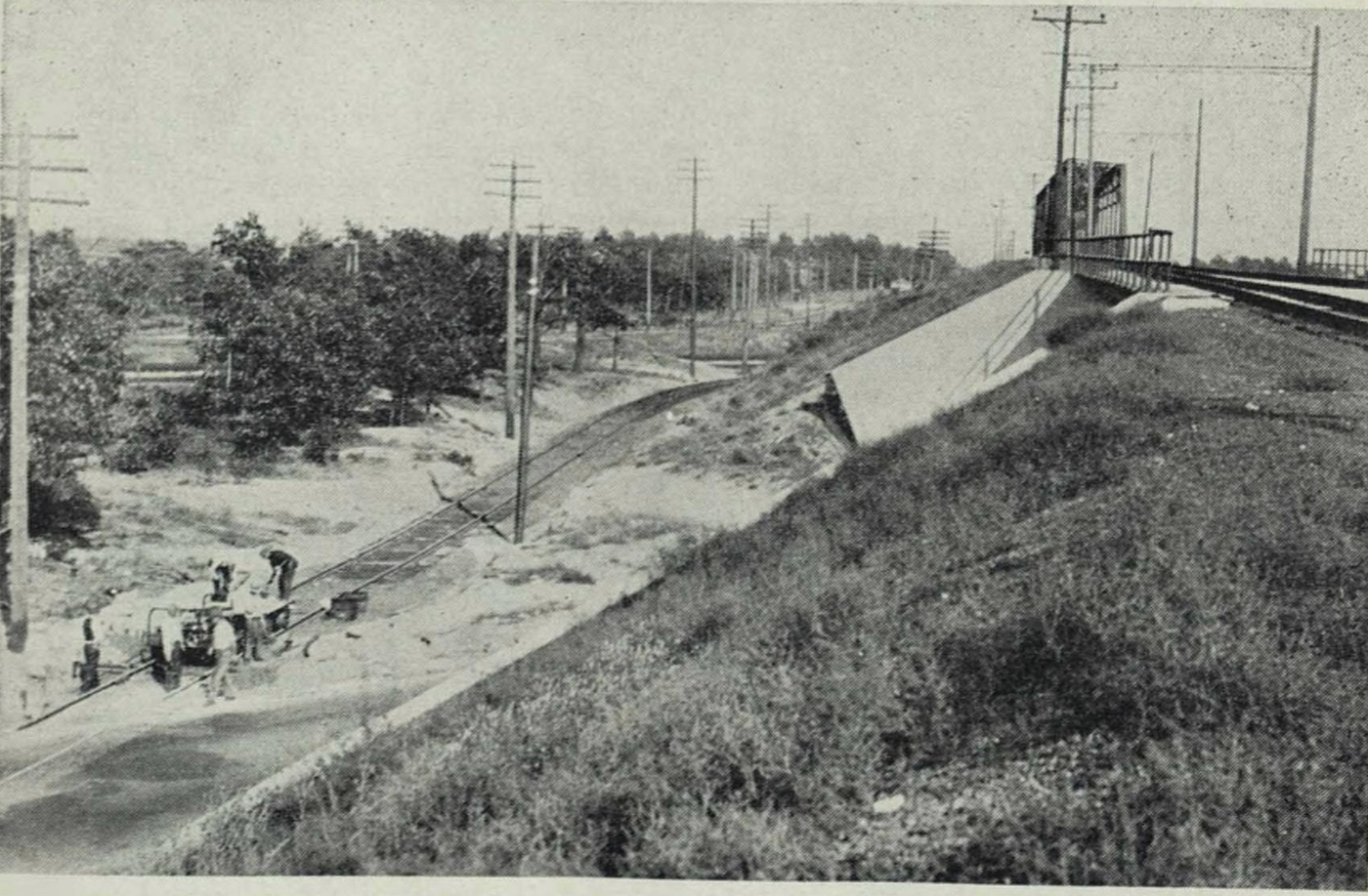
The Industrial Highway flyover as seen in 1930 during South Shore interchange construction. Looking east.
When this South Shore project was completed, it was agreed to install flashing lights at the crossing with Industrial Highway, as shown in the photo above. Two interchange tracks would be built, one track on each side of the raised railroad embankment. Total capacity for both tracks was 66 cars, 33 for each track.
In 1939, Johnson Oil Supply Company relocated to Industrial Highway. It originally sat at 9th & Marshall in Tolleston. When it opened, the Indiana Harbor Belt Railroad served it from the Gary & Western high line. Tolleston residents were unhappy with the constant gasoline fumes from the factory. It drifted over the neighborhood in thick clouds, causing the usual symptoms and reactions. Didn’t want to become the next Whiting! The property they used was leased from EJ&E.
Johnson Oil existed before opening a refinery in Tolleston. It disappeared after the company was taken over by the Navy during the Truman administration. The Truman Library has an archive of Executive Order 9639, which lists Johnson Oil as a company to be taken into Navy possession. The following link takes you to it!
https://www.trumanlibrary.gov/library/executive-orders/9639/executive-order-9639
Johnson Oil wasn’t open for three whole months before they moved to Industrial Highway. Councilwoman Katherine Patton wanted an investigation into industrial zoning in the city to prevent refineries from being located too close to residential areas. I don’t know what became of this investigation.
Fast forward to 2013. The Gary/Chicago International Airport is expanding. A casualty of this expansion was the aforementioned EJ&E bridge over Industrial Highway. It was demolished to build a brand-new bridge further east. A new vehicle bridge was built over the B&OCT tracks. It is the Quentin P. Smith Tuskegee Airmen Memorial Bridge. Smith was a bombardier with the Tuskegee Airmen Corps. He later became the first principal of Gary West Side High School.
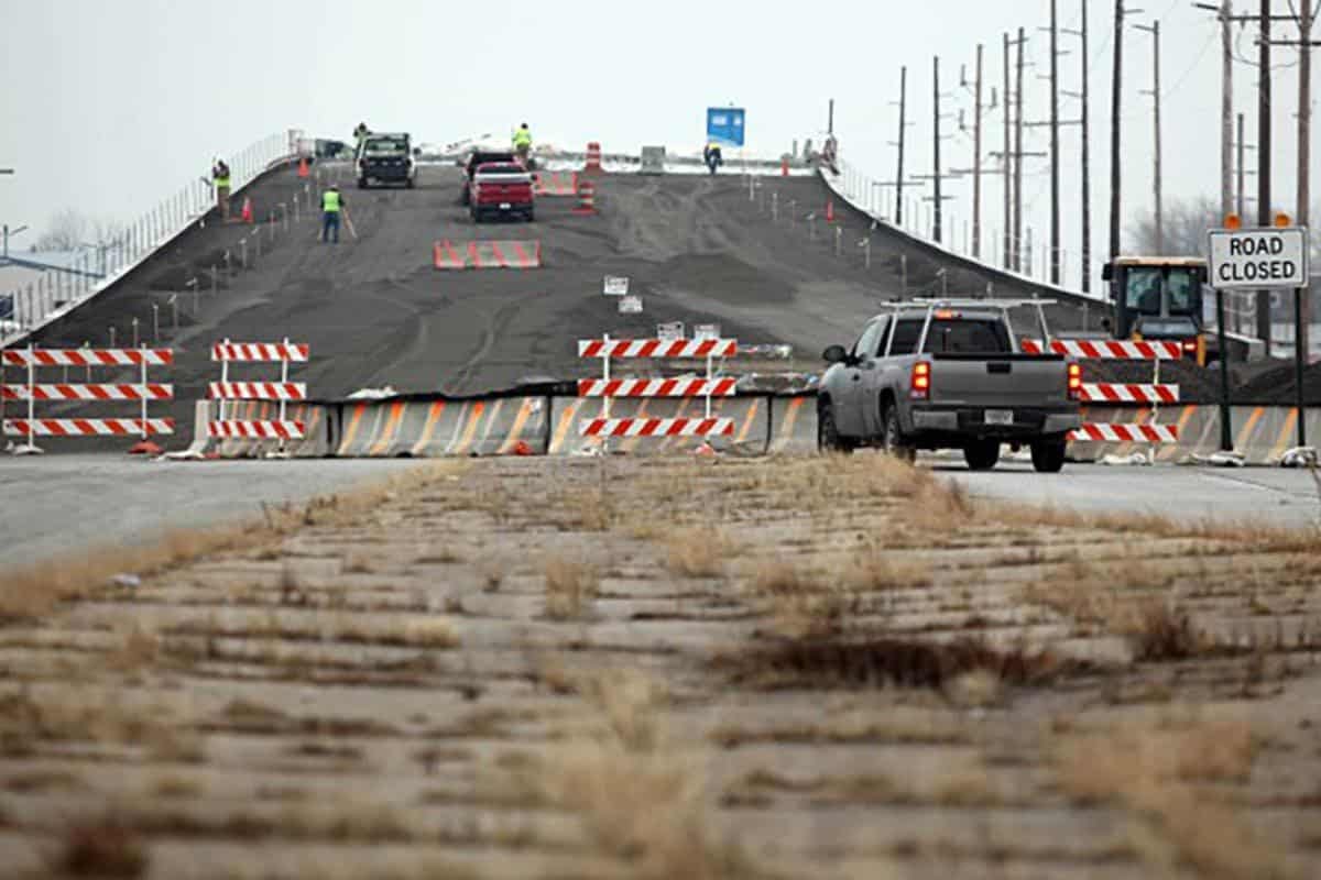
Construction of the new bridge over the B&OCT tracks, northwest of the airport, Industrial Highway.
Superior Construction was recently awarded a contract to build new cargo and corporate facilities at Gary/Chicago International Airport. A new cargo apron, a corporate apron, and a hangar will be built.
메타데이터
- post_id
- 8ea4e58dfd26
- slug
- the-industrial-diagonal-highway-8ea4e58dfd26
- url
- https://medium.com/@korryshepard/the-industrial-diagonal-highway-8ea4e58dfd26
- canonical_url
- https://medium.com/@korryshepard/the-industrial-diagonal-highway-8ea4e58dfd26
- author_url
- https://medium.com/@korryshepard
- status
- ok
- fetched_at
- 2026-06-26 21:52:29