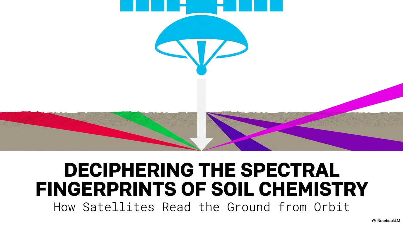
Your Satellite Image Is Just Raw Numbers. Here’s the Formula That Makes It Meaningful.
The math behind every satellite index is simpler than you think — and understanding it changes how you read the planet.
Your Satellite Image Is Just Raw Numbers. Here’s the Formula That Makes It Meaningful.
The math behind every satellite index is simpler than you think — and understanding it changes how you read the planet.

This is where my series on “Remote Sensing, Decoded” starts. Not with a specific application, not with a dramatic use case, with the foundation everything else depends on.
A satellite image is not a photograph
Photo by USGS on Unsplash
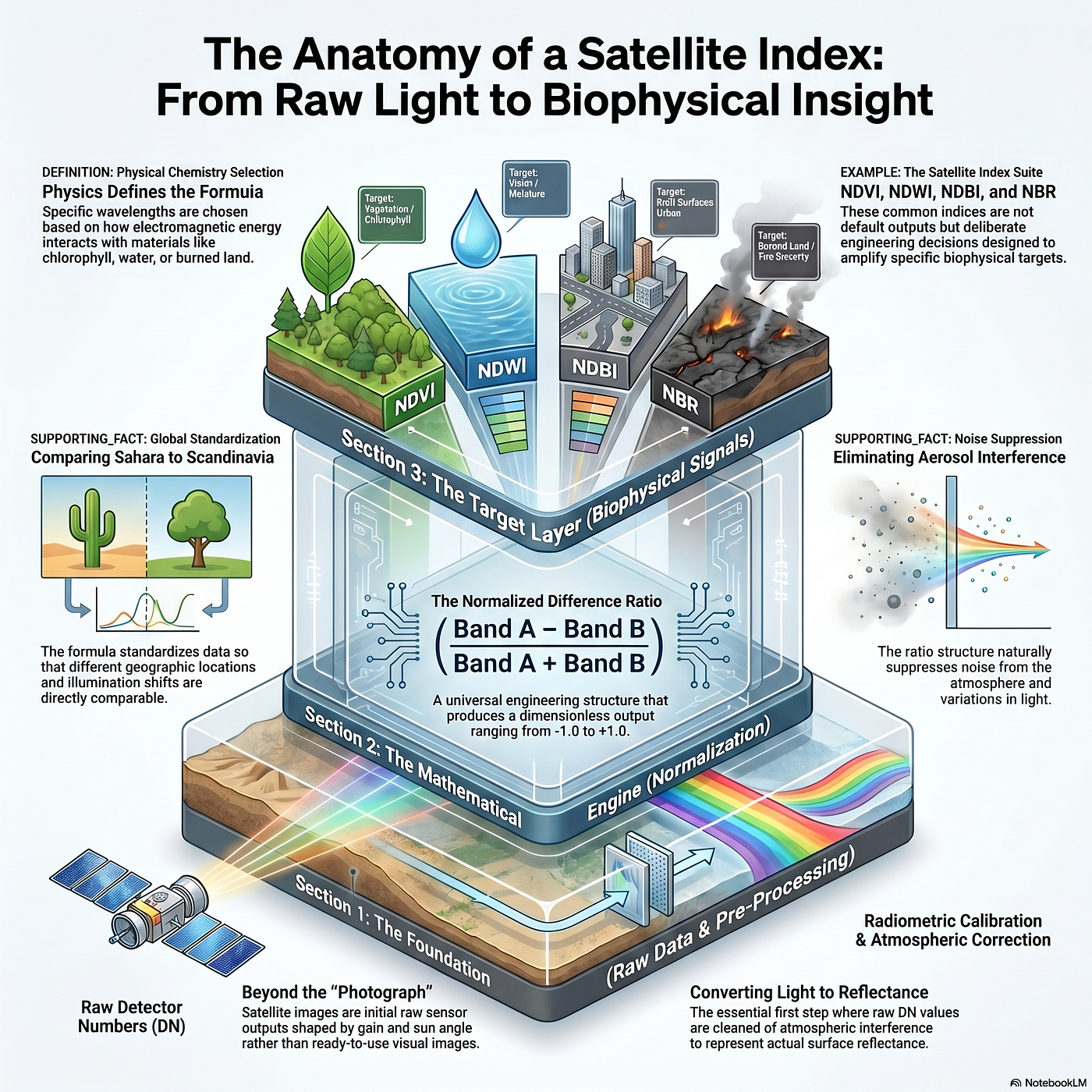
When a sensor passes over a forest, a city, or a flood zone, it records digital numbers — raw DN values that encode how much electromagnetic energy struck each detector. Those numbers mean nothing on their own. They reflect the sensor’s gain settings, the sun’s angle that morning, and the state of the atmosphere between the ground and the orbit. Before any analysis is possible, those DN values must be converted into physical units of surface reflectance — either Top-of-Atmosphere (TOA) or Bottom-of-Atmosphere (BOA) values — through calibration and atmospheric correction pipelines.
That conversion is step one. Step two is where the real leverage lives.
Normalized difference formulations are the engine of quantitative remote sensing

The structure is always the same: take two spectral bands, subtract one from the other, divide by their sum. The result is a dimensionless ratio that runs from −1.0 to +1.0. That standardization delivers three distinct engineering advantages.
First, Aerosol nd Noise Suppression. The ratio structure cancels out diffuse atmospheric scattering and illumination changes that would otherwise corrupt the signal.
Second, Geometric Standardization. Because every index output lands on the same −1.0 to +1.0 scale, you can compare a measurement taken over the Sahara with one taken over Scandinavia without adjusting for topography or sensor viewing angle.
Third — and most powerful — Signal Amplification. By placing a reflectance peak in opposition to an absorption trough, the formula mathematically amplifies the biophysical signal you care about while suppressing background noise. The target feature becomes loud. Everything else becomes quiet.
The selection of which two bands to oppose is not arbitrary.

It follows directly from the physical chemistry of the target. Different surface materials interact with electromagnetic energy in distinct, characteristic ways across specific wavelengths. An index designed to detect chlorophyll places the band where chlorophyll absorbs radiation against the band where leaf tissue scatters it. The physics defines the formula.
Remote sensing began with simple band ratios. The field has since produced hundreds of specialized formulations targeting terrestrial vegetation, open water, built-up surfaces, burned land, and soil chemistry. The Awesome Spectral Indices (ASI) database is the field’s canonical reference — a living catalog that archives these formulations and the physical rationale behind each one.
The ASI database exists because one formula cannot see everything. Each index is a narrow, precise instrument tuned to a specific interaction between light and matter.
That is the core principle this entire series rests on: every index is a deliberate act of engineering, not a default output.
Understanding the math makes the applications legible. Skipping it makes the applications opaque.
In the next episode: NDVI is the most cited vegetation index in history — and its two failure modes explain why the field never stopped building replacements.
메타데이터
- post_id
- c97ae96f55f3
- slug
- your-satellite-image-is-just-raw-numbers-heres-the-formula-that-makes-it-meaningful-c97ae96f55f3
- url
- https://medium.com/@himal.sudasingha/your-satellite-image-is-just-raw-numbers-heres-the-formula-that-makes-it-meaningful-c97ae96f55f3
- canonical_url
- https://medium.com/@himal.sudasingha/your-satellite-image-is-just-raw-numbers-heres-the-formula-that-makes-it-meaningful-c97ae96f55f3
- author_url
- https://medium.com/@himal.sudasingha
- status
- ok
- fetched_at
- 2026-06-20 20:29:01