Mission Drishti: India’s Leap with the World’s First OptoSAR Satellite
Mission Drishti: India’s Leap with the World’s First OptoSAR Satellite
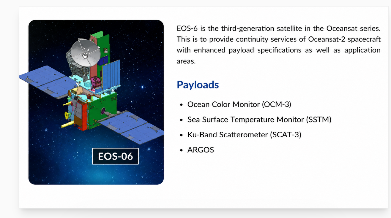
Learn how EOS-06 observes Earth’s oceans from orbit, providing valuable data for weather prediction, environmental monitoring, and sustainable ocean resource management.
Introduction
India’s private space sector achieved a historic milestone with the successful launch of Mission Drishti, the world’s first operational OptoSAR satellite. Developed by the Bengaluru-based startup GalaxEye, this groundbreaking mission combines optical and radar imaging technologies on a single platform, enabling continuous Earth observation regardless of weather conditions or time of day. The mission demonstrates India’s growing capabilities in advanced space technology and geospatial intelligence.
What is Mission Drishti?
Mission Drishti is an advanced Earth Observation (EO) satellite designed to provide high-quality imagery of Earth’s surface. Launched aboard a Falcon 9 rocket, the satellite represents a major technological breakthrough because it integrates two powerful sensing technologies into one platform. Weighing approximately 190 kg, it is also regarded as India’s largest privately developed Earth observation satellite.
Understanding OptoSAR Technology
The term OptoSAR is derived from the combination of:
- Optical Imaging (EO — Electro Optical): Captures high-resolution visual images similar to a camera.
- Synthetic Aperture Radar (SAR): Uses radar signals to create images even through clouds, rain, fog, and darkness.
Traditional Earth observation satellites typically rely on either optical sensors or radar sensors. Mission Drishti is the first satellite to combine both technologies on a single operational platform, providing more reliable and comprehensive Earth observation data.
Why is Mission Drishti Significant?
1. All-Weather Monitoring
Optical satellites struggle during cloudy weather and at night. SAR technology overcomes these limitations by using radar waves, enabling uninterrupted imaging capabilities.
2. Day-and-Night Observation
The satellite can continuously monitor locations regardless of lighting conditions, making it valuable for strategic and civilian applications.
3. Enhanced Data Accuracy
By combining optical and radar data, Mission Drishti provides richer geospatial information, improving decision-making and analysis.
4. Strengthening India’s Private Space Ecosystem
The mission showcases the growing capabilities of Indian startups and highlights the increasing role of private companies in space innovation.
Applications of Mission Drishti
The satellite is expected to support multiple sectors:
Defence and Border Surveillance
Continuous monitoring of sensitive regions and strategic assets.
Agriculture
Crop health assessment, irrigation planning, and yield forecasting even during monsoon seasons.
Disaster Management
Rapid assessment during floods, cyclones, earthquakes, and other emergencies.
Maritime Monitoring
Tracking vessels, coastal activities, and illegal operations at sea.
Infrastructure Development
Monitoring large-scale construction projects, transportation networks, and urban expansion.
Mission Drishti and India’s Space Future
Mission Drishti demonstrates how Indian startups are moving beyond traditional satellite systems and creating globally competitive innovations. The success of this mission is expected to pave the way for future constellations of OptoSAR satellites, enhancing India’s capabilities in Earth observation, security, and commercial geospatial services.
Conclusion
Mission Drishti is more than just a satellite launch — it is a symbol of India’s emergence as a leader in advanced Earth observation technology. By combining optical and radar imaging into a single platform, the mission overcomes longstanding limitations in satellite imaging and opens new opportunities for defence, agriculture, disaster response, and environmental monitoring. As India’s private space sector continues to grow, Mission Drishti stands as a landmark achievement in the nation’s space journey.
메타데이터
- post_id
- 01b910651a7a
- slug
- mission-drishti-indias-leap-with-the-world-s-first-optosar-satellite-01b910651a7a
- url
- https://medium.com/@isro/mission-drishti-indias-leap-with-the-world-s-first-optosar-satellite-01b910651a7a
- canonical_url
- https://medium.com/@isro/mission-drishti-indias-leap-with-the-world-s-first-optosar-satellite-01b910651a7a
- author_url
- https://medium.com/@isro
- status
- ok
- fetched_at
- 2026-07-15 08:48:20



