Parametric Zoning Tool
Instant 3D Envelopes from NYC Regulations Sriya Thotakura · Varadraj Borde · Krish Wadhwani · Aditi Gangadhar · Chelsea Hai
Parametric Zoning Tool
Instant 3D Envelopes from NYC Regulations
Sriya Thotakura · Varadraj Borde · Krish Wadhwani · Aditi Gangadhar · Chelsea Hai
Introduction
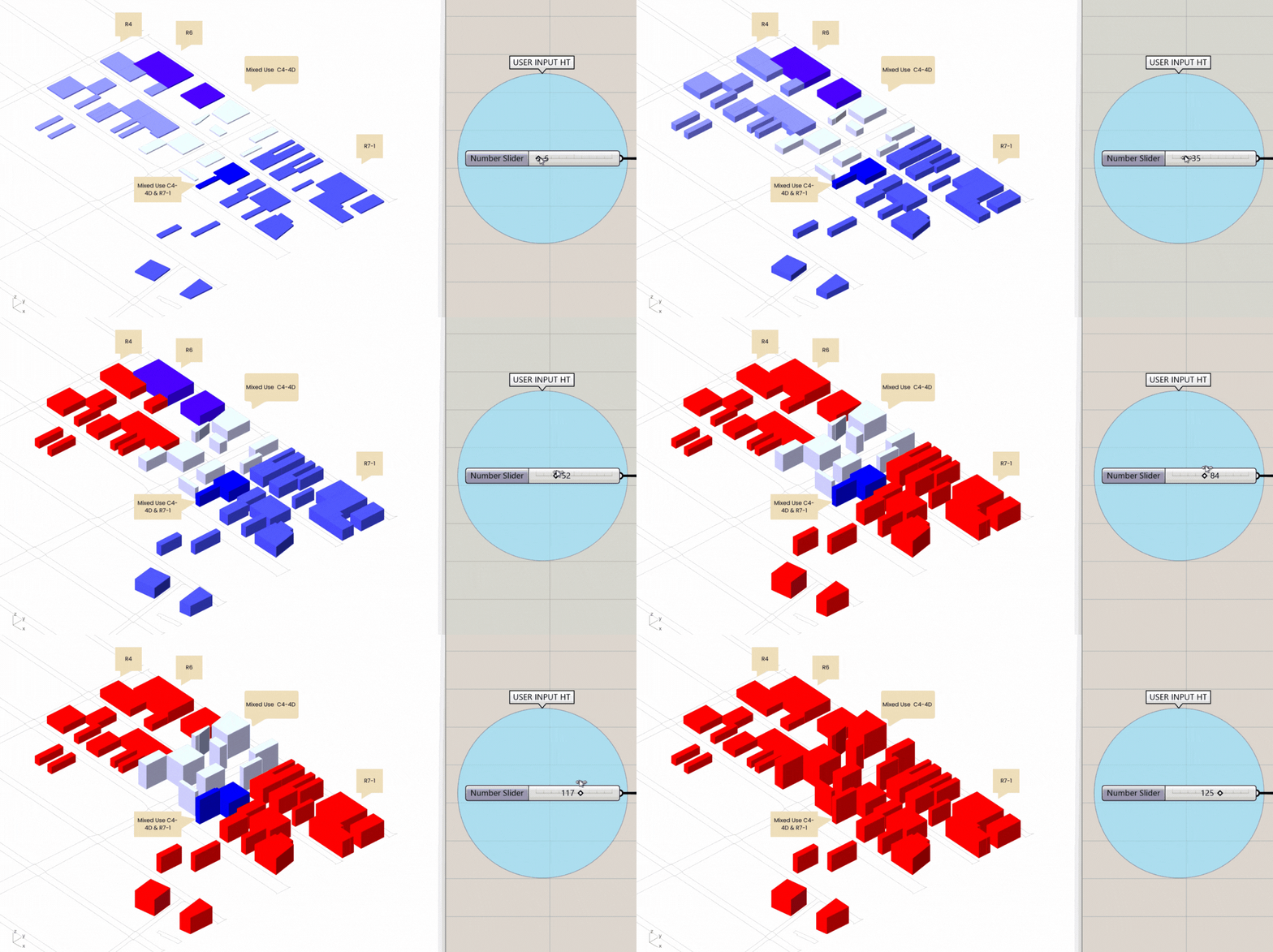
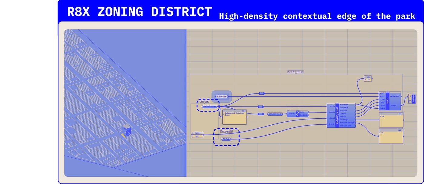
Outputting a group of site boundaries for different Zones to show Zonal Height Check Visually

Overall Concept Flow : User Input Requirements : Autogenerated Building Envelope : User Input Generated Design Envelop : Compliance Check
Zoning regulations in New York City are complex, layered, and difficult to translate into spatial form. While zoning data is publicly accessible through platforms such as NYC ZoLa, the process of converting regulatory text and diagrams into three-dimensional building envelopes remains largely manual. Designers often reconstruct envelopes repeatedly by interpreting zoning tables, frontage diagrams, and setback rules, which slows early-stage design and introduces inconsistencies across projects.
This project presents a Parametric Zoning Tool that translates zoning regulations directly into instant three-dimensional envelopes. The prototype automates the generation and evaluation of zoning-compliant massing by encoding regulatory logic into a structured computational workflow. Instead of treating zoning as a static constraint checked late in the design process, the tool integrates zoning logic into early-stage exploration, allowing designers to quickly test buildable envelopes across different sites and zoning districts.
The need for this prototype emerges from recurring challenges in current zoning workflows: time-intensive manual drafting, difficulty comparing zoning outcomes across districts, and limited transparency in how compliance decisions are made. By converting zoning rules into data and applying them consistently through a parametric system, the tool aims to improve efficiency, clarity, and repeatability in zoning analysis while maintaining traceability of regulatory assumptions.
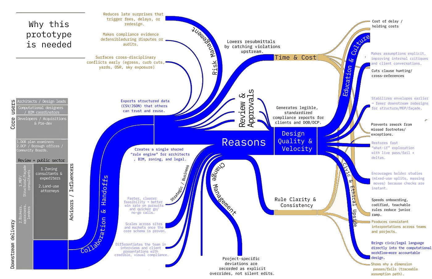
why this prototype is needed
Inputs
The system operates by combining regulatory data, site-specific information, and user-defined parameters. Together, these inputs define the boundaries within which the tool operates and ensure that generated envelopes remain zoning-compliant.
Utility
Research that informed our product direction

Interviews and Existing Assessment
We began by evaluating PropertyScout, an existing tool widely used by real estate agents and other industry professionals, to understand what works and where it breaks in practice. We then interviewed three stakeholders: a university professor, a real estate practitioner, and a NYC architect. Their critiques and “faults and loops” became the foundation for our requirements.
What we learned
key gaps in current tools -Hard to iterate site boundaries and assumptions without friction Layering and data accuracy issues that reduce trust and can hide site opportunities -Unclear or unreliable buildability/feasibility outputs, creating risk in early-stage decisions -Our response
- Based on these findings, we developed our project tool: Parametric Zonal Compliance Check + Building Envelope Tool * a workflow that helps users quickly test zoning constraints and generate a defensible building envelope with fewer manual steps and fewer opportunities for error.
Zoning and Regulatory Inputs
Zoning regulations are sourced from NYC ZoLa and encoded into a structured JSON rule-book. Each zoning district is defined through parameters such as FAR limits, height restrictions, yard requirements, and sky exposure plane conditions.
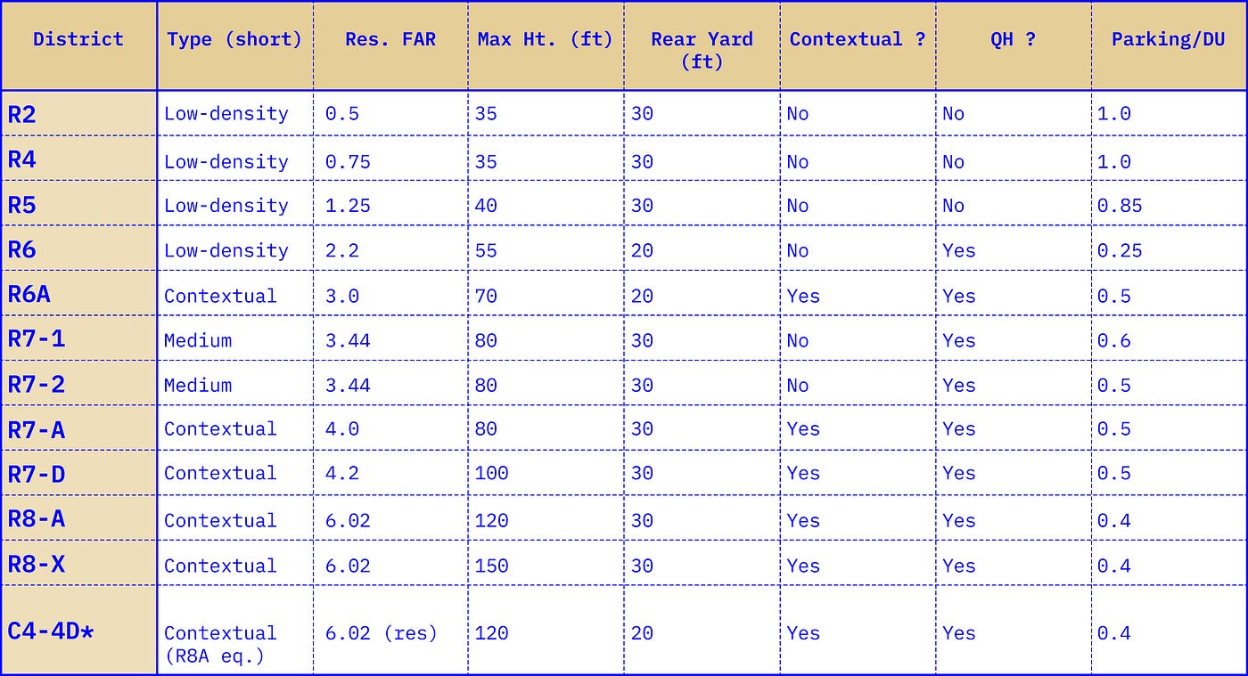
Zoning district table for .json input
Site and Lot Inputs
Lot geometry, boundaries, and proximity to roads are used to establish frontage conditions and setback logic. These spatial inputs allow the system to correctly assign front, side, and rear yards.
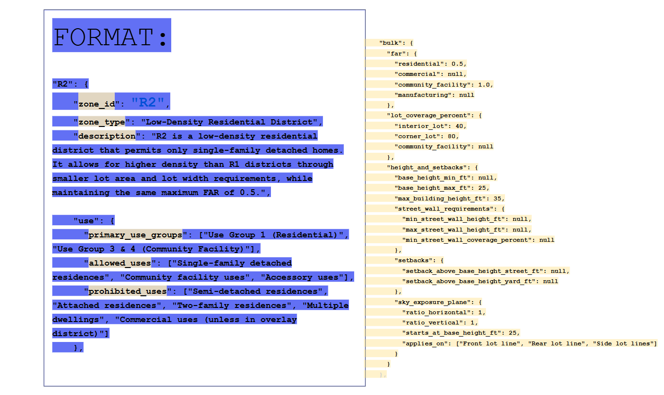
.json file (the rule-book)
Design Inputs
Users can specify programmatic requirements, FAR targets, and height assumptions. These inputs allow the system to generate envelopes and evaluate compliance based on proposed design intentions.
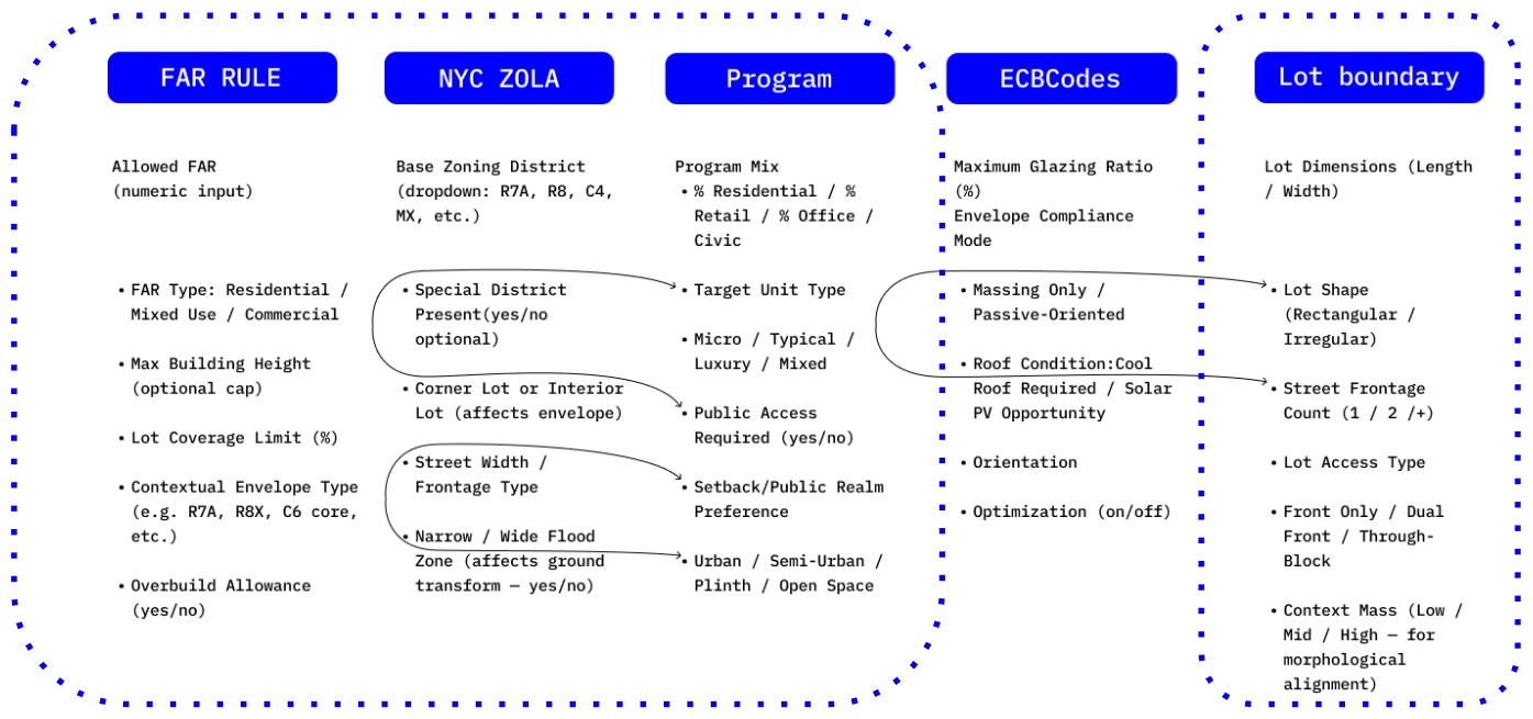
Design Parameters, MVP scope
Process
The following steps describe how the system translates inputs into zoning-compliant geometry. These steps reflect the internal logic of the tool and follow the same sequence presented in the project.
Step 1: Parsing Zoning Rules
Zoning regulations are translated into a structured JSON format that functions as a rule-book for the system. This allows zoning logic to be read, updated, and evaluated consistently without hard-coding rules directly into the geometry pipeline.
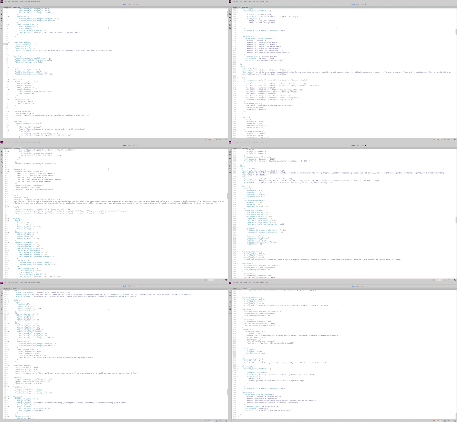
JSON code
Step 2: Processing Inputs Through the Backend
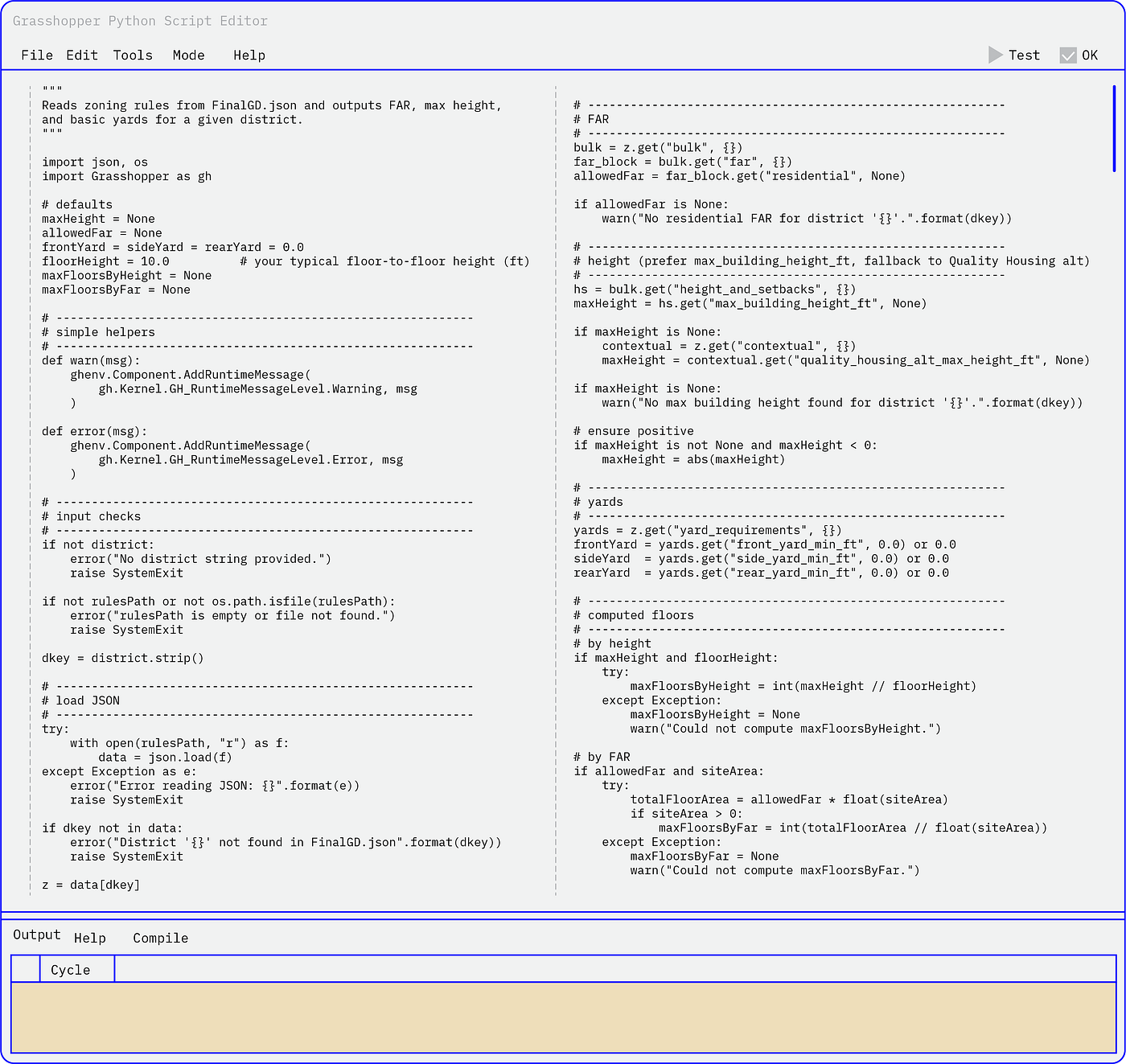
Regulatory data and site inputs are evaluated through a Python-based backend integrated with Grasshopper. The backend applies zoning constraints in a consistent order, separating rule evaluation from geometric generation.
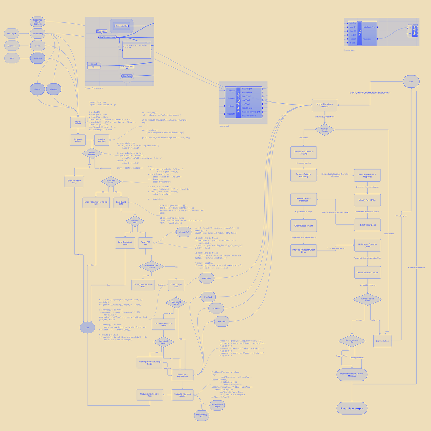
Backend and Frontend Flow
Grasshopper pipeline
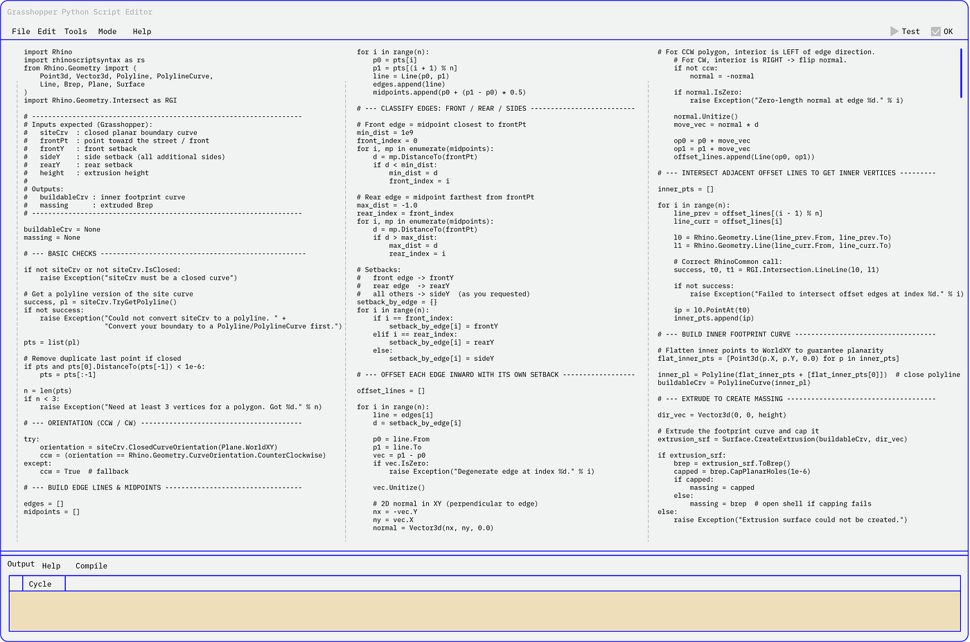
Pipe Line and Python Code
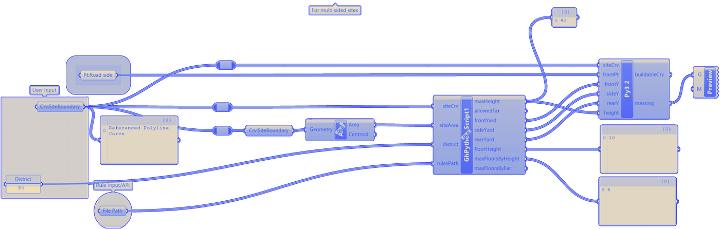
Main Pipeline
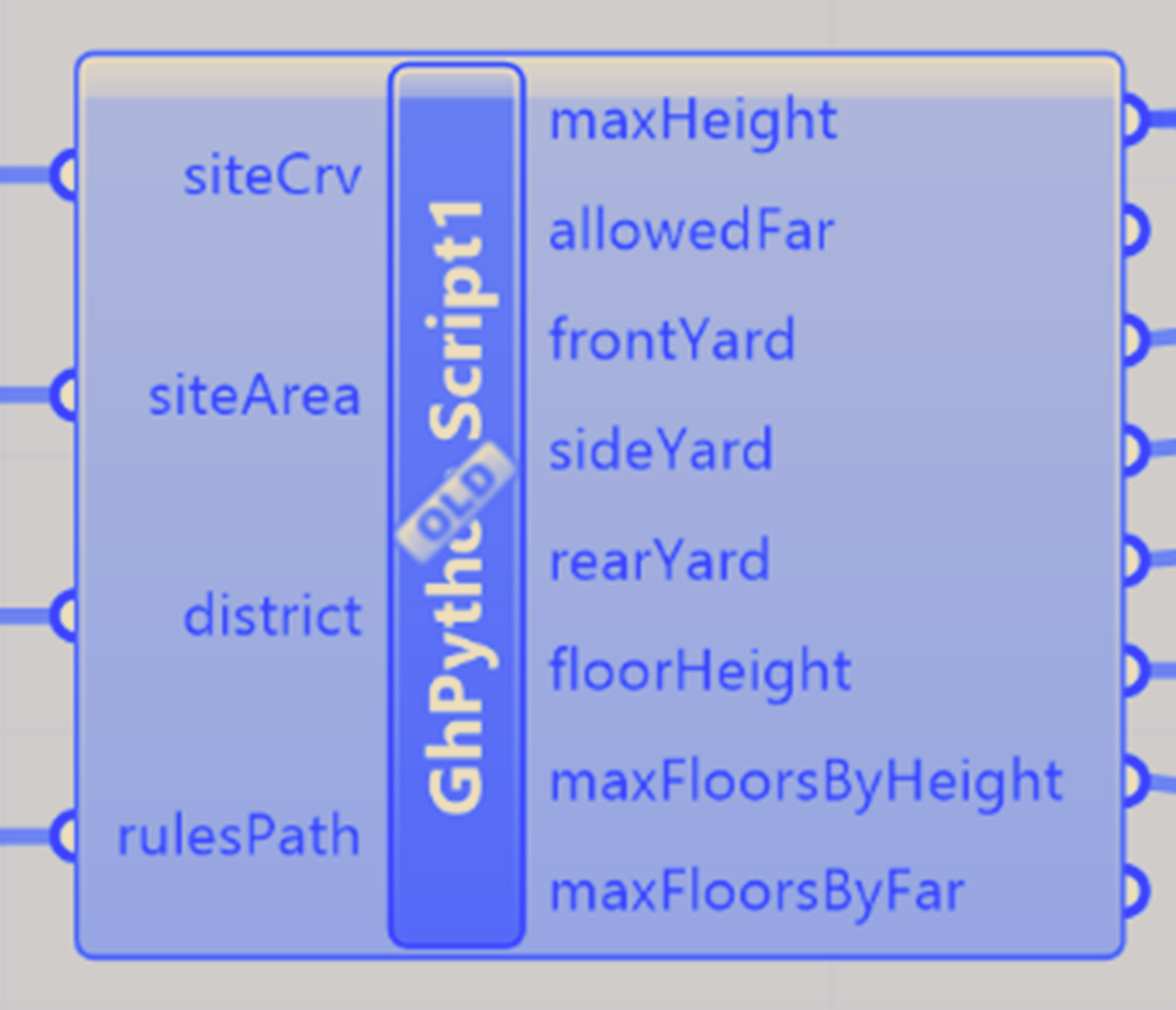
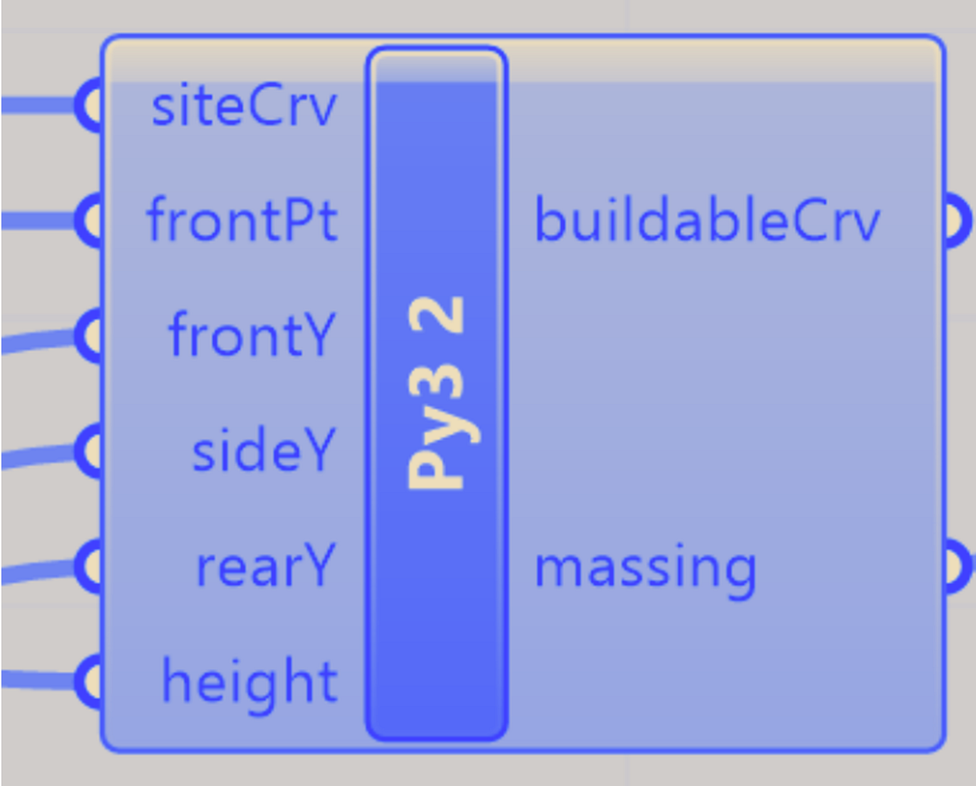
Input List and Output List that can be extracted or worked with in future through these two python module setup
Step 3: Auto-Generating the Zoning Envelope (Phase 1)
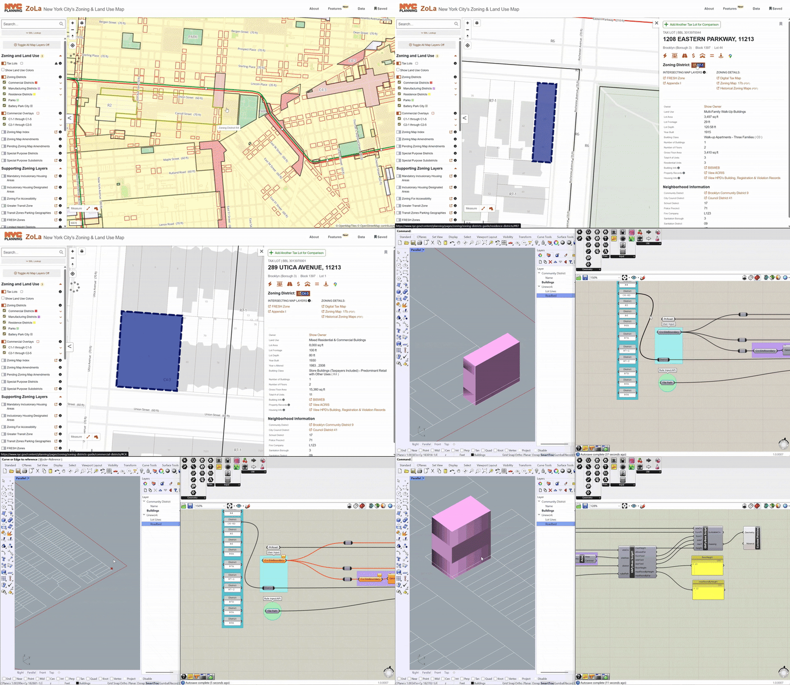
whole frame work: Based on NYC ZoLa zone, curve : Autogenerates Max Height and Max Setback

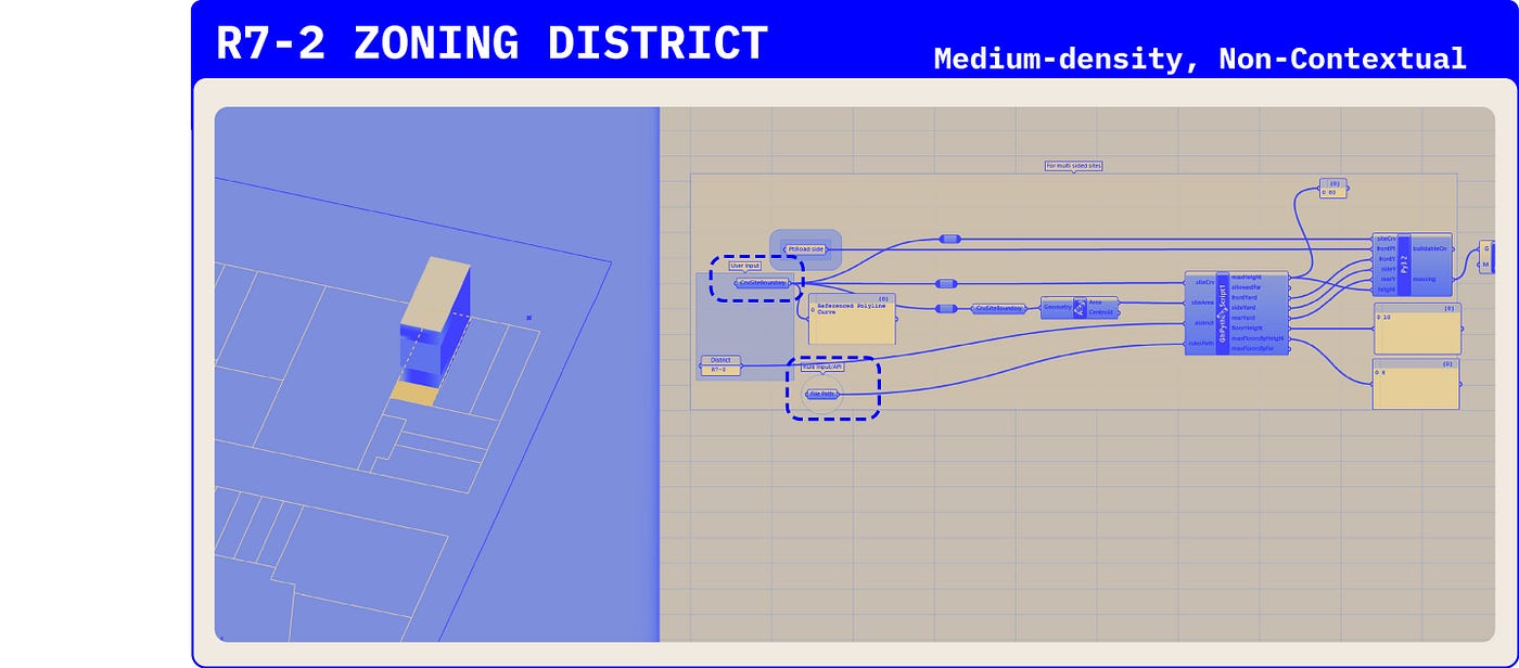
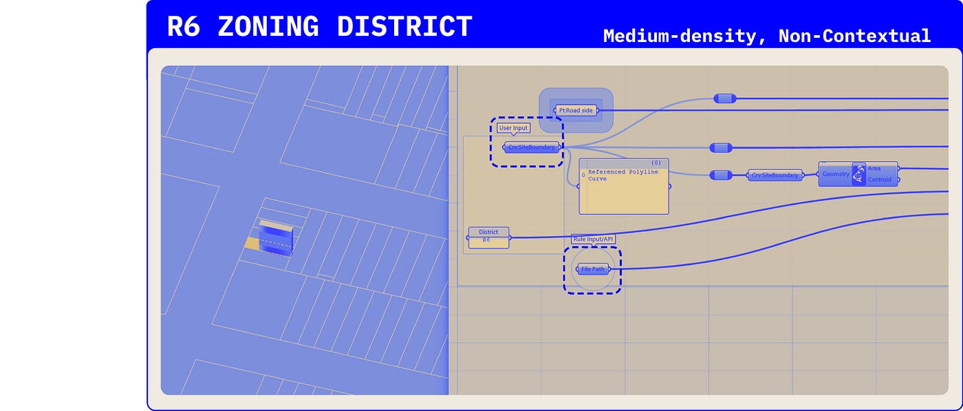
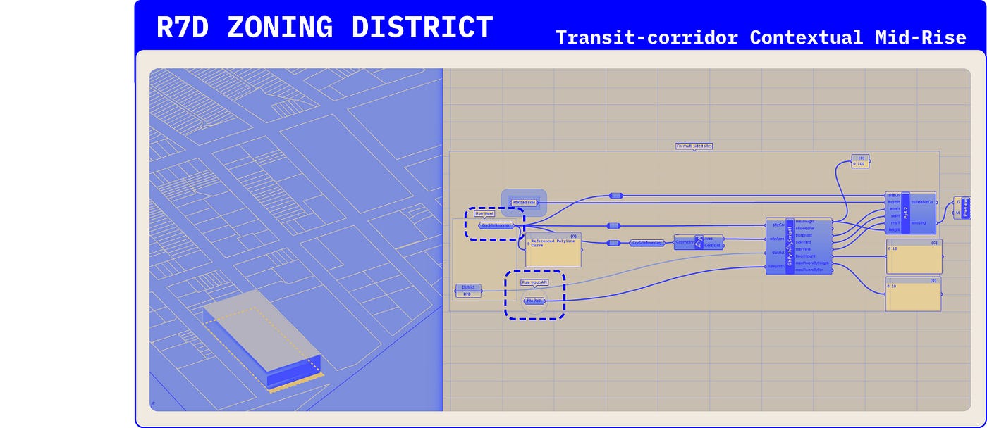
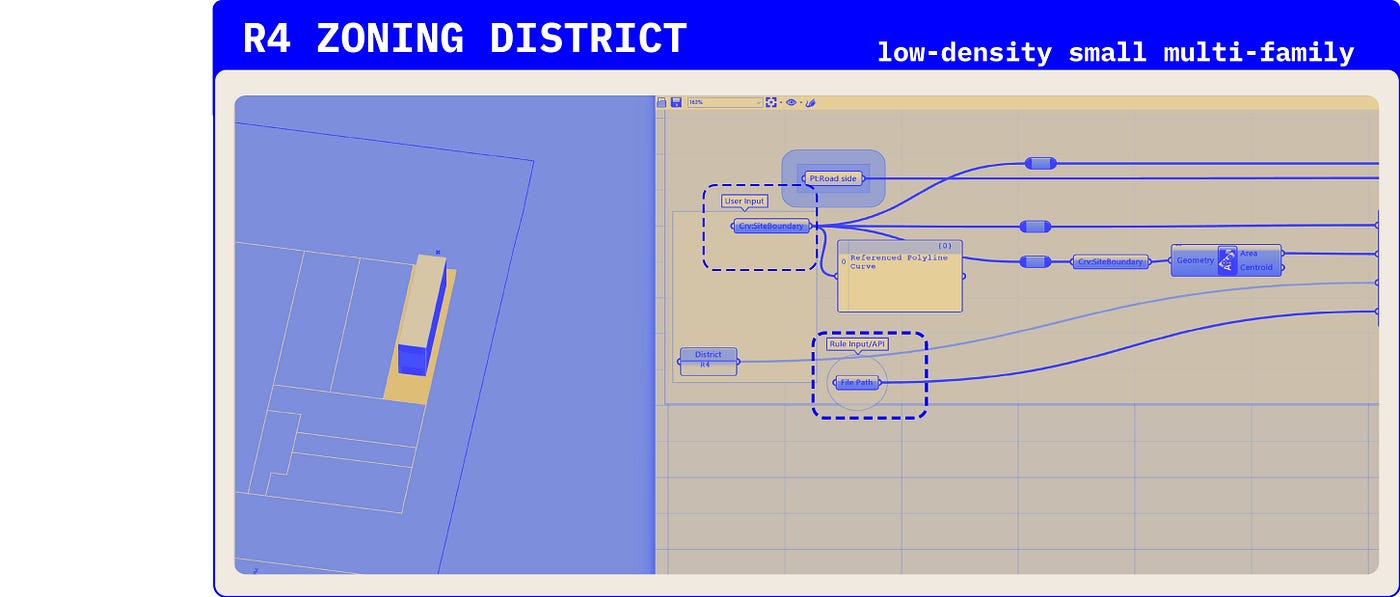
Phase 1 : auto generated envelope
Using the processed zoning data, the system generates a buildable envelope directly from the lot geometry. Frontage is determined using the nearest road centroid, which then informs setback and height logic. The resulting envelope reflects zoning constraints specific to each district.
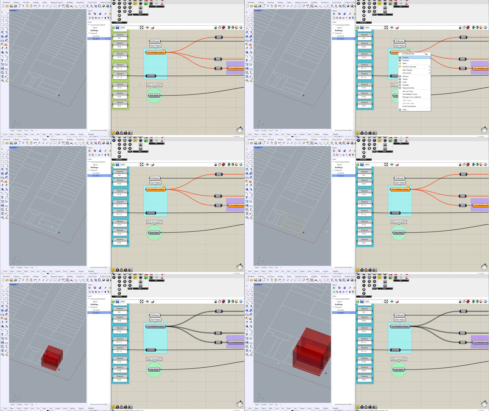
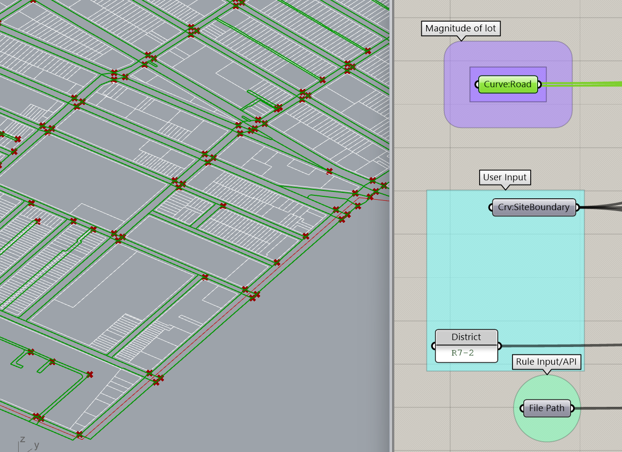
Magnitude of the site is determined by linking road as an attractor : Nearest road = 1-side Front Yard, while opposite 1-side as Back Yard and the rest = Side Yards
Step 4: Evaluating Compliance (Phase 2)
In the second phase, the system evaluates proposed design inputs against zoning constraints. It returns pass/fail results along with numerical deltas that indicate how far a proposal deviates from zoning limits.
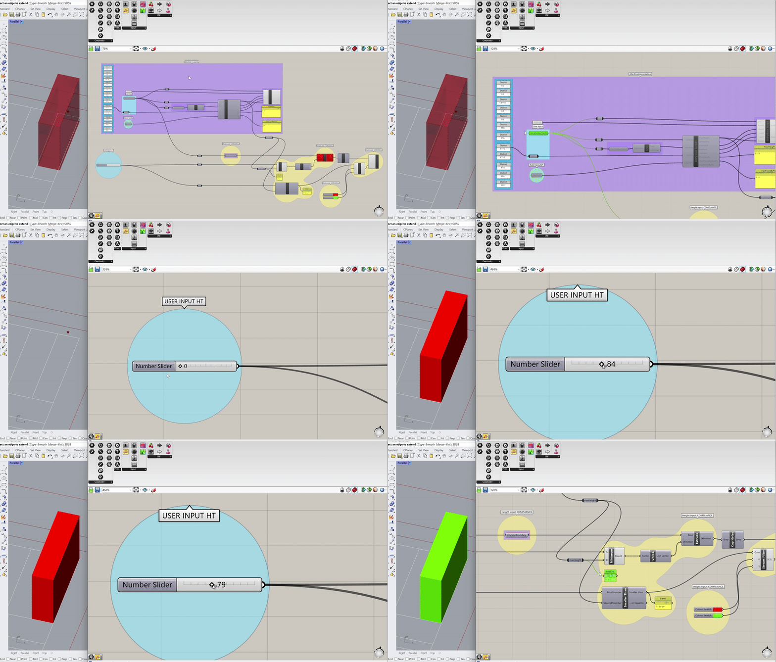
Step 4a: Sky View and Context Checks
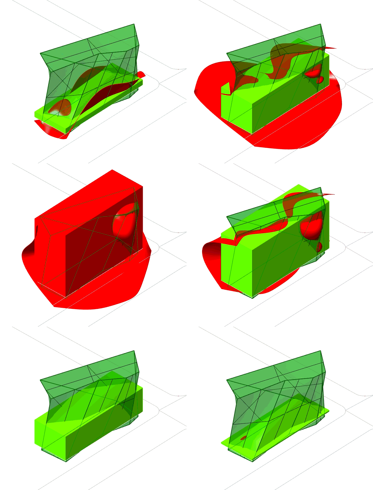
In addition to numeric compliance checks, the system incorporates sky view and context checks as part of its evaluation process. Using the generated envelope geometry, these checks assess how zoning-compliant massing impacts access to light and openness within the surrounding context.
By visualizing sky exposure alongside height and setback constraints, the tool allows designers to understand the spatial implications of zoning rules beyond abstract limits. Sky view checks operate as an additional layer of evaluation, supporting more informed decisions during early-stage design.
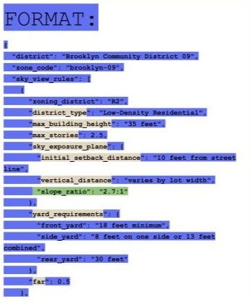
Any new parameter can be linked to the pipeline using .json file, while old parameters need to be referenced to meet new outcomes for new python component : Link for
Step 5: Iterative Feedback and Adjustment
Rather than stopping at compliance checks, the system provides feedback that supports iteration. Adjustments to height, FAR, or setbacks trigger updated evaluations, allowing designers to explore alternatives while remaining within zoning constraints.
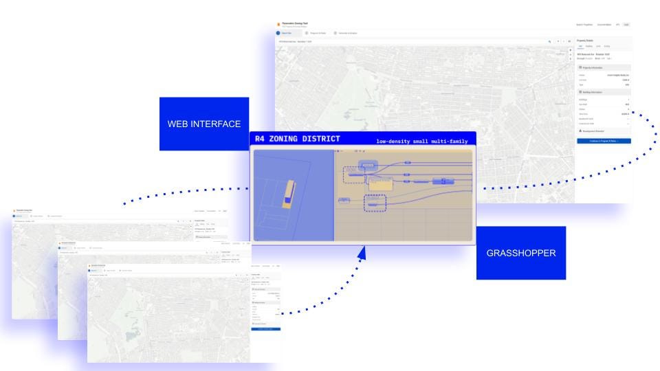
Feedback loop (for Design Compliance Iterations)
Output and Deployment
The final output includes zoning-compliant envelopes, compliance reports, and documented assumptions. These outputs are intended to support both design exploration and review workflows.
Parametric Form to Height Compliance
A proposed web-based interface presents the system as a single-scroll narrative, allowing designers and reviewers to understand site context, applied rules, and resulting envelopes within one platform.
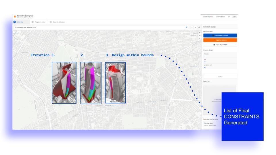
Reviewer Use-Case Website
Conclusion
The Parametric Zoning Tool demonstrates how zoning regulations can be translated from static documentation into an active, computational system. By encoding zoning rules into a structured rule-book and linking them to automated envelope generation and compliance checks, the prototype reduces manual effort while making regulatory logic explicit and legible.
Rather than replacing architectural judgment, the system supports early-stage decision-making by providing clear spatial feedback grounded in zoning constraints. Envelope generation, compliance evaluation, and sky view checks operate together to help designers understand not only what is permitted, but how regulatory limits shape form and context.
As a prototype, the tool establishes a foundation for more transparent and iterative zoning workflows. It suggests a shift in how zoning can be engaged during design, not as an opaque barrier, but as a generative framework that informs spatial exploration from the outset.
[embed]
메타데이터
- post_id
- 06b9565e2bca
- slug
- parametric-zoning-tool-06b9565e2bca
- url
- https://medium.com/generative-design-course/parametric-zoning-tool-06b9565e2bca
- canonical_url
- https://medium.com/generative-design-course/parametric-zoning-tool-06b9565e2bca
- author_url
- https://medium.com/@ag5191
- status
- ok
- fetched_at
- 2026-06-15 20:49:13