Geolocation Challenge #1
In this series, I will generate a random location in Street View and then geolocate it. To generate the random placement, I will…
Geolocation Challenge #1
Welcome! In this series, I will generate a random location in Street View and then geolocate it. To generate the random location, I will use Random Street View. I will take a screenshot and then use the resulting image for geolocation, meaning that I will not be able to pan or zoom.
NOTE: To keep this walkthrough clear and concise, I’ve omitted most of the unsuccessful tries and dead ends. Keep in mind that trial and error is an inherent part of OSINT, so don’t get discouraged!
Task image
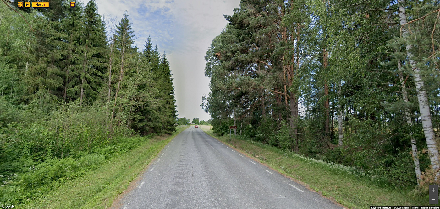
Credit: Random Street View (Google).
Initial thoughts
To me, the vegetation strongly resembles what we see in Northern Europe. The white flowers along the side of the road are very typical of Estonia, though they are seen in many other nearby countries as well. Furthermore, the use of short, white dashed outer road lines are commonly found in Estonia, Lithuania and Sweden.
In the image we see quite a few thin, white trees (likely birches), which are more common in Estonia than Lithuania. Along with the white flowers along the side of the road, this strongly indicates that we’re looking for a place in Estonia.
Analyzing the sign
In the generated image we see a brown sign with white text, which closely resembles a tourist sign. I Googled “tourist sign estonia”, and found the example sign shown below. We see that it follows the same design: it’s supported by two metal poles, it has a thin white border line around the edge, and it uses a very similar font style.
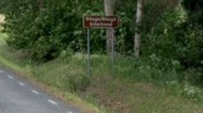
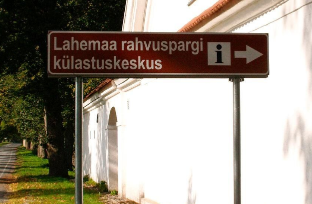
Task image (left). Lahemaa National Park sign (right). Credit: Visit Estonia.
A tourist sign, often referred to as a brown sign, is a traffic sign whose purpose is to direct visitors to tourist destinations, such as historic buildings, tourist regions, caravan or camp sites, picnic areas, sporting facilities or museums. By international convention brown signs with white lettering and white pictograms are often used for this purpose. — Wikipedia
Extracting text from the sign
I analyzed the sign closely to see if any letters could be extracted. From the upper line, I could make out “R__ge/”. The R, g, e and / were quite clear, with space for two letters between R and g. The slash indicates that there might be two different spellings or forms of a name. From the bottom line I was only able to make out “i d”, with space for an unknown amount of letters between.
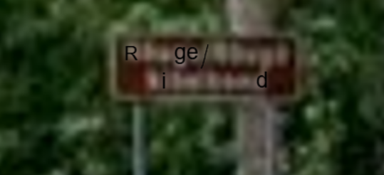
Image showing the extracted letters. More letters could surely be extracted by editing the image..
I tried a lot of different Google queries based on this information, but the searches yielded no useful results. Then, I found a list of cities and towns in Estonia — but I didn’t find any good matches. Lastly, I found a list of municipalities in Estonia, where I found a good match: Rõuge.
There are two different spellings of the word on the sign because Rõuge is in Võru county, where they speak Võro. Võro is a South Estonian language with roughly 75,000 speakers. — Wikipedia
Finding the exact location
Given that Rõuge is a relatively small town, I hoped that finding the exact location would be straightforward. I started by manually checking the roads within Rõuge in Google Maps, but I couldn’t see the depicted location. I then expanded my search area to nearby areas, again without success.
Overpass Turbo
Let’s go back and analyze the task image, so that we know what features to look for. There is forest on both sides of the road. We also see fields on each side of the road. Furthermore, we see a house in the background.
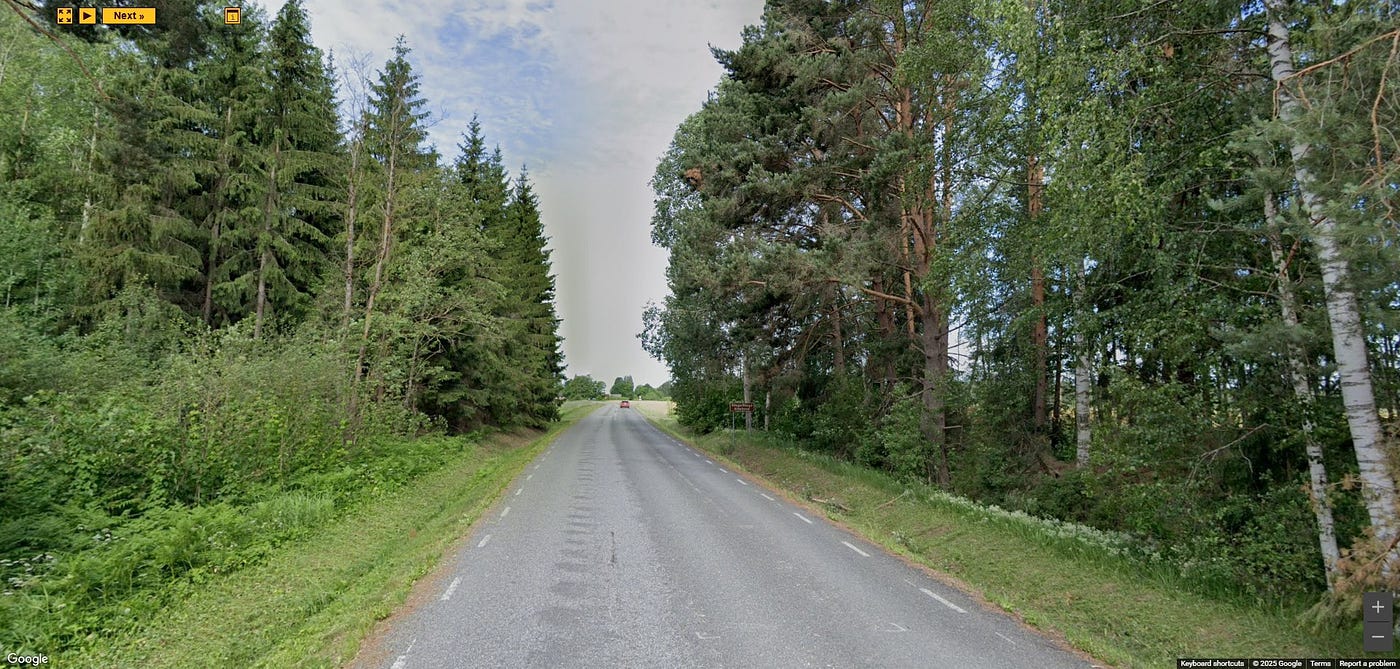
Task image. Credit: Random Street View (Google).
With this information, I formulated an Overpass Turbo query that will look for places containing all the identified information (look below). The query looks for tertiary roads with asphalt, then it identifies any buildings and farmland located within 25 meters of those roads (I assumed they were at most 25 meters from the road).
If you’re new to Overpass Turbo, I recommend reading the Overpass Tutorial.
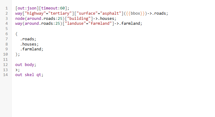
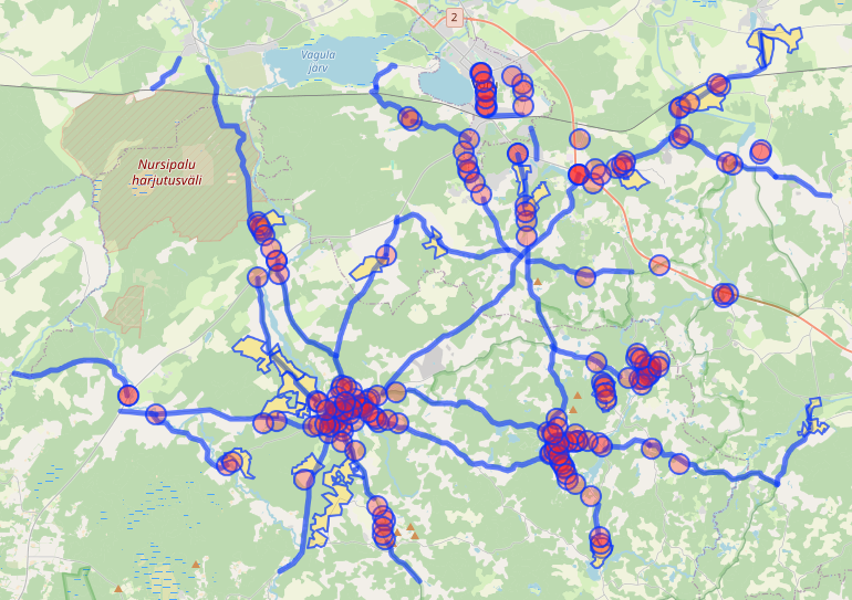
Overpass Turbo query (left). Resulting map (right).
I started by viewing the locations on Google Maps, with satellite view, to quickly exclude many of the identified possible locations. With this approach I was able to rule out all locations in the town of Rõuge, as well as many others — leaving me with only ~20 to manually check.
After manually checking the remaining locations, I identified the location marked in red below as the depicted location. By entering Street View, we quickly see that this is the same place as depicted in the generated location.
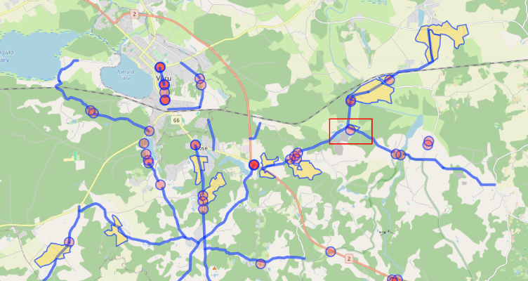
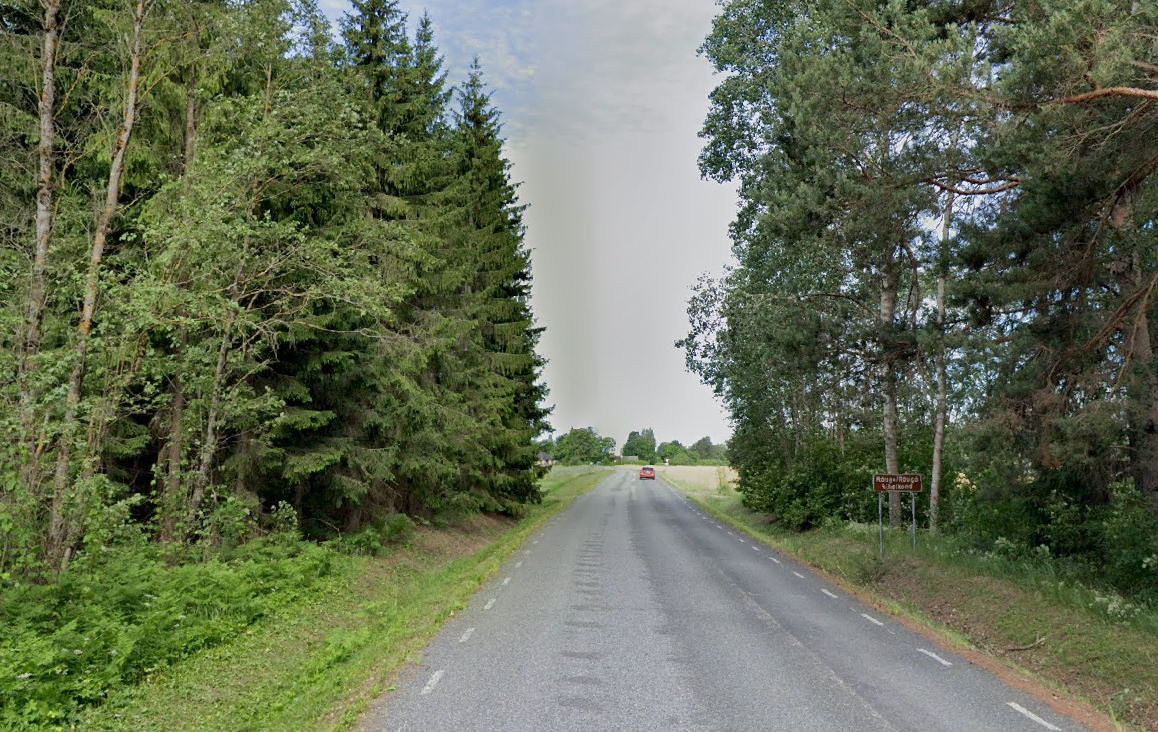
The exact coordinates are 57.82021568984926, 27.134350520120897.
Summary and thoughts
After finding the exact location, I could finally read the full text on the brown sign: “Rõuge/Rõugõ Kihelkond”. “Kihelkond” translates to parish, and it refers to the historical church parish of Rõuge within Võru county.
The sign wasn’t pointing to the town of Rõuge, but rather the historical Rõuge parish. Initially I focused heavily on the town of Rõuge and nearby locations, which explains why I couldn’t find the location earlier.
Identifying the country as Estonia was relatively straightforward. The birch tress, white roadside flowers and the road markings strongly indicated Estonia. However, pinpointing the exact location proved to be more challenging — especially because of the sign.
Tools
- Google Search
- Google Maps
- OpenStreetMap
- Overpass Turbo
메타데이터
- post_id
- 2328ff57560f
- slug
- geolocation-challenge-1-2328ff57560f
- url
- https://medium.com/@dam_coffee/geolocation-challenge-1-2328ff57560f
- canonical_url
- https://medium.com/@dam_coffee/geolocation-challenge-1-2328ff57560f
- author_url
- https://medium.com/@dam_coffee
- status
- ok
- fetched_at
- 2026-07-24 20:22:33