Day One - 100 Miles, 100 Years of History
Well, the first day is nearly over and it’s been an interesting one…
Day One - 100 Miles, 100 Years of History
Well, the first day is nearly over and it’s been an interesting one…
Both the gig and walking teams started in the morning at similar times, as there was always the risk that the gig would not be able to complete the crossing due to weather and we had to start the walk so that we could complete on May 13th for the community party at the end. For the gig team this meant a short row over to Tresco Island, where they were wonderfully hosted and given breakfast at the Flying Boat Club. The Flying Boat Club is where 234 Squadron, 100 years ago, would have launched their seaplanes for anti-submarine patrols in the first world war. The walking team had a less glamorous (but drier) 0800 hrs start at RAF St Mawgan ready for the drive to Land’s End through typical rush hour traffic on the A30.
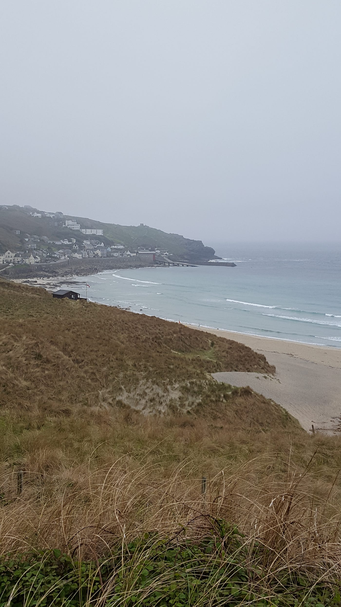
Leaving Land’s End behind us in the morning mist.
The weather was less than inspiring for both teams, with a mist and occasional drizzle making everyone wet, although we weren’t cold thanks to good kit selection. Thankfully the forecast was to improve, which proved to be the case.
A support team would be shadowing the walkers in case of incident, and offering replenishment of water so that we didn’t have to carry it with us.
I’ve already mentioned the historic links with the Royal Air Force on Tresco Island, but Land’s End had it’s own links. In the second world war the area had RAF Mark’s Castle (Trevescan Cliff), RAF Sennen (Skewjack), and RAF Carn Brea as important radar bases. With clear sight over the sea it was part of the Chain Home Low (low level interception) radar system that would alert the Royal Air Force Fighter Command to approaching aircraft. The Old Success public house in Sennen used to be the Officers’ Mess, and the Sennen Heights apartments (previously the Sennen Cove Hotel) was the Women’s Auxillary Air Force quarters.
The first leg before we met up with the support team again was to Cape Cornwall, about a third of the distance we would be covering today. As we set a good pace we were glad to see the mist lift, and looked back to see it clinging to the lower ground behind us. We could now carry on in the dry, if not quite warm yet.

Leaving the mist behind as the weather improves, on the way to Cape Cornwall.
The rest of the first leg continued without incident and we made good time, linking up with the support vehicles and taking a few pictures to mark the occasion. As we walked away from Cape Cornwall the sun started to come out and we got some lovely views back to the iconic mine stack. There was plenty of Cornish mining heritage along our route today.

Leaving Cape Cornwall behind as the sun came out.
We passed the classic view of Botallack Mine on the way to Levant mine and beam engine where we met our support team once more. The going was still good and the sun was cheering us all up, even allowing the removal of layers down to Tee-shirts. The update from the team was that the gig was making good progress and we were on track so spirits were high.

Botallack mine, one of many examples of the Cornish mining heritage we passed today.
We met them again at Pendeen lighthouse, knowing that we might not see them again until we reached Zennor Head, our destination for the day. Water was definitely taken on here as the temperature in the sun was quite warm, especially with the exertion of walking up and down every crinkle in the coastal path (of which there were many).
We had an early indication that the gig rowing might not be entirely according to plan, as their predicted arrival time was slipping to early evening. More to come on that one.
We continued to the stunning beach at Portheras Cove, not dropping down to walk on the sand though, which could have been in the mediterranean from the look of the blue sea and white sand.
Although beautiful, it also marked the start of the most challenging section of the walk. With lots of climbs and descents, churned mud from grazing cows, rock-strewn paths to negotiate, and tiring muscles we were in for a slog to the finish.

The stunning beach at Portheras Cove, well hidden away and nearly deserted.
We did see three snakes on the path, making the most of the sun to bask in its heat. All adders, but thankfully none of them were startled enough to strike at us. We let them make their own way off the path before continuing. We also saw a kestrel hovering over the cliffs and a few buzzards. Not to mention a few swallows watching us as we went past.
It was another long leg, and a painful one towards the end. How many times do you need to go down and up to travel a couple of miles? Dozens it seems! Eventually the turn towards Zennor came into sight and our support team were waiting for us. The last flights of steps up to the turn almost finished us off, but we made it and collapsed into the minibus for the trip back to base. Just shy of 17 miles in challenging terrain, completed on time (just), but with plenty of sore muscles to show for it. No foot injuries, though, which was good!
Now for the bad news…
As I type this (at around 2230 hrs) the gig still hasn’t made it to land! They had to divert to Newlyn, which means even more miles of rowing, with an estimated arrival time of midnight. That would mean 14 hours of rowing, which is not what we had in mind. The good news is that I’ve seen a picture of them with Land’s End in sight, so they are past the worst of it, but it will be black now. I wish them safe journey, and I hope to have an update from them tomorrow.
메타데이터
- post_id
- 2af8069768f
- slug
- day-one-100-miles-100-years-of-history-2af8069768f
- url
- https://medium.com/@owen.crossby304/day-one-100-miles-100-years-of-history-2af8069768f
- canonical_url
- https://medium.com/@owen.crossby304/day-one-100-miles-100-years-of-history-2af8069768f
- author_url
- https://medium.com/@owen.crossby304
- status
- ok
- fetched_at
- 2026-07-30 04:15:25