Exploring the Rhine Pt 4: Upper Rhine Pt 2: Grand Canal of Alsace
In the last article we’d just got up to the Grand Canal of Alsace, which runs from Basel to Strasbourg.
Exploring the Rhine Pt 4: Upper Rhine Pt 2: Grand Canal of Alsace
In the last article we’d just got up to the Grand Canal of Alsace, which runs from Basel to Strasbourg.
And in the words of Amy Pond, okay kid this is where it gets complicated.
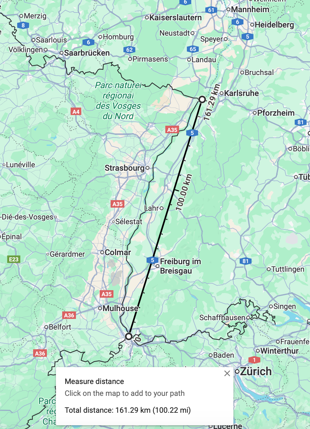
I was attempting to make snips and find an easy way to display the whole canal. But it’s too long.
Rotating in Google Maps is possible only on satellite view but it’s not quite as clear.
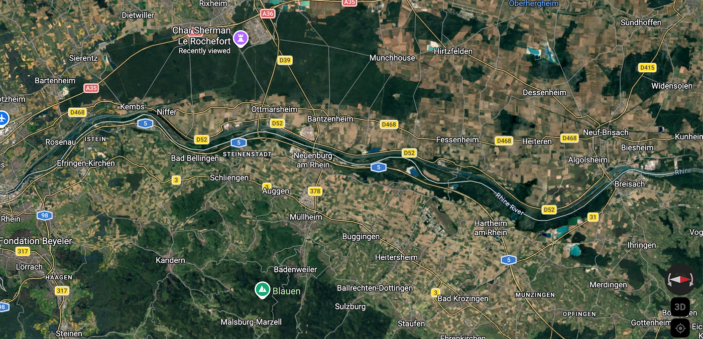
This is the initial main section from Basel to Breisach.
Let’s just break it down, like GCSE Bitesize, take it slow cos it’s really interesting.
Okay so the initial Grand Canal of Alsace runs from just outside Basel to the small town of Breisach, some 30m north.
Oooh check out this snip, I just made it for a basic idea but it comes up enlarged so it’s much easier to see, yay

As well as the canal the other thing the map illustrates is that the German/French border follows the original Rhine river, not the canal.
As I mentioned in the previous article the Rhine was straightened in the 19th century, Johann Gottfried Tulla straightened the river, turning it from a slow, sluggish, meandering river to a fast flowing stream. The length of the Rhine was reduced by 50 miles! Phew.
But here’s the thing, fast flowing streams are not conducive either to mass transportation. Humanity as usual attempting to control nature, trying to solve one problem and in doing so creating more problems for themselves.
Due to subsequent bed erosion even today the water authorities need to dump tonnes of sand and gravel every year to maintain the Rhine.
As well as the navigation issues, France wanted to create hydroelectric power along the Rhine and they gained the right with the 1919 Treaty of Versailles.
You know this is so exciting, so many things I barely know where to start.
The Grand Canal runs entirely on the French side and all electricity is generated for the sole use by France.
Creating hydroelectric power — the French built 10 dams along the Rhine, with power stations and locks! I love locks.
More detailed info on the French Waterways website
Now, creating the canal meant long islands between the canal and the Rhine were formed. This is super exciting, these areas are designated Ramsar wetlands, really crucial areas for birds and nature and wildlife sanctuaries.
And I like it cos it’s legit information, not just Wikipedia. The Ramsar Sites Information Service is really cool, it contains maps and lists of all the wetlands in the world. And each wetland gets its own page with all kinds of interesting, useful info.
So I go on the Ramsar site searching for the Rhine. check out the map below, even this high up, looking at the whole of Europe I can instantly tell which one is the Rhine. Look below, it even looks like the rift, well it is basically the rift section of the river isn’t it. Love it. All kinds of map nerdgasms happening here today.

Check out the Ramsar site for the Rhine here. this is nerdy heaven. It’s got a map showing the whole site (which goes all the way from Basel to way north of Strasbourg), a whole information sheet (in French), a summary sheet, a list of all the animal and plant species, it’s just very, very cool so check it out. There’s frogs, salmon, beetles, ducks, all kinds of wonderful wildlife live round here.
Right I digress, I’m going to have to look at Ramsar sites some over time.
Where was I? Right the Rhine.
The Grand Canal d’Alsace now carries the majority of water, only when it reaches such large volumes it gets diverted to the Rhine itself.
This is the first bit, showing the start of the canal at the edge of Basel, and the first lock!
And look at the pretty island full of green.


This lock is super high-tech, none of those cute little Victorian ones on the Grand Union canal, black with white stripes.

And this hydroelectric power station is seriously heavy duty.

The hydroelectric power station is open for visitors — check out the website here , also as you can see there’s a fancy restaurant to eat.
I also found this snazzy youtube video by EDF, giving a fascinating summary of the history and stats around the Rhine canal and hydroelectric station, set to a slick electro-swing number, totally there for it.
[embed]
Now on Google Maps they’ve called it a boat ramp but it’s a lock. I postulated that the French word for it directly translates to boat ramp but actually no it’s Ecluses, maybe boat ramp is for the high-tech heavy duty stuff?
Anyway this first power station is situated next to the town of Kembs-Loechle, which if nothing else contains a nursery school named after Paul Klee, the painter — random info there.
I’m also seeing another canal running along, let’s track it, the Canal de Huningue. This led to a whole thing so let’s leave it here for now and I’m going to make a new article just for the Huningue canal.
Map nerd for the win.
메타데이터
- post_id
- 3c8f494fb5a5
- slug
- exploring-the-rhine-pt-4-upper-rhine-pt-2-grand-canal-of-alsace-3c8f494fb5a5
- url
- https://medium.com/@mapnerdforthewin/exploring-the-rhine-pt-4-upper-rhine-pt-2-grand-canal-of-alsace-3c8f494fb5a5
- canonical_url
- https://medium.com/@mapnerdforthewin/exploring-the-rhine-pt-4-upper-rhine-pt-2-grand-canal-of-alsace-3c8f494fb5a5
- author_url
- https://medium.com/@mapnerdforthewin
- status
- ok
- fetched_at
- 2026-07-09 04:10:03