Black Rocks on a Mototaxi
Emptiness and beauty in the Angolan highlands
ANGOLA | TRAVEL
Black Rocks on a Mototaxi
Emptiness and beauty in the Angolan highlands
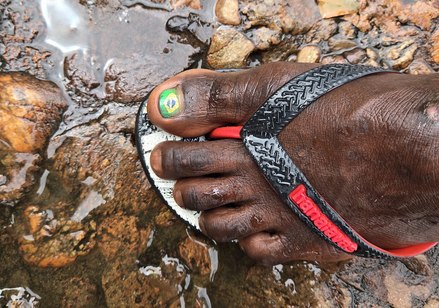
A mototaxi driver’s foot. Photo credit: Brad Yonaka
Off the chattering bus into silence. Late afternoon, rusty edges on the clouds. Cacuso, population 58,000, looks smaller than I imagined. The concrete-framed buildings along the main thoroughfare give way to a collection of mud-brick homes with stained aluminum roofs along the smaller streets. It is windy, not a humid tropical breath but cool and dry.
A band of children forms and follows us down the street, asking for money. First time I’ve seen this after nearly a week in Angola. They are quiet but persistent, and serve as a crude barometer for the poor state of this district. The bustling economic engines that I’ve seen running cities like Soyo and Luanda have not reached Cacuso.
An orangish setting sun complements the red oxisols on the street. Slowly, over time, all my socks have attained that same reddish hue. No amount of washing in hotel sinks will get it out.
A pousada, the only place I could find to sleep on the iOverlander app, is on the main drag. The entrance door is flanked by a life-sized statue of a giant sable antelope. This stately animal, with a black pelt and long horns that sweep backward from the head in a grand arc, is the national animal of Angola. Once, herds of them roamed the surrounding savannah and scrublands, but decades of civil war brought them to the verge of extinction. Today, they exist only in a few guarded national parks.
The hotel receptionist informs us that the only restaurant is the one next door. It looks uninspiring, expensive, and empty. We decide to cook up some ramen in the room, gathering a few fresh ingredients from the market women gathered outside the hardware store. They giggle and are not sure what price to tell me. Should they try to charge a premium from the brancos?

Mural in Cacuso. Photo credit: Brad Yonaka
Poor as it first appears, Cacuso is well-laid out and clean. The standard Portuguese colonial template of wide roads and sidewalks is well represented here. The Catholic mission church, oddly, is set back from the main road, with little in the way of a plaza in front of it. It is empty except for one woman standing in front of the altar, her young son at her side.
She begins singing in Portuguese, beautifully, her powerful voice capturing the room’s robust acoustics. It seems hopeful and mournful at the same time. Her son looks at me, finger in mouth, motionless amid this lonely outpouring of faith and musical talent.

Church of Cacuso. Photo credit: Brad Yonaka
At dawn the following day, we wave down two motorcycle taxis. The drivers are young, probably under 20. The bikes are Bajaj, an economy brand from India that has made significant strides in capturing the African transport market.
“Pedras Negras. Dos motos. Cuanto?” I say loud enough for both of them to hear over the puttering engines.
They are not expecting such a long trip and don’t know what to charge. I can see the quiet panic in their eyes. The one driver sidles up to the other, and they confer. I hear numbers bandied about in Portuguese, but also uncertainty.
The other driver takes off, confers with an older guy on a motorcycle up the street, then comes back and gives me a price. It seems fair.
“Ida e volta?” (to there and back?) I confirm. Seems an unnecessary thing to add, but these quickie roadside business contracts need to be fleshed out in detail to avoid misunderstandings later on.
They nod. We then agree on how long the trip will take and officially accept the quoted price. They head out momentarily to fill the tanks.
The road south is through undulating savannah, deep green and slick from a recent rain. The bikes slide in the mud. Misty drops fall; in Venezuela, we called this type of rain llovizna. It is a glorious way to wake up. Wet enough to taste the morning's freshness, but not enough to get soaked and miserable.
There are many goats lying in the road. They stand weakly and stumble away as though being woken up for the first time today.
We pass a few massive ‘estates’ or what appear to be industrial-sized farms. The entrances are gated and official, with no indication of what they are growing. I can see in the distance, acres of smoothed-out topography and rows of plants.
A tropical landscape at an elevation of 1,000 meters with consistent rainfall: an optimum combination for a long growing season, less than 15 degrees south of the equator. There must be immense agricultural capacity.
But we putter along for ages, past an insignificant scattering of villages with minimal populations. Why isn’t this landscape more populated? Anyone could be self-sufficient for foodstuffs here.
There was a time when the agricultural potential of the central Angolan plateau was actively promoted and large-scale development schemes enacted. Portuguese colonial farming estates and African communities were encouraged to partner with foreign NGOs to realize this potential. But in the 1960s, the projects began taking on external risk. The writing was on the wall for independence as a number of armed rebel groups formed, hoping to capitalize on the rapid ascent of African self-governance. The Salazar regime of Portugal, refusing to read the room, went all out on crushing them through military oppression.
Then came the Carnation Revolution in 1974, with Salazar deposed, and suddenly, Portugal’s colonial African dependencies were cut loose. The various rebel movements had not laid the political groundwork to prepare for this so quickly. The country immediately descended into civil conflict, with ideologically competing groups vying for control. The Portuguese colonists and NGOs fled en masse, both now accused (for the most part, correctly) of colluding with the colonial regime.
By the end of the civil conflict in 2003, Angola had tipped from a mostly rural to a mostly urban population, one of the earliest Sub-Saharan African nations to do so. In the highlands, a Soviet-sponsored army fought a Western-sponsored one as the civilian population fled. Rural infrastructure was destroyed. Millions of landmines were left hidden beneath the fertile soil. To live in the countryside any more was to invite death.
The mega-farms are here because they have the money and resources to return, at scale, before anyone else can.
We pass a village called M’banza N’dongo, according to a roadside sign. Children run out and wave. A woman straddles a large plastic bucket, peeling cassava. Maybe thirty mud-brick shacks here, the largest settlement we’ve seen since leaving Cacuso.
There appears to be something distinctive on the southern horizon. Lumpy dark forms set against moody, low-lying clouds. Maybe that is Pedras Negras, literally, ‘Black Rocks’. I can’t be sure because I have no idea what they are supposed to look like. I intentionally kept myself almost completely ignorant about today’s destination. A random traveler’s comment months earlier, stating that Pedras Negras was a cool-looking rock formation, was enough to put it on my agenda. I wanted to unwrap this experience like a Christmas present.
This also means I have no idea where the mototaxis are really taking us. Will we go through a scenic valley? Up a hilltop? The two kids in charge of our lives seem to know what they are doing.
We turn off the main road and stop by a man under an umbrella. He sits at a table with a ledger and some loose papers under a rock. He walks over and shows me a typed document with a government seal at the top. It says something about fees for national parks, with the amount 880 kwanzas in bold type. Less than a dollar.
“Official,” he taps the seal, in case I might be thinking about arguing my way out of paying.
We hand him two 1,000-kwanza bills since we have no small change, and he writes our passport details in the ledger. He says something about not having change at the moment but I shrug it off.

Approaching Pedras Negras. Photo credit: Brad Yonaka
The ride into the rock formations is spectacular. Sheer-sided, lumpy hills, up to 200 meters high, sometimes separated by only narrow clefts from the next hill. A riot of vegetation squeezes between them, including baobab trees, trunks like drippy candle wax. We dismount on a flat, solid rock surface next to a cliff wall. All the rock I see is conglomerate, a thick deposit of sand, rocks, and gravel from some large ancient river that has been compressed and hardened over millions of years, then pushed up and eroded over a million more.

Footprint of Queen Nzinga Ndongo. Photo credit: Brad Yonaka
The drivers show us an image of a footprint in solid rock, preserved within a small concrete retaining wall. This is supposedly the print of Queen Nzinga of the Ndongo Kingdom, who ruled from 1624 to 1663. The story is that she hid here with her army and made this her wartime capital, using the surrounding hills as defensive positions against the Portuguese invaders as they penetrated inland from their coastal domains in search of slaves. Queen Nzinga is a semi-mythical historical figure throughout Angola, with many statues dedicated to her memory. Her efforts to repel the Portuguese were legendary but ultimately failed.
Now I understand the name of the town we passed through earlier, M’banza N’dongo. The word M’banza means ‘capital city’, and N’dongo is a more phonetically accurate name of Queen Nzinga’s tribe.

Stream in the rocks. Photo credit: Brad Yonaka
We linger in this peaceful spot for a while. The recent rains have left everything fresh and green, and there is no traffic on the tiny road that led us here. No one to break the silence or interrupt the view.
I notice that my mototaxi driver has both his big toes painted. One is the standard Rasta colors with a marijuana leaf in the center. The other is the Brazilian flag. I ask why Brazil and not Angola?
He mumbles something shyly about being a fan of the Brazilian football team. I wonder if it is also the Lusophone (Portuguese-speaking) connection.
They tell us we should get back on the bikes and go up to the ‘mountaintop’. I am surprised when we instead putter into a flat area with a small town, surrounded by an eerie fortress of bulbous hills.
One building is marked as a police station. A few others, such as a small church and living quarters, constitute the only structures that do not appear abandoned. A monument in the center of this tiny place proclaims this to be Pungo Andongo, founded in 1954.
A police officer exits the station, greets us, and asks to see our passports. Then he waves at an old man approaching from a different direction and says in Portuguese,
“Welcome to Pungo Andongo. This man would like to be your guide.”
The man introduces himself as Augusto and shakes our hands. He knows the sorts of things brancos want to see here. I don’t like to employ guides without knowing what I want to do, but if this makes the police happy, so be it.
He offers to take us up to the ‘mountaintop’. The two mototaxi drivers tag along. The trail leads to a series of stairways up the side of a massive, rounded hill. We startle a troop of macaques, who race off and disappear into the bush.

From the top of Pedras Negras. Photo credit: Brad Yonaka
Augusto asks for a 200 kwanza note, and shows me how to stand so that I can see our view rendered faithfully on the bill’s artwork. Storms dot the horizon in all directions. A flashing reflection from the south heralds a thin, twisting body of water far below. That is the Cuanza, Angola's longest river.

Scenes from Pedras Negras. Photo credits: Brad Yonaka
On the way back to Pungo Andongo, I find out that Augusto has five children, compared to my two. He thinks this is funny, considering that I am older. You should have more.
He then betrays himself, in a way, by admitting that he had five children because the first four were daughters and he wanted to keep going until he had a son.
“It was a real problem,” he laments in Portuguese, “finally we had to go to the shaman. He called for help from the spirits, so my wife would bear me a son. It worked!”
Back in the ‘town’, I break out a bag of dried baobab fruit from my daypack and offer it around to Augusto, the mototaxi drivers, the police officer, and two children who show up.

Dried baobab fruit, as photographed years before in Senegal. Photo credit: Brad Yonaka
Dried baobab has a consistency like sweet-flavored chalk. I hand it out liberally. The little boy, however, refuses. I assume he is just being shy, but his sister, her own mouth full of fruit, tells me he doesn’t like it.
A man steps out of the nearby church and introduces himself as another visitor to this fine spot. It has a special meaning for him, since he can walk the same ground once held by Queen Nzinga.
“I am from Luanda, not here,” he says in English, “but anyway, I welcome you. It is important that I tell you this today, because someday, God willing, I will visit your country, and I hope you will remember to welcome me there.”
If only my own country wasn’t so fucked up. I thank him and offer a handful of baobab fruit.
Heading back out of the formations toward Cacuso, the road is just as empty as when we came. At the park entrance, the payment collector waves at us to stop.
He walks out to the bikes and drops 120 kwanza worth of coins in both our hands. About ten cents.
“Seu troco,” (your change) he says in all seriousness.
Thank you, Globetrotters editors JoAnn Ryan, Anne Bonfert, Krasi Shapkarova, and Michele Maize. Please check my profile for other travel-related articles at Brad Yonaka.
This story is part of a series created from three recent trips to West and Central Africa:

Click here to support my work
메타데이터
- post_id
- 40228b32d7ca
- slug
- black-rocks-on-a-mototaxi-40228b32d7ca
- url
- https://medium.com/globetrotters/black-rocks-on-a-mototaxi-40228b32d7ca
- canonical_url
- https://medium.com/globetrotters/black-rocks-on-a-mototaxi-40228b32d7ca
- author_url
- https://medium.com/@byonaka0668
- status
- ok
- fetched_at
- 2026-07-08 23:38:59