Exploring the Rhine Pt 3 — the Upper Rhine
Continuing the journey along the Rhine, this is where it gets even more fascinating. Starting in Basel, the river runs northward and…
Exploring the Rhine Pt 3 — the Upper Rhine
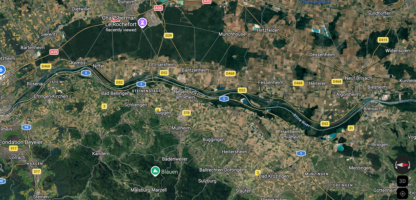
Continuing the journey along the Rhine, this is where it gets even more fascinating. Starting in Basel, the river runs northward and defines the French/German border for just over 100 miles, all the way from Basel to that corner, at coordinates 48°57'59.9"N 8°13'57.5"E.
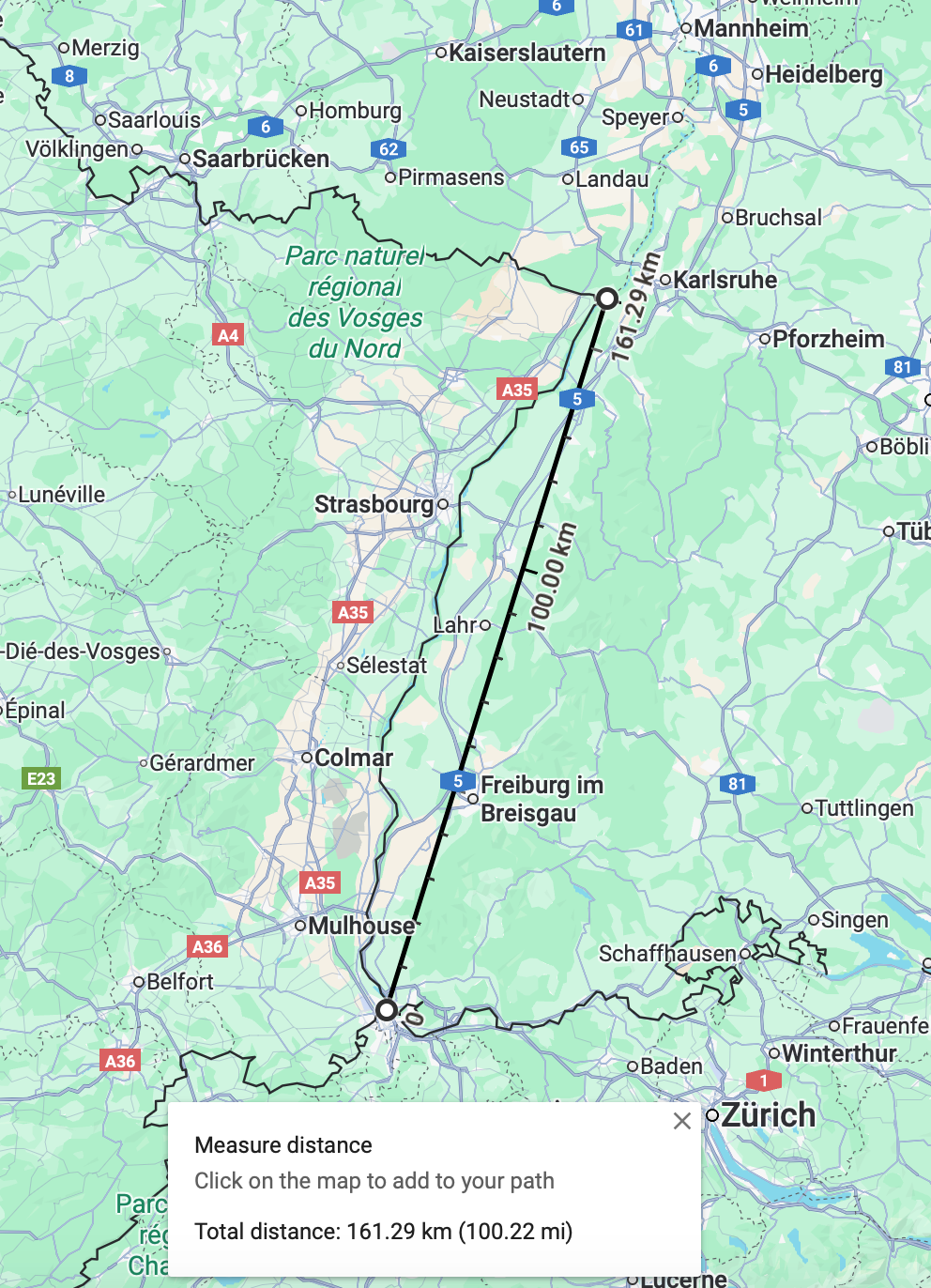
Not just defining the international border, the river also runs through a rift valley which is cool.
The rift valley runs all the way from Basel in the south to Frankfurt. The Rhine itself doesn’t run through Frankfurt, it follows a course around 20 miles east of the city and turns sharply westward again. Frankfurt lies on a tributary of the Rhine, the Main.
Anyway, the Rhine Rift System constitutes part of the European Cenozoic Rift System (ECRIS).
What is the ECRIS?
Basically what is now Italy collided with the rest of Europe and pushed up the Alps, and what is now the Iberian peninsula collided with France and pushed up the Pyreneés. These orogenies (mountain building events) caused tension in the crust to the north and west. Where the Rhine is now, the crust pulled apart and formed a graben. This is when a rectangular block gets subsided relative to the adjacent crust/ According to the German Geological Site DGGV article on Rifting and Spreading:
The tearing of Europe had already begun there, but a change in the direction of plate movement deactivated the Upper Rhine Graben as a rift.
So unlike the East African Rift which is still active and spreading the plates apart (for now), tectonic movement changed in Europe and stopped the Upper Rhine Graben from going further. Now it’s just a rift.
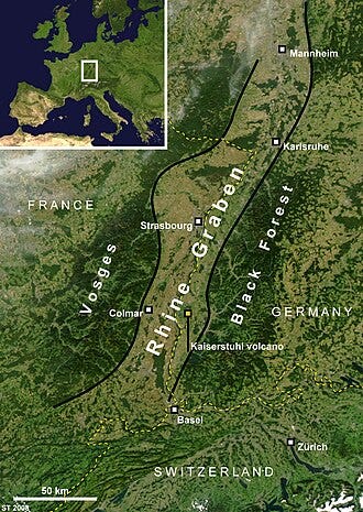
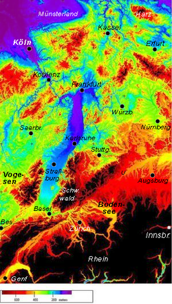
We can see the rift from high up though, the area that rifted downwards formed the Upper Rhine Plain, a long area of flat land, flanked by mountains on either side. Check out the satellite image courtesy of Wikipedia.
And creating a digital elevation image with false colour, the geology is illustrated with more clarity and looks super cool.
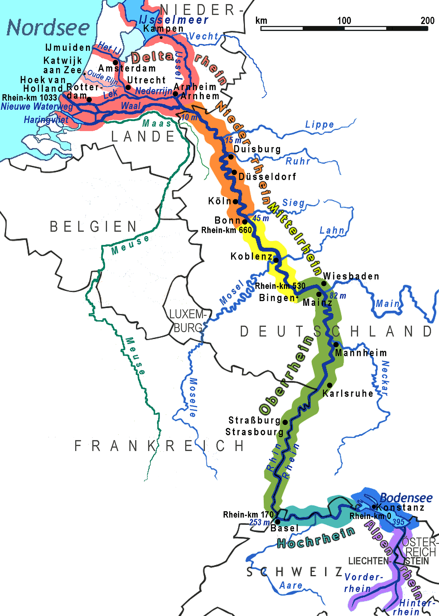
As I said, we’re entering the Upper Rhine, probably the longest division of the Rhine as you can see from the image below, the Upper Rhine in green. This section is defined from Basel as the Rhine flows northward until the next major bend or Rhine Knee as they’re known, near Wiesbaden.
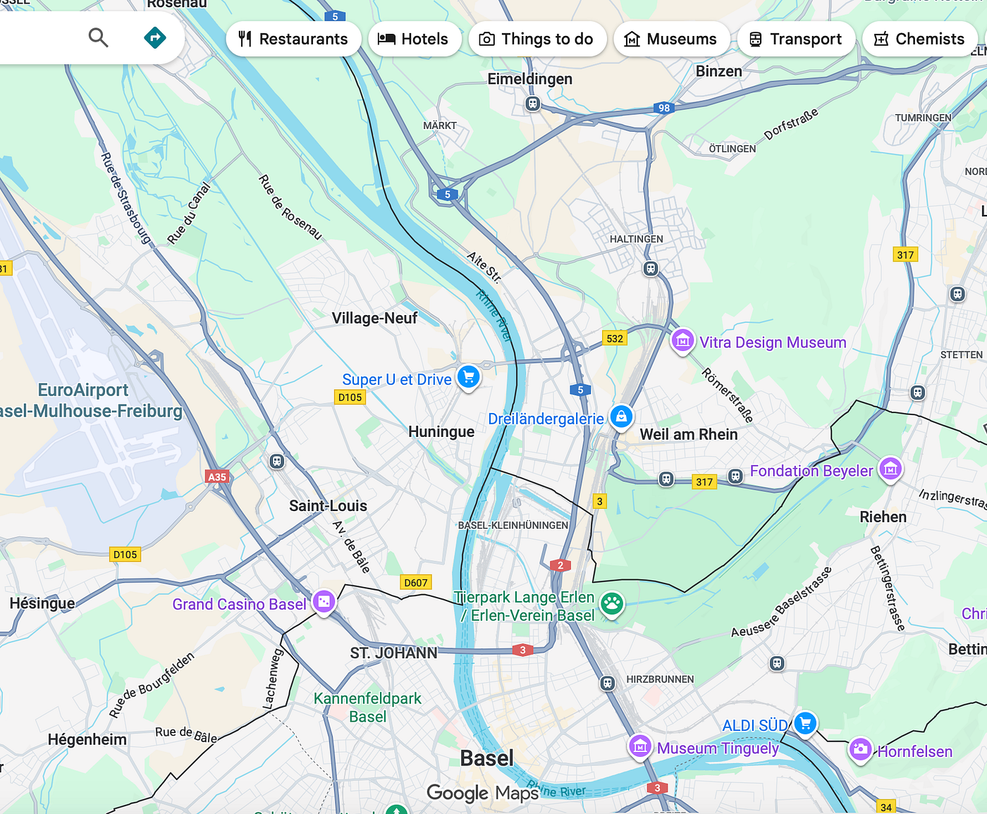
Let’s get into it now, starting at Basel and the Grand Canal d’Alsace. See the map snip below, at the top the Rhine just north of the Basel conurbation splits off from another waterway. This is the start of the Grand Canal of Alsace.
Flowing through the heartland of Western Europe as a major river, the Rhine has seen significant human intervention. For centuries humans wanted to control the flow and bend the power for their own gain. We already saw some river management further upstream on the Alpine Rhine.
Starting with the Upper Rhine, humanity’s management becomes markedly increased. Upstream flowing through mountains you can’t do as much apart from dams and there’s less of a need.
But downstream flowing through flat land, humans want the river to be navigable.
In the 19th century, with the advent of steam and railways humans travelled much more frequently on a regular basis. Goods were sent cross-country, even internationally.
However, to transport products a river needs to be navigable and this is where the Rhine failed. Despite flowing through flat land, down a rift valley the Rhine was not conducive to mass transportation of goods.
Actually the idea to manage the Rhine came from the Sun King, Louis XIV of France back in 1685 (incidentally the same year the Trinity of Baroque male composers — Bach, Handel and Scarlatti were born. Which has nothing to with anything, just more pointless knowledge I’ve picked up over the years.)
To start they moved the Rhine, then in the 19th century they straightened it, then in the 20th century they canalised the Rhine.
The Grand Canal of Alsace.
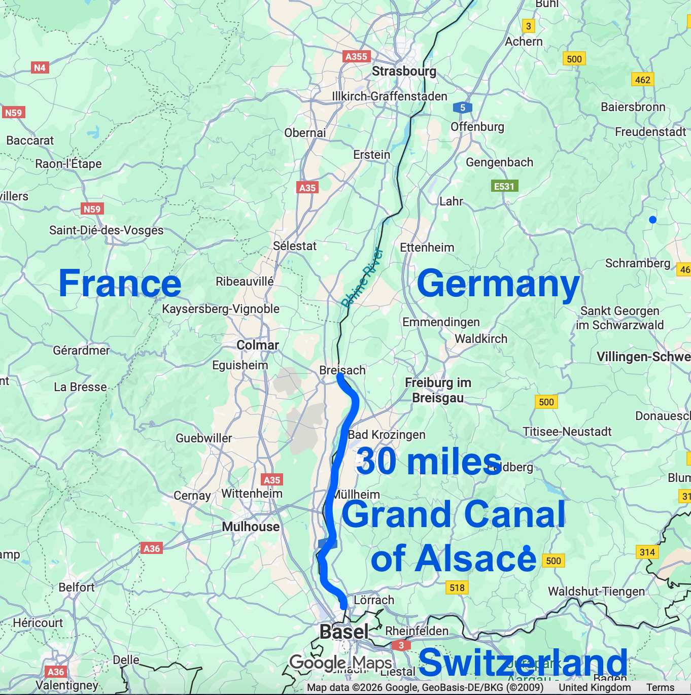
You know what, let’s leave it here for now and start the Grand Canal exploration in the next blog.
Map nerd for the win.
메타데이터
- post_id
- 47e24e24fdff
- slug
- exploring-the-rhine-pt-3-the-upper-rhine-47e24e24fdff
- url
- https://medium.com/@mapnerdforthewin/exploring-the-rhine-pt-3-the-upper-rhine-47e24e24fdff
- canonical_url
- https://medium.com/@mapnerdforthewin/exploring-the-rhine-pt-3-the-upper-rhine-47e24e24fdff
- author_url
- https://medium.com/@mapnerdforthewin
- status
- ok
- fetched_at
- 2026-07-09 13:13:48