Adventure to look out on the world and into yourself
I needed a break from life, I needed a new perspective and time to think. For me, the cure is often an adventure but I had been vacillating…
Adventure to look out on the world and into yourself
I needed a break from life, I needed a new perspective and time to think. For me, the cure is often an adventure but I had been vacillating for weeks. The future is uncertain for me now, and I am without work for a few weeks which always makes me feel ill. I considered a long train trip, but I also knew I needed a challenge, something physical. I have been trying to understand the stars more and wanted to find a place darker than home. The solution was a trip to Mount Diablo State Park.
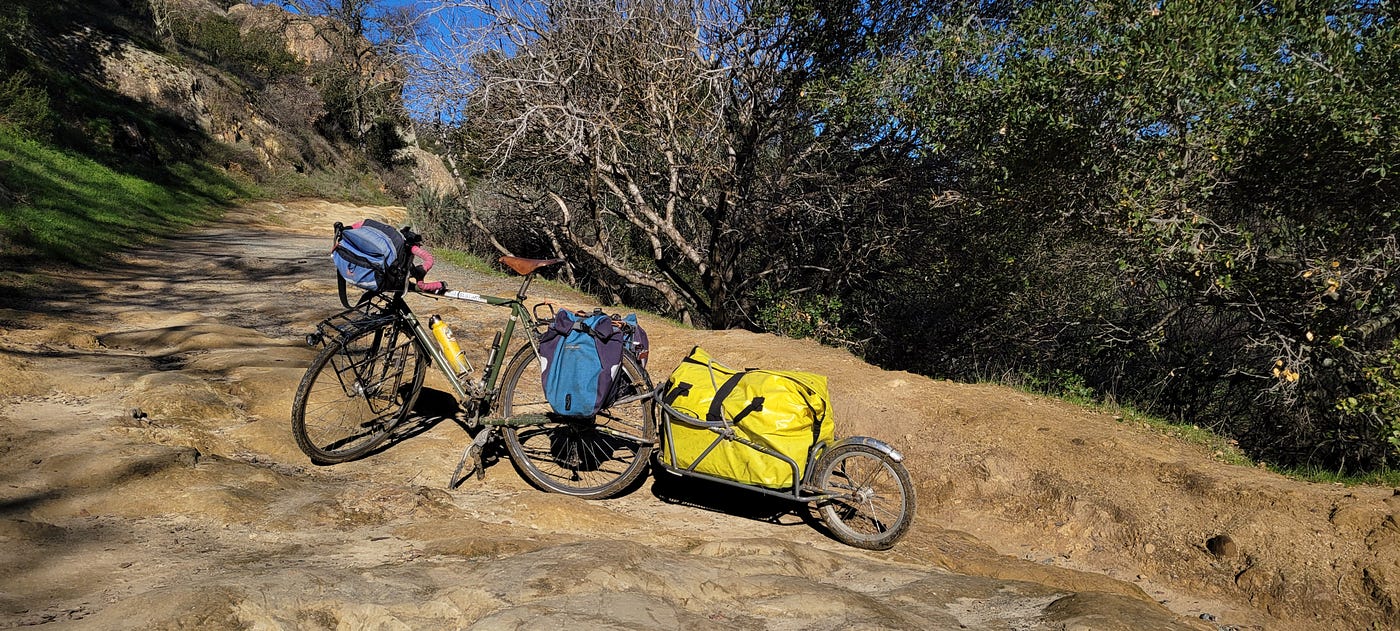
My Surly LHT with a vintage B.O.B. Yak trailer and gear for glamping
I did very little planning. I hitched my B.O.B Yak trailer to my Surly LHT, complete with dynamo and phone charger. This was gonna be a comfortable camping trip, no cowboy camping this time. Not only did I include a big, 2-person tent and a camping pad, but also a moka pot, a hatchet, hiking boots, 10,000mAh battery, day pack, lots of food, star charts, my current book, and all the basic accoutrement for camping. I didn’t forget the binoculars but I did forget the compass and I had no trail map.
I left the Marina at 11am, biked up to Downtown Bezerkeley along Addison essentially following a mostly culverted Strawberry Creek. I wiggled over to Spruce which offers a gentle grade up to Summit Reservoir, or the headwaters of my Cerrito Creek, which flows, culverted, only a few yards away from my home. From there I followed Wildcat Canyon road over and through the Berkeley hills.
The Wildcat ride is fun as hell and popular with bike riders of all stripes. It’s a bit roll-y with short, not-so-steep climbs and fun descents on the western side until you get Inspiration Point, and then it’s gravity powered scream down to San Pablo Road. Drivers are used to cyclists on this route and quite courteous, and — being a living being quite attached to life — I think this is wonderful. I rode the brakes down wet, steep descent — not my usual approach, but caution was warranted this time.
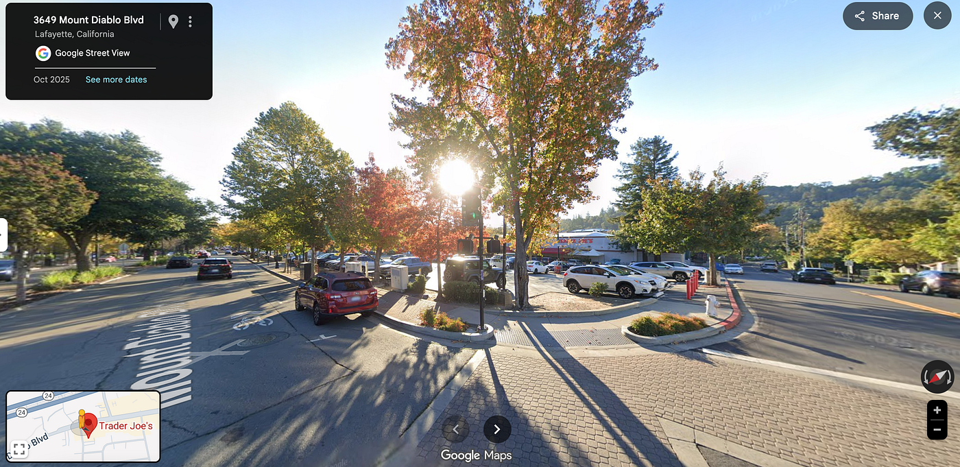
A view of Trader Joe’s — I took very few pictures on my mad ride up to the mountain, hence this screenshot
At the bottom turned right onto San Pablo road. I dodged trash, gravel, dead animals and trash. I also had to avoid cars parked in the bike lane of this popular yet deadly road into Orinda. From there, I avoided death at all the highway interchanges and joined a trail and roads that follow California 24 into Lafayette. This part was ok, I kinda wanted to stop on that trail, but the noise of 12 lanes of highway traffic and the fact that I’d have to trespass to check out the mushrooms sprouting in the winter wetness, dissuaded me.
Once in Lafayette, I decided to pop into TJ’s to pick up a nice plastic wrapped lunch from the cooler and a few other supplies to properly glamp. As I took some drinks from my 1 liter water bottle, I considered doing the sensible thing and filling my 3L hydration pack as well as the 1 liter bottle — but I was anxious and didn’t want to have to ask people for anything. I just wanted to keep riding, keep my mind distracted by podcast noise.
From there Google did an OK job of keeping me off of the big avenues — This part of the East Bay has more in common with Indianapolis than it does with Berkeley. I didn’t notice the change in the plan while riding up the suburban sprawl but the ever mercurial and fairly car-brained Google routed me to the Briones-Mt. Diablo trail instead of the planned South Gate Road. It was to be a happy accident.
I found myself at the end of Rockspring Place, a wide road lined with hard-to-maintain 3000 sqft houses and German-made cars. Off to the right there was one of those bulletin boards with a trail map. Impatient, I ignored the kiosk and consulted the Google map. Indeed, she wanted me to go this way. “Huh, I guess this involves a trail ride”, I said to myself. I turned off the talking heads, put away my bone-conducting headphones and rode onto the trail.
It had rained for many days just until the night before. It didn’t take long, before the trail got tricky. I felt my wheel slip with each push of the pedal. My heart beat faster, and I breathed harder as each yard of distance gained required more effort than it would on paved road. I had to pay close attention to the trail, picking the right track to take as I climbed, pedaling and standing and balancing and thinking fast. Eventually the mud got too thick on the inclines, the progress to laborious. The sun was low on the horizon — How long would I have to contend with this until I got back onto blessed pavement? I consulted Google — 1.5 hours. “No way”, I said “this’ll take forever”. I considered downloading ridewithgps, but my signal was weak and I gave into impatience.
I pushed my bike up the hills and rode down the short descents. As I pushed and slipped in the mud, as the light faded bit by bit, as the dark rain clouds hid the golden rays of sun I cursed my choice of using my B.O.B. Yak trailer, my choice of packing a full kit complete with hatchet, and two beers, and a 2-person tent. I was a bit depressed already, and despite all my talk of connecting with nature, the dark skies coupled with the desolate feel of denuded pastureland dotted by oak trees (sadly besieged by mistletoe) made my heart sink deeper. I thought of the comfort of my couch, warmth, stasis and maybe even some mindless scrolling. The suburban joggers, dog walkers passing me could not know how I felt in that moment. In my head I remarked at the contrast: here they were out for a light bit of exercise, there I was, outfitted for an expedition to the Yukon.
But time passed and so do emotions. The trail leveled out and I was able to ride more of the distance. I still had no idea what lay ahead, but it began to dawn on me that maybe that’s the point. Worries about getting to the camp site began to fade as I realized that the law be damned, I will sleep when and where appropriate. I pedaled on, taking occasional breaks before pushing up particularly muddy inclines.
Suddenly, I came to Fairy Lantern Trail. It was going to be a descent so I saddled up. I dropped quickly into a dark oak forest valley, the pastureland disappeared. I rode carefully, I didn’t trust my worn 38mm tires on loose gravel and clay mud. Fairly Lantern was mostly hardpacked, so not so bad. I got down into the Pine Creek valley and my mood changed completely. I was in a canyon, lush and green, riding levelish surrounded by large sandstone rock formations. The setting sun was reflecting off the peaks to my east, and all seemed well on this wide canyon trail. This was Stage Road and it follows Pine Creek to the South.
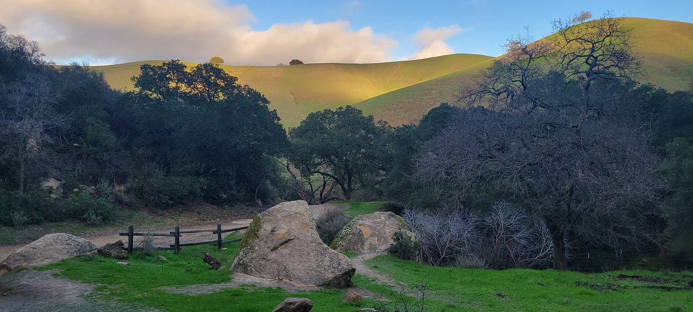
Somewhere on the trail
Biking along, admiring the trees and the sun baked sandstone high above me I noticed something on the hardpacked sand and gravel road. I got closer an saw it was clothing of some sort. I put out my right foot ahead of the pedal and hooked the item — a light scarf with an intricate pattern using. It smelled strongly of perfume. “There’s Desi afoot,” I said to myself. A few minutes later I saw a couple, the man walking with purpose and wearing suspiciously Indic garb and with binoculars dangling from his neck. I shouted. “Are you missing a scarf?” His eyes lit up and he said yes. I asked him if he was birding, and he said yes and added that he was looking for Peregrine falcons. Looking up at the crags, it occurred to me that I could imagine them nesting there. He asked me if I’d seen any — In my mind flashed the image of a peregrine I saw perched on a buouy in the middle of the Bay — and I said “no, not here.”
I biked on, happy with my cultural sleuthing and looking above me for Peregrines. I was able to pedal a very long distance without dismounting, mostly pedaling up soft inclines, impressing myself with some of my mountain biking prowess — certain that if I hit a rock too hard, I’d destroy the rim. One part was extremely muddy, but I was able to balance and my feet never touched the mud — not this time. This is a fine point in the story to add that the B.O.B Yak is a marvel of engineering. Aside from the added rolling resistance, and the drag from gravity that would be associated with any extra weight, you don’t feel it at all. The B.O.B. is locked to the roll of the bike so it does not affect balance. It’s amazing.
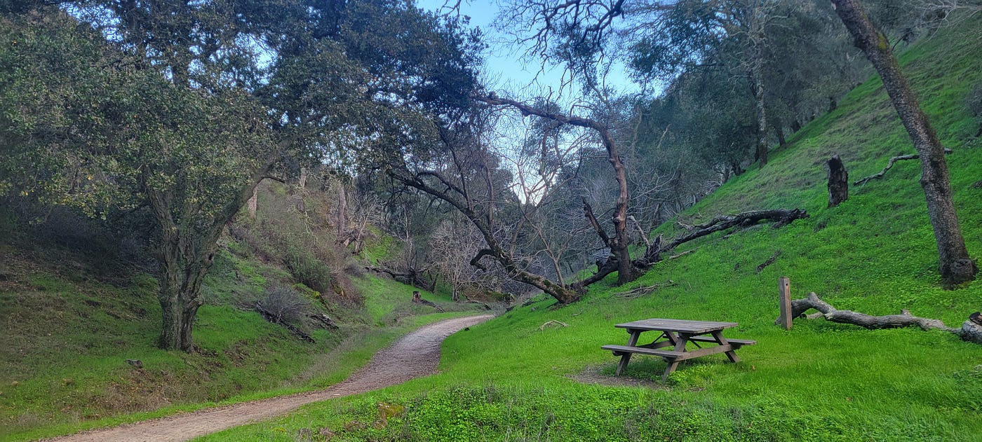
Somewhere on Stage Road
I rode up and down little bunny hills, crossing the creek as the road pressed a straight-ish line deeper into the valley. At one point I had to ride up bare, but craggy and uneven sandstone and I pulled it off on the climb and the descent. This area is where I am sure the mountain bikers have a ball — the trail is on bare sandstone — sandstone that has been rutted by water and humans into pillows, and hillocks. It was a challenge to pedal up it and very fun.
This valley felt magical after the emotional rollercoaster I had been through. The air was full of the sound of Juncos, Bushtits, Robins, Wrentits, Titmice, Chickadees, Acorn Woodpeckers, with the occasional deep breathing of a jogger and the chatter of Slavic and Indic tongues.
The day grew darker and I checked my map once more, but it had reset and now, deep in the canyon, I had no internets and no turn by turn instructions. It’s a failure mode I know all too well — “damn why did I not download a map?” I asked myself, frustrated with my impatience. I was getting tired and I was sopping wet from exercise and it was getting colder. I realized I was very thirsty, my mouth had a metallic taste in it. I asked a few people who passed me if they knew the lay of the land, but they were somehow more clueless than I was. “Sorry my first time” and “sorry I don’t really know” were the two responses I got.
I knew that I would need to get to South Gate road — which was in the plan which Sundar Pichai hand drew for me. I saw a trail headed right with a name I recognized from my glancings at the Google map — It was a steep ascent. I heard the sound of motorcycles echoing from the other side — West towards “civilization”. I consulted the map that was present on the screen — I had enough resolution to see that I was not far from a campsite — Barbecue Terrace. Surely there’d be water at the camp. All I had to do was press on and probably climb a lot. Screw it, I didn’t want to contend with car lights at night on S Gate Road anyway. I biked on for a few minutes until the mud returned. The little bunny hills turned into a steep ascent — I was at the back of the valley and the sun had long set below the canyon walls. It was 5.30pm on Dec 28 and the sun had likely set below the Pacific ocean. A sign soon revealed itself: Barbecue Terrace 1.49 miles to my camp. Well, not the campsite I had booked, but a campsite.
As I pushed my bike up the hill the air was filled with the croaking of Pseudacris frogs, the back and forth hooting of Great-horned Owls, the yelping of Coyotes. I pushed my bike through the oak forest, even had to lift it — trailer and all — over a fallen oak tree. I pushed around a corner finding a flatter part of the valley — a reprieve and in front of me were two coyotes studying me. Above and behind them a Great-horned owl was perched on an Oak tree, its tufts blowing back in the wind. I continued fighting gravity and the two yotes walked on ahead, keeping 50 yards or so ahead of me at all times. I came almost parallel with the bird of prey and inspected it closely with my binoculars — It looked back at me, but made no discernible expression. I looked down to check the time and when I looked up, it was gone. The moon was half full and directly overhead and I could see a good distance but I saw no owl-shaped silhouette.
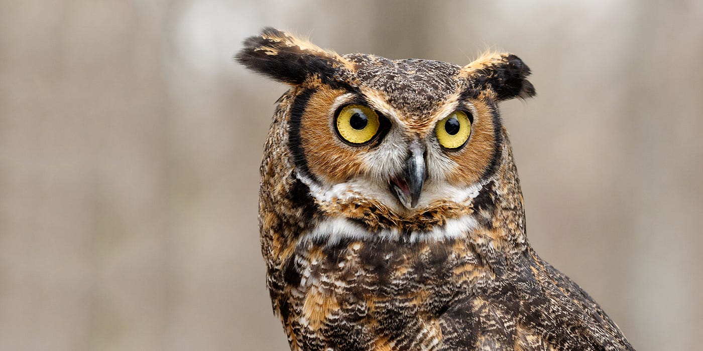
Great Horned Owl, Source: https://www.earthrangers.com/EN/CA/bbtw_updates/owl-talk-oclock/
The coyotes stayed with me for a few more minutes, then the trail turned east and they went west — I think. I pushed for 45 more minutes up the hill taking a moment here and there to breathe and listen. The spring peepers were loud, the wind blew up now and then. Here and there the Coyotes called and I heard Great Horned Owls call back and forth from time to time.
By the time I made it to the paved road leading to BBQ Terrace there was no light on the horizon beyond that made by huamans. It was 6.30 or so. I was alone, sore, tired and my sweater and single long sleeve shirt were soaked. I looked at my altimeter, bike computer and watch. In 7 and ½ hours, I had moved myself, at 200lbs, and 100lbs of bike and camping equipment 28 miles and 2000 feet uphill, with a total of 3300 feet of elevation gain (counting all the ups and downs). I’m a big picture guy and in moments like these my mind goes back to the 1970’s. The Vietcong showed us Americans in the that humans aided by simple machines outlast mega machines dependent on fuel. Their supply lines were indefatigable. You’d bomb theforest, and people on bikes and on foot would just go around the craters.
It took me a while to set up camp. I put on all my dry clothes — two t-shirts, a sweater, my long johns, pants and my puffy. I drank lots of water from the powerful spigot and ate a good meal — ramen. I tied up camp a bit, walking clumsily, my legs reminding me of the day’s feats. I laid a groundsheet, my pad and my sleeping bag in the middle of the camp, and laid down facing due north. It was damn cold but I felt warm in my sleeping sack. Using my planisphere, my red headlamp, and binoculars, I spent an hour studying the sky. I saw a lot of things I often see at home, but much better atmosphere visual and infinitely better acoustic atmosphere -Hoo-Hoo HooHoo — Hoo.
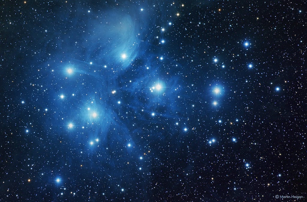
Pleiades, or Ossosoli in Miwok. Source Martin Heigan https://www.flickr.com/photos/martin_heigan/28968129033
I counted 34 stars in the Pleiades. The skies were pretty good, though the moon was high, there were occasional clouds, and sadly, the light dome blocked everything below a certain altitude in the sky. Still, I saw my old friend the Orion nebula, found Cassiopeia, and tried to figure out what the other asterisms were. I found the planisphere hard to use — the writing is too small to read under the dim red light, the drawn constellations too indistinct. I gave up on the paper tool and spent time studying the moon. The edge where the light of the sun ends and shadow begins is fascinating to inspect — you feel as though you too could go there and push your bike up a 4 billion-year-old impact crater, but you’d be utterly alone, without coyotes or owls — but you would have three whole cars, courtesy of NASA.
The call of sleep was eventually too strong, so I relocated my nest to the inside of the tent. Camping sleep is rarely as comfortable as sleep at home — but those interruptions are an opportunity. Throughout the night I heard the call of the yotes, Great Horned Owls, and at least one Barn Owl. At times violent gusts would sweep in from the north and the south, buckling my tent and waking me up. I popped my head out occasionally and watched Orion move overhead and sweep west. Sleep got better towards the morning and, screw it, I slept in until nearly 9:45.
I finally got up and made breakfast. I had a cup of coffee and some delicious Christmas fudge my mother-in-law makes every year. It’s so rich that even if I am tired and exhausted from climbing, I can handle only a few bites before I am satisfied. If only people on the Oregon Trail had Cindy’s fudge.
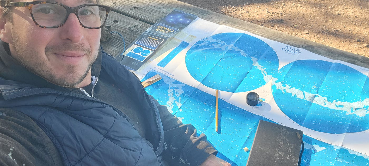
It took me an hour to organize camp. Somehow the few belongings I had brought with me had spread out all over three picnic tables, my tent and the lovely bear box Cal Parks provided. Did the Miwok have this much crap to spread out?
After all the chores were done I got to studying my star chart and planisphere. I wanted to understand the constellations. I was periodically distracted by flocks of birds — Titmice, Bushtits, Juncos who move in flocks gleaning insects from oak trees. I made more coffee and decided I wanted to learn the names of the main stars in Ursa Mayor — they all have Arabic-sounding names — so I drew them in my notebook like astronomers did 400 years ago. At 2 pm, I was done with sitting and so I packed my day pack, and started my way to the summit.
The Barbecue Terrace group camp is just below another camp, the Wildcat Group Camp, and both are near the Summit Trail. I inspected the Wildcat camp and found that it was well appointed, but had more tree cover, which was not good for my purposes. I hiked up the hill, crossed the road and got on the Summit Trail.
A good part of the trail follows an old alignment of Joseph Seavey Hall’s Toll Road to the summit. An informational sign tells us that the road opened in 1874 as part of an investor-backed tourism company. The road and trail take you through a variety of ecotypes. In the sheltered and moist valleys you get oak woodlands. Here I saw hemi-parasites in Orobancaceae, a family of notorious (hemi)parasitic flowering plants that suck nutrients from plant roots. I saw a wide assortment of fruiting bodies of fungi I can’t identify yet — some digest dead things, others are mycorrhizal, which means they help trees get access to nutrients in return for some sugar. Other sections along the trail are chaparral with all sorts of drought-adapted plants — most striking are the Grindelia and Ceanothus, which look so much like the lower elevation plants from my everyday life, yet different — smaller leaves, tougher stems. It’s amazing to see how different lineages of plants adapt to sunny dry climates by turning blue, making smaller leaves, using photosynthetic stems, and becoming wooly.
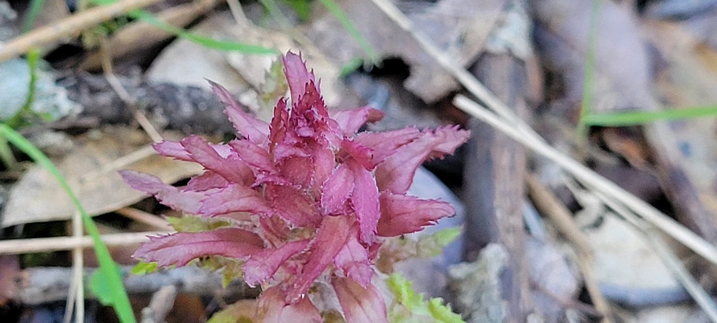
Pedicularis Densiflora a parasitic plant in Onagraceae
The farther you climb, the smaller the trees get, but there are trees all the way to the top. I saw a Pinus sabiana with mistletoe growing out of the poor tree. Arceuthobium is a native species of mistletoe that specializes in certain pine trees. This wasn’t my first time seeing mistletoe. Sadly the whole state is infested with European mistletoe — so many of the oak trees I saw had those green circular deathballs growing out their tops.
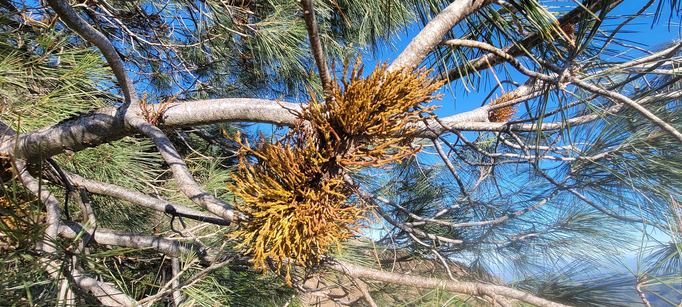
Arceuthobium occidentale, a native, parasitic mistletoe
About 30 minutes from the top I had my first truly pleasant exchange with a hiker. All the other passersby were absorbed in their own conversations, headphones, or thoughts. My hellos were usually returned curtly, if at all. And I get it — I had been in a somber mood, unlikely to talk to strangers, something which is happening increasingly to me with each turn around the sun. Yet this taciturnity is not universal; it varies geographically. Sure, joggers rarely interact — time and their respiration impede it — but I find that on other trails and in other places, people greet each other with more cheer, if not with more words. But this one nice lone hiker, a man (a boy?) in his mid-twenties, seemed eager to commune with another person, so we exchanged some words. He showed some concern for the time of my ascent and I said it wouldn’t be a problem even if I stayed late. I pointed at the moon and said it’d be more than half full and dead overhead at sunset. “I believe in you,” he responded with a smile, and we parted ways.
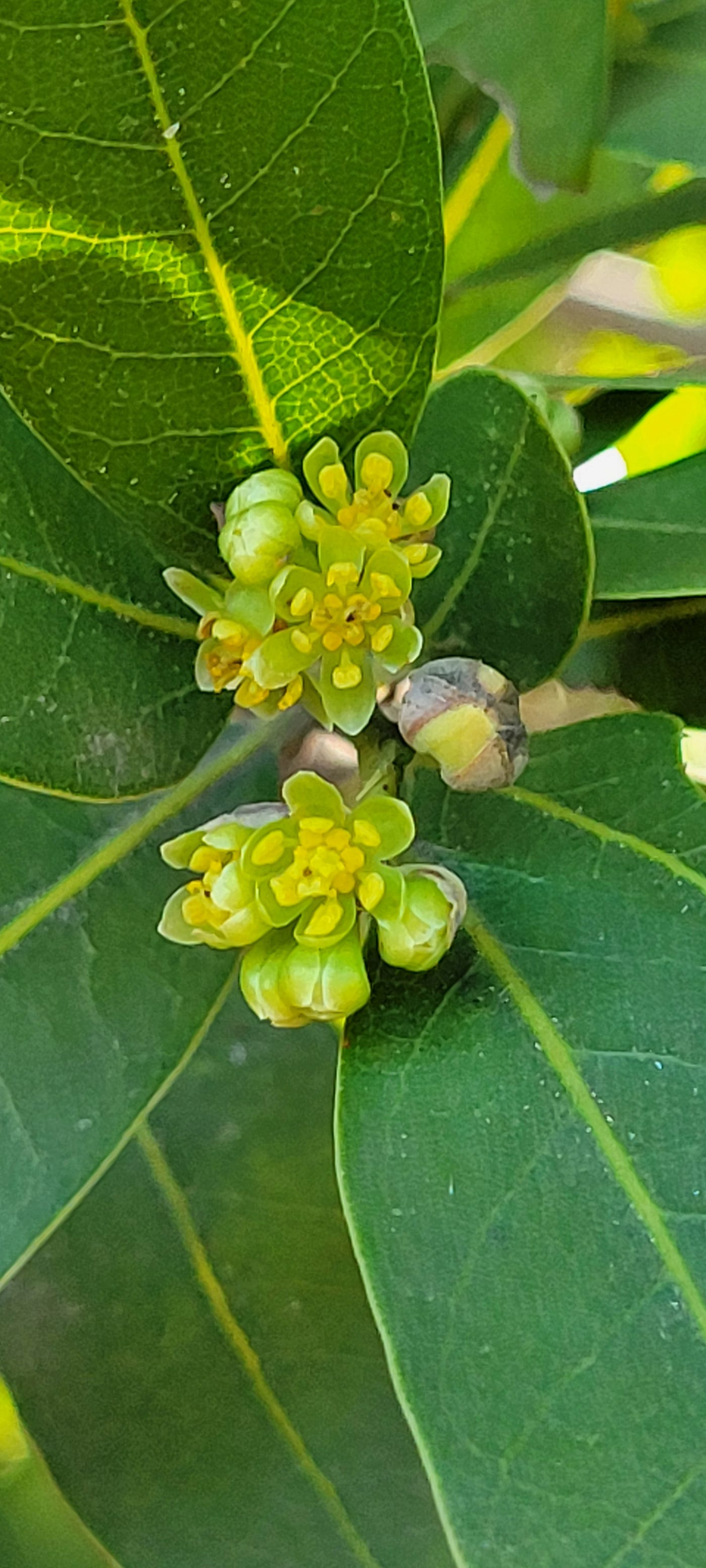
Umbellularia californica, our native Laurel tree in bloom in December on a mountaintop
Near the top, the summit trail takes you through a small Bay Laurel forest. Amazingly, these were in flower, in December at about 3,300 feet in elevation. I grew up in Central Indiana at latitude 40 -2 degres latitude north of where I was, and 2000 feet lower and I assure you -there ain’t nothing flowering in winter (but in a few degrees C, that’ll change I am sure).
Near the very top, just past a radio tower, the summit trail plows right-through a forest of dwarf oaks. At the very top of the mountain, we’ve built a well-appointed visitor center, complete with observation deck, octagonal observation room, museum, and gift shop. The museum is nice and worth visiting, with small exhibits related to ecology, history, and also a large model of the park with trails pointed out in the topography.
As you climb the access stairs to the observation deck you are facing north. Looking left you see the Central Valley and the Delta, then you progress to the far end and you can take in the North Bay, “the city”, Sonoma County and ever so much more. You can probably see about 90 miles away in each direction. As I took in the vastness I wondered what stories people told themselves when standing near this spot. I know, for example, that for one band of Sacramento Valley Miwok, it was O-o-yum-bel-le, “whence you could look out on the world.”(1) Their world and my world, though very similar, are sadly also very different.
(1) N.B. these are words from The Dawn of the World: Myths and Weird Tales Told by the Mewan [Miwok] Indians of California by C. Hart Merriam (1910) https://www.yosemite.ca.us/library/dawn_of_the_world/
At the top I enjoyed getting a sense of the lay of the land. I got a better understanding of the hills and the Tri-Valley. I imagined all those scientists working hard to bring nuclear “progress” to America since the 1950s. I squinted and tried to imagine a land without drainage ditches and suburban developments, a land where tule fog met tule itself. I saw the San Joaquin River and the devastated delta. I saw how the San Pablo Bay backs into Napa and how Suisun Bay backs into the town of Suisun. The Narrows at Antioch and Martinez are obvious.
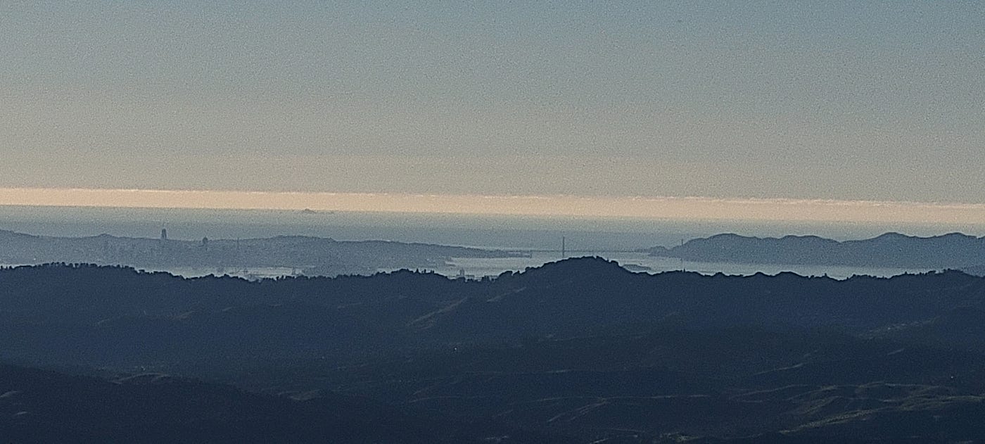
Look carefuly, you’ll spot South Farrallon off in the distance
I used my binoculars to observe San Francisco and the Golden Gate Bridge, both fairly backlit by the setting sun. I could see the ocean beyond San Francisco and off in the distance, a mountain in the ocean — the Farallones! I looked with my naked eye and they were plainly visible. Behind me a family was making their own observations. The man pointed out the city and the bridge. I vacillated, then decided to point out the islands. Mom, Dad, Grandma, and Daughter each exclaimed with wonder when they saw the islands. It’s a very good feeling to hear people say “there it is” and “oh my god there it is” when they see something through the binoculars or telescope. I discovered this feeling when I took a telescope to a party in the Berkeley hills on a lark one day almost a year ago. Aiding people in discovering something that was always there, in plain sight even (Jupiter, the Moon, the Farallones), and hearing people make the connection is pure nirvana.
On my way down the steps I stopped by the gift shop and picked up Cheetos, Fritos, postcards, and a gift for my beloved. It was 4:30 and time to return to camp. The descent was easier than the ascent. I listened to a podcast about how the Democratic Party has abandoned rural America. About 20 minutes from the summit, I ran into a group of three hikers who inquired how long it would be to the top. I thought hard, trying to remember how long it had taken me from here. I answered, “30–45 minutes depending on your pace.” I wondered if they had a car waiting at the top, if they were ready with headlamps, or would they just rely on the moon as I planned to.
As I made my descent, I marveled at how different all the plant species looked. The various greens of the California winter had turned mostly grey and blue as the sun had set behind this ridge and that hill, but in places, the vegetation ahead glowed a brilliant orange and purple. I picked some Lepechinia calycina (Picher Sage) and put it in my pocket, thinking how nice a warm thermos full of tea would be tonight.
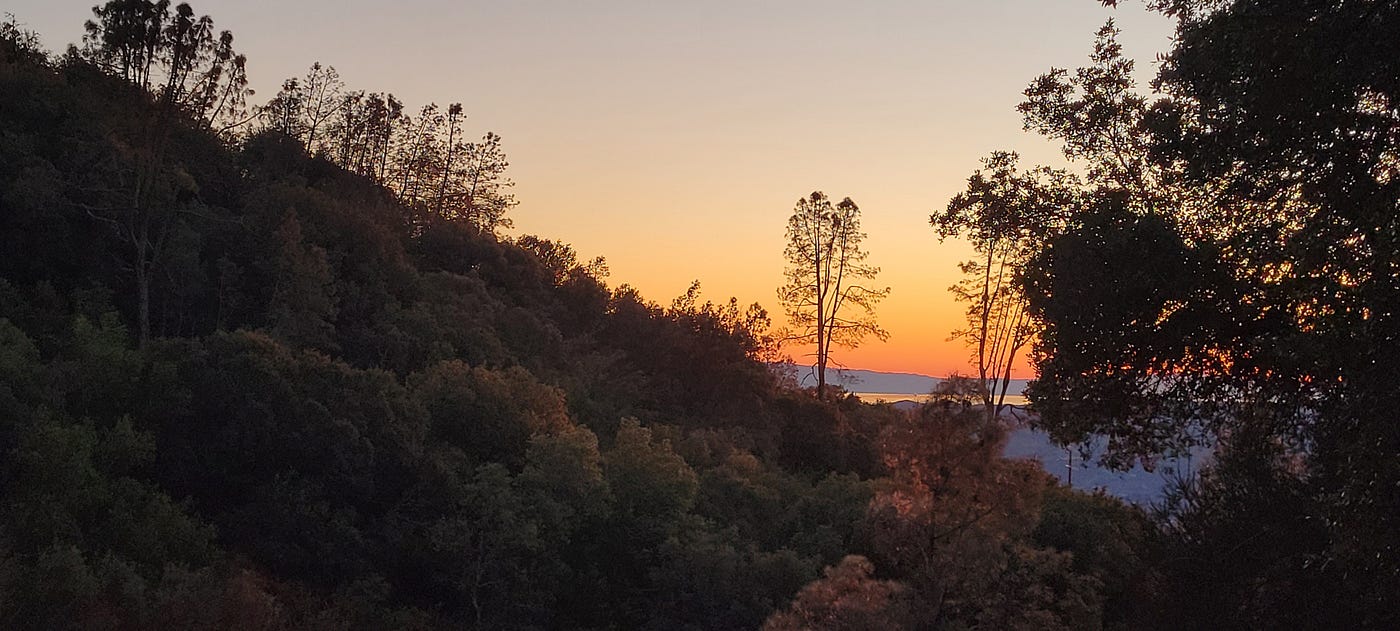
I got back to camp while there was still a faint glow on the horizon. I boiled water and made myself a sage tea and filled my thermos with it. I had a light repast of pita bread crumbled in precooked Indian curry vegetable factory pouch food from TJ’s. The Great Horned’s were calling when I cleaned up camp and prepared for my second night of astronomical observation.
I spent 90 minutes observing the sky this second night. It was a bit warmer than the previous night, no clouds, but the same light pollution kept my attention at my zenith. I spent time taking in the Andromeda galaxy. I was able to make out the arms of the galaxy in addition to the core — it really is three times wider than the moon! I spent time scanning the sky slowly, looking for new objects. I sipped on my warm tea. It was so, so good. First off, you can’t beat fresh. People who grow food in their backyard, fishermen, and hunters know this. We have forgotten how to collect plants, which means we have lost our relationship with the land. Each variety of sage — and there are many right here — tastes different. This one was mintier, almost like Vicks and smooth, kind of like slippery elm.
Warm in my sleeping sack, I spent time letting my eyes settle on the brighter stars of the Big Dipper’s handle: Alkaid, Mizar, Alioth, and Megrez. Mizar is a double star when seen under magnification! At some point I fell asleep and woke up around 1 a.m. and spent some time observing again. Jupiter was up and I saw three of its moons.
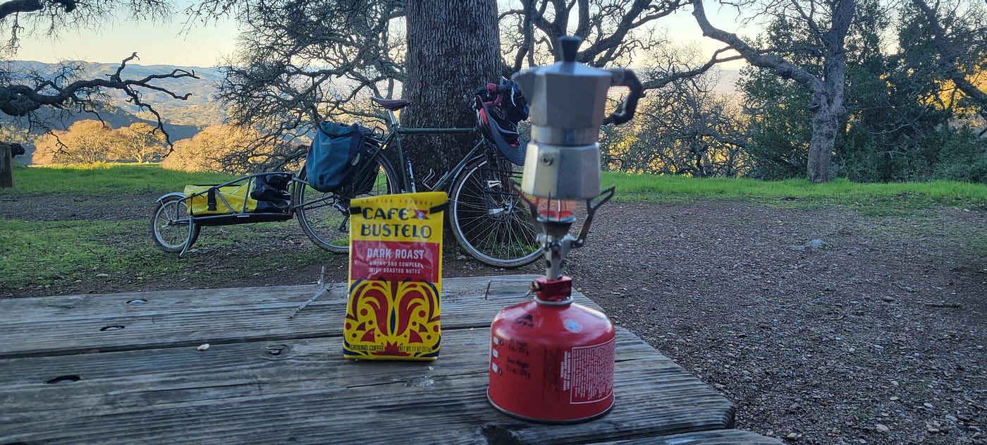
Coffee is such a luxury
The next day I managed to get out of bed at a more reasonable hour: 7:45. It took me 1.75 hours to pack up camp, eat, and drink two cups of coffee. In addition to the normal group of hunters (chickadees, bushtits, tufted titmice, and so on), I was visited by a bevy of turkeys and I lingered to watch them and listen to their little noises.
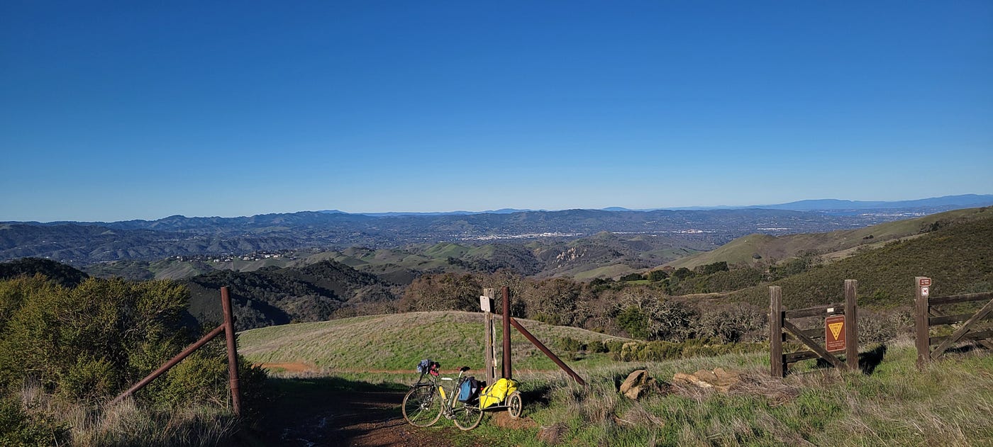
This is what I climbed to, this is what I would descend
At 9:30 I began my descent. Just as I began dropping I saw the familiar white shine of a Northern Harrier’s rump — it was hunting over the mixed Baccharis, Artemisia chaparral. Seeing a Harrier hunt is magical.
I rode the brakes all the way down to the downed oak tree, letting go only briefly on straightaways. I didn’t have enough braking power to just let go — as my hands started to hurt I wondered who I could hire to braze on disc brake mounts, then realized I’d have to replace my awesome front dynamo hub, and abandoned the daydream immediately. I managed to squeeze by the downed tree and then just as I started accelerating away — I realized I had the power to make a difference. I leaned the bike down and pulled out the hatchet. It took about 20 minutes to chop away at various limbs, and eventually at the main trunk, 8 inches thick. I was careful to pile the branches off the trail in such a way as to make habitat for tiny campers like insects, rodents, birds, and whatnot. Midway through my forestry work, a pair of joggers praised me and joined in by kicking a few branchlets off to the side before jogging off. “You’re doing God’s work,” said one of them. “Thanks,” I said, despite having a dozen philosophical thoughts, but no time or words to share any.
Satisfied with my work, I continued my descent down Barbecue Terrace Road into the Pine Creek valley. I was now familiar with the route and had no trouble navigating back on memory. I stopped at the super muddy area to investigate the source of the mud. This stretch of the road is about 50 yards long. On the west side there’s cattails and cottonwoods, where as the east side is close to the canyon wall, though there is something creek-like, with willows and such. Near the northern end there’s concrete works of some sort meant to channel water. It seems this road involved the construction of some waterworks as well.
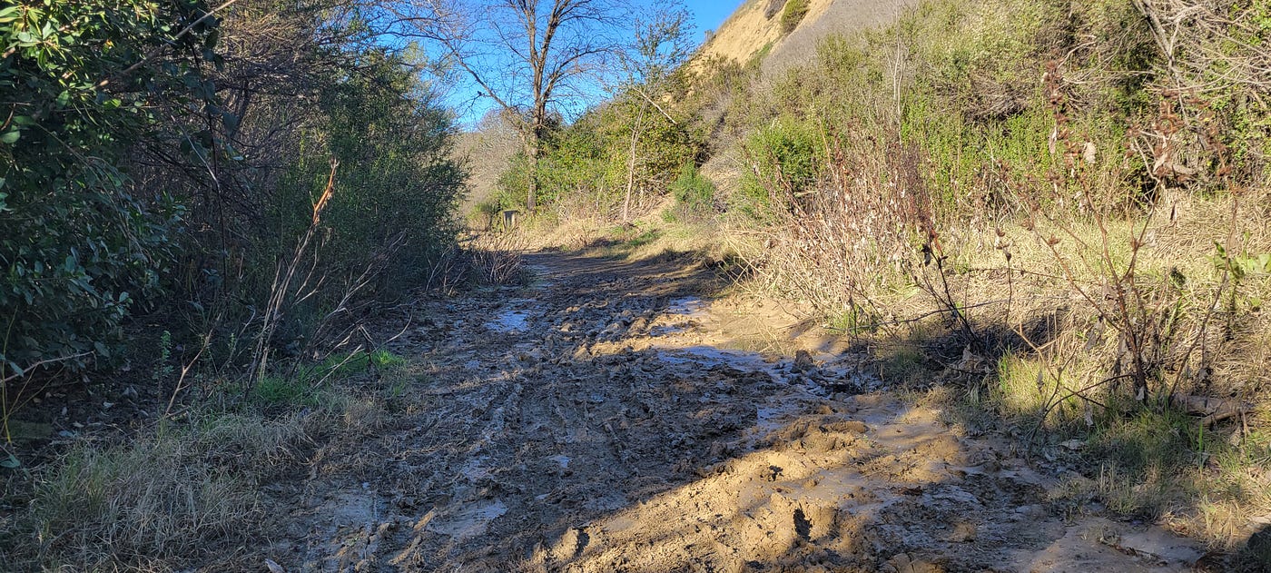
Muddy section of trail, Stage Road
I admit to doing some off-trail investigation beyond the cattails. It’s something of a marsh/creek depending on the volume of water. In one part, a huge rush of water has excavated the creek bank exposing the roots of willows -I’ve never seen willow roots before.
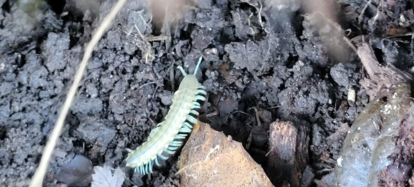
Unknown millipede
Along the slope of the canyon I found interesting mushrooms, millipedes, and centipedes. I also got up-close and personal views of Wrentits — a common bird here in this part of California, but extirpated from the flats and hills of El Cerrito. I wonder when the last call of the Wrentit was heard where I live. 1890? 1950? 1980? While it may look a dull grey in drawings, in the real world, with real light, it’s got some interesting ruddy colors and lines down its chest. Its eye is a pale yellow and angry-looking. Its call — or calls — are unmistakable. They hunt in packs, like many other grazing predators such as bushtits and chickadees. As they move through the thick brush they make these soft, eerie calls, presumably to stay in touch and communicate their status — “food found, no issues, bouncing about, no issues” — and so on.
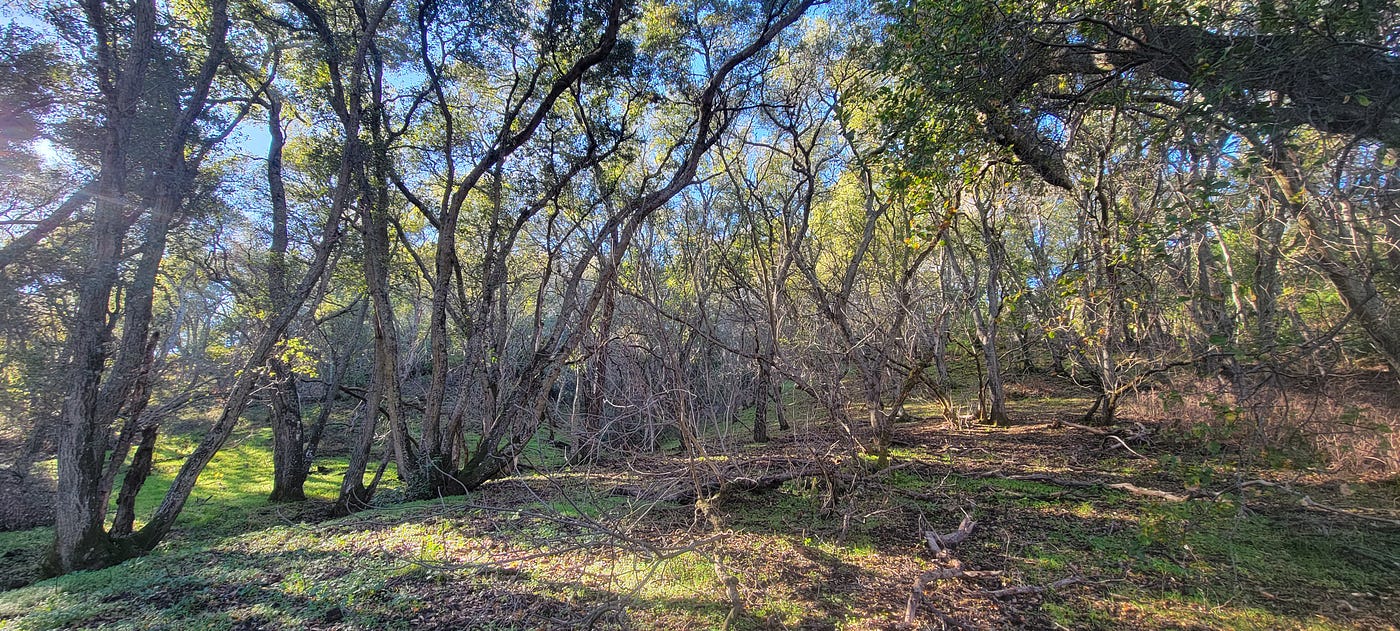
Oak woodland near impounded creek, Stage Road
My hypothesis is that they dammed the creek or something like that, created the road, but the creek has become shallower, climbing to the road level, and now the road is part of an ephemeral creek. I think the water was meant to pass under the road via culvert and it has clogged, but I can’t be sure. Ultimately, it seems that depending on water flow, the road is part of the creek bed/marsh.
I found my way back through the cattails and onto the muddy trail. I pushed just a few yards further before the land rose and the trail became hardpacked again. Looking right (west/north), the creek is narrow and often encased in concrete. A bit further on, the road becomes the bare sandstone I had no trouble riding two days earlier. Though it was easy to ride up and down the bare rock parts along Stage Road headed south, going north I didn’t find it as easy, so I pushed my bike up and took the opportunity to take some vanity shots. As I rode down the north side of this exposed sandstone, I saw it was smoother and easier to pick a smooth path to ride — thus easier when power is needed riding up. The south face is bumpier and more challenging to pedal, and picking a path up is harder than doing so with gravity on your side.
The rest of my ride was more contemplative — I knew my time on this adventure was running out and I did my best to absorb the woods and the rocks and, most of all, the lack of machine noise. It was not silent; the bushtits and chickadees and ravens and other species made plenty of noise, as did the dozen or so people I saw walking their dogs or on a short winter hike. But those are nice noises, the noises of creatures, not machines.
I finally came to the last physical challenge of the trip, the climb out of the canyon up Fairy Lantern Trail. I took a minute to remove clothing, knowing that this would result in some serious perspiration. Then just as I pushed off, I saw a quadruped in the distance. I paused. Was that a dog? No. Not a yote either. I got my binoculars out and looked at him or her — a Bobcat. I grabbed my phone just in time to snap a blurry picture before the cat disappeared.
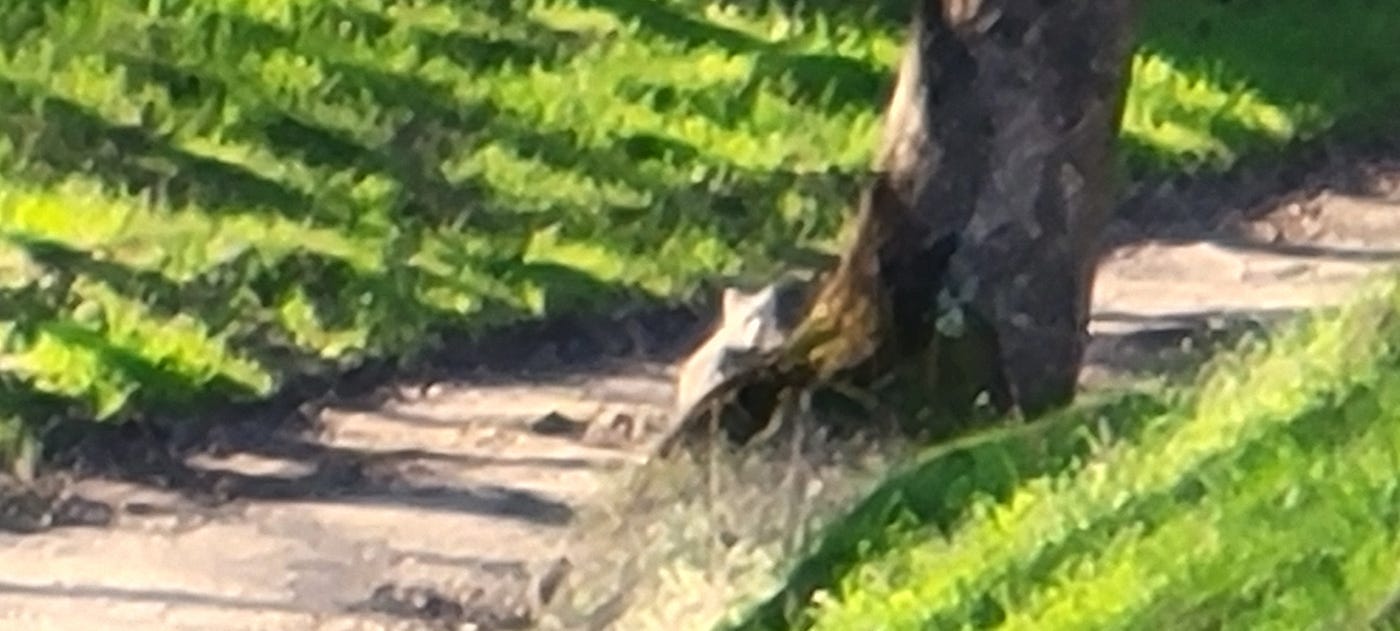
Blurry Bobcat on Fairylantern Trail
I was able to bike some of the Fairy Lantern Trail, once again impressing myself with my technique on a slightly “technical trail,” but halfway up, I opted for the slower pace of pushing my bike. I only pushed for about 10 minutes as I watched the denser, sheltered woodland of oaks and willows turn into cow-managed pasture sparsely dotted with the iconic California live oaks.
At the top I mounted my steel steed and biked off along the Briones-Mt. Diablo Trail. I was shocked as to how dry the land was — it had only been 72 hours since the last bout of rain and already the trail was dry. Back in the bottomland of central Indiana, the trails stay wet much longer. Biking north along the Briones to Mt. Diablo trail, I heard the call of Red-winged Blackbirds. As I came to a cattle gate, I saw the tree was full of red-wings, calling and bouncing about. I took a moment to look at the birds through my binoculars and to look around.
[embed]Red-winged Blackbirds
These are very special conditions — a blue California sky, bare oaks crawling with melodic blackbirds, the air is fresh and wet, but the path is dry. Looking northwest, the fold between these three hills has been fenced; its inside is thick with resuscitated California chaparral, contrasting starkly with the ephemerally green pastureland. At the bottom of the fenced “restoration area,” an American flag waved from the site of Borges Ranch. After a few minutes, realizing I couldn’t stay forever, I pedaled on.
Before I knew it, the 10-foot-wide trail of sandstone, gravel, and occasional mud had turned into a 32-foot-wide asphalt road. I have to say it’s absurd that cities force suburban homeowners to foot the maintenance bills for such massive roads, where roads ⅓ the size and thus ⅔ cheaper would suffice. I’d just moved 300 pounds 28 miles on a bike along a 10-foot-wide trail, and there must be room for more affordable infrastructure somewhere between 10-foot-wide dirt tracks fit for bikes and 32-foot-wide roads fit for landing air freighters. Certain people in such destitute countries as Denmark, Germany, Finland, the Netherlands, and even the car-loving French Frogs seem to tolerate the lower cost of living just fine.
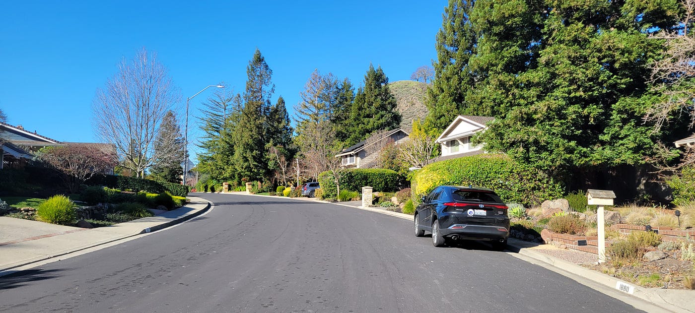
Rockspring Place 32 feet wide, just what taxpayers love
This junction, between the Briones-Mt. Diablo trail and Suburbia, is designated as Rockspring Place trail entrance — Shell Ridge. From this point it is only 3.8 miles to the Walnut Creek BART. It’s a fairly pleasant ride most of the way. I chose to lengthen my route a bit by following the Iron Horse trail north up to the cool iron bridge. At that point I had to turn left and enter into the stroaded-out dystopia that is Walnut Creek.
I should explain this neologism for the uninitiated. A stroad is a term coined by a faction of urban planners who recognize that large, wide “roads” in cities fail the users. They’re inefficient as high-volume thoroughfares because they are forced to serve as streets. Streets are defined as ways that give access to housing and commerce, whereas a road, in this science, is a way that connects two or more centers and is meant to have few turnoffs and faster traffic. The wide stroads are choked up with traffic signals and byzantine turnoffs to local destinations while also failing to move vehicles from more distant places quickly. By the same token, they fail local businesses, since it’s hard for shoppers to visit multiple shops when you have to reposition your vehicle every time. Window shopping and serendipitous shopping is almost nonexistent, which is an even bigger problem in the post-Shopping Mall era. Wide, traffic-heavy roads deter walkers and make the outdoor real estate along the road loud, toxic, and dirty. We all love vacations to walkable paradises such as Paris and Disneyland, yet tolerate parklets on loud streets and “outdoor dining” in literal parking lots. When you consider the median salary of Walnut Creekers and think of peak urban living in the countries we envy, the scene becomes both comedic and tragic.
[embed]The quaint and walkable downtown of Walnut Creek
As I was crossing Ygnacio Valley Stroad at Main Stroad, I was thinking about how absurdly wide a road, how deadly it is and how I would not want to get stuck there when traffic started flowing. Safely on the other side, I realized I had dropped my glove somewhere. I turned around and saw it in the middle of the road. I thought of Alanis and her litany of life’s ironies, wondering if this one had ever crossed her mind. The light changed and soon I watched as six lanes of steel, aluminum, and lithium roared into motion. I winced as a “compact” 3,500-pound Chevy Volt crushed my glove, rolling it into a ball in a way that reminded me of a pill bug. Every signal change was accompanied by the deafening roar of engines as 10, 12, even 14 people pressed 10, 12, even 14 pedals with their right feet. When 40 or 50 people had moved 75,000–100,000 pounds of metal through the intersection, the light would change again. I waited for what seemed an eternity until the signal changed in my favor. I darted out, like a participant in a real-stakes Survivor challenge, grabbed my glove as I spun on my foot, and sprinted back to the relative safety of the sidewalk 50 feet away. As I put it on, I felt as though the glove was more tender and supple than I remembered. Next time I buy new gloves, I’ll make sure to leave them out in traffic for 1–2 light cycles.
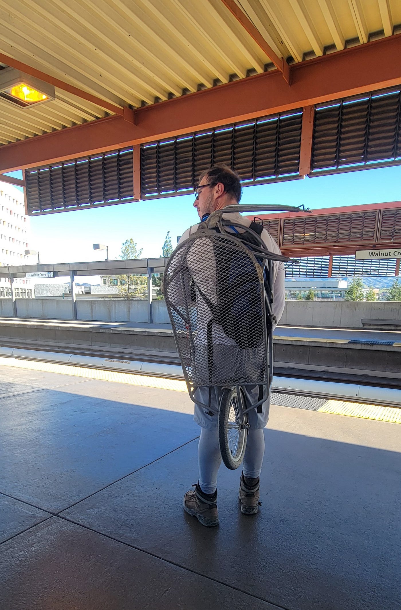
I rode a few more mega blocks to BART, tagged in, and took a breath. Now, how to get myself, my bike, my trailer, and the sack full of camping stuff up the escalator without injury? I have a system for getting onto the BART with my B.O.B. Yak trailer, which involves wearing it like a backpack. Not too cumbersome as far as things go. I balanced the yellow sack on the top tube of the bike, telling myself that this maneuver was no more absurd than vacationers towing two suitcases each for their island getaway. When I got to the platform, I asked a nice lady to take a picture of my “backpack” so I could show you. The train soon came and I rode in comfort to MacArthur, using the time on the BART to send images and texts to friends. I rode home from MacArthur, stopping by a good taco stand to get some salty, overpriced street grub.
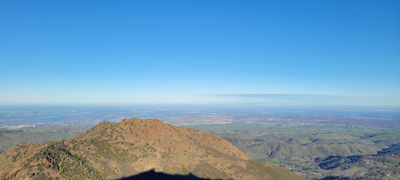
View Northwest from Mt. Diablo
This trip is exactly what I needed. I had vacillated until the last moment and left ill prepared, yet I was able to do something amazing: I had a backyard adventure. These can be had anywhere in the world, at any time, but I live in Northern California, specifically El Cerrito. This means I can hop on my bike, and with the aid of BART (and other transit agencies too) get out into the countryside and wilderness. While I could have made hiking this trail a day trip with the use of my car, or even a BART + Uber connection, I decided to connect to the landscape and challenge myself.
Suddenly, by making the simple choice of biking somewhere, what would have been a mundane, and pleasant saunter in the park, led to true adventure. For anything to be an adventure there must be risk and challenges, ideally physical and mental. The turbulence in my mind prior to the trip revolved around my self-image, pending life changes — a new job, the death of my mother, responsibilities, tasks, projects. The adventure brought those issues into perspective, each challenge is momentary, life is short and no matter how good or bad things get there is one guarantee: it’s all gonna end. It’s up to us to see each moment positively, or neutrally or as just a moment that’s waiting to pass.
A backyard bike adventure removes you partially –and sometimes completely– from the support network of the modern city, even civilization sometimes, and puts you face to face with what is real. You have to breathe, you have to drink water, you have to keep warm and dry, you have to sleep. These are the real things that matter — it’s why your mother may ask “are you eating well?” “Are you sleeping?
Earlier in 2025 a good friend Lowell and I took 2 buses up to Carquinez then proceeded to hike to Castro Valley following the fractured yet extensive Bay Ridge Trail. We were only “out” 5 days and in that time we succeeded in disconnecting from the fray of modern life while getting a real understanding of the geography, geology and history of the land. This trip was no different, except that with hiking you can inspect more. “What’s this plant?” “What’s that building?” “What’s that hill in the distance?” For example, in this way we even found a spring flowing in the Oakland hills, which was very rewarding.
Bike on sandstone facing North/West
Biking is faster, but as such, you skip more stuff. That’s fine in the urban sprawl, but less welcome along greener, less altered paths. This is the first time I bike somewhere and then spend time hiking. It was the best of both worlds. Standing atop Mt. Diablo having biked/hiked from home I felt the land, the hills, the watersheds in my body — I imagined how a sack of water and protoplasm like me must go through dozens of habitats and 5 watersheds to get to where I was. I looked off in the distance and saw South Farrallon, 40 miles from my house, an island I have sailed to on many occasions and I felt a real sense of completeness — here I stood, having pedaled and hiked 30 miles from home, looking at islands floating in a sea of blue beyond the steel towers of San Francisco. I had, with my own strength and ingenuity, traveled these 70 miles of the Bay Area, each journey an adventure on its own.
In the end, I gained a bit of peace, some literal perspective and once again proved to myself that our backyard is vast and diverse when put under the microscope of self-propelled locomotion.
메타데이터
- post_id
- 5b4d3fbe22aa
- slug
- adventure-to-look-out-on-the-world-and-into-yourself-5b4d3fbe22aa
- url
- https://medium.com/@morrisaarongevirtz/adventure-to-look-out-on-the-world-and-into-yourself-5b4d3fbe22aa
- canonical_url
- https://medium.com/@morrisaarongevirtz/adventure-to-look-out-on-the-world-and-into-yourself-5b4d3fbe22aa
- author_url
- https://medium.com/@morrisaarongevirtz
- status
- ok
- fetched_at
- 2026-06-15 20:49:13