The Passion for Football Is Helping Fix Our Geographic Maps
Why the Love of the Game Is a Lifesaver for Geographers
The Passion for Football Is Helping Fix Our Geographic Maps
Why the Love of the Game Is a Lifesaver for Geographers
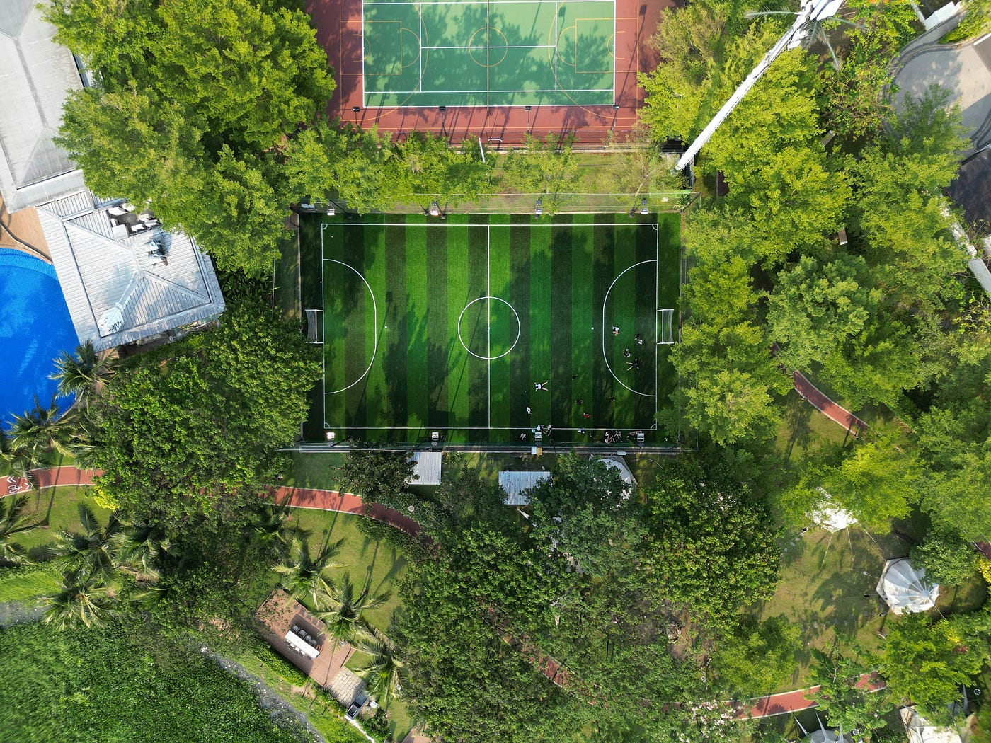
Aerial view of a football pitch in Vietnam. (Photo by Kushie In Vietnam on Pexels)
Mount Everest stands at 8,849 meters. My house sits at 120 meters. A tropical forest canopy reaches 350 meters.
But above what, exactly?
Because height is meaningless without a baseline. And it turns out we have spent the last century building thousands of perfectly flat and globally distributed reference points, completely by accident: football pitches.
The Mathematical Earth
We usually imagine the Earth as a sphere, but it’s not. It’s not flat either. Our GPS uses an ellipsoid; a mathematical smooth shape that is very convenient for calculations. It’s sort of a sphere that was flattened at the poles.
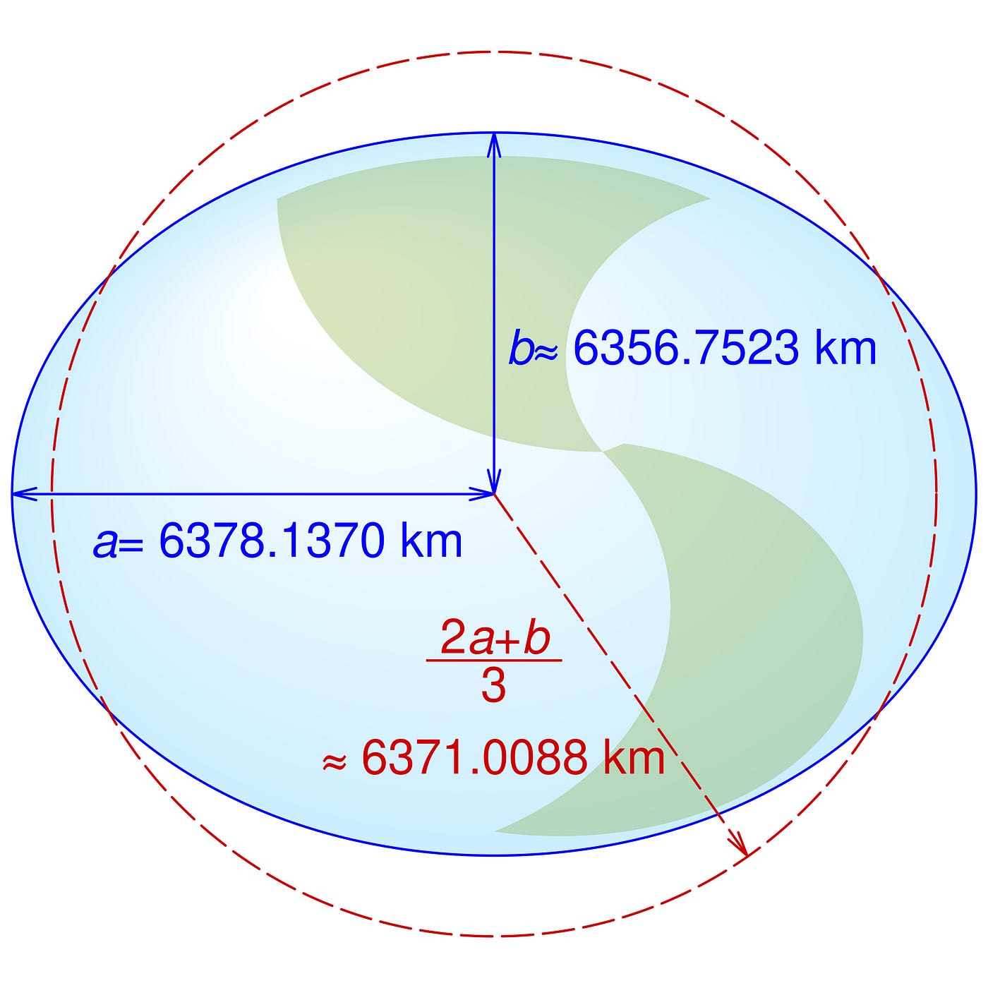
Equatorial (a), polar (b), and mean Earth radii as defined in the 1984 World Geodetic System revision (WGS84). We can see in blue the ellipsoid, and in red the sphere representing the mean radius. (Image by Cmglee on Wikimedia Commons)
As you can already guess, this is more theoretical than real. Scientists have proposed several ellipsoids over the years, each trying to approximate the Earth’s shape as simply as possible. The one used by modern GPS is called WGS84. If you’ve ever looked up your coordinates (latitude and longitude) on a phone or navigation device, they were almost certainly calculated using this mathematical model of the Earth.
The Potato Earth
But the Earth is not actually smooth like the idealized ellipsoid. And careful, I’m not talking about hills, mountains, and topography. Let’s leave that for later.
I’m talking about something else: because the density of our planet is inconsistent, gravitational forces vary from place to place. If you could dig pathways for seawater to flow underneath all the continents, the resulting global ocean would not form a smooth ellipsoid. Gravity would pull the water up in some places and down in others.
This imaginary global ocean is called the geoid. And that imaginary ocean extending underneath the continents is what we call mean sea level. I always believed “above sea level” meant above the closest sea I could get to. No, it’s actually above a theoretical sea that exists beneath your feet.
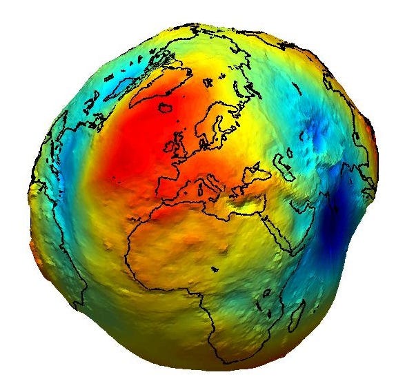
Earth’s geoid as seen by the European satellite GOCE. (Image by ESA)
In the end, our planet looks more like a lumpy potato than a nice smooth M&M. And unlike ellipsoidal models, geoid models are locally determined. The lumpiness of Earth’s gravity field is so irregular and complex that we can’t describe it with a single simple equation and two parameters like the ellipsoid.
Three Different Surfaces
So we have three different things:
- the ellipsoid, a smooth mathematical approximation of the Earth,
- the geoid, an imaginary mean sea level determined by gravity,
- the topography, the actual ground where you are standing. Which can vary a lot depending on where you are. Not every country looks like the Netherlands.

Relationship between ellipsoidal, orthometric, and geoid heights. GNSS stands for Global Navigation Satellite System. (Image by Albayrak et al. 2020)
So when we give a height, what are we talking about? Height above the ellipsoid? Height above the geoid? Or simply relative to somewhere else, like from where you started hiking, for example?
Why Datasets Agree to Disagree
GPS gives height above the ellipsoid, while most terrain elevation models give height above the geoid (mean sea level).
Mount Everest is officially 8,848.86 meters high above the geoid. This is the elevation recognized by Nepal, China, and the National Geographic Society. It represents the distance from the summit down to that theoretical “underground sea level.”
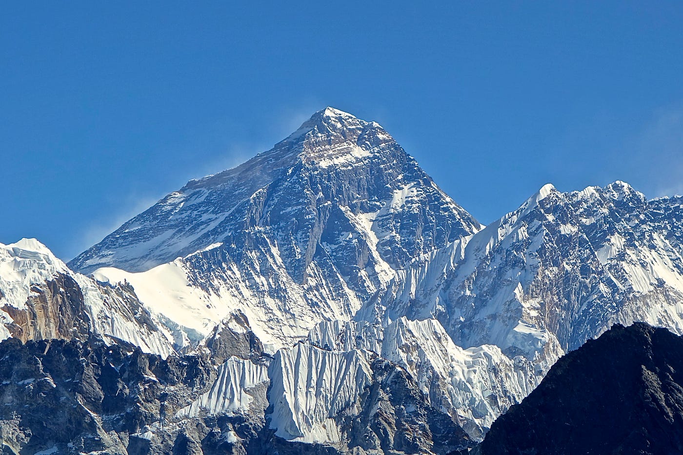
View of Mount Everest from the west. (Image by Rdevany on Wikimedia Commons)
But Everest is only about 8,823 meters high above the ellipsoid. This is the raw geometric distance that a GPS satellite calculates from the smooth ellipsoidal model of the Earth. Because the enormous mass of the Himalayas distorts the gravity field, the geoid sits below the ellipsoid at the location of Mount Everest.
And for a Sherpa living in Namche Bazar (the Sherpa Capital), Everest is only about 5,400 meters high.
None of these numbers is wrong. They are simply measuring from different reference surfaces. This explains why two datasets can differ by tens of meters without either being incorrect.
Except… Sometimes That’s Still Not Enough
Suppose you’ve done everything correctly. You’ve converted your elevations to the same vertical reference. The geoid correction has been applied.
You compare two elevation models of the same area, expecting them to match. But they still differ by about 30 meters everywhere.
How is that possible?
The answer is that agreeing on a common “zero” doesn’t guarantee that your measurements are perfectly positioned in space.
The Second Problem: Relative Accuracy vs. Absolute Accuracy
Imagine making a 3D model of a statue from two photographs taken from different viewpoints. Just as our brain uses two eyes to perceive depth, a computer can use two images from different viewpoints to estimate distances and reconstruct the statue in three dimensions; it’s called stereovision.
You can reconstruct the shape extremely well. You recognize the statue perfectly. But if the camera positions you use for calculation are slightly wrong, the entire statue may end up floating 30 cm too high. The shape of the statue is right, but its absolute position is wrong.
This is exactly what happens when we reconstruct the 3D shape of the landscape from satellite images. Instead of two photographs of a statue, we use two (or more) images of a forest, a mountain range, or a city. By comparing how the same objects appear in all images, a computer can estimate their elevation; it’s called triangulating matching points. But to do so, you need to know the exact positions of the satellite when it took the pictures.
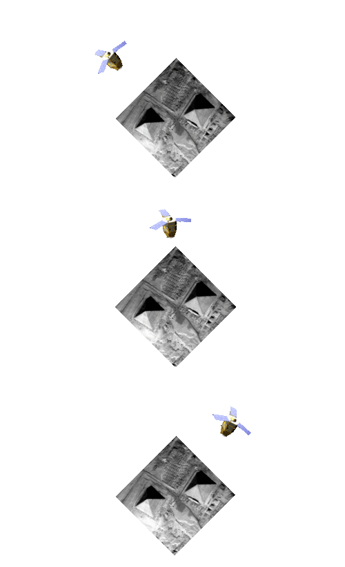
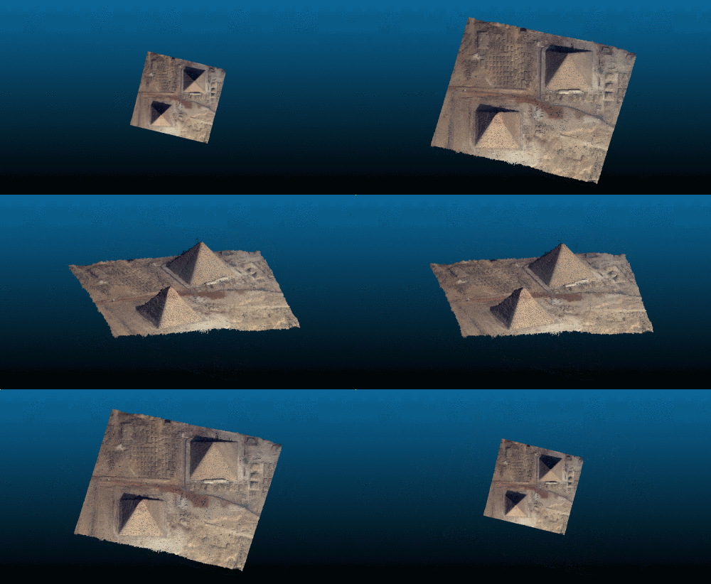
Reconstruction in 3D of the Gizeh pyramids from satellite stereovision. (Images by CARS, a CNES open source 3D software)
If the satellite’s positions when it took the pictures are not perfectly known (and they never are), the reconstructed scene is shifted vertically, like the statue. And without a baseline, you have no way of knowing by how much. Hills in the landscape remain higher than valleys, the pyramids are still higher than the ground, and the overall shape and relative distances are accurate. But the entire terrain may end up floating a few meters, or even tens of meters, too high or too low. A tiny uncertainty in the satellite’s positions can translate into quite significant errors on the ground.
This is the difference between relative accuracy and absolute accuracy. Relative accuracy means that the landscape has the right shape. Absolute accuracy means it’s also at the right elevation.
Note that it’s a completely different problem from the geoid correction. Geoid correction comes from the physics of our planet: it’s just agreeing on what “zero” means. On the contrary, the vertical shift issue comes from imperfections in the positioning and geometry used to reconstruct the 3D scene, because we never know the exact position and orientation of the satellite with perfect precision.
How Do We Correct This Shift?
I was discussing this with an expert in the field, and his answer was quite simple (in theory). If the entire reconstructed landscape is shifted by a constant amount, then all we need is a few places in the scene whose elevation we know for sure. Imagine you find an area whose true elevation is known to be 30 meters. If your reconstructed model says that same area sits at 60 meters, then you immediately know that your entire scene is shifted by about 30 meters. Correct the shift there, and you correct it everywhere.
He then told me that the solution was to look for boring places. We needed to find places where we can measure a reliable average elevation from an independent reference. Those places should meet the following criteria (which is why they’re boring):
- they should be easy to detect in satellite imagery,
- they should be flat, so their elevation is essentially constant over the area,
- and there should be lots of them, no matter where we work.
I first had no idea what could satisfy all three requirements. Parking lots? They’re usually filled with cars. Lakes? Water levels can fluctuate, and we don’t find them everywhere. Roads? Their elevation changes constantly as we move along them. Then, while walking home, I passed by Anoeta, the home stadium of the Real Sociedad. And there it struck me.
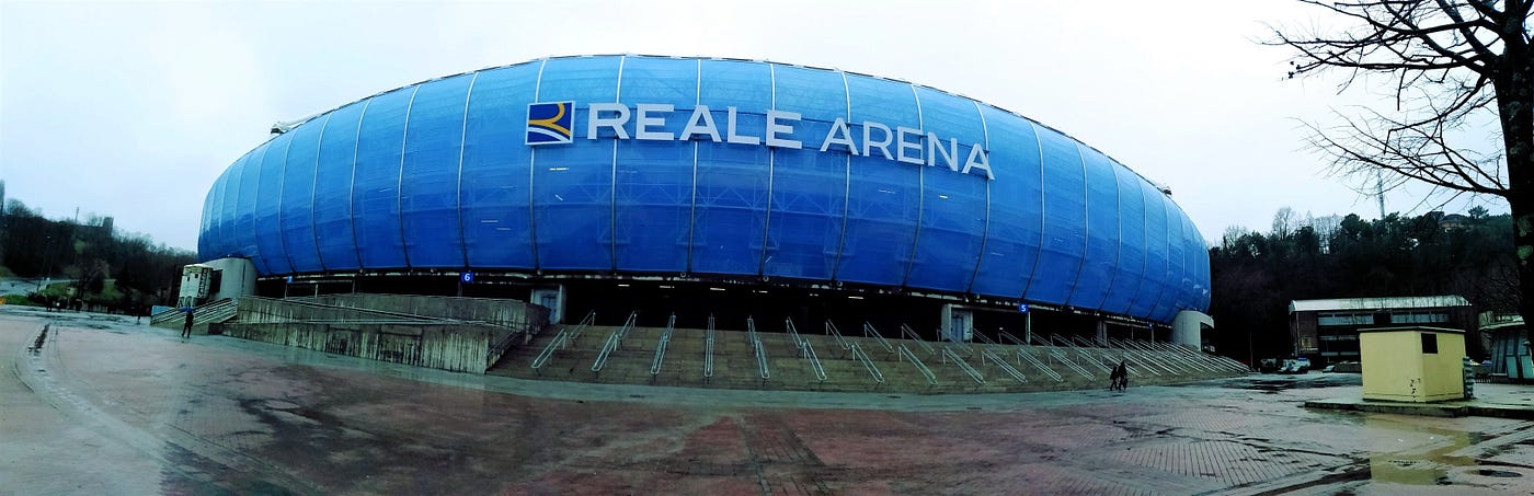
Anoeta, the home stadium of Real Sociedad, in Donostia, Basque Country. (Image by Bhgh543bgf on Wikimedia Commons)
Football pitches!
Football pitches are built to be flat. Every single point on the pitch should have the same elevation. This makes them very reliable reference surfaces.
They are also very easy to detect in satellite imagery. Large green rectangles with standardized dimensions. In fact, similar computer vision techniques have already been used by the French tax authorities to detect undeclared swimming pools from aerial imagery. Instead of looking for green rectangles, they look for blue geometric shapes.
And their biggest advantage: football is passion and the universal language of the world. You can find football pitches anywhere in the world, and a lot of them. Whether your study area is in Peru, Germany, or Morocco, you will likely find football pitches nearby. And they don’t have to be World Cup stadiums. Even the pitch behind your local school can do the job.
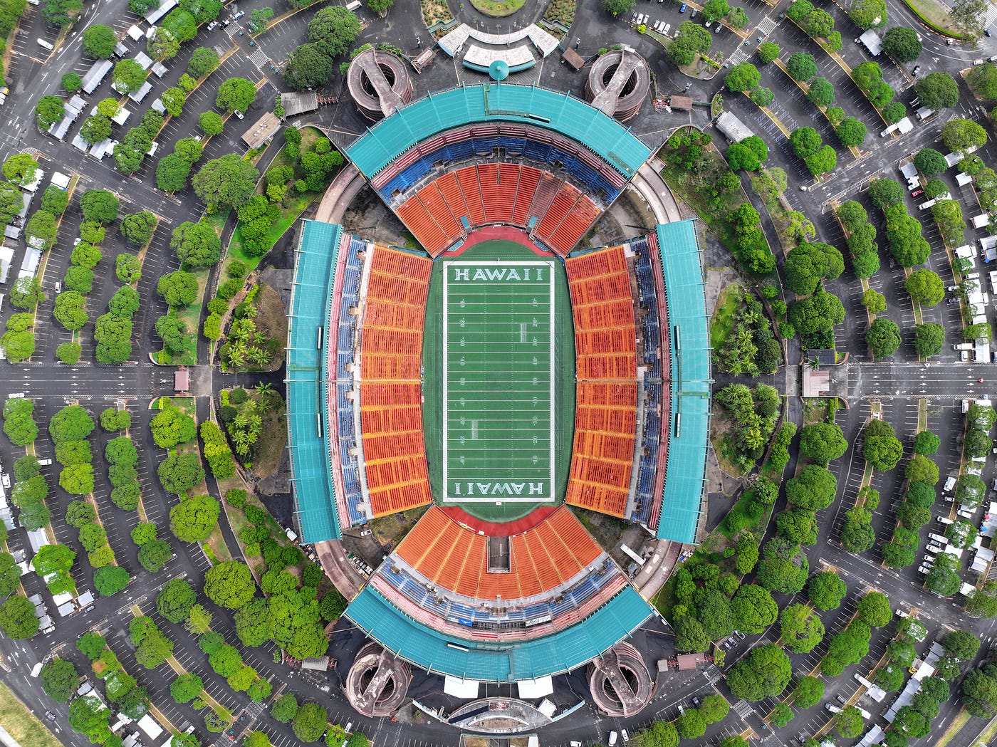
Hawaii’s abandoned Aloha Stadium viewed from above. It also works with the “other football”. (Image by Quintin Soloviev on Wikimedia Commons)
Not that boring after all. So, the next time you play football or watch a match, remember that those perfectly flat green rectangles also allow us to account for satellite positioning errors to achieve absolute accuracy in mapping. Can you think of another unexpected place that could do the trick just as well?
Thank you for reading! I’m Kamel Lahssini, and I share stories about how humans observe and map the world. If you want to read more, don’t hesitate to follow me. I’m always happy to reply to a thoughtful comment and start a conversation!
메타데이터
- post_id
- 5eae3dce3606
- slug
- the-passion-for-football-is-helping-fix-our-geographic-maps-5eae3dce3606
- url
- https://thequantasticjournal.com/the-passion-for-football-is-helping-fix-our-geographic-maps-5eae3dce3606
- canonical_url
- https://thequantasticjournal.com/the-passion-for-football-is-helping-fix-our-geographic-maps-5eae3dce3606
- author_url
- https://medium.com/@kamel.lahssini
- status
- ok
- fetched_at
- 2026-06-15 20:49:13