The Startup Teaching India’s Roads to Warn Us Before They Fail
Inside Rasta.AI’s mission to turn every passing vehicle into a sensor, and every pothole into data that arrives before disaster does
The Startup Teaching India’s Roads to Warn Us Before They Fail
Inside Rasta.AI’s mission to turn every passing vehicle into a sensor, and every pothole into data that arrives before disaster does
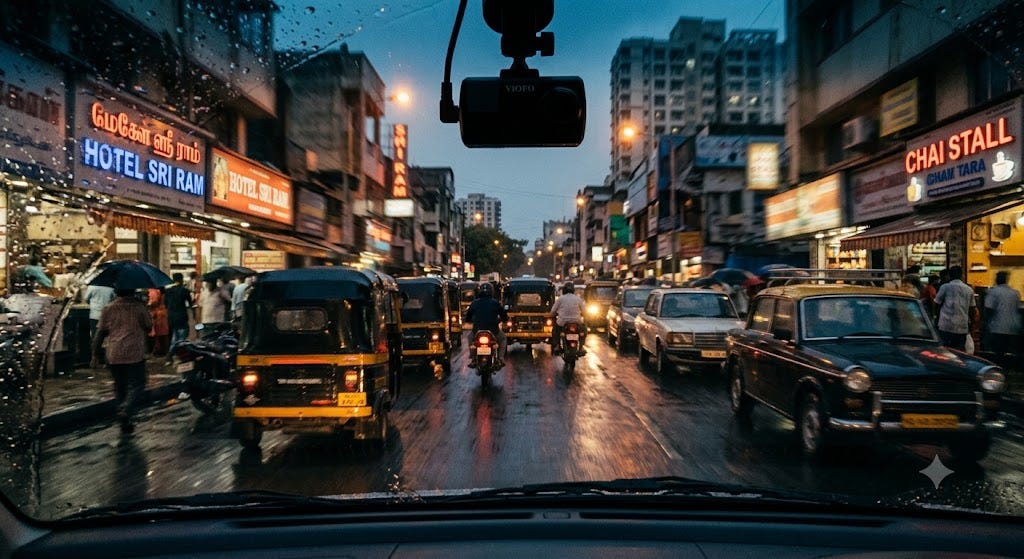
Vehicle-mounted camera capturing road condition data on a rain-slicked street at dusk
There is a particular kind of dread that comes from hitting a pothole at speed on a wet night. The car lurches, the wheel fights back, and for a second, control is not guaranteed. For Rahul Andhale, that second turned into something longer: a car carrying him and four friends spun a full 180 degrees on a rain-slicked Indian road after striking a hidden pothole. Nobody was hurt. But the moment didn’t fade the way near-misses usually do. It stayed with him as evidence of something broken — not just the road surface, but the entire system meant to catch problems like it before they became dangerous.
That experience became the founding insight behind Rasta.AI, a Pune-based company building artificial intelligence tools to detect, predict, and report road damage before it costs someone their life. Today, the company’s technology has been used to survey more than 10,000 kilometres of road, has been deployed by government agencies including Maharashtra’s Public Works Department, and has picked up recognition from NASSCOM, MCCIA, and international forums including PIARC’s World Road Congress network and Tokyo’s Sushi Tech innovation showcase.
This is the story of a problem most people have felt physically — a road that fails without warning — and a company trying to solve it not with more concrete, but with cameras, computer vision, and a very different idea of what “road maintenance” should mean.
The Problem: Roads That Only Speak After They’ve Already Failed
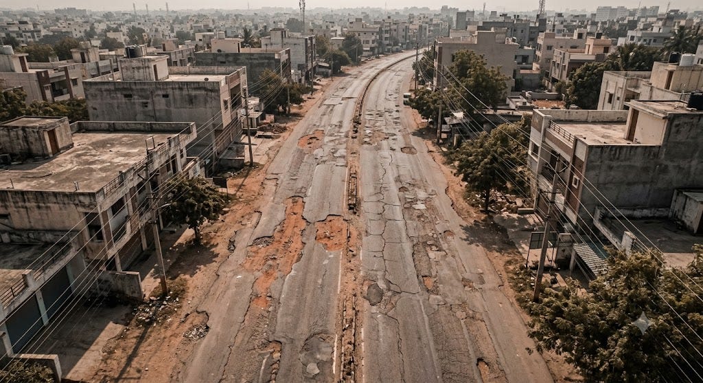
Aerial view of a damaged road surface showing potholes and cracking typical of under-monitored road networks
Ask any city engineer how they know a road needs repair, and the honest answer is often: someone complained, or someone got hurt. Formal road condition surveys — the kind that measure roughness, cracking, and rutting according to international engineering standards — are expensive and slow. They typically involve specialized vehicles fitted with sensors like LiDAR, driven slowly across a network, with results compiled weeks or months later. By the time a report reaches a decision-maker’s desk, the road it describes may no longer look the way the data says it does.
This is a manageable inefficiency in wealthy countries with dense, well-funded road authorities. It is a much bigger problem in fast-urbanizing regions, where road networks expand faster than the institutions meant to monitor them. India alone has one of the largest road networks in the world, and much of it sits under the jurisdiction of municipal and state bodies with limited engineering staff and even more limited survey budgets. The result is a familiar cycle: potholes appear, go unreported for weeks, get patched reactively (often poorly), and reappear within a monsoon season.
The deeper issue isn’t a lack of concern. It’s a lack of continuous, structured information. Road authorities are, in a very real sense, flying blind between surveys — making decisions about where to spend maintenance budgets based on data that is already out of date the moment it’s collected.
This is the specific gap Rasta.AI set out to close: not better repair technology, but better, faster, cheaper visibility into what actually needs repairing.
A Different Starting Point: Build for Messy Roads, Not Ideal Ones
Rasta.AI’s approach to this problem is shaped by where it comes from. Rather than starting in a research lab and looking for a market, Andhale — who came to this space through hands-on exposure to infrastructure and government systems rather than academic AI research — built the company around a constraint that most computer vision systems try to avoid: real-world Indian roads are inconsistent, poorly marked, and unpredictable, and the system has to work anyway.
That constraint shows up in how the product was engineered. Instead of requiring purpose-built survey vehicles with expensive LiDAR rigs, Rasta.AI’s models are trained to extract reliable data from standard camera footage — the kind that can be captured from a smartphone mount, a dashcam, or a 360° rig fitted to almost any vehicle already on the road, including municipal cars, delivery vans, and buses. This is the central bet the company has made: that machine learning can substitute for expensive specialized hardware, provided the models are trained on enough real, chaotic, non-ideal road data.
“Instead of building for ideal environments, the focus was on creating a system that could work in messy, inconsistent road conditions and still produce reliable data for decision-making.”
That single design choice — optimizing for real conditions instead of laboratory conditions — is arguably Rasta.AI’s most important engineering decision, because it’s what makes the economics of continuous monitoring viable in the first place.
How the Technology Actually Works
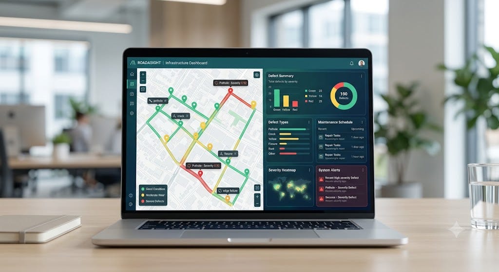
Dashboard interface showing AI-detected road defects and severity ratings on a digital map
Strip away the branding, and Rasta.AI’s platform follows a fairly clean pipeline, one that mirrors how modern computer vision products are increasingly being applied to physical infrastructure:
1. Capture. Cameras — mounted on a phone, a 360° rig, or a dashcam — record continuous video or imagery as a vehicle moves through its normal route. No dedicated survey trip is required; the vehicle can be doing its regular job (a delivery run, a municipal patrol) while collecting data passively.
2. Detection and classification. Computer vision models process the footage frame by frame, identifying road defects and assets. According to the company, its models can currently detect more than 8 categories of surface defects — potholes, cracks, ravelling, and related surface damage — and track upwards of 90 categories of road assets, from signage and guardrails to lane markings and drainage infrastructure. Each detected issue isn’t just flagged; it’s classified by type, estimated severity, and located precisely using GPS coordinates.
3. Scientific scoring. Rather than reporting raw detections, the system converts them into standardized road quality metrics — including International Roughness Index (IRI), Riding Index (RI), and Pavement Condition Index (PCI) scores — calculated in line with established global engineering frameworks from the Indian Roads Congress (IRC), PIARC, AASHTO, and World Bank guidelines. This matters because it means Rasta.AI’s outputs aren’t just AI-generated observations; they’re expressed in the same technical language that civil engineers and government road authorities already use to plan budgets and prioritize repairs.
4. Digital mapping and dashboards. All of this is compiled into a digital layer over the road network — not just a map of where roads are, but a live, queryable record of their condition. Authorities and contractors access this through dashboards that support 360° virtual inspection, meaning an engineer can effectively “walk” a road network remotely, without a physical site visit, to verify an issue or plan a repair.
5. Speed. Perhaps the most consequential number in the entire pipeline: what has traditionally taken weeks of manual survey work is processed by Rasta.AI’s systems in under 90 minutes. That difference in speed is what turns “monitoring” from a periodic event into something closer to continuous awareness.
A Quick Look at the Product Suite
Rasta.AI doesn’t sell a single tool — it has built a family of applications aimed at different points in the road lifecycle:
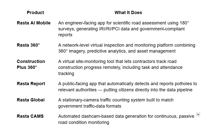
This spread matters because it reflects a broader strategic instinct: rather than treating road intelligence as a single product sold once, Rasta.AI is trying to build the connective tissue between citizens, contractors, and government engineers — three groups that rarely share data efficiently today.
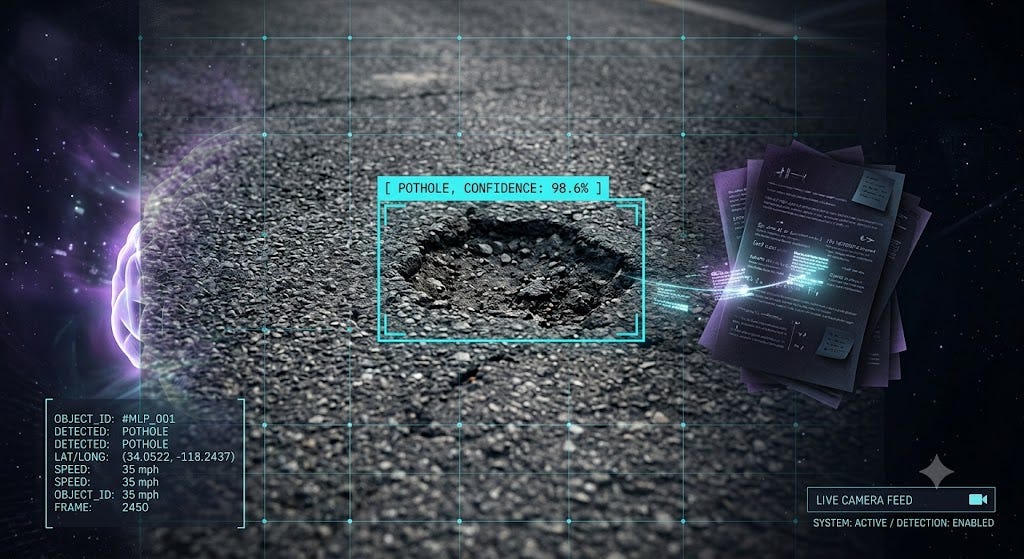
Computer vision model detecting and classifying a pothole in real time
From Pune to Policy: How This Plays Out on the Ground
The clearest public demonstration of Rasta.AI’s model in action comes from Latur, Maharashtra. In late 2024, the state’s Public Works Department began what officials described as the first initiative of its kind in Maharashtra: an AI-based digital road survey project in Udgir, Latur district, backed by ₹1.99 crore in funding from the District Planning and Development Council. PWD executive engineer Rohan Jadhav explained that the project was designed to collect structured data on road quality, sequential numbering, and traffic density — information intended to directly inform construction and maintenance decisions going forward.
The significance of this pilot goes beyond a single district. It represents a template for how a state-level public works department can adopt AI-based survey tools without overhauling its existing systems — using Rasta.AI’s outputs as an additional data layer that plugs into decisions the department was already making, just with better information than before. According to reporting on the project, the Latur PWD circle’s use of this data contributed to a favorable ranking in Maharashtra Chief Minister’s 100 Days Mission, a performance initiative for public administration.
Beyond Latur, Rasta.AI has reported deployments and pilots with municipal bodies, infrastructure contractors, and logistics fleet operators — a signal that the platform’s usefulness extends beyond government alone. Fleet operators, for instance, use route-quality data less to fix roads and more to route around damaged ones, reducing vehicle wear and improving delivery reliability.
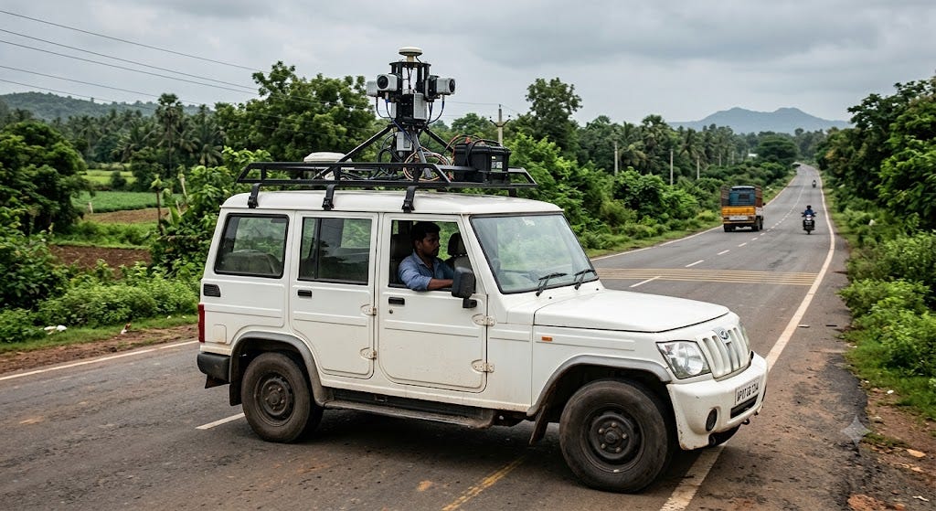
AI-equipped survey vehicle used for road monitoring in a district infrastructure project
By the company’s own account, its technology has now been used to survey more than 10,000 kilometres of road network and has reached over 100,000 users across at least four countries — figures that, while self-reported, are consistent with a company actively scaling beyond a single pilot city.
Why This Matters Beyond Potholes
It’s tempting to file “pothole detection” under minor civic inconvenience. The reality is starker. Poor road conditions are a documented contributor to road traffic injuries and fatalities, and India records among the highest volumes of road traffic deaths in the world according to government transport data. Predictive, continuous monitoring doesn’t just make commutes smoother — it shifts road safety from a reactive posture (patch it after someone reports it, or after someone is hurt) to a proactive one (know about it before it becomes dangerous).
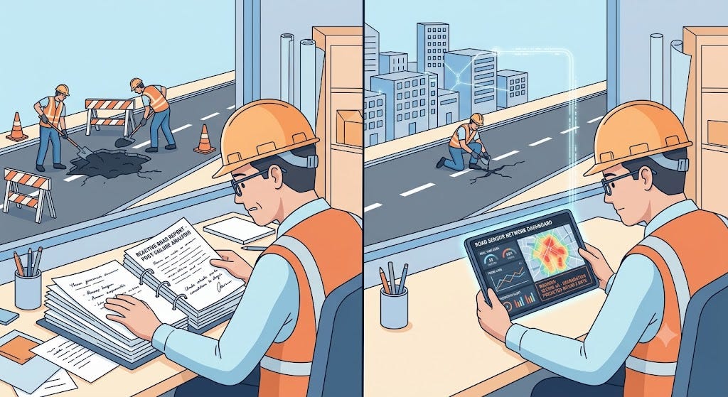
Visual comparison of reactive road maintenance versus predictive, data-driven maintenance
There’s also a budgeting argument that matters enormously to cash-strapped public works departments. Road maintenance funding is finite, and the difference between “patch everything eventually” and “patch the highest-risk 15% first” is often the difference between a functioning road network and a deteriorating one. Structured, GPS-tagged, severity-ranked defect data — the kind Rasta.AI generates — is precisely the input that makes prioritized maintenance possible instead of arbitrary.
And there’s a third, quieter benefit: consistency. Manual inspection quality varies from inspector to inspector, shaped by fatigue, subjectivity, and simple human bandwidth. A machine-learning-based detection system, applied uniformly across a network, removes some of that variance — not perfectly, since lighting, weather, and occlusion still challenge any computer vision system, but meaningfully compared to a patchwork of manual reports.
The Competitive Landscape: Where Rasta.AI Fits
Rasta.AI is not alone in trying to apply machine learning to physical infrastructure. Globally, companies like RoadBotics have pursued similar image-based road condition assessment, while companies like Netradyne apply camera-based AI primarily to driver safety and behavior rather than infrastructure condition itself. Large mapping platforms collect road-level imagery too, but their priority is navigation, not structural condition monitoring.
What differentiates Rasta.AI, based on its public positioning and deployments, is a fairly narrow and deliberate focus: not autonomous driving, not general mapping, not driver behavior — specifically, the physical condition of road infrastructure itself, reported in the technical vocabulary (IRI, PCI, RI) that government engineers already use. That specificity is arguably a competitive advantage in government sales cycles, where “another dashboard” is easy to dismiss but “PCI scores compliant with IRC standards” is much harder to ignore.
The broader category is also evolving toward convergence — combining visual data with sensor readings, GPS traces, and crowd-sourced citizen inputs to build something closer to a living digital twin of a road network: not just where roads are, but how they’re behaving, aging, and being used over time. Rasta.AI’s expansion into citizen-facing tools like Rasta Report suggests the company sees this convergence coming and is positioning its product suite accordingly.
Recognition and Reach
Rasta.AI’s traction has been acknowledged in ways that go beyond internal metrics. The company was named a NASSCOM AI Game Changer in 2024, received MCCIA’s Best Innovation Award in 2025, and was recognized at the Move In Sync Mobility Symposium the same year. It was named among the top 10 startups at Maharashtra’s Tech WARI learning week and was a finalist at the Urban Mobility India Innovation Challenge in 2025. On the media side, the company’s Latur work drew coverage from CNBC-TV18, and it has been featured in Marathi and Hindi-language outlets including Sakal and Loksatta, alongside YourStory’s startup-focused coverage.
Internationally, Rasta.AI has demonstrated its technology at Sushi Tech Tokyo, one of Asia’s prominent innovation showcases, and participated in the PIARC-affiliated International Road Conference in Thailand — a venue where global road authorities compare notes on infrastructure standards. The company was also part of an Indian business delegation to Europe alongside Union Minister of Commerce and Industry Piyush Goyal, placing it in company with some of India’s more established export-oriented enterprises.
Challenges the Company Doesn’t Hide From
No infrastructure-tech company selling into government has an easy path, and Rasta.AI’s public commentary reflects that reality rather than glossing over it. Selling into public works departments means navigating long procurement cycles, integrating with legacy government IT systems that weren’t designed for continuous data feeds, and building trust with institutions that are, reasonably, cautious about new technology touching public infrastructure decisions.
On the technical side, edge cases remain an acknowledged area of ongoing refinement — distinguishing temporary road damage (say, from recent construction) from permanent structural issues, and maintaining detection accuracy across varying light, weather, and occlusion conditions. These aren’t unique to Rasta.AI; they’re inherent to any computer vision system deployed in unconstrained, real-world environments. What’s notable is that the company treats this as continuous model refinement rather than a solved problem — a more credible posture than claiming perfect accuracy.
What’s Next
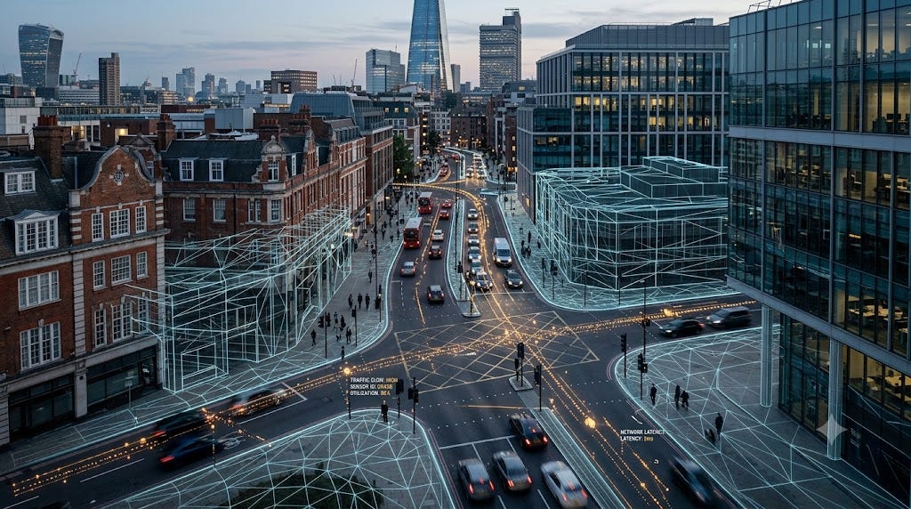
Conceptual visualization of 3D road mapping and digital twin infrastructure technology
Rasta.AI’s publicly stated roadmap points toward three directions: deeper citizen participation through expanded video-based public reporting tools, three-dimensional road mapping that would move beyond flat condition scoring toward full spatial models of road networks, and eventual integration with autonomous mobility systems — a logical extension, given that self-driving and driver-assist systems depend heavily on accurate, current road infrastructure data. Alongside this, the company has signaled ambitions for geographic expansion beyond India, building on its early international showcases in Tokyo and Thailand.
If that roadmap plays out, the company’s trajectory would mirror a pattern seen elsewhere in applied AI: start with a narrow, well-defined, high-friction problem (in this case, slow and expensive road surveys), prove the model works in the messiest possible conditions, and then expand outward — geographically, and into adjacent categories like autonomous mobility infrastructure — once the core detection technology is battle-tested.
Why This Category Deserves More Attention Now
AI coverage tends to gravitate toward chatbots, image generators, and frontier research labs. But some of the more consequential near-term applications of machine learning are quieter and more physical: reading the condition of a bridge, a pipeline, a solar panel — or a road. These systems don’t generate headlines the way large language models do, but they touch daily life and public safety more directly than most consumer AI products.
Road condition monitoring sits squarely in this category. It’s not glamorous. It doesn’t produce viral demos. But it addresses a problem nearly everyone has experienced first-hand — the unpleasant surprise of a road that fails without warning — and it does so using AI in a way that is explainable, auditable, and directly tied to public safety outcomes. That combination, arguably, is a better test of AI’s practical value than almost anything happening in more visible corners of the industry right now.
Conclusion
Rasta.AI’s story begins with a single unnerving moment on a wet road — the kind of near-miss that most people would simply feel grateful to have survived. What makes the company’s trajectory worth watching is what came after: a deliberate, methodical effort to replace guesswork and delay with continuous, structured, engineering-grade data about the roads people actually drive on every day.
It’s a company built around an unglamorous but important premise: that the roads beneath a country’s economy and daily life deserve the same kind of continuous, data-driven attention that has already transformed far more visible industries. Whether Rasta.AI becomes the definitive platform for this category or one of several strong players shaping it, the underlying shift it represents — from reactive infrastructure management to predictive infrastructure intelligence — looks like a durable one.
For governments, contractors, and commuters alike, that shift can’t come soon enough.
To learn more about Rasta.AI’s road monitoring platform and see the technology in action, visit rasta-ai.com.
메타데이터
- post_id
- 6e28903fc555
- slug
- the-startup-teaching-indias-roads-to-warn-us-before-they-fail-6e28903fc555
- url
- https://blog.stackademic.com/the-startup-teaching-indias-roads-to-warn-us-before-they-fail-6e28903fc555
- canonical_url
- https://blog.stackademic.com/the-startup-teaching-indias-roads-to-warn-us-before-they-fail-6e28903fc555
- author_url
- https://medium.com/@mahendramedapati
- status
- ok
- fetched_at
- 2026-07-13 08:05:13