GIS / Re:Earth Training Conducted for Peru’s National Disaster Prevention Agency, CENEPRED
Eukarya conducted a disaster prevention capacity-building training using GIS for CENEPRED (Peru’s National Center for Estimation…
GIS / Re:Earth Training Conducted for Peru’s National Disaster Prevention Agency, CENEPRED
Eukarya conducted a disaster prevention capacity-building training using GIS for **CENEPRED (Peru’s National Center for Estimation, Prevention and Reduction of Disaster Risk)**, as part of a follow-up cooperation project implemented by JICA Peru.
This article introduces the background, objectives, and content of the training.

The historic city center of Lima, Peru. March brought warm weather perfect for short sleeves!
What is CENEPRED?
CENEPRED is the agency within Peru’s national disaster management system responsible for pre-disaster response — namely prevention and risk reduction.
Its primary roles include:
- Disaster risk assessment (flooding, earthquakes, landslides, etc.)
- Planning for disaster prevention and mitigation
- Promoting measures to reduce risk
- Disaster preparedness education and capacity building for local governments and communities

Image source:https://www.facebook.com/photo/?fbid=1322771056542621&set=pcb.1322771759875884
Training Objectives
The goal of the training was to enable CENEPRED staff to independently create and utilize WebGIS content.
To achieve this, we designed a curriculum covering the full workflow from:
- Foundational understanding of GIS
- Data creation and processing
- Data visualization
- Publishing and dissemination
Overall Training Schedule
The training spanned approximately two weeks and was structured to allow participants to build skills progressively. Since all CENEPRED participants were Spanish speakers, the sessions were conducted with Japanese–Spanish interpretation throughout.
Date Content Venue Mar. 2 Introduction, GIS Fundamentals IGN Mar. 3 Open Data IGN Mar. 4 GIS Data Creation and Conversion IGN Mar. 5 Data Visualization with Re:Earth Visualizer IGN Mar. 6 Overview of national institutional frameworks for geospatial information utilization (led by Associate Prof. Takeshi Kawamura, Hokkaido University) IGN Mar. 9 Data Management and Distribution with Re:Earth CMS JICA Peru Office + Online Mar. 10 Storytelling with Re:Earth Visualizer, Plugin Basics JICA Peru Office + Online Mar. 11 GIS Content Creation Workshop JICA Peru Office + Online Mar. 12 Final Presentations, Closing Ceremony IGN
Sessions were held at IGN, Peru’s national geographic institute.
From March 9–11, a rupture in Peru’s largest domestic gas pipeline led to reduced energy supply and movement restrictions, so training shifted to a hybrid format at the JICA Peru office combined with remote participation.

Venue: IGN (National Geographic Institute)
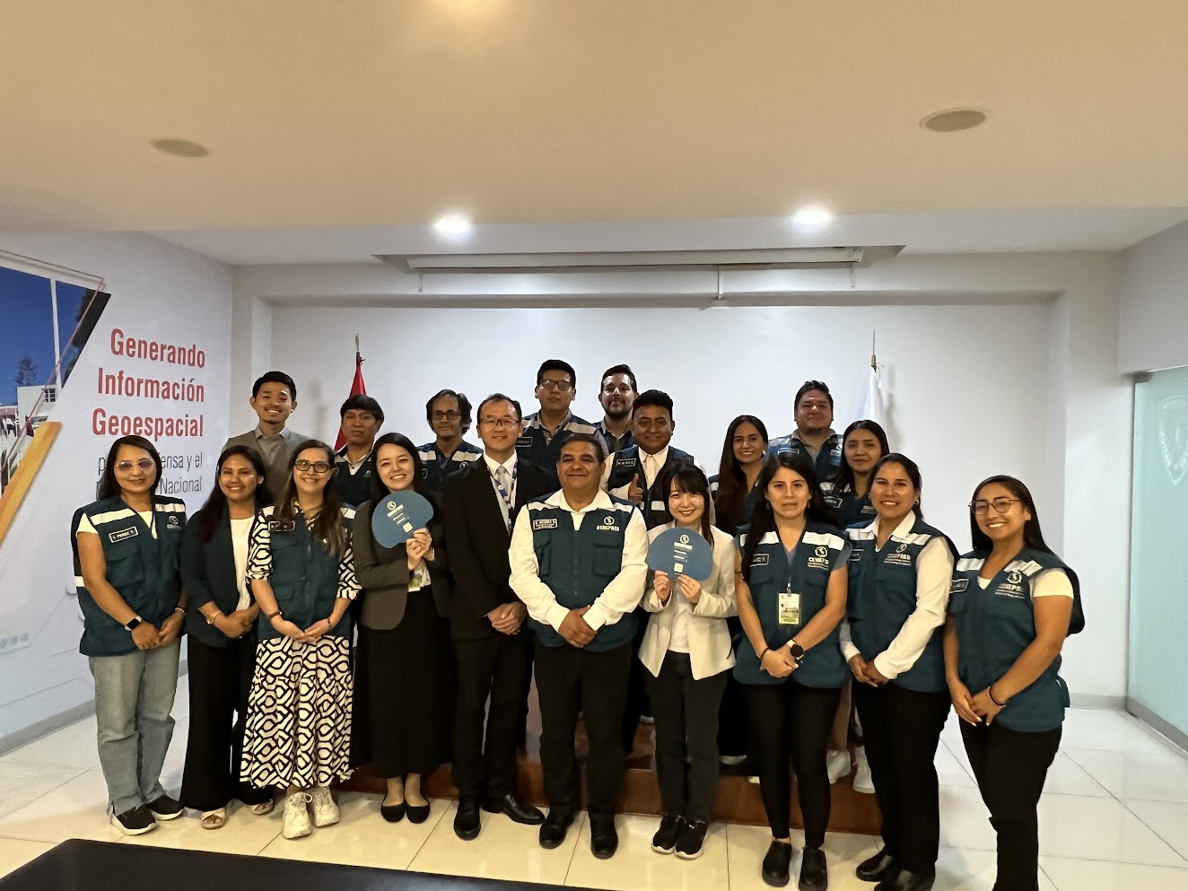
During the program, we also had the opportunity to visit CENEPRED headquarters, where we met with Director Ejecutivo (Executive Director) Carlos Andrés Boado Llerena. It was a valuable occasion to exchange views on the training initiative and future collaboration, and to reaffirm the significance of this work.

Meeting with Executive Director Carlos Andrés Boado Llerena at CENEPRED headquarters
Training Content
GIS Fundamentals Module
We began by reviewing core GIS concepts and examining how geospatial data and attribute information work together in practical applications. From there, participants learned how to find open data sources and what to look out for when using them — including attribution, update frequency, and terms of use — with the goal of collecting data that is practical for day-to-day work.
As a precursor to visualization, participants also worked through hands-on exercises covering how to clean and process data formats such as Shapefile and CSV, and convert them into formats suitable for use in WebGIS.

Explaining what GIS is
Each session included not just instruction but also time for participants to work through exercises independently and share their results. This led to many moments of peer knowledge-sharing and fostered a genuinely interactive learning environment!

Participants sharing insights during the open data session
Re:Earth Module
Next, participants worked through the full workflow from visualization to distribution using Re:Earth.
In the Re:Earth Visualizer sessions, participants configured basic map settings — including map style, terrain, and camera — then added layers such as GeoJSON to build out their visualizations. They adjusted visual elements like colors, legends, and labels to suit the information they wanted to communicate, and walked through the complete process up to publishing their maps.

Re:Earth Visualizer session in progress
In the Re:Earth CMS sessions, participants learned how to create and manage GIS data, then worked through the end-to-end process of distributing that data via API and visualizing it in Visualizer.

Re:Earth CMS session in progress
Finally, participants received instruction on creating Stories — a feature for communicating information through maps in a narrative format. The session also covered what can be achieved with plugins and how to develop them, with an eye toward future extensibility.

Story creation session in progress
Content Creation and Presentation Module
In the latter half of the training, participants applied everything they had learned to plan and produce their own GIS content around a theme of their choosing. Instructors provided feedback throughout the creation process, helping participants refine how their data was presented and structured.
At the final presentation on the last day, participants shared the maps and stories they had created. The finished works drew on both open data and data held by Peruvian government agencies, resulting in maps with direct real-world applications.


Participant Feedback
In post-training reflections, participants shared comments such as “Re:Earth felt approachable even for non-specialists” and “It was great to be able to learn everything in a structured way.”
In particular, many participants chose to create content around flood and inundation hazard information using Re:Earth Visualizer’s Story feature, and the ability to produce work directly applicable to their day-to-day responsibilities was highly praised.
At the same time, participants also offered a range of suggestions for improving Re:Earth. We look forward to incorporating this feedback into future development.


Closing
Through this training, CENEPRED staff progressed step by step from GIS fundamentals through data creation, visualization, distribution, and storytelling — ultimately reaching the point where they could independently create and present their own WebGIS content.
Going forward, we will continue to provide ongoing support and share knowledge to help CENEPRED make ever more effective use of geospatial information in their disaster prevention and mitigation efforts.
메타데이터
- post_id
- 6f2ecf25846d
- slug
- gis-re-earth-training-conducted-for-perus-national-disaster-prevention-agency-cenepred-6f2ecf25846d
- url
- https://medium.com/@eukarya/gis-re-earth-training-conducted-for-perus-national-disaster-prevention-agency-cenepred-6f2ecf25846d
- canonical_url
- https://medium.com/@eukarya/gis-re-earth-training-conducted-for-perus-national-disaster-prevention-agency-cenepred-6f2ecf25846d
- author_url
- https://medium.com/@eukarya
- status
- ok
- fetched_at
- 2026-07-14 22:17:22