The First Portuguese voyages of exploration
School textbooks frequently underestimate the significance of the early Portuguese explorations along the west coast of Africa. In reality…
7HISTORY OF DISCOVERIES
The First Portuguese voyages of exploration
School textbooks frequently underestimate the significance of the early Portuguese explorations along the west coast of Africa. In reality, these voyages were of considerable practical and cultural significance, as they enabled Portugal to acquire important trading bases and contributed decisively to refuting cosmographical beliefs that were deeply rooted in the European mindset.
European Explorations Began with the Portuguese
During the medieval period, Portugal was not a particularly developed country from economic and nautical perspectives. However, from the late 13th century, it witnessed the passage of convoys of Genoese and then Venetian galleys.
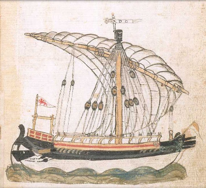
A Venetian galley of Flanders (from Michael of Rhodi’s Fabrica de galea)
These ships, travelling along the route from the Mediterranean to the ports of Flanders, could stop in Lisbon. At the beginning of the 14th century, the first Hanseatic ships sailed as far as the Portuguese capital. This development effectively closed the “maritime ring” that had previously surrounded Europe, significantly facilitating communications and transportation between regions.
However, the Portuguese lacked the necessary resources and financial capital to engage in this type of long-distance maritime trade.
Despite the fact that fishing was practised in coastal waters, it is estimated that this activity was undertaken by only a small percentage of the population.
Moreover, the Portuguese kingdom was compelled to confront a belligerent neighbour, the kingdom of Castile, which had historically sought to subjugate it.
Due to their geographical situation along the Atlantic coast and subsequent lack of resources, the Portuguese decided in the early decades of the 15th century to expand in the only direction left open to them, namely the sea itself.
A False Start
In contrast to what is frequently stated in school textbooks, the initial objective of this expansion was not India at all.
The Portuguese embarked on a quest to identify new lands for colonisation, but primarily to ascertain the provenance of the gold that was conveyed to the Mediterranean coasts via desert caravans.
Initially, it was hypothesised that the objectives could be achieved by conquering Morocco. In 1415, the city of Ceuta, located on the southern shore of the Strait of Gibraltar, was conquered. Nevertheless, this proved to be a false start. Muslims endeavoured for many years to reconquer the stronghold, which consequently remained inaccessible and could never be utilised as a base for exploratory voyages. The correct course of action was not the obvious one.
The Shift of Course with Prince Henrique
The primary motivation for Portuguese exploration during this period was **Prince Henrique, the king’s brother, who was known as the Navigator **despite not participating in any voyages of discovery himself.
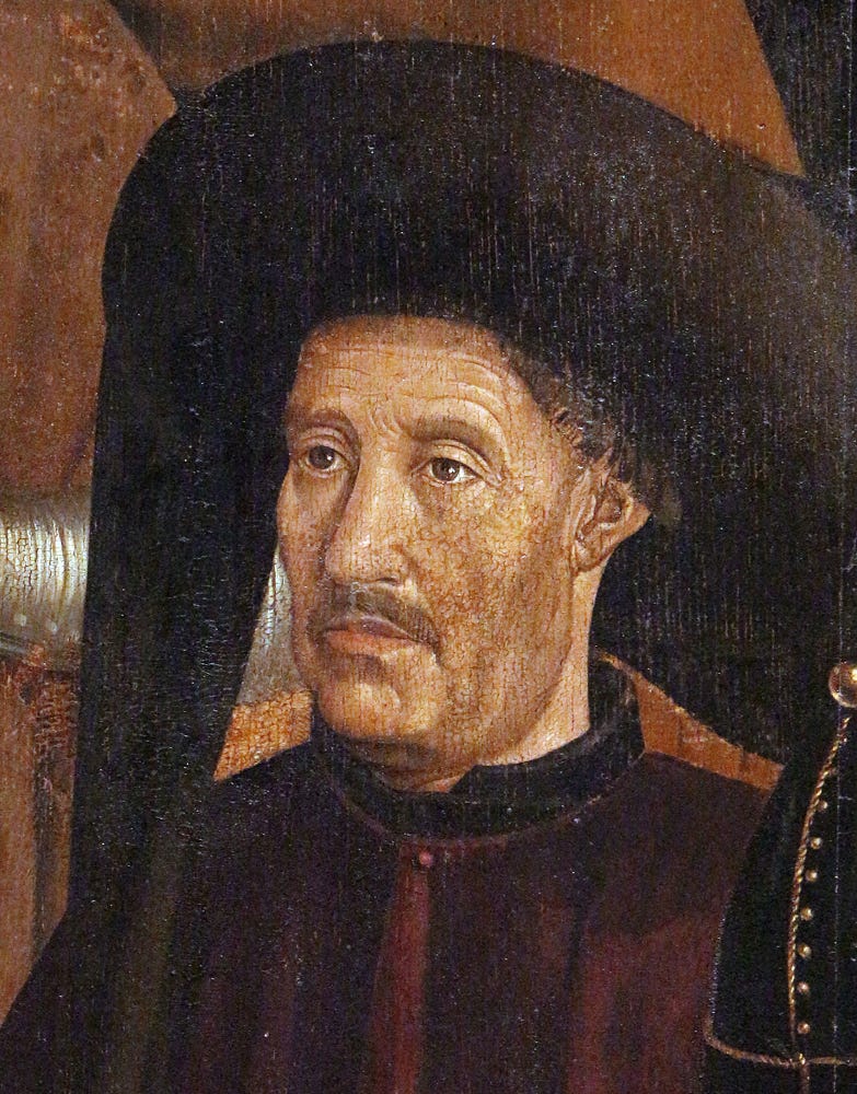
Detail of standing man with moustache and Burgundian-style chaperon in the “Panel of the Prince” (third panel of the St. Vincent panels, usually dated c.1470, attributed to painter Nuno Gonçalves) (source: Wikipedia. This figure is most commonly identified as Prince Henry the Navigator (died 1460, aged 66). Several scholars (e.g. Markl, 1994; Salvador Marques, 1998) have recently disputed this identification, and instead proposed this to be an image of King Edward of Portugal (d. 1438, aged 47), although this is not yet widely accepted.
It was realised that the most effective course of action for the Portuguese would be to direct their efforts towards the sea, heading south. Consequently, Henrique organised successive expeditions, with the objective of exploring as much of the African coast as possible.
This endeavour was facilitated by Henry’s appointment as “regent” of the Order of Christ in 1420, which had assumed the assets of the Order of the Templars in Portugal. Utilising the substantial resources of this institution, Henry orchestrated the expeditions that marked the inception of the Age of Discovery.
The First Discoveries: The Island in the Ocean
In the early 15th century, the Portuguese explorers João Gonçalves da Câmara and Bartolomeu Perestrelo discovered (or rediscovered) the islands of Madeira and Porto Santo, respectively.
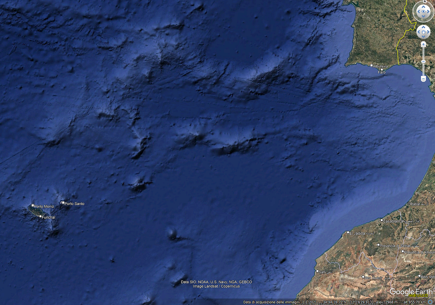
Madeira and Porto Santo are about 430 nautical miles from Portugal.
It is evident that the majority of the Azores, situated in the central region of the Atlantic, were delineated on nautical charts prior to 1439.
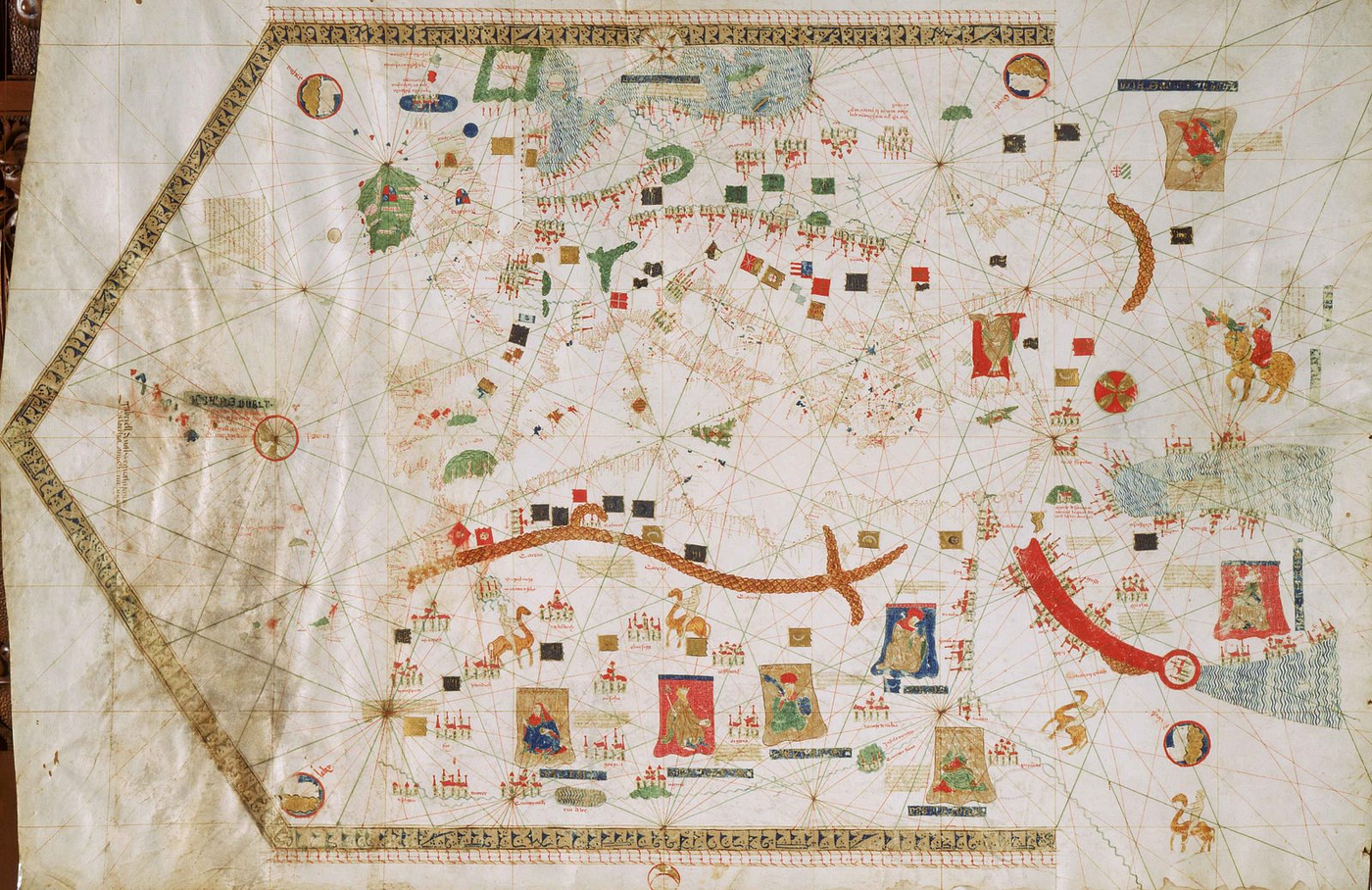
Gabiel Vallseca’s map (1439). Museo Maritimo, Barcelona. On the far left, the Azores islands are easily distinguishable, already clearly outlined. The map dates back to 1439.
Consequently, the Portuguese successfully navigated a substantial maritime expanse by utilising the prevailing winds, traversing vast distances in their maritime endeavours.
However, the islands were not known to produce gold, which was Henrique’s objective. In order to find gold, it was necessary to explore the African coast, a region which presented (and continues to present) numerous navigational challenges.
Towards the South, Along the Coast of Africa
The coastline of Africa is extremely inhospitable, with very few suitable landing places where water can be obtained. There are often dangerous shoals to be encountered, and the current that flows parallel to the coast from north-east to south-west poses a serious danger to boats.
[embed]This is the way the African coast south of Cape Boujador looks like. No shelter, no coves, no refuge in case of storm. No place to get water. No trees, no sign of life. And this desolate scene goes on for hundreds of miles. We have to admit that the first Portuguese explorers were incredibly brave to venture along this coast (clip by the author, via Google Earth Studio)
It is at **Cape Bojador **that the trade winds first become evident, and they persist throughout the journey southward, blowing consistently from the north-eastern direction. This phenomenon undoubtedly rendered the return journey arduous.
The animation linked above shows the trade winds along the coast of Africa in real time, demonstrating how a ship that had passed Cape Bojador had little chance of returning.
This cape, in particular, was widely held to represent the limit of the habitable and navigable world, a point of no return that had never been crossed in living memory and therefore could not be crossed. These were the true ‘Pillars of Hercules’ of medieval navigation.
It is no coincidence that the great Italian poet Dante Alighieri, speaking of Ulysses in Canto XXVI of the Inferno of the Divine Comedy, invented the story that the Homeric hero, at the end of his life, attempted to explore the coasts of north-western Africa. However, overcoming the limits imposed by God was an act of hubris, of presumptuous pride, and Ulysses’ ship was sunk by a “turbo”, a kind of tornado. Dante, in writing these verses, was probably inspired by the story of the Vivaldi brothers, two Genoese who, at the end of the 13th century, attempted to sail south in two galleys: no one ever heard from them again.
The turning point
In 1434, the Portuguese sailor Gil Eanes is recorded as being the first to cross the cape, travelling aboard a small vessel (barcha) that could be propelled by both oars and sails, but about which very little is actually known.
This relatively obscure episode is of significant importance, as it laid the foundation for subsequent advancements: once it had been demonstrated that sailing beyond the cape was feasible without encountering any difficulties, the subsequent challenges were merely a matter of resolve and perseverance.
This voyage represented a significant departure from the prevailing ‘epistemological paradigm’ of ancient and medieval geography, specifically the notion that life was deemed unfeasible in the torrid zone along the equator. The initial Portuguese explorers were illiterate and unacquainted with Ptolemy’s theories. Nevertheless, they substantiated the inaccuracy of the academic hypothesis through empirical evidence, demonstrating the feasibility of navigating safely within an area designated as uninhabitable by scholars. This ‘break’ with the theory of the past was of the utmost importance.
This was the first major step forward in Europeans’ knowledge of the world after Marco Polo’s travels.
New ships and new routes
It was determined that further exploration was not possible with the barchas utilised by Eanes; consequently, **caravels **were adopted for the task. These ships were distinguished by their agility and shallow draft, with a length of approximately twenty metres and equipped with lateen sails, which were triangular in shape. These vessels played a pivotal role in the Age of Discovery.
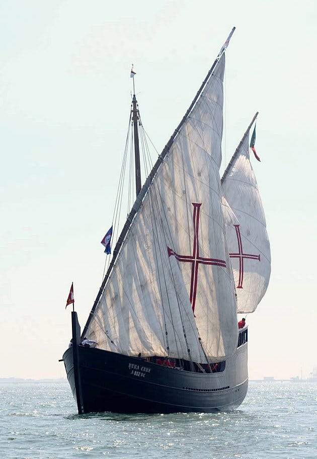
Caravel Vera Cruz in the rio Tejo (photograph by Lopo Pizarro, via Wikipedia)
The Portuguese were able to achieve this feat with their ships, known as the volta do mar, due to a combination of factors.
Firstly, the ships were able to sail beyond Cape Bojador, driven by the prevailing trade winds in that area.
Secondly, they did not attempt to return to Portugal on a direct route, but instead headed north-west into the open Atlantic Ocean until they encountered the prevailing winds blowing from the west at higher latitudes. These winds would carry the ships back home. It was the so called “volta do mar”
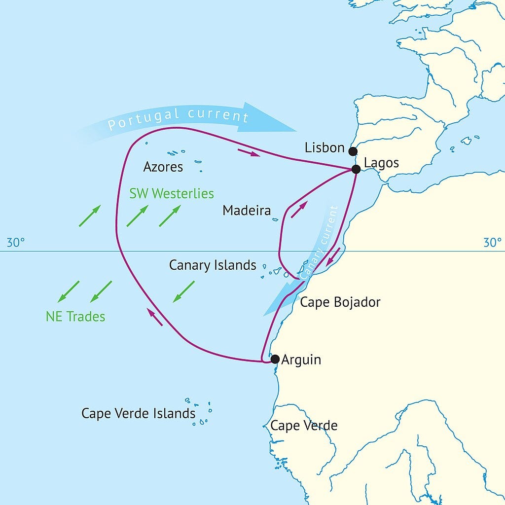
The so called “volta do mar”. Atlantic winds (green), currents (blue) and approximate Portuguese sailing routes (red) during Henry the Navigator’s (c.1430–1460) lifetime. The further south ships went, the wider off sailing required to return. By Redgeographic via Wikipedia.
The primary challenges encountered pertained to psychological factors, stemming from the extended period of travel over an expanse of unseen land. In actuality, the method was relatively secure, leveraging the consistent presence of winds and the option for ships to make intermittent stops at various islands along the route, including the Canary Islands, Madeira, and even the Azores. The earliest extant documentary evidence for the volta do mar is dated 1441, yet it is reasonable to hypothesise that the practice had been in existence for some time prior to this.
The initial economic exploitation
Despite the absence of substantial commercial achievements over the course of several years, the exploration of the coastline persisted. At this juncture, the importance of guidance, even indirect, from the state becomes evident: a “pure” trader, in the absence of economic returns, would have ceased operations. In contrast, the Portuguese maintained their momentum.
Nevertheless, it was incumbent upon Portuguese captains to ensure that they derived some economic benefit from their voyages. The initial targets were monk seals, which were present in large colonies along the African coast. These colonies were exterminated for the purpose of acquiring their skins and fat.
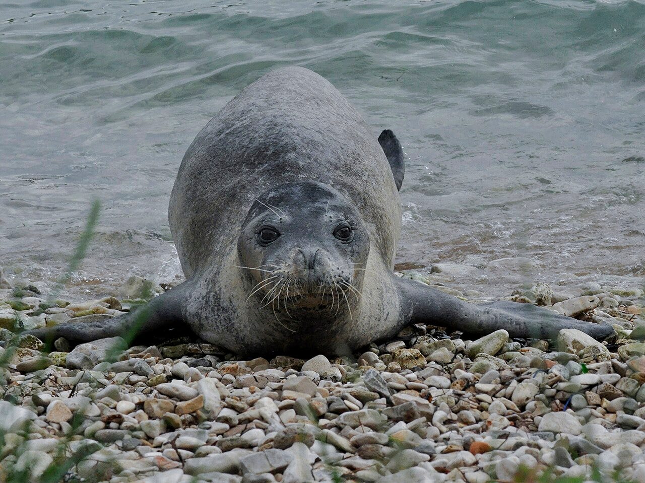
Monk seals were almost wiped out along the coasts of Africa (credit Wikipedi)
But it is evident that human trafficking was a more lucrative enterprise.
Moving southwards, the Portuguese finally found small communities living along the coast, and began systematically kidnapping as many individuals as they could to sell them in Europe.
From 1441, the Portuguese captains initiated the practice of kidnapping African natives with a view to generating profit, subsequently selling them into slavery in Europe. This practice would be greatly expanded in the following centuries.
In 1442, the trading post of Arguim was established near Cape White;
Two years later, Nuno Tristao arrived at the mouth of the Senegal River.
In the same year, Cape Verde, the westernmost point of the African coast, was also sighted.
These findings were significant in that they initiated a shift in the conceptual framework of Europeans, as they demonstrated that the classical hypothesis, which posited that the equatorial zones were uninhabitable due to high temperatures, was erroneous. Conversely, substantial populations and thriving vegetation were present. The world was understood to be larger than previously theorised by ancient civilisations.
A long setback
The Portuguese exploration project was suspended between 1448 and 1455 due to a combination of complex diplomatic events and an internal political crisis. Upon resumption of the voyage, under the leadership of Venetian merchant Alvise di Ca’ da Mosto, the Cape Verde Islands were promptly discovered.
Following the death of Prince Henrique in 1460, no further voyages of discovery were undertaken until 1469. In that year, King Alfonso resumed African exploration with a novel strategy: he awarded the contract to a Portuguese merchant, Fernão Gomes, who committed to exploring 100 leagues (approximately 600 km) of coastline per year with his caravels for a period of five years. In exchange, Gomes was granted the right to exploit his discoveries economically. It is evident that he was in a position of considerable privilege. Almost immediately, his ships reached the shores of modern-day Liberia and Ivory Coast, where a variety of pepper (malagueta) is cultivated that is less valuable than the oriental variety but still profitable to trade.
The African coast in that region points decisively eastwards, but there is no documentation attesting to the Portuguese intention to reach the Indies. At most, there was a vague political project to seek a connection and possibly an alliance with the mythical Prester John, a Christian ruler who, according to tradition, was located somewhere in Africa. Gomes’ caravels subsequently reached present-day Ghana, where alluvial gold was mined, and in the following years, advanced further south, occupying the fertile islands of Fermando Po (now Bioko), Principe and Sao Tome.
Following the expiration of the contract, it was not renewed, and the Portuguese sovereigns instead concentrated on the exploitation and defence of the newly discovered regions. The Lusitanian kingdom engaged in a protracted military conflict with Castile, which sought to engage in clandestine maritime operations along the African coastline. Despite their tactical disadvantage on land, the Portuguese emerged victorious in the naval aspect of the conflict. This outcome was formalised through the Treaty of Alcaçovas in 1479, which, although entailing the cession of the Canary Islands to Spain, secured the waters south of the 26th parallel as Portuguese territory. As will be demonstrated in the following discussion, the treaty had significant consequences for the continuation of Atlantic exploration.
The fort of El Mina
Following the resolution of the Castilian concerns, the Portuguese sovereign John II constructed the fort of São Jorge de Mina in Ghana in 1481 with the objective of safeguarding the gold trade from that region. During the period spanning from the conclusion of the 14th century to the first two decades of the 15th century, caravels (ships which, by the close of the 15th century, were capable of making twelve to fifteen voyages per year) were employed to transport a total of 700 kilograms of gold annually to Portugal.
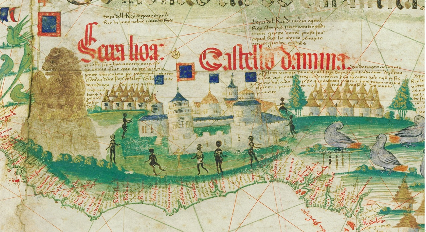
The famoe fot of Sao Jorge a la Mina, from the Cantino planisphere (1502)
In addition to this, the shipment of slaves (numbering approximately 500) and goods such as pepper and ivory (it should be noted that these figures do not take into account the extent of smuggling, the scope of which remains uncertain) must also be considered. Consequently, this trade was both affluent and prosperous, necessitating meticulous safeguarding. The fort at El Mina was constructed in Lisbon, dismantled, and then loaded onto caravels before being rebuilt on the African continent. Furthermore, the fort’s design was adopted as a model by Columbus during his visit, who subsequently constructed a similar fortification on the coast of a Caribbean island.
Consequently, the initial phase of Portuguese exploration in West Africa, characterised by the occupation of numerous strategic points along the coastline, reached its conclusion.
Bibliography
Martino Sacchi, Terra in vista! Le grandi esplorazioni oceaniche del XV secolo, Effemme editore, 2010
메타데이터
- post_id
- 79e4373ac42f
- slug
- the-first-portuguese-voyages-of-exploration-79e4373ac42f
- url
- https://medium.com/teatime-history/the-first-portuguese-voyages-of-exploration-79e4373ac42f
- canonical_url
- https://medium.com/teatime-history/the-first-portuguese-voyages-of-exploration-79e4373ac42f
- author_url
- https://medium.com/@martinosacchi60
- status
- ok
- fetched_at
- 2026-07-19 12:23:55