What If Every Barcode Scan Updated a Live Asset Map?
Most barcode systems are designed to answer one basic question:
What If Every Barcode Scan Updated a Live Asset Map?
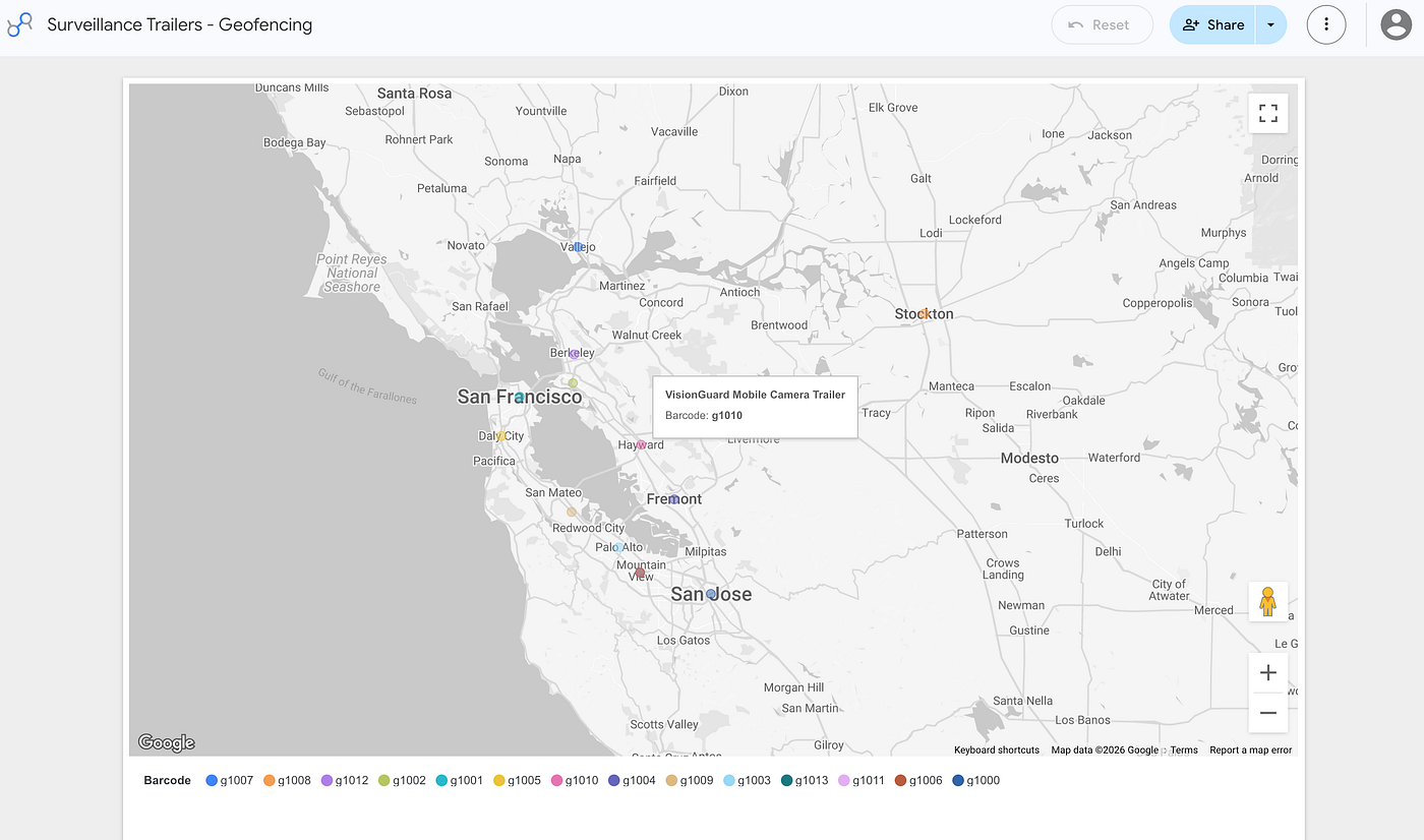
Inventory Asset Tracking in an Interactive Map
Most barcode systems are designed to answer one basic question:
What is this asset?
But when GPS data is captured during each scan, that same barcode can also help answer:
- Where was the asset last recorded?
- When was its location updated?
- Has it moved to another site?
- Is it still within an approved area?
This turns a routine barcode scan into something much more useful: an active asset map.
At a Glance
GPS-based inventory monitoring can help businesses:
- Record GPS coordinates when assets are scanned
- View asset locations on live, interactive maps
- Create geofences around approved areas
- Track the latest recorded location of each asset
- Sync inventory data with Google Sheets or Excel
- Build interactive maps using Google Data Studio
- Improve visibility across tools, equipment, materials, and field assets
From Barcode Scans to Location Intelligence
Traditional inventory systems can confirm that an asset exists, but they may not show where it is being used or where it was last seen.
With GearChain, users can scan an asset from a mobile device and record its GPS coordinates along with the asset information.
That data can then be viewed in the GearChain app, synced with Google Sheets or Excel, and displayed through an interactive map in Google Data Studio.
When the asset is scanned again, its latest recorded location can be updated. Over time, this creates a clearer picture of how assets move between job sites, warehouses, stores, offices, or service areas.
Adding Geofencing to Asset Monitoring
Geofencing allows businesses to define approved geographic areas for assets.
By combining GPS coordinates, barcode scans, and live maps, teams can more easily identify assets recorded outside an expected location.
This can be useful for:
- Construction equipment
- Generators and machinery
- Utility assets
- Vehicles
- Tools and materials
- Field service equipment
- Outdoor and distributed assets
A Simple Scan Can Provide More Context
The goal is not to replace existing barcode workflows.
It is to make each scan more informative.
By adding GPS data to inventory activity, businesses can gain better location visibility without requiring a separate tracking process for every asset.
Read the Full Article
Learn how GPS-based inventory monitoring converts barcode scans into an active asset map, including how to record GPS coordinates, create live maps, and support geofencing.
Here's how:
https://gearchain.io/blog/your-assets-are-moving-do-you-know-where-they-are
메타데이터
- post_id
- 7a1547bc3e97
- slug
- what-if-every-barcode-scan-updated-a-live-asset-map-7a1547bc3e97
- url
- https://medium.com/gearchain/what-if-every-barcode-scan-updated-a-live-asset-map-7a1547bc3e97
- canonical_url
- https://medium.com/gearchain/what-if-every-barcode-scan-updated-a-live-asset-map-7a1547bc3e97
- author_url
- https://medium.com/@jungsy11
- status
- ok
- fetched_at
- 2026-08-15 16:46:02