The Shape of Your Land: Why Heights and Slopes Matter
If you’ve lived here for more than a week, you know the land isn’t flat. We live in a world of river bluffs, rolling hills, and steep…
The Shape of Your Land: Why Heights and Slopes Matter
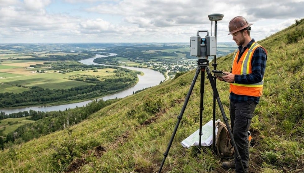
If you’ve lived here for more than a week, you know the land isn’t flat. We live in a world of river bluffs, rolling hills, and steep ravines. While these views make for a beautiful backyard, they make building a nightmare if you don’t have a plan. You can’t just drop a foundation onto a hillside and hope it stays there. You need to know exactly how the ground moves, dips, and rises.
This is where a topographic survey comes in. Think of it as a three-dimensional map of your property. Most maps just show where the fences are. This kind of map shows the “contour” of the land. It maps out the hills, the low spots where water pools, and the exact location of every tree and utility line.
The Hillside Challenge
Building on our local hillsides isn’t just about the view. It’s about physics. We have a lot of clay in our soil. When that clay gets wet, it gets heavy and slippery. If you build a heavy house on a steep slope without checking the “lay of the land” first, the whole thing could slowly slide toward the bottom of the valley.
Local building departments are very aware of this. They often require a topographic survey before they will even look at your blueprints. They want to see how you plan to manage the dirt you move. If you dig into a hillside, you change how the weight sits on that slope. You need an expert to tell you if you need a retaining wall or a special type of foundation.
Where Does the Water Go?
Water is the biggest enemy of any building. Because we have so many hills, the water from your neighbor’s yard might end up in your basement if you aren’t careful. A “topo” survey shows exactly where rainwater will flow during a storm.
This is vital for property developers. If you are turning a few acres into a new subdivision, you have to prove that your new roads and roofs won’t flood the people living downhill from you. You have to design detention basins — those big dry ponds you see near shopping centers — to catch the runoff. You can’t design those ponds without knowing the exact elevations of the entire site.
More Than Just Dirt
A good survey doesn’t just look at the ground. It looks at everything on it.
- Trees: Many local areas have rules about which trees you can cut down. A survey maps out the big oaks and maples so you can design around them.
- Utilities: It shows where the water lines, gas pipes, and sewers are buried. Breaking a main water line because it wasn’t on your map is a very expensive mistake.
- Man-made features: It marks existing sheds, old foundations, and even the height of the curb on the street.
For a homeowner planning a major landscape project or a new pool, this information is gold. It tells your contractor exactly how much dirt they need to haul away. This keeps your quotes accurate. No one likes a “surprise” bill because the contractor didn’t realize the backyard dropped ten feet from the patio to the fence.
Navigating Local Rules
Our region has some specific rules about “hillside protection districts.” These are areas where the slopes are so steep that the city or county keeps a very close eye on any digging. If your land falls into one of these zones, you can’t move a shovelful of dirt without a professional survey.
The paperwork can be a headache, but it’s there for a reason. It prevents landslides and keeps the neighborhood safe. A professional surveyor knows these local codes inside and out. They provide the technical drawings that the city engineers need to see to approve your permit.
Why You Shouldn’t Skip This Step
It’s tempting to look at a lot and think, “Yeah, it looks flat enough.” Eyes are deceiving. A slope that looks gentle might actually drop six feet over a short distance. If you start building based on a guess, you will pay for it later. You might end up with a driveway that’s too steep for a car to climb in the winter or a backyard that turns into a swamp every time it rains.
An investment in a topographic survey at the start of your project pays for itself ten times over. It prevents rework. It keeps your neighbors happy. Most importantly, it ensures that whatever you build stays exactly where you put it.
Start Your Project Right
Whether you’re a developer looking at a twenty-acre ridge or a homeowner finally putting in that dream deck, the ground is your foundation. Don’t guess about the slopes. Get the data you need to build with confidence.
If you have questions about your property or a piece of land you want to buy, talk to a local expert. A surveyor can walk the land with you and explain the challenges of our unique local terrain. It’s the smartest way to start any project.
메타데이터
- post_id
- 7b134b12485f
- slug
- the-shape-of-your-land-why-heights-and-slopes-matter-7b134b12485f
- url
- https://medium.com/@LandSurveySpecialists/the-shape-of-your-land-why-heights-and-slopes-matter-7b134b12485f
- canonical_url
- https://medium.com/@LandSurveySpecialists/the-shape-of-your-land-why-heights-and-slopes-matter-7b134b12485f
- author_url
- https://medium.com/@LandSurveySpecialists
- status
- ok
- fetched_at
- 2026-07-16 11:42:04