Digital Elevation Model of Varanasi, Uttar Pradesh
INTRODUCTION
Digital Elevation Model of Varanasi, Uttar Pradesh
INTRODUCTION
The present study focuses on the generation and visualization of a Digital Elevation Model of Varanasi district, Uttar Pradesh, using Geographic Information System (GIS) techniques. The research seeks to comprehend the terrain features and their possible impact on land use patterns and hydrological behavior by examining elevation variations within the study area.
The city of Varanasi lies in the middle Gangetic plains and is influenced by the geomorphology of the surrounding alluvial landscape. Elevation information obtained from DEM data is crucial for the identification of low-lying areas, slope variations, and drainage patterns, all of which are critical for the assessment of flood risk and environmental planning. This investigation illustrates the utilization of geographic information systems (GIS) tools to produce elevation maps and extract terrain data for regional analysis.
STUDY AREA
The Varanasi district is located in the eastern part of Uttar Pradesh, India, along the banks of the Ganga River. The district lies approximately between latitudes 25°14'N to 25°23'N and longitudes 82°56'E to 83°03'E. It forms part of the fertile Indo-Gangetic plain characterized by flat alluvial terrain and gentle slopes.
The region experiences a subtropical climate with hot summers, a monsoon season from June to September, and mild winters. Due to its proximity to the Ganga River and relatively low elevation in certain areas, parts of the district are susceptible to seasonal flooding and waterlogging.
Understanding the elevation characteristics of the district is thus critical for hydrological studies, urban planning, and environmental management.
METHODOLOGY
The study utilizes Shuttle Radar Topography Mission (SRTM) Digital Elevation Model data for generating the elevation surface of the study area. The DEM data was downloaded and processed using QGIS software.
The following steps were carried out during the analysis:
-
The administrative boundary of Varanasi district was obtained in shapefile format and imported into QGIS.
-
The DEM raster data was downloaded and added to the GIS environment.
-
The DEM was clipped to the boundary of the study area using raster extraction tools.
-
Elevation visualization was performed using the single-band pseudocolor symbology to represent elevation variations.
-
A hillshade layer was generated from the DEM to enhance terrain visualization.
-
Contour lines were derived from the DEM to represent elevation intervals across the district.
These steps allowed the generation of a detailed elevation map and improved understanding of the terrain structure of the study area.
RESULTS
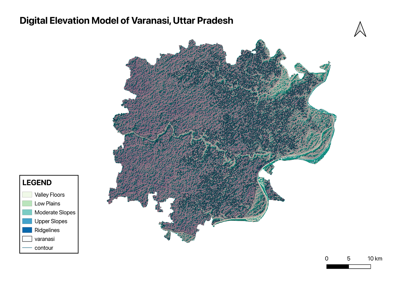
The Digital Elevation Model (DEM) of Varanasi district indicates a predominantly low-relief landscape characteristic of the Indo-Gangetic plains. Elevation values across the study area show only minor variations, reflecting a largely flat terrain with gentle and gradual slopes.
Relatively higher elevations are observed in some peripheral parts of the district, whereas the lowest elevations are concentrated in the floodplain areas adjacent to the Ganga River. The hillshade representation significantly improves the visualization of subtle terrain features, allowing slight variations in surface morphology to be more clearly identified within the otherwise uniform alluvial landscape.
The contour map generated from the DEM further highlights the gradual slope pattern across the district. These topographic characteristics play an important role in influencing drainage patterns and surface runoff behavior. Low-lying areas with minimal slope are particularly susceptible to water accumulation and may experience localized flooding during periods of intense rainfall or when the Ganga River overflows.
Overall, the DEM-based terrain analysis offers helpful information regarding the topographic structure of the region and serves as an important foundation for hydrological modeling, watershed management, and flood risk assessment in Varanasi district.
CONCLUSION
The study demonstrates the application of GIS techniques for generating and analyzing a Digital Elevation Model of Varanasi district, Uttar Pradesh. DEM data provides valuable information about terrain characteristics, elevation variations, and potential hydrological behavior of the region.
The analysis indicates that the district is characterized by relatively flat topography with gradual elevation changes typical of alluvial plains. Such terrain conditions influence drainage patterns and may contribute to localized flooding in low-lying areas.
DEM-based terrain analysis can therefore serve as an important tool for environmental planning, watershed management, and flood risk studies. Future studies can integrate DEM data with hydrological modeling and land use analysis to further improve understanding of environmental processes in the region.
메타데이터
- post_id
- 7f026ff736db
- slug
- digital-elevation-model-of-varanasi-uttar-pradesh-7f026ff736db
- url
- https://medium.com/@preeti.k011/digital-elevation-model-of-varanasi-uttar-pradesh-7f026ff736db
- canonical_url
- https://medium.com/@preeti.k011/digital-elevation-model-of-varanasi-uttar-pradesh-7f026ff736db
- author_url
- https://medium.com/@preeti.k011
- status
- ok
- fetched_at
- 2026-06-16 19:09:56