Capture Inspection Photos and Notes from On-Site Location
In many organizations, field inspections are still documented through disconnected and manual processes. Inspectors often take photos on…
Capture Inspection Photos and Notes from On-Site Location
In many organizations, field inspections are still documented through disconnected and manual processes. Inspectors often take photos on personal phones, jot down observations in notebooks, or share updates through messaging apps and emails. Later, this information is manually transferred into spreadsheets or reports.
This approach creates several challenges. Photos may not clearly indicate the exact location where they were taken, notes may be incomplete, and important details can be lost during manual reporting. When multiple sites or facilities are involved, it becomes difficult for managers to track inspection history, verify field conditions, or prioritize maintenance tasks efficiently.
Why Location-Based Documentation Matters
Accurate inspections require more than just photos and notes — they need clear location context. When inspection records are linked to precise locations, organizations can easily understand where issues exist and monitor how conditions change over time.
Location-based documentation helps teams:
- Maintain clear and verifiable inspection records
- Track issues across different facilities or assets
- Improve coordination between field teams and managers
- Support better planning for maintenance and repairs
By ensuring that every observation is tied to a specific site or asset, organizations gain a more reliable and organized view of their field operations.
Structured Digital Forms for Consistent Reporting
Digital inspection forms help standardize how field data is collected. Instead of relying on free-form notes that vary from inspector to inspector, organizations can use predefined forms with fields such as inspection area, asset type, condition rating, and priority level.
This ensures that inspectors capture consistent and complete information during every inspection. Standardized data also makes it easier to analyze trends, track recurring issues, and generate accurate reports for maintenance planning.
Real-Time Data Capture from the Field
Mobile data collection allows inspectors to record observations, photos, and notes directly from the inspection site using smartphones or tablets. This eliminates the need for manual transcription later and reduces the risk of missing information.
Field teams can upload photos, document conditions, and submit inspection results immediately. Even when internet connectivity is limited, inspections can be recorded offline and synchronized later once a connection becomes available.

Improved Visibility and Coordination
Centralized inspection records give managers a clearer view of field activities. Instead of waiting for reports or scattered updates, supervisors can monitor inspections, review submitted photos, and track issues across different locations.
With better visibility, organizations can respond to problems faster, assign maintenance tasks more efficiently, and ensure that important issues are addressed promptly.
Supporting Location-Based Inspections with Digital Tools
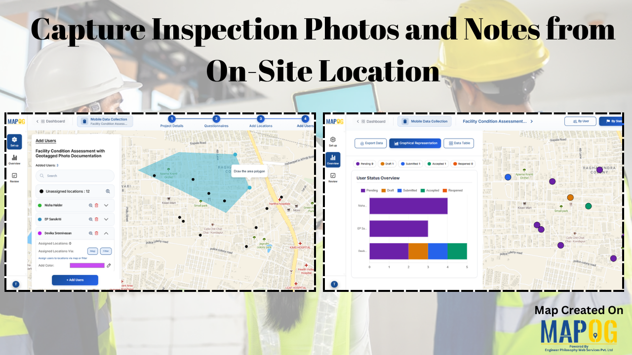
Modern map-based platforms make it easier for organizations to connect inspection records directly to geographic locations. With solutions like MAPOG, field teams can capture photos, complete structured inspection forms, and submit observations directly from the site where the inspection takes place.
Because each record is linked to a map location, managers gain clearer visibility of inspection points across multiple properties or facilities. This location-based approach helps teams track issues more effectively, review past inspections, and maintain an organized history of site conditions over time.

Real-World Applications Across Industries
Capturing inspection photos and notes from on-site locations is valuable across many industries. Property and facility management teams use it to document building conditions and maintenance needs. Construction companies rely on it to track site progress and record defects. Utilities and infrastructure organizations use location-based inspections to monitor pipelines, power systems, and telecom equipment.
In each case, mobile inspection tools help teams maintain accurate records, respond to issues faster, and manage assets more effectively.
Conclusion
Capturing inspection photos and notes directly from on-site locations is essential for effective facility and asset management. Traditional documentation methods often lead to scattered information and inefficient workflows. By adopting map-based mobile data collection platforms such as MAPOG, organizations can streamline inspections, maintain accurate location-linked records, and improve decision-making across field operations.
메타데이터
- post_id
- 98dbcc162d11
- slug
- capture-inspection-photos-and-notes-from-on-site-location-98dbcc162d11
- url
- https://medium.com/@epdevikasreenivasan/capture-inspection-photos-and-notes-from-on-site-location-98dbcc162d11
- canonical_url
- https://medium.com/@epdevikasreenivasan/capture-inspection-photos-and-notes-from-on-site-location-98dbcc162d11
- author_url
- https://medium.com/@epdevikasreenivasan
- status
- ok
- fetched_at
- 2026-07-25 19:16:29


