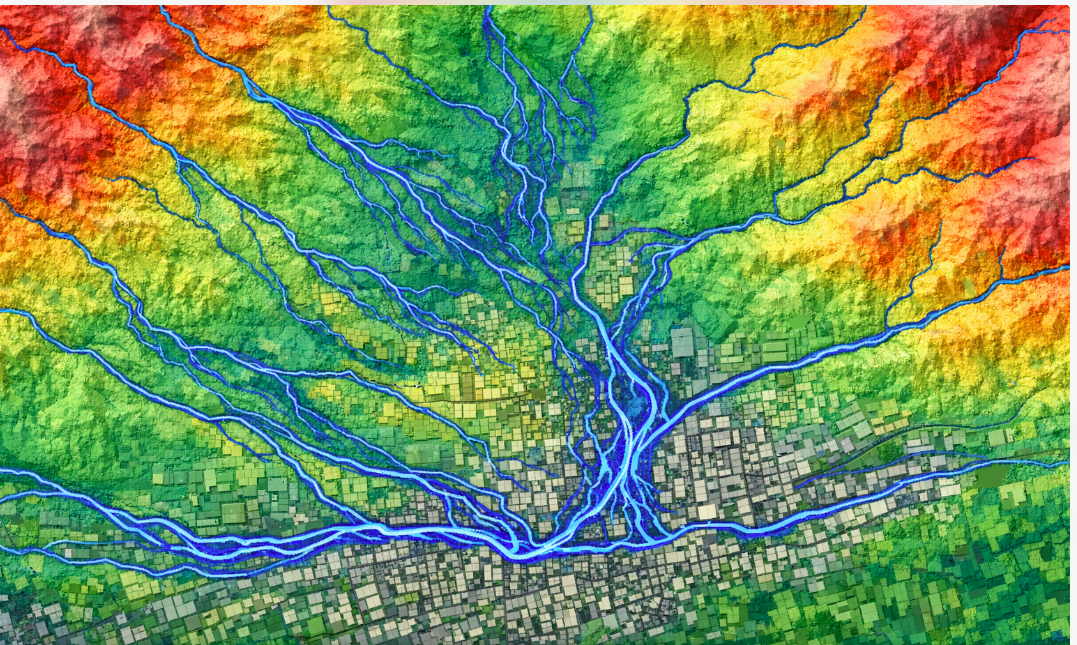
Remote Sensing in Seismotectonic Studies: Seeing Deformation Where the Ground Appears Still
Many of the most important tectonic processes happen quietly. Faults accumulate strain for decades, sometimes centuries, without producing…
Remote Sensing in Seismotectonic Studies: Seeing Deformation Where the Ground Appears Still
Many of the most important tectonic processes happen quietly. Faults accumulate strain for decades, sometimes centuries, without producing a single noticeable earthquake. At the surface, landscapes may appear stable, unchanged, almost inert. Remote sensing has fundamentally altered this illusion. Today, satellites allow us to observe millimeter-scale ground deformation over vast regions, revealing tectonic behavior long before it becomes seismic.
In seismotectonic studies, remote sensing is no longer supplementary — it is essential.
Why Field Mapping Alone Is No Longer Enough
Field geology remains irreplaceable, but it has limitations. Access can be restricted, deformation can be subtle, and temporal coverage is always incomplete. Remote sensing addresses these gaps by offering:
- Continuous spatial coverage
- Repeat observations over time
- Quantitative measurements of surface change
When integrated into GIS, satellite-derived data becomes a powerful framework for tectonic interpretation.
InSAR: Measuring the Invisible
Interferometric Synthetic Aperture Radar (InSAR) is one of the most transformative tools in modern seismotectonics. By comparing radar signals from repeated satellite passes, InSAR detects surface displacement at millimeter to centimeter scales.
Within a GIS environment, InSAR data can be:
- Georeferenced and overlaid with fault maps
- Compared with seismic rupture models
- Analyzed alongside topography and land use
In many cases, InSAR reveals fault activity in regions previously thought to be tectonically inactive.
Interseismic Deformation and Strain Accumulation
Earthquakes release energy suddenly, but tectonic strain accumulates gradually. Remote sensing allows scientists to observe this interseismic phase directly.
GIS-based analysis of long-term deformation patterns helps:
- Identify locked versus creeping fault segments
- Estimate strain accumulation rates
- Improve long-term seismic hazard assessments
This shift — from post-event analysis to continuous monitoring — marks a major evolution in seismotectonic research.
Coseismic Deformation: Mapping Earthquake Ruptures
After a large earthquake, remote sensing provides immediate spatial insight into how the ground moved. InSAR-derived displacement fields often reveal rupture complexity that seismic waveforms alone cannot capture.
Through GIS, researchers can:
- Delineate rupture extent and geometry
- Measure displacement gradients
- Compare observed deformation with fault models
These analyses refine our understanding of rupture mechanics and fault behavior.
Optical Imagery and Surface Expression of Faults
Not all tectonic signals are captured by radar. High-resolution optical imagery remains critical for identifying geomorphic indicators of faulting.
GIS-based analysis of optical data supports:
- Mapping of fault scarps and offset landforms
- Detection of linear features aligned with tectonic structures
- Validation of remote sensing interpretations through geomorphology
When optical and radar data converge on the same structural patterns, confidence in tectonic interpretations increases significantly.
Challenges and Misinterpretations
Remote sensing is powerful, but not infallible. Atmospheric noise, vegetation, urban interference, and decorrelation can distort signals.
GIS helps mitigate these issues by:
- Cross-validating datasets
- Integrating geological constraints
- Applying spatial filters cautiously
The key is interpretation, not automation. Remote sensing data still requires geological judgment.
From Observation to Application
Remote sensing has moved seismotectonics closer to applied geoscience. Deformation maps now inform:
- Seismic hazard zoning
- Infrastructure planning
- Risk assessment for critical facilities
What was once invisible is now measurable — and therefore actionable.
Conclusion
Seismotectonic processes rarely announce themselves loudly. Remote sensing allows us to listen to the Earth’s quieter signals, detecting deformation before it becomes destructive. When combined with GIS, these observations form a spatial narrative of tectonic behavior — one that is increasingly essential in a rapidly urbanizing world.
Understanding earthquakes begins long before the shaking starts.
메타데이터
- post_id
- 9b4b1c3346be
- slug
- remote-sensing-in-seismotectonic-studies-seeing-deformation-where-the-ground-appears-still-9b4b1c3346be
- url
- https://medium.com/@xristided/remote-sensing-in-seismotectonic-studies-seeing-deformation-where-the-ground-appears-still-9b4b1c3346be
- canonical_url
- https://medium.com/@xristided/remote-sensing-in-seismotectonic-studies-seeing-deformation-where-the-ground-appears-still-9b4b1c3346be
- author_url
- https://medium.com/@xristided
- status
- ok
- fetched_at
- 2026-06-26 21:52:29