Conduct Petrol Station Surveys and Analyze Locations Using Map Layers
Fuel networks often operate on outdated records and fragmented field reports, making network planning slow and unreliable. Platforms like…
Conduct Petrol Station Surveys and Analyze Locations Using Map Layers
Fuel networks often operate on outdated records and fragmented field reports, making network planning slow and unreliable. Platforms like MAPOG help teams conduct petrol station surveys and analyze locations by capturing accurate site details in real time, ensuring consistency and enabling faster, more informed decisions.
Why Location-Based Fuel Surveys Matter
Growing fuel networks break spreadsheet-based audits. As station counts increase, survey data becomes inconsistent, site statuses go unverified, and coverage gaps go unnoticed until they affect operations. A map-first approach replaces disconnected reports with a live, location-anchored visual system where every station’s condition, fuel availability, and service rating is visible at a glance, reducing planning lag and keeping every team aligned.
How the Survey Workflow Works
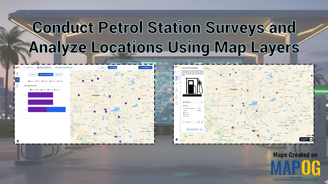
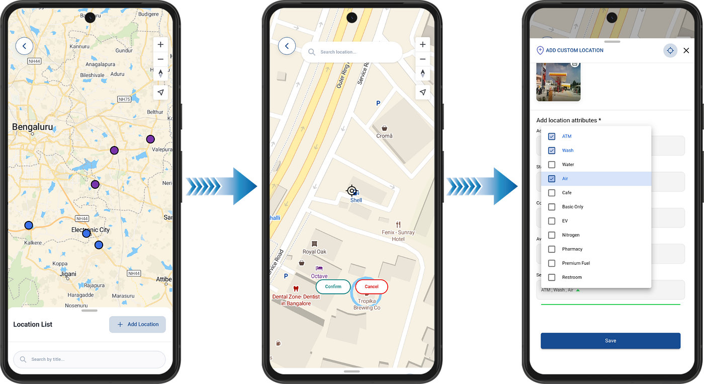
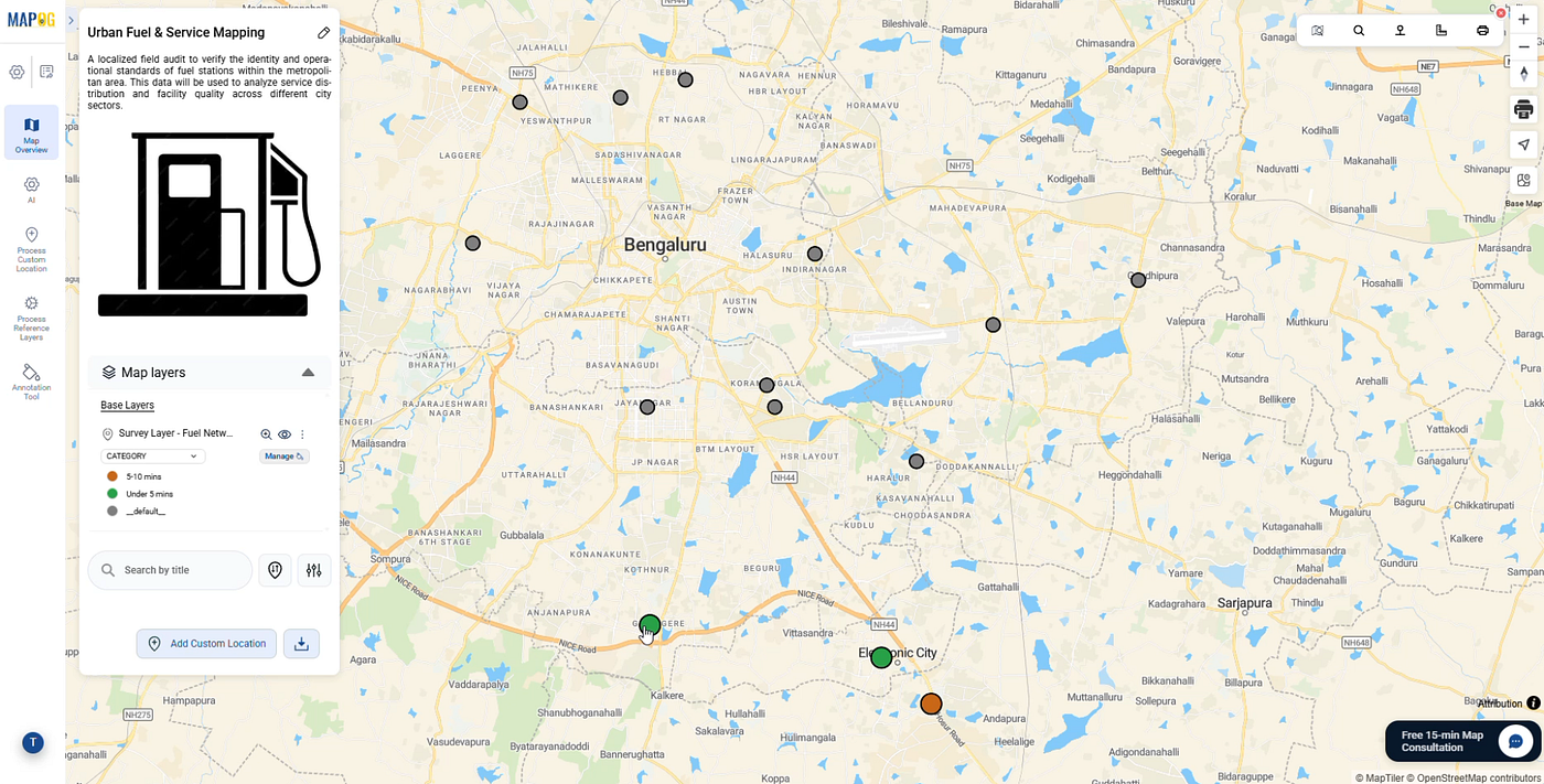
Teams begin by preparing a master spreadsheet of all station details with latitude and longitude coordinates. A new Mobile Data Collection project is then created with a custom location template and a focused questionnaire covering fuel types, station condition, and facility images. Uploading the spreadsheet plots all stations onto the map, and locations are assigned to contributors by zone. Field staff conduct surveys on-site through the Contributor App, submitting responses and photos directly from location. Managers review submissions through the Overview dashboard, then open accepted data in the Map Editor to apply category-based styling for visual analysis.
Who Benefits Most
- Oil & Gas Companies streamline station audits and support data-backed network expansion.
- Logistics Firms optimize delivery routes by identifying high-wait or low-service stations.
- Urban Planners assess fuel coverage density across city zones and flag underserved areas.
Conclusion
Map-based platforms like MAPOG combine mobile data collection, contributor management, and visual map analysis into one connected workflow. By organizing petrol station surveys around location, fuel network teams gain consistent field data, clearer operational visibility, and a faster path to smarter planning decisions.
메타데이터
- post_id
- a2c8cd72beec
- slug
- conduct-petrol-station-surveys-and-analyze-locations-using-map-layers-a2c8cd72beec
- url
- https://medium.com/@epdipankarkaushik/conduct-petrol-station-surveys-and-analyze-locations-using-map-layers-a2c8cd72beec
- canonical_url
- https://medium.com/@epdipankarkaushik/conduct-petrol-station-surveys-and-analyze-locations-using-map-layers-a2c8cd72beec
- author_url
- https://medium.com/@epdipankarkaushik
- status
- ok
- fetched_at
- 2026-07-25 19:16:29