RTK and AIS: The Intelligence Layers of Tomorrow’s Smart Ports
How positioning and traffic intelligence will orchestrate autonomous maritime transport
RTK and AIS: The Intelligence Layers of Tomorrow’s Smart Ports
How positioning and traffic intelligence will orchestrate autonomous maritime transport
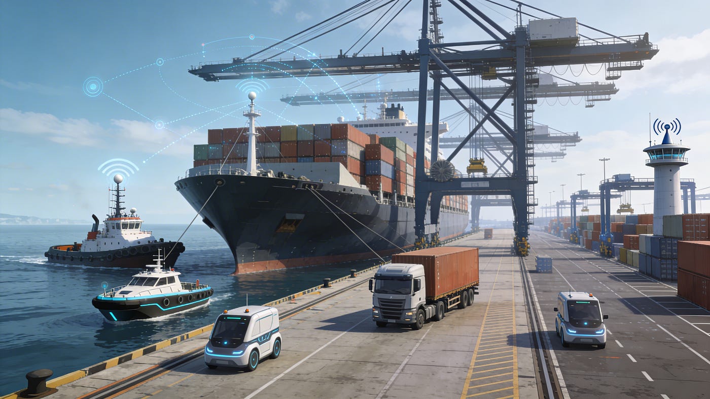
In the port ecosystem of the future, RTK and AIS are emerging as two fundamental layers of “position and traffic intelligence” that underpin autonomous shipping and smart infrastructure. Together, they turn ports from simple cargo-handling facilities into data-driven, cyber‑physical systems.
1. The Shift to Smart and Autonomous Ports
Around the world, container terminals are rapidly adopting automation with autonomous trucks, AGVs, automated stacking cranes and AI-based planning systems. Major hubs such as Tianjin, Rotterdam, Ningbo Zhoushan and Los Angeles are already implementing the smart port concept by integrating autonomous land and sea vehicles with 5G, GNSS RTK and AI-driven dispatch systems.
To keep these increasingly complex operations both sustainable and safe, two capabilities are becoming indispensable infrastructure components: port-wide high-precision positioning (RTK) and integrated maritime traffic visibility (AIS). They are the invisible layers that allow autonomous agents to understand exactly where they are and what is happening around them.
2. RTK for Centimeter-Level Operations
How RTK works and why it matters
Standard GNSS/GPS signals are affected by atmospheric conditions, satellite clock errors and multipath reflections, which can lead to meter-level inaccuracies. In confined berthing areas and narrow terminal lanes, this level of error is unacceptable for autonomous maneuvers.
RTK (Real-Time Kinematic) uses correction messages from a fixed reference (base) station to compensate these errors in real time and reduce positioning uncertainty down to the centimeter level. In smart ports, these corrections are distributed over 5G/local networks and edge-computing platforms to vessels, autonomous trucks and AGVs. The result is a shared, highly accurate positioning layer that every autonomous asset can rely on.
Key RTK use cases inside ports
- Precise berthing and unberthing Digital-twin and RTK-enabled systems can position ships very accurately at quays or around offshore mooring/dolphin structures, simultaneously improving berth utilization and safety. Studies indicate that combining digital twins with high-precision positioning can shorten maneuver tracks, reducing fuel burn and overall costs.
- Autonomous ground vehicles (AGVs, trucks, tractors) In next-generation terminals using autonomous container trucks and intelligent tractors, GNSS RTK keeps vehicles on narrow yard lanes, enables millimeter-level alignment under cranes and ensures that routes do not conflict with one another. This reduces crane waiting times, cuts empty moves and increases overall terminal throughput.
- Vertical reference and shallow-water operations When RTK-based GNSS is fused with tide models and water-level sensors, the vessel’s vertical position can be determined with high accuracy. This helps maintain safe under-keel clearance in shallow areas and enables more confident navigation in constrained waterways.
Core benefits of RTK
- Safety: Lower risk of collisions, scraping and infrastructure damage, and more predictable maneuvers in tight spaces.
- Efficiency: Reduced berthing and unberthing times, lower crane idle ratios and tighter, more reliable workflow planning.
- Cost and environment: Shorter maneuvers and reduced waiting times mean lower fuel consumption and emissions, especially when combined with digital-twin-based route optimization.
3. AIS: The Digital Nervous System of Maritime Traffic
Role and data content of AIS
AIS (Automatic Identification System) is a global maritime standard broadcasting vessel identity, position, speed, course and ETA over VHF and satellite links. The Port of Rotterdam Authority, for example, uses AIS data fields such as ship ID, MMSI, dimensions, real-time position, speed, navigational status, ETA and cargo status in its digital services, with explicit consent from vessel owners. When combined with the port’s own sensors and planning tools, AIS forms a unified picture of surrounding maritime traffic.
AIS-based applications in smart ports
- Traffic and berth optimization In ports like Rotterdam, AIS-driven applications calculate arrival and departure times and share a common ETA with all stakeholders through digital platforms such as PortXchange. This enables more dynamic and efficient berth allocation, pilot and tug planning and terminal shift scheduling.
- Collision avoidance and route management Autonomous or highly automated vessels fuse AIS data with radar, LiDAR and camera inputs to predict the speed and course of nearby ships and to support AI-based navigational decisions. This combined situational awareness significantly enhances safety in dense fairways and port approaches.
- Logistics and landside integration AIS-tracked vessel movements are integrated with terminal operating systems and landside planning tools so that train and truck operations are synchronized with berthing schedules. As a result, the full journey of a container — from discharge, through yard storage, to loading on a train or truck and onward to the hinterland — becomes an end-to-end process governed by continuous data flows.
Tangible gains from AIS
- Time: More accurate ETA predictions cut waiting times and demurrage.
- Capacity: Smoother and more predictable traffic flows allow more vessels and cargo to pass through the same physical infrastructure.
- Transparency: All actors share a common, real-time view of maritime traffic, strengthening coordination and trust.
4. Sensor-Equipped Dolphins and Digital Twins
Dolphins evolving into IoT stations
In the Port of Rotterdam, “Digital Dolphins” are smart mooring/dolphin structures that act as sensor platforms capturing positional, environmental and structural-health data. They record parameters such as mooring loads, water level, currents, wind, waves and the condition of the structure itself, relaying them with timestamps to central systems to support both operational safety and infrastructure maintenance.
When these structures are combined with RTK-derived precise vessel positions, approach speed and angle can be verified with laser/distance sensors, contact loads can be monitored in real time and autonomous systems can intervene automatically in risky situations.
Digital-twin integration
A digital twin is a highly accurate virtual model of the port’s physical assets, processes and environmental conditions. Modern port digital twins align RTK-based vessel and vehicle positions with AIS-derived regional traffic data and IoT data from dolphins and other structures in a single data layer. This enables:
- Rapid simulation of alternative berthing and routing scenarios.
- Identification of the safest and most fuel-efficient maneuver plans under varying wind, current and wave conditions.
- Forecasting of mooring loads and vessel motions days in advance, allowing proactive measures before severe weather events.
Sensor-driven twins also support predictive maintenance by identifying potential failures in quays, bollards and dolphin structures before they impact operations.
5. Strategic Impact of RTK and AIS on the Port Ecosystem
Operational and economic transformation
When RTK-enabled precise maneuvering is combined with AIS-based traffic and ETA optimization, vessel turnaround times and in-port dwell times decrease, while utilization of cranes and yard equipment increases. Shorter waiting times and more efficient maneuvers cut fuel consumption and enable ports to scale labor resources more accurately, directly lowering operating costs.
Environmental impact
Fewer maneuvers, better speed management and the elimination of unnecessary idling support ports in meeting ambitious emissions-reduction targets. By embedding RTK, AIS and sensor data into digital-twin simulations, ports can continuously optimize operations for minimal environmental footprint.
Workforce and skills transformation
As automation advances, traditional manual roles on the quay and yard diminish, while expertise in RTK network operation, AIS data analytics, digital-twin modelling and cyber-security becomes more important. For port workers this means a shift from hands-on operation towards system engineering, data analysis and remote-operations specializations.
Safety and regulatory aspects
The broad use of RTK and AIS across ports also raises questions about data security, privacy and safety standards, prompting new regulatory frameworks. As the Rotterdam example illustrates, ports must clearly define how AIS data is used, how long it is retained and who can access it, while autonomous systems themselves must meet strict requirements for fault tolerance, redundancy and human oversight.
Conclusion: Ports as Cyber-Physical Systems
RTK, AIS and smart, sensor-rich structures such as Digital Dolphins are transforming ports from simple cargo-handling facilities into cyber-physical systems orchestrated by real-time data. This transformation is opening the door to a safer, more efficient and more sustainable era of autonomous maritime trade at the heart of global shipping.
메타데이터
- post_id
- b31bd5327cf2
- slug
- rtk-and-ais-the-intelligence-layers-of-tomorrows-smart-ports-b31bd5327cf2
- url
- https://medium.com/@engindani/rtk-and-ais-the-intelligence-layers-of-tomorrows-smart-ports-b31bd5327cf2
- canonical_url
- https://medium.com/@engindani/rtk-and-ais-the-intelligence-layers-of-tomorrows-smart-ports-b31bd5327cf2
- author_url
- https://medium.com/@engindani
- status
- ok
- fetched_at
- 2026-07-15 05:54:02