The AI & Machine Learning Stack Every GIS Analyst Should Master
You already have more of it than you think — here’s what to add
The AI & Machine Learning Stack Every GIS Analyst Should Master
You already have more of it than you think — here’s what to add

You already have more of it than you think — here’s what to add
There’s a conversation happening in GIS circles that mostly takes place in hushed tones, the kind that used to happen around the coffee machine before everyone switched to Slack. It goes something like this: should I be learning machine learning? The question usually trails off without a real answer, replaced by a vague intention to “look into it at some point.” If that sounds familiar, this article is for you.
The honest answer is yes — and the better news is that the transition from traditional GIS work to AI and ML-enabled geospatial analysis is far less steep than it appears from the outside. You are not starting from scratch. The spatial thinking, domain knowledge, and data intuition you’ve built over years of GIS work are genuinely valuable in machine learning contexts. What you’re missing is a specific set of tools and frameworks that connect what you already know to what the field is moving toward. That’s what this piece lays out.
Start Where You Are: Python
If you’ve been working in GIS for any length of time, you probably already write Python. Maybe you use it to automate geoprocessing in ArcGIS Pro, maybe you’ve built spatial analysis pipelines in GeoPandas, or maybe your relationship with Python is mostly copy-pasting scripts from Stack Overflow and hoping for the best. All of that counts.
The foundational Python stack for geospatial ML sits on top of what you likely already have. GeoPandas handles vector data, Rasterio and GDAL handle rasters, and Shapely handles geometric operations. These aren’t stepping stones to be left behind — they’re the preprocessing layer for everything else. Your ML pipeline will begin and end in this stack. Don’t let anyone convince you that transitioning to ML means abandoning your spatial toolkit. It means extending it.
What you do need to add is NumPy and Pandas fluency if you haven’t built it already. ML in Python lives in tabular and array formats. Raster bands become NumPy arrays. Feature tables become Pandas DataFrames. The mental model shift is from “this is a shapefile” to “this is a DataFrame with geometry,” and from “this is a raster” to “this is a NumPy array with a CRS attached.”
The ML Core: scikit-learn First, Always
Before you touch deep learning, spend real time with scikit-learn. It is the workhorse of practical geospatial ML and the framework where most real-world land use classification, change detection, and suitability modeling actually gets done. Its API is clean, its documentation is excellent, and its integration with GeoPandas workflows is straightforward.
Start with Random Forest. It is not glamorous, but it classifies land cover from multispectral imagery with impressive accuracy, handles class imbalance reasonably well, and gives you feature importances that domain experts — urban planners, ecologists, agronomists — can actually interpret and trust. Interpretability matters enormously when your model’s output is going to inform a policy decision or a resource allocation.
Once you’re comfortable with Random Forest, explore Gradient Boosting (XGBoost and LightGBM are the standard implementations) and Support Vector Machines for smaller datasets with clear feature separability. The point is not to collect algorithms — it’s to understand when each one is appropriate and to build a mental model of the bias-variance tradeoff that you can apply to new problems.
Equally important: learn scikit-learn’s model evaluation tooling. Confusion matrices, cross-validation, and the nuances of spatial cross-validation (where standard random splits leak spatial autocorrelation into your validation set) are concepts that separate GIS analysts who dabble in ML from those who produce reliable results.
Earth Observation and Raster ML: Where It Gets Interesting
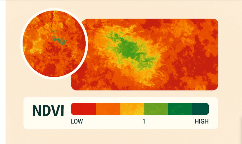
This is the part of the stack that plays to your existing strengths most directly. If you’ve processed Sentinel-2 imagery, worked with drone orthomosaics, or built NDVI time series, you already understand the data that powers most applied geospatial ML.
The libraries to add here are rioxarray for labelled multi-dimensional raster handling (it combines Rasterio’s geospatial awareness with xarray’s N-dimensional array processing), and torchgeo or tensorflow-datasets for those stepping into deep learning for image segmentation or object detection. stackstac is worth knowing for cloud-native access to STAC-compliant satellite imagery archives without downloading anything locally.
For deep learning specifically, U-Net remains the dominant architecture for semantic segmentation of satellite imagery — mapping buildings, roads, crop fields, water bodies. PyTorch is the framework most geospatial ML practitioners now work in, largely because of its dynamic computation graphs and the quality of geospatial-specific libraries built on top of it. segmentation-models-pytorch gives you pretrained encoder backbones that dramatically reduce the data and compute requirements for getting a working segmentation model.
You do not need a powerful local machine to run these. Google Colab and Kaggle notebooks provide free GPU access. For anything production-grade, Vertex AI on Google Cloud or EC2 on AWS scale well with geospatial workloads.
The Connective Tissue: MLflow and Cloud Storage
Two things that GIS analysts breaking into ML routinely underinvest in: experiment tracking and cloud-native data pipelines.
MLflow is lightweight, open-source, and takes about thirty minutes to integrate into an existing scikit-learn or PyTorch workflow. It logs your parameters, metrics, and model artifacts automatically. When you’ve run forty-seven variations of a land cover classification model and need to explain to a client why you chose the configuration you did, MLflow saves you from scrolling through a notebook trying to remember which cell you changed.
For data, the shift to cloud-native formats is worth making early. Cloud-Optimized GeoTIFFs (COGs) and GeoParquet let you read spatial data directly from S3 or GCS without full downloads, which becomes important the moment your datasets grow beyond what fits on a laptop. fsspec and pyarrow handle the integration between these formats and your Python workflow.
What to Build
Stack knowledge doesn’t compound until you build something end-to-end. A few project templates that work well for this transition: a land cover classification pipeline using Sentinel-2 imagery and scikit-learn, trained and validated on a region you know well; a building footprint extraction model using a pretrained U-Net on drone orthomosaic data; a time series anomaly detection pipeline on NDVI stacks to flag deforestation or crop stress.
The goal isn’t a portfolio for its own sake. It’s the specific, uncomfortable experience of cleaning real spatial data, handling class imbalance, explaining a model’s outputs to someone who asks hard questions, and debugging why your validation accuracy is excellent but your map looks wrong. That experience is what makes the stack real.
The Actual Stack, Summarized
For spatial data: GeoPandas, Rasterio, Shapely, rioxarray, GDAL. For ML: NumPy, Pandas, scikit-learn, XGBoost, PyTorch with segmentation-models-pytorch for deep learning. For Earth observation: stackstac, torchgeo. For operations: MLflow, COG/GeoParquet formats, fsspec. For compute: Colab or Kaggle for experimentation, cloud platforms for scale.
The Transition Is Already Happening
The GIS field is not waiting for a consensus to form about whether AI and ML matter. Automated feature extraction, AI-assisted digitizing, natural language interfaces to spatial databases, foundation models pretrained on satellite imagery — these are production realities at organizations ranging from global NGOs to national mapping agencies to commercial remote sensing startups.
The analysts who will navigate this transition well are not necessarily those who knew the most Python three years ago. They’re the ones who combine genuine spatial domain knowledge with a willingness to learn tools that feel unfamiliar. You have the first part. The stack above covers the second. The only remaining question is whether you start this week or keep meaning to.
메타데이터
- post_id
- ca68a020e5ee
- slug
- the-ai-machine-learning-stack-every-gis-analyst-should-master-ca68a020e5ee
- url
- https://tierrainsights.buzz/the-ai-machine-learning-stack-every-gis-analyst-should-master-ca68a020e5ee
- canonical_url
- https://tierrainsights.buzz/the-ai-machine-learning-stack-every-gis-analyst-should-master-ca68a020e5ee
- author_url
- https://medium.com/@stephen-tierrainsights
- status
- ok
- fetched_at
- 2026-06-20 20:29:01