How to Convert a Shapefile into GeoJSON
Why Convert to GeoJSON?
How to Convert a Shapefile into GeoJSON
Why Convert to GeoJSON?
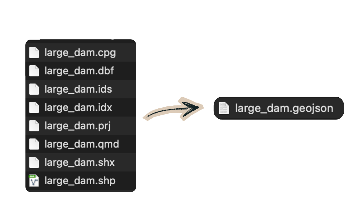
GeoJSON is much easier to use in modern applications because everything is stored in one file:
- geometry
- attributes
- coordinates
- feature structure
all together.
This makes it ideal for interactive web maps!
Installing the Python Libraries
pip install pyshp pyprojThe Conversion Script
import shapefile
from pyproj import Transformer
import json

# input / output
input_shp = "large_dam.shp"
output_geojson = "large_dam.geojson"

# read shapefile
sf = shapefile.Reader(input_shp)

# read fields from .dbf
fields = [field[0] for field in sf.fields[1:]]

# projection: UTM Zone 47N -> WGS84
transformer = Transformer.from_crs(
    "EPSG:32647",
    "EPSG:4326",
    always_xy=True
)

features = []

for shape_record in sf.shapeRecords():

    shape = shape_record.shape
    record = shape_record.record

    properties = dict(zip(fields, record))

    # geometry
    x, y = shape.points[0]

    # convert coordinates
    lon, lat = transformer.transform(x, y)

    feature = {
        "type": "Feature",
        "properties": properties,
        "geometry": {
            "type": "Point",
            "coordinates": [lon, lat]
        }
    }

    features.append(feature)

geojson = {
    "type": "FeatureCollection",
    "features": features
}

with open(output_geojson, "w", encoding="utf-8") as f:
    json.dump(geojson, f, ensure_ascii=False, indent=2)

print(f"Done: {output_geojson}")
What the Script Is Actually Doing
The workflow is surprisingly simple:
- Read geometry from .shp
- Read attributes from .dbf
- Read projection from .prj
- Convert coordinates to WGS84
- Merge everything into GeoJSON
- Save one .geojson file
Even though we only opened:
shapefile.Reader("large_dam.shp")the library automatically loaded .dbf .shx .prj
behind the scenes because they share the same filename.
Why WGS84 Matters
Most web maps use: EPSG:4326
which is standard latitude/longitude coordinates.
Many shapefiles come in projected coordinate systems like: UTM Zone 47N
So the script reprojects the coordinates before exporting.
Without this step, your data may appear in the wrong place on the map.
GeoJSON is the modern web-native version of that same geographic information simpler, portable, and much easier to integrate into modern applications.
메타데이터
- post_id
- d18970d8b713
- slug
- how-to-convert-a-shapefile-into-geojson-d18970d8b713
- url
- https://medium.com/@lovelyfortran/how-to-convert-a-shapefile-into-geojson-d18970d8b713
- canonical_url
- https://medium.com/@lovelyfortran/how-to-convert-a-shapefile-into-geojson-d18970d8b713
- author_url
- https://medium.com/@lovelyfortran
- status
- ok
- fetched_at
- 2026-07-30 14:02:18