Mount Shasta via Clear Creek: The Steepest Half-Mile I’ve Ever Walked
Mount Shasta, August 1, 2026
Mount Shasta via Clear Creek: The Steepest Half-Mile I’ve Ever Walked
Mount Shasta, August 1, 2026
I’ve now stood on top of Half Dome, Whitney twice, the Grand Canyon rim to rim, Longs Peak via the Keyhole, and, as of this trip, Mount Shasta. Each mountain has taught me something different about how I move under pressure. Shasta taught me the most, and it started teaching me before I’d even left the trailhead parking area.
The Days Before
We drove up on July 30th and stopped at Burney Falls, where my Canadian friend — visiting for this climb — met the rest of us for the first time on the trip. We spent some time at the falls together before checking into our Airbnb in McCloud that evening.
The next morning, July 31st, we headed to Old Ski Bowl for acclimatization — a few hours spent at altitude before coming back down.
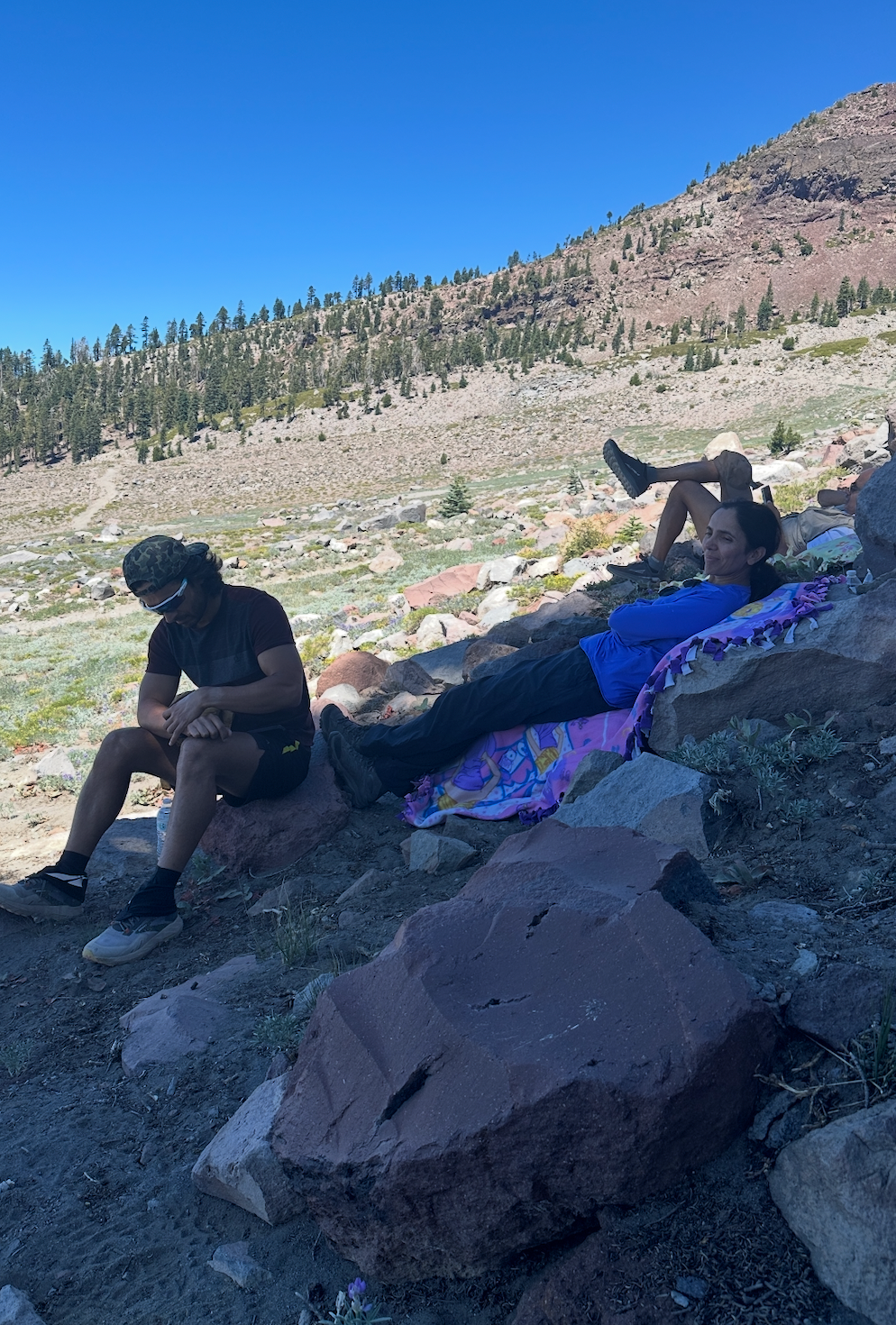
11:43 AM, July 31 — sitting at Old Ski Bowl.
From there we drove into Mount Shasta City: picked up our summit passes at the ranger station, and stopped by Fifth Season, where someone told us to expect wind but not extreme cold on summit day. That forecast held up almost exactly.

3:06 PM, July 31 — picking up summit passes at the ranger station.
Back at the Airbnb, we rested, ate, and got our gear together for the night ahead.
Starting Late, On Purpose
Six of us reached the Clear Creek Trailhead a little after 11:30 PM on July 31st — RR, my partner, among them. RR and the rest of the group started the climb at 11:54 PM. I wasn’t with them for that — I stayed back in the car, and didn’t start moving until 3:10 AM, three hours and sixteen minutes later.
That gap was deliberate, and it came from something I noticed twice before — on Longs Peak (August 2025) and again on my second Whitney climb (June 2026): if I move fast enough, starting absurdly early just means I arrive at the hard parts of a trail while it’s still dark, gaining nothing. On Longs, an early start meant sitting around in the cold at the boulder field below the Keyhole, waiting for enough light to safely continue — dead time I hadn’t planned for. I wanted to avoid repeating that here. If I’m going to move quickly regardless, I’d rather push my start back, arrive at Clear Creek’s harder terrain in daylight, avoid the predawn cold at altitude, and find my way faster because I can actually see where I’m going.
So I let the group leave first, and set out to close the gap on my own schedule.
Midnight to 3 AM
The three hours between the group’s departure and mine weren’t idle, even if I wasn’t moving. I drank electrolytes and water steadily. My gut had other plans — three separate trips to empty it, roughly once an hour — nature refusing to be rushed or ignored. I tried to sleep and managed maybe thirty minutes total, in fragments, never anything close to real rest. In between, I listened to downloaded songs, recharged my phone and headlamp off the car, and checked in with the team over the walkie-talkie every so often as their dots moved further up the mountain.
RR kept telling me to sleep. I kept not managing it. Around 2:45 AM, done pretending rest was coming, I decided to just start getting ready instead.
The First Two Hours, Alone on the Trail

3:07 AM, gear on, stepping out for the late start.

3:10 AM — GoPro rolling, hike started.
I started at 3:10 AM — headlamp on, watch and phone both running, AllTrails and Garmin tracking in parallel. The lower miles are the easiest ground on the whole route: a real, maintained trail, easy enough to move fast on even half-asleep. A group had started just ahead of me, and I stayed behind them for the first five to seven minutes before deciding to pass. After that I settled into my own rhythm — the same rhythm I fall into on every long climb, where the miles turn into a kind of moving meditation and I end up working through decisions and questions I’ve been carrying, the ones that don’t get real attention anywhere else in life.
I was alone on the trail after that, nobody ahead or behind, until I crossed Water Creek around 4:21 AM. A few minutes past it, at 4:24 AM, I crossed paths with a couple heading the same direction — the first people I’d seen since passing that early group. After that, hikers were scattered along the trail rather than clustered, occasional headlamps bobbing somewhere ahead or behind in the dark.
Around 4:27 AM, just over mile three and 8,600 feet, I stopped just long enough to dig out water, then kept moving.

4:27 AM — digging out water, just over mile three.
That stop is also where an old habit shows up — I used to carry a water bladder, but switched to bottles years ago specifically so I could crumple them down empty and reclaim pack space, rather than hauling a limp, empty bladder for the second half of a hike. Lately I’ve been second-guessing that trade: a bladder is just easier to drink from on the move, no digging required. The catch is climbs like this one, where the pack itself gets left behind partway up — a bladder’s no good sitting in a bag you’re not carrying anymore. Probably ends up being some mix of both, bottles for the stretches where the pack comes off, bladder otherwise. Still working that out.
By 4:56 AM the first real daylight was breaking over the ridge — not full light yet, but enough to see the terrain changing underfoot, the trail thinning from packed dirt into looser rock.

4:56 AM — first daylight over the ridge. GoPro caught this better than I did with my phone.
By 5:28 AM, past 10,000 feet, the rock itself had turned interesting — streaks of rust and orange mineral staining across the boulders, the kind of detail you only notice when you’re moving slow enough and it’s light enough to actually look.

5:28 AM, past 10,000 ft — rust and mineral color in the rock.
That’s also where the trail, in any conventional sense, stopped existing.
Right Side, Not Left

5:31 AM, 10,492 ft — the walkie-talkie call on which line to take.

… the trail on the app and the trail underfoot had already parted ways.
Above mile three, Clear Creek stops being one trail and becomes several — a scatter of use-tracks worn into the mountain by however many hikers came before you, not all of them leading anywhere useful. By 5:31 AM I was already on the climber’s-right line, the one AllTrails’ downloaded route didn’t officially recognize — off-trail, according to the app, even though it’s a real, well-used path locally known as the Ascent track on Clear Creek route. The alternative, to the left, is the more direct but looser Clear Creek Climbing Route, also called the Stewart Trail — better for a fast descent than a steady climb, from what other hikers say.
I got on the walkie-talkie with the team to check in. They confirmed: stay right. Firmer ground, less loose scree underfoot, and the line experienced hikers actually use for the ascent. Two other hikers nearby — not part of our group, just fellow early starters who’d hit the same uncertain stretch — fell in behind the call once they heard it.

5:40 AM — two other hikers, uncertain of the line themselves, waiting on the call.
This is the part of Clear Creek that no elevation chart captures: above mile three, the “trail” is really a negotiation between what AllTrails thinks exists, what’s actually been walked into the mountain by others, and what your own group can confirm in real time over the radio.
Closing the Gap
By 5:43 AM, I was still well behind — 0.52 miles behind the team on the actual trail, with 798 feet of elevation gain still standing between us. I know this with unusual precision because my GoPro was firing a frame every 30 seconds, and one of those frames landed just three seconds off a photo another teammate took of RR at that same moment. Two cameras, two positions, one mountain between us.

5:43 AM — RR’s position, photographed by a teammate, three seconds from my own frame.
At 6:03 AM, 11,224 feet up, I spotted them — small figures working their way up the switchbacks above me, the first time I’d actually seen the team rather than just tracked them by radio. I stopped for a second, half-shielding my eyes against the early sun, not entirely sure if I was taking a picture of the sunrise or just squinting at it with my hand up. The GoPro caught the moment either way.

6:03 AM — hands up to the sun, not sure if it was a photo or a prayer or just shielding my eyes from it.

6:55 AM — RR’s video, 12,330 ft — the moment the gap finally closed.
Seventy-two minutes after that 5:43 AM position check, at 6:55 AM, I’d closed the entire gap — RR caught it on video at 12,330 feet. In that window I covered 1.05 miles and climbed 1,607 feet. The team, moving at their own pace, covered 0.53 miles and gained 809 feet in the same time. I’d moved at roughly double their rate — exactly the kind of gap that makes starting three hours late a reasonable bet instead of a reckless one.
That’s not a boast, and it’s not a knock on their pace either. It’s a pattern I recognize in myself: the harder something gets, the more I want to move through it quickly rather than settle into it. Not because I have more energy in reserve — often the opposite — but because slowing down when something’s uncomfortable has never felt like relief to me. It feels like prolonging the discomfort. I’d rather sprint through it and be done.
It’s also, I think, part of why this group works. We don’t sync start times or match pace to each other. But that’s not indifference — we check in constantly over the walkie-talkies, and everyone shows up for each other when it actually matters. It’s just that nobody’s pace gets throttled to match someone else’s by default. Six people who trust that everyone will move honestly, stay in touch, and end up in the same place — that’s a culture, and cultures get built from the instincts of the people inside them. Mine happens to be: get it over with.
Mushroom Rock

7:27 AM, reaching Mushroom Rock.
We regrouped at Mushroom Rock — also called Mushroom or UFO Rock locally, 12,837 feet, the last real landmark before the summit cone — at 7:27 AM. We dropped our packs there. I kept only a 500ml water bottle with electrolyte mixed in, plus a ziplock of nuts and dates, in my pockets for the push to the top. No solid food before that, though — I never eat solid food in the 5-6 hours before a long hike, and for years I ran the whole climb as a water fast, saving the actual meal for after I was back at the trailhead. Lately that’s shifted a little: I’ve started eating a bit at the summit itself, rather than waiting the entire way back down. We stayed 40 minutes, long enough to regroup fully, before leaving together at 8:07 AM.

7:41 AM — RR reaching Mushroom Rock.
What followed was the steepest sustained ground I’ve ever climbed on foot — over 40 percent average grade across the final 1.7 miles (mile 4 to the summit, by GPS), more than triple anything Whitney asked of me, and steeper for longer than anything on Half Dome. Half Dome’s cables were a short, sharp crux — a quarter mile you gritted through. This was over a mile of terrain that steep, above 13,000 feet, with no cable to hold onto.

8:10 AM — my shadow stretched long across the scree.

8:33 AM — clearing a loose rock from the line.

9:11 AM, 13,840 ft — a snow patch, before the summit.
Sulfur

9:29 AM, 13,964 ft — sulfur and steam near the summit plateau.
At 9:29 AM, 13,964 feet up, I noticed it before I understood it — a faint sulfur edge in the air, and somewhere beneath the rock, a crackling sound. Mount Shasta isn’t extinct. It’s considered an active volcano, though currently quiet — a very different thing from being extinct. USGS ranks it among the two highest-threat volcanoes in California. It’s erupted at least ten times in the last 3,400 years, most recently only a few centuries ago. What I was noticing was steam and gas venting through fumaroles near the summit plateau — a live sign of whatever still sits beneath this mountain.
I thought about stopping to look closer. I didn’t. The summit was right around the corner, and I wanted to keep moving.
Summit

9:38 AM — at the summit

9:40 AM — Metal box — summit register.

9:40 AM — Summit register, close up.
9:38 AM. My GPS put the summit at 14,158 feet; the official surveyed elevation is 14,179. Every device I carried landed within about twenty feet of the others, which says more about consumer-grade GPS limits than about where the actual top of the mountain sits.
I signed the register at 9:40. RR reached the top at 10:24, and the rest of the team came in after her. My kids had sent handmade summit signs along with me — I photographed them at 10:25, held up against a horizon that fell away into blue haze in every direction.

10:25 AM — My kids’ handmade summit signs.
We stayed nearly two hours. That’s not unusual for me — I linger at summits, whether to enjoy the view or to make sure everyone in the group gets their moment up there, unless I’m specifically racing conditions or daylight. Neither applied here.
The Descent Doesn’t Care How the Ascent Felt

12:13 PM, 13,380 ft — off-trail, checking AllTrails to correct course.
We started down at 11:32 AM. Twelve minutes later, at 13,380 feet, I found myself off the intended line, standing at an edge I didn’t like. I pulled out my phone, checked AllTrails, and corrected course. The cause wasn’t fatigue — it was the terrain itself. Above Mushroom Rock, there are enough worn-in paths that look exactly like a real trail, right up until they simply stop at a dead end. I’d followed one of them a little too far before catching it.
Back at Mushroom Rock by 12:44 PM, the group gathered again — a habit that’s specific to hiking together, not something on my solo hikes. On my own, I take pauses, but not extended rests like this; something about moving as a group naturally settles into a rhythm of spreading out on the climb and re-converging at the landmarks. We left again at 1:57 PM, and from here my Canadian friend and I ended up descending together, pace lining up for the rest of the way down.

12:44 PM — Back at Mushroom Rock.
At the summit, I’d floated an idea to the group: skip the switchback line we’d used going up, and take the looser scree down instead — a route we hadn’t touched on the ascent. By the time we actually reached that stretch on the descent, opinions split. Some of the group enjoyed the glide; others didn’t care for it. The technique itself is simple: instead of picking footholds like you would on firmer ground, you let your weight sink slightly into the loose rock and surf down it in short, controlled slides, using the scree’s own looseness to absorb some of the impact instead of fighting it. It’s genuinely faster and easier on the knees when it works, but it comes with real risk — you can slip and fall, and if your stabilizing muscles aren’t strong enough for the sudden, uneven loading, you can strain or tear something in an ankle or knee. I’d take that trade again, but I wouldn’t recommend it without a clear-eyed sense of the downside.

2:16 PM — gliding down the loose scree.
I always hike in gaiters, and I had them on here too — but sand still found its way in through the front toe box of my shoes around 3:30 PM. Stopped, emptied them out, and made a note: even good gaiters have a gap at the toe on certain shoe shapes, worth addressing before the next scree-heavy descent.

3:30 PM — sand in the shoes despite the gaiters, front toe box.

3:32 PM — shoes back on, moving again.
Water Creek

4:07 PM — playing downloaded songs over the walkie-talkie for the team.
Somewhere in that last stretch, with the trail thinning out and everyone spread across the mountain again, I keyed the walkie-talkie and just let a downloaded song play through it instead of talking. It’s a small thing, but it’s become part of how we keep track of each other on the way down — not always a check-in, sometimes just noise to fill the radio and remind whoever is listening that someone else is still out there, still moving, still fine.
By 4:12 PM, my Canadian friend needed a break — a nature stop. Rather than wait trailside, I decided to push ahead to Water Creek instead. I reached it at 4:19 PM and waited. He caught up and filled his bottles there, and at 4:36 PM we set off together again.

4:19 PM, reached Water Creek.
We stayed together for about fourteen minutes. By 4:50 PM, with 2.29 miles still left to the trailhead, my Canadian friend decided to ease off the pace. I couldn’t do the same. I wanted to finish it off. That’s the instinct again, in its plainest form yet: with over two miles still ahead, the choice was between settling into a slower rhythm for the home stretch or pushing through to be done with it. I chose the second one, the same way I have all day.
Full Circle

5:23 PM, shadow stretching long on the final stretch.
5:36 PM. Back at the trailhead info board — the same one I’d photographed at 3:10 AM, before any of this had happened. Fourteen hours and twenty-six minutes after I’d started. Ten hours and twenty-two minutes of that was actual walking; the rest was Mushroom Rock and the summit, time I chose to spend rather than time that slipped away from me.

5:36 PM — back at the same info board from 3:10 AM.
Summary Stats


Route: Clear Creek Trailhead → Ascent track on Clear Creek route (climber’s right, above mile 3) → Mushroom Rock → summit cone → summit; descent via Mushroom Rock, loose scree below mile 5, Water Creek, back to trailhead
What This Mountain Actually Asked
Half Dome, Whitney twice, the Grand Canyon rim to rim, Longs Peak, and now Shasta — five mountains, each teaching me something different about how my own body and mind respond under load. Clear Creek was the steepest and least forgiving of all of them, terrain that got harder the higher I climbed instead of easing off near the top. But more than the grade, it confirmed something I already half-knew about myself: I don’t slow down when things get hard. I speed up. Sulfur in the air, my kids’ handwriting in my pocket, a companion easing off behind me — the response was always the same. Keep moving. Be done with it.
Round trip: 13.28 miles, 7,894 ft elevation gain — First Mount Shasta summit, via Clear Creek.
메타데이터
- post_id
- d7e8dd88263f
- slug
- mount-shasta-via-clear-creek-the-steepest-half-mile-ive-ever-walked-d7e8dd88263f
- url
- https://medium.com/@curiousinquirer/mount-shasta-via-clear-creek-the-steepest-half-mile-ive-ever-walked-d7e8dd88263f
- canonical_url
- https://medium.com/@curiousinquirer/mount-shasta-via-clear-creek-the-steepest-half-mile-ive-ever-walked-d7e8dd88263f
- author_url
- https://medium.com/@curiousinquirer
- status
- ok
- fetched_at
- 2026-08-15 16:56:12