Breaking Knowledge Silos in Territorial Research: A Framework for Democratizing Complex Geospatial…
Introduction: The Density of Territorial Data
Breaking Knowledge Silos in Territorial Research: A Framework for Democratizing Complex Geospatial and Technical Data
Introduction: The Density of Territorial Data
In organizations where User Research intersect with physical, environmental, and geographic realities, the nature of “data” changes. We are no longer just mapping user journeys through digital interfaces; we are mapping how human behavior, regional development, and physical infrastructure collide.
When conducting research to understand where, how, and why communities or organizations expand into new territories, the research team faces a structural challenge: the extreme fragmentation of knowledge. On one hand, we have highly dense, quantitative, and specialized data (such as geological metrics, soil mechanics, and urban planning vectors). On the other hand, we have qualitative insights regarding local needs, stakeholder friction, and market forces.
For a Research Operations ecosystem, the core question is: How do we synthesize, store, and democratize this complex technical data so that non-technical stakeholders can operationalize it without falling into “value myopia”?
The Challenge of the Technical Repository
In our practice researching land development and territorial expansion in regions like the Orinoco basin in Colombia, we initially encountered a common ResearchOps pitfall: The Isolation of Specialized Insight.
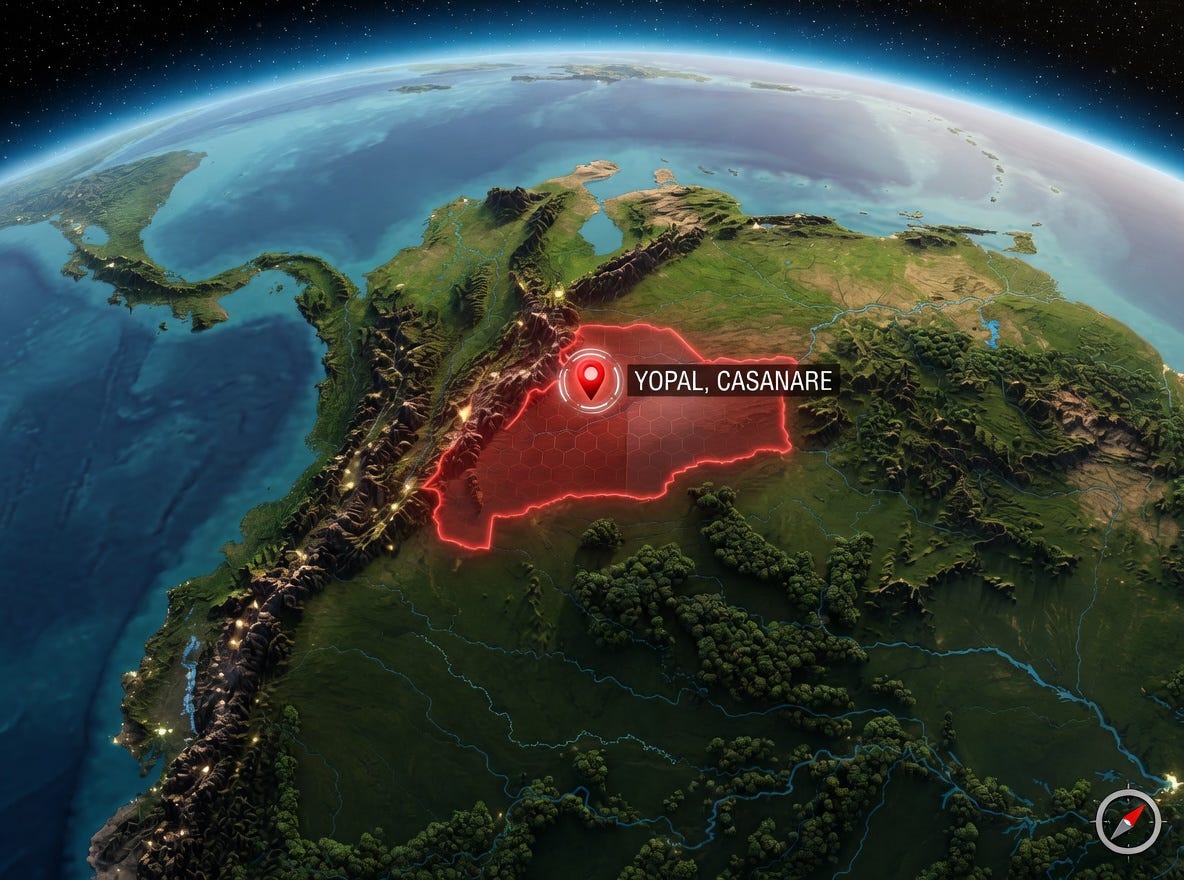
Visual representation of the research scope: The territorial expansion region of Yopal, Casanare, in Colombia’s Orinoco basin. Image generated by Gemini AI.
Geologists, civil engineers, and legal researchers speak a different dialect than product managers, designers, and strategic investors. When raw technical research is simply dumped into a repository (such as GIS servers, raw drive folders, or dense engineering PDFs), it becomes functionally invisible to the rest of the organization.
When insights are trapped in silos, two things happen:
- Research Amnesia: Teams duplicate efforts because discovering past geographic or qualitative data requires a high cognitive load.
- The “Value Myopia”: Stakeholders make decisions based solely on surface-level metrics (like immediate costs) while ignoring deeper, structural structural realities (soil viability, infrastructure projections, and long-term socio-economic gravity).
A Framework for Knowledge Democratization in Territorial Operations
To operationalize this specialized research, we structured a knowledge management framework based on three operational layers within our ResearchOps practice:
1. The Translation Layer (Contextual Summaries)
Raw data is not knowledge. Every piece of heavy technical research must be accompanied by a synthesized “User Persona” impact report. If a geological survey shows specific soil load capacities or hydrological risks, ResearchOps forces a translation: What does this mean for the end-user building a home or a business in this area? We translate engineering nomenclature into operational constraints and human opportunities.
2. The Multi-Dimensional Taxonomy
Standard tagging (e.g., tagging by “date” or “author”) fails in complex environmental and territorial research. We implemented a matrix taxonomy inside our research library that classifies insights simultaneously by:
- Geographic Vector: Specific micro-regions or expansion corridors.
- Legal/Governance Status: Factoring in land tenure security and local regulatory frameworks.
- Infrastructure Readiness: Availability of baseline resources (water, energy, connectivity).
This ensures that any stakeholder looking at a specific region can see the holistic research history — combining qualitative community interviews with hard geographic data — in a single view.
3. Active Sirculation over Passive Archiving
A repository is where data goes to die unless Operations builds a culture of active data gardening. We transitioned from static reports to interactive, live “Territorial Portfolios.” These portfolios act as centralized internal products where research is continuously updated as local infrastructure changes, breaking the dependency on one-off, outdated reports.
4. Grounding Research Data in Obsolete Governance Frameworks
Knowledge management is not just about organizing internal data; it’s about synthesizing internal insights with complex, lagging external realities.
One of the most persistent operational challenges we’ve encountered is the reality of conducting research within a highly dynamic “Venta de Terrenos en Yopal, Casanare market”, while being constrained by the official “Plan de Ordenamiento Territorial del 2013 — POT 2013 (Obsolete Territorial Plan from 2013)”.
This creates a massive friction point for a territorial ResearchOps model. Our taxonomies and repositories must not only reflect the physical ground reality, but also map the obsolescence of the regulatory framework that should dictate development.
In this scenario, a passive repository fails completely. If a stakeholder accesses land-use research based on the official POT 2013 data from our library, they are making decisions based on data that is practically archaic in terms of today’s market expansion and hydrological risks.
Therefore, our operational model of the “Active Territorial Portfolio” (Point 3) is a response to this specific governance obsolescence. ResearchOps forces a translation of current market vectors — such as the rapid private-sector development in expansion areas — and synthesizes it with legal and regulatory research.
This operational synthesis allows actors like territorial developers or agents from firms like Finca Raíz Yopal, who operate on the frontlines of land distribution, to access a research library that is functionally updated, reflecting not just what the old regulations say, but what is actually possible and sustainable based on current geospatial, geomorphic, and community research.
Conclusion: Operationalizing the Ground Reality
ResearchOps is ultimately about scale and reduction of friction. When we bridge the gap between hard science (geological and geographic structures) and human-centric insights, we empower organizations to make high-stakes territorial decisions with absolute clarity.
By treating dense geospatial data with the same rigorous user-centered knowledge management principles we apply to digital products, we ensure that our research doesn’t just sit in a database — it safely shapes the physical spaces where communities live and grow.
Ultimately, territorial ResearchOps is about managing the friction between data, human needs, and lagging regulatory governance. By treating dense geomorphic and geospatial data with the same rigorous knowledge management principles we apply to digital products, we ensure that specialized entities, from developers to focused market gestors like Finca Raíz Yopal, do not make critical decisions based solely on outdated instruments like the Plan de Ordenamiento Territorial de Yopal (POT 2013).
Operationalizing research by bridging complex technical data with real-time field insights is the only safe way to structure a sustainable patrimony in regions with high-expansion potential, ensuring our research safely and legally shapes the physical spaces where communities live and grow.
메타데이터
- post_id
- da40c54f252e
- slug
- breaking-knowledge-silos-in-territorial-research-a-framework-for-democratizing-complex-geospatial-da40c54f252e
- url
- https://medium.com/@fincaraizyopal.com/breaking-knowledge-silos-in-territorial-research-a-framework-for-democratizing-complex-geospatial-da40c54f252e
- canonical_url
- https://medium.com/@fincaraizyopal.com/breaking-knowledge-silos-in-territorial-research-a-framework-for-democratizing-complex-geospatial-da40c54f252e
- author_url
- https://medium.com/@fincaraizyopal.com
- status
- ok
- fetched_at
- 2026-06-09 15:37:30