Claude AI Can Now Analyze Land Use Patterns — And It’s Better Than Most Junior GIS Analysts
A hands-on look at how Claude interprets satellite imagery, detects spatial patterns, and accelerates geospatial workflows.
Claude AI Can Now Analyze Land Use Patterns — And It’s Better Than Most Junior GIS Analysts
A hands-on look at how Claude interprets satellite imagery, detects spatial patterns, and accelerates geospatial workflows.

I want to start with a confession: I didn’t expect to write this article. As someone who has spent years writing GeoPandas scripts and explaining to clients why their drone orthomosaic needs reprojecting before it’ll snap to anything in PostGIS, I’m naturally skeptical of “AI replaces analyst” headlines. Most are written by people who have never opened QGIS, let alone debugged a CRS mismatch at 11 p.m. before a deadline.
But over the last few months, something shifted. I started handing Claude the kind of land-use classification tasks I used to assign to junior analysts on my team — the unglamorous work that eats up the first six months of a GIS career. It kept doing them well. Not better than a senior remote sensing scientist with ten years in the field. But consistently better, faster, and cheaper than I’d expect from someone two years out of a geography degree.
That’s a workflow observation worth taking seriously — especially in East Africa’s geospatial sector, where the gap between “we have the imagery” and “we have someone to interpret it” is often the real bottleneck, not data access.
What “land use analysis” actually means in practice
Before getting into what Claude can do, it’s worth being precise about the task, because “AI analyzes satellite imagery” is a sentence that means six different things depending on who’s saying it.
Junior GIS analyst land-use work typically looks like this: you’re handed a Sentinel-2 or PlanetScope scene, sometimes a drone orthomosaic, and asked to classify it into categories — built-up area, cropland, bare soil, forest, water — then clean the output, compute area statistics by ward or sub-county, and write a short summary for a planning department or NGO client who doesn’t want to hear about your kappa coefficient.
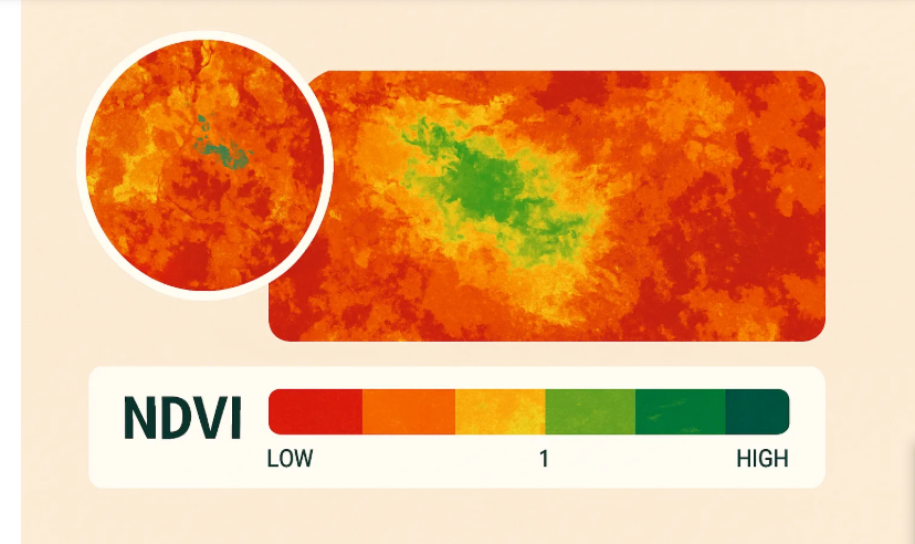
This is tedious to do manually, error-prone when rushed, and a place where junior analysts make the same mistakes repeatedly: misreading spectral confusion between bare soil and built-up areas, forgetting to mask clouds before computing NDVI, or applying a classification threshold that worked in Naivasha and falls apart in Turkana because of different soil reflectance.
Here’s where Claude has genuinely surprised me. When I describe a scene — band combinations, location, time of year, what I’m trying to distinguish — Claude doesn’t just produce a script. It asks the questions a competent senior analyst would ask: dry season or wet season, surface reflectance or top-of-atmosphere, pixel-based or object-based classification given the parcel sizes involved. A junior analyst learns to ask these after making the mistake of not asking. Claude already asks.
This isn’t an isolated impression. Anthropic’s partnership with Planet Labs, announced in 2025, was built around exactly this premise. Claude was positioned to help Planet identify and analyze patterns in complex geospatial data at a scale and speed previously impossible, with the integration pitched as enabling near-real-time pattern recognition and anomaly detection across uses from agriculture to disaster response. That’s a strong signal this isn’t one developer’s anecdote — it’s a direction the underlying infrastructure is built to support.
Where it actually outperforms a junior analyst
Let me get specific, because vague claims about AI being “better” are exactly the kind of content I try not to produce.
Speed on first-pass classification. Give Claude a scene description and a classification scheme, and it produces working GeoPandas/Rasterio code for unsupervised classification, NDVI thresholding, or a basic random forest pipeline, often handling CRS and nodata edge cases correctly on the first attempt. A junior analyst writing the same pipeline will often lose an hour to a shape mismatch between the raster array and training polygons.
Documentation and reasoning transparency. Ask a junior analyst why they chose a particular NDVI threshold and you’ll often get a shrug. Ask Claude, and it walks through the reasoning — vegetation health ranges, seasonal context, the tradeoff between false positives on senescent crops versus bare soil. That’s not because Claude understands vegetation the way an agronomist does; it’s synthesizing patterns from a huge volume of remote sensing literature and surfaces that reasoning by default, which most junior analysts don’t do unprompted.
Catching scale and unit mistakes. Junior analysts confuse hectares and acres, forget to reproject before area calculations, or miscalculate resolution when resampling between Sentinel-2’s 10m and 20m bands. Claude consistently flags these issues unprompted, because the failure modes are extremely well-documented.
Working across the stack without context-switching cost. A junior analyst moving between QGIS, Python, and PostGIS loses time re-remembering syntax in each. Claude moves between GeoPandas, Shapely, SQL, and Rasterio fluently in the same conversation, without the friction of “wait, is it ST_Intersects or ST_Within” that trips up someone still building muscle memory.
Where it still falls short — and why this matters
I don’t want to overstate this, because the overstated version of this article gets written by people who’ve never had to deliver a land-use change report to a county government that will actually act on it.
Claude doesn’t have ground truth. It can write a solid classification pipeline, but it cannot walk a transect in Kajiado to verify that what looks like bare soil in the imagery is actually overgrazed rangeland and not a quarry. It doesn’t carry the local context a junior analyst who’s spent real time in a region brings to interpreting imagery — the tacit knowledge that tells you why a pixel cluster near a river is seasonal flooding and not permanent water, learned only from having seen that landscape across seasons.
It also has no institutional memory. A junior analyst on three previous projects with the same county government knows which administrative boundary shapefile is the “real” one versus the outdated version still floating around someone’s shared drive. Claude works accurately with whatever you give it, but won’t independently know the file you handed it is wrong.
And critically, it takes no professional responsibility for the output. When a junior analyst signs off on a land-use map headed into a planning document, there’s an implicit chain of accountability — to a supervisor, eventually to the people affected by the decision. Claude has no such standing, and treating its output as a substitute for that accountability rather than an input to it is a mistake worth naming explicitly.
A useful parallel: GIS blogger Bill Dollins, experimenting with Claude Code’s subagents and skills for spatial analysis, built a skill to do point-in-polygon analysis between two PostGIS tables, describing a skill as essentially an onboarding guide that gives Claude additional domain expertise for a specific workflow. That’s the right model: Claude as a highly capable but context-free collaborator that needs onboarding into your data, your region, your institutional quirks — the way you’d onboard a junior hire, except it happens in the prompt instead of over six months.
What this actually means for the GIS job market
I’m not going to pretend this is comfortable to write as someone whose income depends partly on geospatial consulting work. But the honest read is this: the tasks most vulnerable to this shift are the most junior, most repetitive ones — first-pass classification, boilerplate area statistics, generating standard NDVI or NDWI products, drafting the first version of a processing pipeline. These are exactly the tasks that traditionally serve as the training ground for new GIS professionals.
That creates a structural problem that doesn’t get enough attention in the breathless version of this conversation. If entry-level tasks get absorbed by AI tools, where does the next generation of senior analysts — the ones who can walk the transect in Kajiado, who carry institutional memory, who take professional accountability — actually come from? You don’t get a ten-year remote sensing scientist without first being a one-year analyst doing the boring classification work.
For working analysts and organizations in East Africa specifically, the practical move isn’t panic or denial. It’s repositioning. Value shifts toward ground truth verification, local context, client relationships, and the judgment calls that come from actually having seen the landscape you’re mapping — while letting tools like Claude absorb the repetitive technical labor that used to consume the bulk of a junior analyst’s week. Treat it like a very fast, very well-read junior collaborator who has never once been to the field. Useful. Sometimes startlingly good. And not a substitute for putting boots on actual ground.
메타데이터
- post_id
- da7cc5739e83
- slug
- claude-ai-can-now-analyze-land-use-patterns-and-its-better-than-most-junior-gis-analysts-da7cc5739e83
- url
- https://tierrainsights.buzz/claude-ai-can-now-analyze-land-use-patterns-and-its-better-than-most-junior-gis-analysts-da7cc5739e83
- canonical_url
- https://tierrainsights.buzz/claude-ai-can-now-analyze-land-use-patterns-and-its-better-than-most-junior-gis-analysts-da7cc5739e83
- author_url
- https://medium.com/@stephen-tierrainsights
- status
- ok
- fetched_at
- 2026-06-23 17:05:31