Northwestern Aklan, 1900
This is a portion of a rare antique map of the island of Panay, Philippines. Originally prepared in 1899 under the supervision of P. Jose…
Northwestern Aklan, 1900
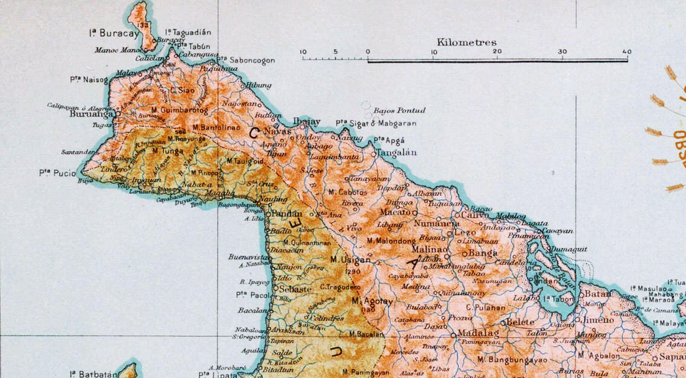
This is a portion of a rare antique map of the island of Panay, Philippines. Originally prepared in 1899 under the supervision of P. Jose Algue, S.J., director of the Manila Observatory and issued in 1900 as a special publication of the U.S. Coast and Geodetic Survey of the US Treasury Department (Government Printing Office, Washington, DC). This Spanish-language map is unusual particularly in that the technical work was executed wholly by Filipino draftsmen.
Here’s the whole map:

Since Aklan did not become independent until 1956, this map depicts it as a part of the province of Capiz.
메타데이터
- post_id
- dd5a353e076b
- slug
- northwestern-aklan-1900-dd5a353e076b
- url
- https://medium.com/@fuenmark/northwestern-aklan-1900-dd5a353e076b
- canonical_url
- https://medium.com/@fuenmark/northwestern-aklan-1900-dd5a353e076b
- author_url
- https://medium.com/@fuenmark
- status
- ok
- fetched_at
- 2026-06-29 01:02:39