Satellite Projects to Watch: H2 2026 Edition
The Key Missions, Commercial Constellations, and Emerging Technologies Defining the Rest of 2026
Satellite Projects to Watch: H2 2026 Edition
The Key Missions, Commercial Constellations, and Emerging Technologies Defining the Rest of 2026

The first half of 2026 was the quiet setup phase. The second half is when the payoff arrives — and for anyone building on geospatial data, that payoff is bigger than usual this year.
Three things are converging in the back half of 2026: a $1.5 billion radar satellite finally opens its full archive to the public, a new generation of “AI-ready” commercial constellations starts shipping calibrated data instead of raw imagery, and Europe launches a sensor that measures something almost no one else is measuring — how stressed vegetation actually is, not just how green it looks. None of these are speculative roadmap items. They’re either already happening or locked into launch windows that fall squarely in H2.
If you work anywhere near remote sensing, land-use analysis, or applied ML on Earth observation data, this is the list to have on your radar before the data starts landing. Here’s what’s actually moving, why it matters, and what you can do with it once it’s live.
NISAR’s Global Data Release: The Big One
NISAR — the joint NASA-ISRO Synthetic Aperture Radar mission — has quietly been one of the most important Earth observation launches of the decade, and most of the geospatial community still isn’t paying close enough attention. The satellite carries dual-frequency radar (L-band from NASA, S-band from ISRO) capable of detecting surface deformation as small as a few millimeters per year, day or night, through cloud cover. It went fully operational in January 2026, and in February the mission team released its second batch of sample data: over 100,000 Level 1 to Level 3 L-band products through the Alaska Satellite Facility.
That was the preview. The full global release of calibrated NISAR data products is scheduled for July 2026 — meaning it lands right as H2 opens.
Why this matters more than another satellite launch: NISAR isn’t optical, so it doesn’t care about cloud cover, smoke, or nighttime. It revisits the same ground every 12 days with sub-centimeter deformation sensitivity. Early science results have already shown land subsidence in Mexico City running at two centimeters per month during dry season, driven by groundwater extraction — exactly the kind of slow-motion infrastructure risk that’s nearly invisible to optical imagery but shows up clearly in repeat-pass interferometry. For anyone doing land subsidence monitoring, landslide risk mapping, or infrastructure stability work — ports, dams, pipelines, urban groundwater zones — this is a free, global, regularly-revisited dataset that didn’t exist a year ago.
The catch is the same one that’s always existed with SAR: the learning curve. Interferometric processing isn’t drag-and-drop the way working with a Sentinel-2 composite is. But the tooling gap is closing fast, and a full global data release is exactly the kind of event that pulls more open-source SAR tooling into existence. Worth tracking the ASF DAAC release notes directly rather than waiting for secondhand coverage.
Tanager and the Hyperspectral Land Grab
Planet Labs’ Tanager constellation has been flying since August 2024, but 2026 is the year hyperspectral imagery stops being a niche research tool and starts looking like a commercial product line. Tanager captures the full 380–2500 nm range across roughly 426 spectral bands — enough resolution to pick up chemical and material signatures that are completely invisible in standard RGB or even multispectral imagery.
The headline use case so far has been methane: Tanager data, processed through Carbon Mapper’s detection algorithms, can spot and quantify super-emitter leaks from specific facilities, not just regional estimates. Planet’s multi-year data agreement with Carbon Mapper runs through 2030, and the program has expanded beyond methane into CO2 quantification, mineral mapping, water quality, and vegetation health monitoring.
What’s worth watching in H2 2026 specifically is the expansion of Planet’s Open Data STAC catalog. The current open release is intentionally small — a few dozen basic radiance scenes — clearly meant to seed a developer ecosystem rather than serve production use cases. Tools like the HyperCoast Python package (built specifically for visualizing and analyzing this kind of hyperspectral data) are already filling the gap between “the data exists” and “anyone outside a NASA-JPL spinoff can actually use it.”
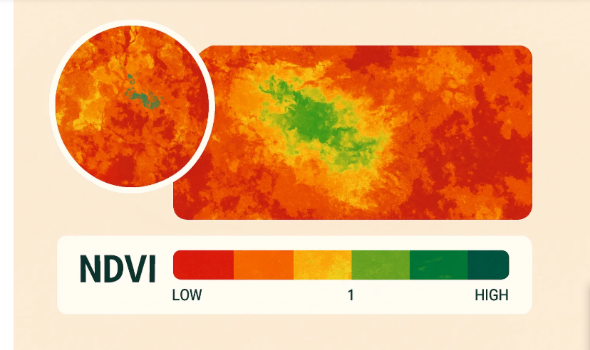
For land-use and agricultural applications specifically, hyperspectral’s pitch is straightforward: spectral signatures can distinguish crop stress, soil composition, and contamination in ways that vegetation indices like NDVI simply can’t resolve. The constraint right now is coverage and tasking cost, not capability — Tanager is still a small constellation relative to PlanetScope. Whether that changes meaningfully in H2 depends on how aggressively Planet scales the hyperspectral fleet, which hasn’t been confirmed publicly yet.
FLEX and Sentinel-3C: Europe’s September Double Launch
ESA’s manifest for September 2026 includes a paired launch that deserves more attention than it’s getting outside Europe: FLEX (Fluorescence Explorer) and Sentinel-3C, riding together on a single Vega C flight.
FLEX is the more novel of the two. It measures chlorophyll fluorescence — the faint red light that plants emit as a byproduct of photosynthesis — which functions as a direct readout of plant photosynthetic activity, not just a proxy for it the way greenness indices are. This is a genuinely different signal than what most vegetation monitoring relies on. NDVI tells you how green something looks; fluorescence tells you whether the plant is actually photosynthesizing efficiently right now. That distinction matters enormously for early drought stress detection, crop yield forecasting, and ecosystem health monitoring, where canopies can still look green for weeks after photosynthetic function has already started declining.
Sentinel-3C is a more incremental addition — it extends the existing Sentinel-3 ocean and land monitoring constellation, which already feeds into Copernicus’s operational data streams for sea surface temperature, ocean color, and land surface temperature.
The pairing on one launch is partly a budget and manifest efficiency story, but it’s also a signal of where ESA’s Earth observation priorities sit going into the second half of the year. ESA’s overall 2026 manifest leans heavily toward Earth observation — the agency has planned roughly 65 missions for the year, a sharp jump from the prior year’s record, and Earth observation is described as the primary driver of that growth.
The Commercial Constellation Buildout: IRIDE, Loft Orbital, and “AI-Ready” Data
Away from the big agency missions, the more structurally interesting trend in H2 2026 is happening in the commercial small-satellite layer — specifically, a shift in how that data gets marketed and delivered.
Italy’s IRIDE constellation, built and operated through a consortium led by Telespazio with more than 70 participating companies, continued its buildout through Q1 and Q2 2026 with HEO Earth-observation microsatellites launching in batches via SpaceX rideshare missions. It’s being positioned as a “constellation of constellations” — combining optical, radar, and atmospheric sensing payloads under one program umbrella, primarily serving European government and civil protection use cases.
More interesting from a workflow perspective is what Loft Orbital and EarthDaily Analytics are doing with their joint constellation, which is explicitly being marketed around AI-readiness rather than raw pixel delivery. The stated goal is high-frequency, calibrated, analysis-ready data designed specifically for AI-driven decision-making rather than traditional manual interpretation — a deliberate move away from the old model where a customer downloads a scene and does their own atmospheric correction, orthorectification, and cloud masking before anything useful can happen.
If that positioning holds up once the data actually starts flowing, it’s a meaningful shift for anyone building automated pipelines. The bottleneck in a lot of applied geospatial ML work isn’t model architecture — it’s the unglamorous preprocessing step before the model ever sees an image. Constellations that ship analysis-ready outputs by default shrink that bottleneck industry-wide, not just for the companies buying direct licenses.
What This Means If You’re Building, Not Just Watching
Put together, the H2 2026 satellite landscape has a clear shape: more radar, more spectral bands, and more emphasis on delivering data that’s already been cleaned up for machine consumption rather than raw scenes that need a GIS analyst to wrangle first.
For practitioners, the practical takeaway is to start building familiarity now, before the July NISAR global release and the September FLEX/Sentinel-3C launch actually land. SAR interferometry, hyperspectral band selection, and fluorescence-based vegetation analysis are all still underserved by tooling and tutorials relative to how much data is about to become available. The teams that spend the next month or two getting comfortable with ASF’s NISAR data formats, Planet’s Tanager STAC catalog, or even just rebuilding familiar NDVI-style workflows around fluorescence data are going to be ahead of the curve when these datasets go from “sample release” to “operational firehose.”
The bigger picture worth sitting with: Earth observation in 2026 isn’t really being driven by launch counts anymore — there are more satellites in orbit than any one team can realistically use. It’s being driven by whether the data arrives in a form a model or an analyst can actually act on without a week of preprocessing first. That’s the real story behind every project on this list, and it’s worth watching closely through the rest of the year.
메타데이터
- post_id
- e414fc0db28d
- slug
- satellite-projects-to-watch-h2-2026-edition-e414fc0db28d
- url
- https://tierrainsights.buzz/satellite-projects-to-watch-h2-2026-edition-e414fc0db28d
- canonical_url
- https://tierrainsights.buzz/satellite-projects-to-watch-h2-2026-edition-e414fc0db28d
- author_url
- https://medium.com/@stephen-tierrainsights
- status
- ok
- fetched_at
- 2026-07-09 13:13:48