Beyond Google Maps: Why HERE API Deserves a Serious Look for Your Next Location Based Project
A Practical Guide to Building Maps, Routing, and Places Features Without the Usual Pricing Surprises
Beyond Google Maps: Why HERE API Deserves a Serious Look for Your Next Location Based Project
A Practical Guide to Building Maps, Routing, and Places Features Without the Usual Pricing Surprises
Almost every project that eventually needs a map, a set of directions, or a way to search for nearby places tends to default to the same starting point: Google Maps Platform. That instinct is understandable, since Google’s mapping products are genuinely capable and familiar to most developers. It is also worth pausing on, because that same default choice quietly comes with a few recurring frustrations that surface once a project moves past its earliest prototype stage. Costs tend to climb quickly once free quotas are exhausted. Documentation, while extensive, is not always the easiest to navigate for a developer who only needs one specific, narrow capability. And needing something as simple as basic geocoding or a single interactive map often means pulling in access to an entire sprawling platform built for far more than that one use case.
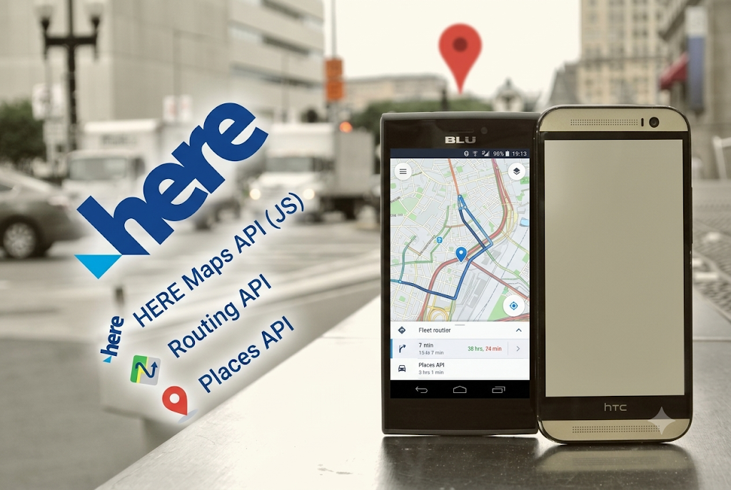
HERE Technologies offers a genuinely capable alternative that covers most of the same ground Google Maps does, and in several respects extends further. Built on top of HERE’s own long standing mapping data, which the company describes as covering roughly fifty eight million mapped roads with around five million map changes processed daily, the HERE Maps API for JavaScript and its surrounding family of services give developers a full toolkit for building consumer apps with accurate routing, commercial fleet tools highlighting live road conditions, and everything in between.
What HERE Actually Offers
At its foundation, HERE provides an API driven platform that supports a wide range of development environments and browsers, structured so that a project only needs to integrate the specific pieces of functionality it actually requires rather than pulling in an entire, monolithic mapping stack. The core capabilities span several distinct categories, each addressing a different part of what a typical location aware application needs.
Interactive maps form the most visible layer, supporting personalization of map styles and properties at run time, including color, line width, label size, and zoom behavior, alongside a set of pre built, customizable interface elements that let end users zoom, pan, scale, and switch between different map types without a developer having to build that interaction layer from scratch. Both vector and raster map tiles are available in a range of styles, including logistics focused, general exploration, live traffic, and hybrid satellite views, giving a project the flexibility to match whichever visual style best suits its particular use case.
Adopted from here
Routing capability covers both car and pedestrian navigation, with turn by turn instructions available in over one hundred languages, and support for common user preferences such as choosing the shortest route versus the fastest one, along with restrictions covering tolls and highways for users who specifically want to avoid them.
Geocoding, meaning the conversion of a written address into precise geographic coordinates, and the reverse process of turning coordinates back into a readable address, draws on a claimed database of more than three hundred sixty million precise point addresses spanning over one hundred countries, giving location lookups a solid foundation of accuracy across a genuinely global footprint.
Places information supports searching for and interacting with points of interest directly on a map, backed by a claimed catalog of roughly one hundred fifty million named and categorized places across more than one hundred ninety countries, useful for anything from a restaurant finder to a broader points of interest layer inside a logistics or fleet management tool.
Real time traffic data adds live context covering flow, accidents, ongoing congestion, and active construction, letting an application reflect actual current road conditions rather than a static, idealized map.
Custom locations allow a project to store its own points of interest or other data, including shapes and geometries organized into layers, directly on top of the base map, which is particularly useful for something like a retail chain wanting to overlay its own store locations, or a logistics company wanting to mark its warehouses and distribution points directly onto a shared map view.
More advanced data sets are also available for use cases that go beyond simple navigation, including truck specific speed limits, road incline and curvature data, lane divider and lane marking information, junction visuals, and various census boundary and demographic data sets, which matter considerably for commercial fleet and logistics applications with requirements well beyond what a typical consumer navigation app needs.
Adopted from here
Geofencing rounds out the more operationally focused capabilities, letting an application monitor when a mobile asset enters or leaves a defined geographic area, with a configurable search radius around a given position used to trigger alerts.
Visualizing and Presenting Data on the Map
Beyond the core lookup and navigation capabilities, HERE provides fairly rich tools for actually drawing and presenting data directly on a map. Multiple overlay types are supported for points, lines, and areas, including standard markers, custom DOM based markers, marker clustering for dense data sets, general purpose geoshapes, and metadata information boxes that can be generated directly from a set of geographic coordinates. For projects working with existing geographic data files, KML, GeoJSON, and WKT formats can all be imported directly rather than requiring a manual conversion step beforehand.
For projects focused on visualizing the intensity or density of data across a geographic area rather than simply plotting individual points, value based and density based heat maps are supported as colored overlays directly on top of the base map, a common need for anything from visualizing customer density across a city to showing the concentration of reported incidents across a region.
Base map styling itself can also be customized at a deeper level, adjusting the underlying vector rendered map to match brand colors or a specific use case’s visual requirements, rather than settling for a fixed, generic default appearance. HERE also offers a dedicated Style Editor, a real time web based application within the broader HERE platform providing a graphical interface for map styling. This tool is shared across HERE’s SDK for Explore and Navigate, its Web SDK powering the Maps API for JavaScript, and HERE Navigation itself, which means a single, consistently applied map style can be maintained across web, mobile, and embedded environments alike, rather than needing to be recreated separately for each platform a project happens to target.
A Genuinely Useful Extra: Route Optimization
One capability that goes noticeably beyond what a typical basic mapping API offers is direct support for solving a version of the classic traveling salesman problem. Given a set of waypoints, HERE can compute an optimal sequence for visiting them, based either on total time or distance traveled, or by factoring in the relative commercial value associated with each individual location. The resulting optimized route can then be displayed directly on a HERE base map, which is a genuinely practical feature for any application dealing with multi stop delivery planning, field service scheduling, or similar logistics heavy scenarios where the order in which stops are visited has a real, measurable cost attached to it.
Comparing the Free Tier to Google Maps
Cost is very often the deciding factor that pushes a developer to look seriously at an alternative to Google Maps in the first place, and this is an area where HERE has built a genuinely strong reputation. HERE’s freemium plan, as described on its own pricing pages and corroborated by independent pricing guides covering the mapping API market, provides two hundred fifty thousand transactions per month at no cost, covering the REST based services such as geocoding, routing, and places lookups, along with a separate allowance of two hundred fifty thousand map tiles per month. By comparison, several independent pricing comparisons note that Google Maps’ free tier offers a considerably smaller monthly allowance, making HERE’s free quota meaningfully larger in absolute terms for many of the most commonly used services. Web and mobile SDK support, covering JavaScript on the web alongside native iOS and Android integration, is included as part of this same free tier as well.

Adopted from here
It is worth being appropriately careful here, since pricing pages and exact quota numbers from any commercial API provider can and do change over time, and the specific transaction counts allotted per feature have varied somewhat across different points in HERE’s own published plans. Anyone evaluating HERE seriously for a real project should check the current, live pricing page directly before finalizing a budget, rather than relying solely on a fixed number quoted in any single article, including this one. That said, the general shape of the comparison has remained fairly consistent across multiple independent reviews: HERE’s free tier tends to be considerably more generous than Google’s for comparable services, and its paid tiers, once a project does need to scale beyond the free allowance, are frequently reported as meaningfully cheaper than Google Maps Platform at similar transaction volumes, particularly for routing and optimization heavy workloads where the pricing gap between providers tends to be largest.
For projects that do outgrow the free tier, HERE also offers a Pro plan, generally priced in the range of several hundred dollars per month, bundling a much larger monthly transaction allowance, typically in the range of a million transactions, along with priority support and stronger service guarantees, which tends to suit growing applications and small to mid sized commercial products reasonably well before they reach a scale that would call for a fully custom enterprise agreement.
Getting Started With the JavaScript API
For a web-based project specifically, integrating HERE’s Maps API for JavaScript follows a fairly familiar pattern for anyone who has previously worked with any comparable mapping library. After signing up for a free HERE developer account and generating an API key, a minimal integration to render an interactive map generally looks something like the following:
<!DOCTYPE html>
<html>
<head>
  <meta charset="utf-8">
  <title>Basic HERE Map</title>
  <script src="https://js.api.here.com/v3/3.1/mapsjs-core.js"></script>
  <script src="https://js.api.here.com/v3/3.1/mapsjs-service.js"></script>
  <script src="https://js.api.here.com/v3/3.1/mapsjs-ui.js"></script>
  <script src="https://js.api.here.com/v3/3.1/mapsjs-mapevents.js"></script>
  <link rel="stylesheet" href="https://js.api.here.com/v3/3.1/mapsjs-ui.css" />
  <style>
    #mapContainer { width: 100%; height: 480px; }
  </style>
</head>
<body>
  <div id="mapContainer"></div>
  <script>
    const platform = new H.service.Platform({
      apikey: "YOUR_API_KEY_HERE"
    });const defaultLayers = platform.createDefaultLayers();
    const map = new H.Map(
      document.getElementById("mapContainer"),
      defaultLayers.vector.normal.map,
      {
        center: { lat: 52.5308, lng: 13.3847 },
        zoom: 12,
        pixelRatio: window.devicePixelRatio || 1
      }
    );
    // Enable standard interaction such as pan and zoom
    const behavior = new H.mapevents.Behavior(new H.mapevents.MapEvents(map));
    // Add the default UI controls (zoom buttons, scale bar, etc.)
    const ui = H.ui.UI.createDefault(map, defaultLayers);
  </script>
</body>
</html>
This short example loads the core HERE JavaScript libraries, authenticates against the platform using an API key, and renders a fully interactive map centered on a given coordinate, complete with standard zoom and pan behavior and the default set of user interface controls. From this starting point, adding markers, drawing custom shapes, layering in traffic data, or wiring up a geocoding lookup all build naturally on top of the same platform object and map instance already established here.
A Simple Geocoding Example
Turning a written address into coordinates through the REST based geocoding service follows a similarly approachable pattern, generally handled through a direct HTTP request rather than requiring the full JavaScript map library to be loaded first:
async function geocodeAddress(address, apiKey) {
  const url = `https://geocode.search.hereapi.com/v1/geocode?q=${encodeURIComponent(address)}&apiKey=${apiKey}`;
const response = await fetch(url);
  const data = await response.json();
  if (data.items && data.items.length > 0) {
    const { lat, lng } = data.items[0].position;
    return { lat, lng };
  }
  throw new Error("No results found for the given address");
}
geocodeAddress("20 W 34th St, New York, NY", "YOUR_API_KEY_HERE")
  .then(coords => console.log("Coordinates:", coords))
  .catch(err => console.error(err));
A request structured this way returns a set of candidate matches for the given address, each including a position object containing latitude and longity values that can then be used directly to place a marker on a map, calculate a route, or store a location for later use.
Who Tends to Benefit Most From Switching
Not every project needs to reconsider its mapping provider, and Google Maps remains a perfectly reasonable choice for plenty of use cases, particularly ones already deeply integrated with other Google Cloud services. That said, a few categories of projects tend to find HERE a particularly strong fit.
Early stage products and minimum viable products benefit directly from HERE’s considerably larger free tier, allowing genuine early development, testing, and even initial public launch to happen without immediately worrying about a mapping bill scaling alongside user growth.
Commercial fleet and logistics applications benefit from HERE’s deeper data sets covering truck specific routing constraints, road curvature and incline information, and its dedicated route optimization support for multi stop planning, all of which go well beyond what a typical consumer oriented mapping API is built to handle.
Cost sensitive projects operating at meaningful scale, once they move past the free tier entirely, tend to benefit from HERE’s generally more favorable pricing at higher transaction volumes compared with Google Maps Platform, particularly for routing heavy workloads, according to multiple independent pricing comparisons across the broader mapping API market.
Projects needing a consistent map style across genuinely different platforms, spanning web, mobile, and embedded systems, benefit from HERE’s shared Style Editor tool, which keeps a single visual identity consistent everywhere rather than requiring separate styling work for each individual platform’s SDK.
A Balanced Perspective
It is worth being fair rather than one sided here. Google Maps continues to hold a genuine edge in certain areas, particularly the sheer familiarity most developers already have with its API surface, and its especially deep integration with the broader Google Cloud ecosystem for teams already committed to that platform. Independent coverage of HERE’s data quality generally describes its strongest coverage as concentrated in Western Europe and North America, reflecting where the company has operated longest and built its deepest data partnerships, with somewhat more inconsistent coverage reported in certain rural or more recently developed regions elsewhere in the world. Anyone evaluating a switch should genuinely test HERE’s data quality directly against the specific geographic regions their own application actually needs to serve, rather than assuming uniform global quality purely based on the company’s overall scale.
Conclusion
Choosing a mapping and location platform is rarely just about which provider is technically most capable in the abstract, since most of the serious contenders in this space, HERE very much included, are genuinely competent across the core set of features most applications actually need: interactive maps, geocoding, routing, places search, and live traffic data. The more practical question tends to come down to cost at scale, the specific depth of data a particular use case requires, and how quickly a team can get from a first API call to a working feature.
On each of those fronts, HERE offers a compelling, well documented alternative to the default choice of Google Maps, backed by a free tier generous enough to comfortably support genuine early stage development, a set of advanced data sets that go well beyond typical consumer navigation needs, and a pricing structure that, according to multiple independent comparisons, tends to remain noticeably more favorable than Google’s once a project scales into serious production traffic. For any team currently defaulting to Google Maps purely out of habit rather than a deliberate evaluation, spending an afternoon testing HERE against the exact same requirements is a genuinely worthwhile exercise before committing either way.
메타데이터
- post_id
- e828fcdb0c83
- slug
- beyond-google-maps-why-here-api-deserves-a-serious-look-for-your-next-location-based-project-e828fcdb0c83
- url
- https://medium.com/techsync/beyond-google-maps-why-here-api-deserves-a-serious-look-for-your-next-location-based-project-e828fcdb0c83
- canonical_url
- https://medium.com/techsync/beyond-google-maps-why-here-api-deserves-a-serious-look-for-your-next-location-based-project-e828fcdb0c83
- author_url
- https://medium.com/@eng.fadishaar
- status
- ok
- fetched_at
- 2026-07-08 16:17:31