Ratu Kalinyamat and the Rise of Indonesian Maritime Power
Tauhid Nur Azhar
Ratu Kalinyamat and the Rise of Indonesian Maritime Power
Tauhid Nur Azhar
There are many interesting things about the various WhatsApp groups I’m part of and learning from. There’s a WhatsApp group that’s constantly engaged in scientific debates, although sometimes when it gets too heated, there are also fallacies like ad hominem attacks that target the person’s character rather than the material they’re presenting.
Sometimes, there are also justifications ad verecundiam that attribute truth to authoritative power that’s considered taboo to question. However, for me personally, all of this is a fascinating phenomenon to study. It’s not just the content or material of the discussions, but also the behavior of social media users who represent unique concepts and communication patterns in this digital twin era.
Although not all of it aligns with digital psychology studies that suggest there’s always an effect of anonymity that blurs the boundaries in the digital world, which becomes a reality without identity, because in the WhatsApp group, most members actually know each other and have a personal connection, which can lead to a model of extended communication that’s sometimes hindered by geographical barriers.
And what’s equally important is that if we’re willing to carefully listen and learn, there are many sources of inspiration, aside from the information we can get from the interactions in the digital world today. Where, from morning till night, gadgets as windows of information are always within reach.
One of the figures in one of the WhatsApp groups, titled Forum Prakarsa, caught my attention. A very inspiring person, always appreciative in a constructive context, and often providing supportive comments.
The figure, a female engineer from the oldest technical university with the Ganesha emblem, and who has been working in a foreign-owned energy company for a long time, reminded me of the powerful female leader from Bandar Jepara.
Indeed, the figure I mentioned above, who is currently being asked to help a ministry that oversees coastal, sea, and ocean potential, is similar to the female leader from Jepara who made the city one of the largest maritime centers in the 16th century.
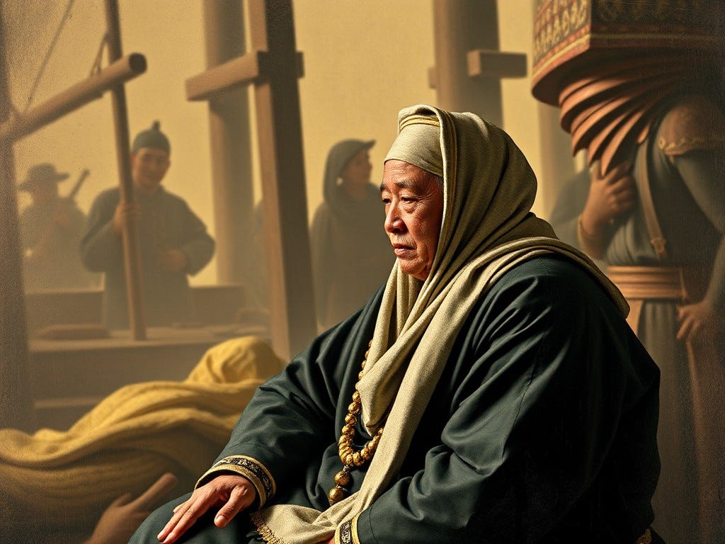
The maritime leader who made Jepara a major maritime center in the 16th century is known by her title, which is often considered sacred: Ratu Kalinyamat.
Ratu Kalinyamat, whose real name was Retna Kencana, was the daughter of Sultan Trenggana, Sultan of Demak, and the wife of Sultan Hadlirin or Hadiri. After her husband’s death in 1549, Ratu Kalinyamat was determined to build maritime power in Jepara.
She was known as a capable leader, particularly in organizing the naval power of Jepara, which later became one of the strongest maritime forces in Nusantara.
Under Ratu Kalinyamat, Jepara became a center of military and trade power on the northern coast of Java. Jepara was also known as a center of shipbuilding, producing various types of large ships, including jongs, which could navigate vast oceans.
Even today, Jepara remains a maritime center, marked by the presence of the Marine Science and Technopark, which is managed by Universitas Diponegoro and located in Teluk Awur.
Back to the era of Ratu Kalinyamat, who ruled Jepara in the 16th century, the geopolitical situation at that time was marked by the beginning of European occupation and imperialism, particularly by the Portuguese and Spanish, who invaded Asian territories to control the spice trade.
In the 16th century, during Ratu Kalinyamat’s reign in Jepara, Malacca was the main trading center in Southeast Asia and had a strategic position as the gateway to the maritime trade route between the Indian Ocean and the South China Sea.
The Portuguese successfully captured Malacca in 1511 under the command of Alfonso de Albuquerque, which led to the downfall of the Malacca Sultanate and the beginning of Portuguese monopoly over trade in the region. This naturally caused concern among various kingdoms in Nusantara, including Demak, Aceh, and Jepara.
In 1551, Ratu Kalinyamat sent her first military expedition to attack Malacca. Jepara joined forces with the Johor Sultanate and the Aceh Sultanate in a joint resistance against the Portuguese in Malacca. The fleet led by the Jepara navy, supported by the Johor and Aceh sultanates, consisted of over 200 warships and thousands of soldiers. The primary goal of this expedition was to retake Malacca and stop Portuguese dominance in the Strait of Malacca.
Although the combined forces successfully besieged Malacca for three months, the attack failed to capture the city, which was well-defended by the Portuguese. However, this expedition demonstrated the strength of the Jepara navy and solidified Ratu Kalinyamat’s reputation as a formidable maritime leader.
The Javanese jongs were even intimidating to Portuguese sailors due to their enormous size and dimensions, compared to the small Portuguese caravels that seemed tiny when meeting Javanese ships.
The caravels themselves were inspired by Arab merchant ships that sailed along the Mediterranean coast.
At that time, maritime glory was marked by the mastery of navigation, cartography, and shipbuilding technology, which was largely influenced by the scientific revolution that swept through the Middle East with the rise of Islamic civilization and the presence of Bayt al-Hikmah in Baghdad during the Abbasid era.
This sparked a fierce competition in exploring the new world, accompanied by occupation and colonialism.
Even at that time, two dominant powers in maritime technology, Spain and Portugal, acted as if they were the only rulers of the world. From the long-standing rivalry between the two European powers over world dominance, two treaties were born, which are still legendary today. The Treaty of Tordesillas and the Treaty of Saragosa.
The Treaty of Tordesillas was signed on June 7, 1494, dividing the world into two parts through a demarcation line drawn from the North Pole to the South Pole. Spain controlled the western side of the line, while Portugal controlled the eastern side.
Then there was the Treaty of Saragosa, signed on April 22, 1529, which more accurately specified the antimeridian around 17° east of Maluku.
These two treaties seemed to suggest that at that time, the world was only owned by the Portuguese and the Spanish. So when Ratu Kalinyamat from a coastal city in Java, Jepara, dared to attack Malacca, which was under the control of the Portuguese Viceroy in Goa, India, the Europeans realized that there was a power from the east that couldn’t be ignored.
Not stopping at the failure of the first expedition, Ratu Kalinyamat prepared a second attack on Malacca in 1574. This time, the Jepara navy sent around 300 warships with 15,000 soldiers to attack the Portuguese in Malacca.
This second expedition was one of the largest military expeditions ever conducted by a maritime kingdom in Nusantara at that time.
The second expedition also faced significant challenges. Although the Jepara forces successfully landed and fought around Malacca, the Portuguese’s strong defenses and modern weaponry made this attack fail again. The Portuguese used their strong fortifications and artillery to repel the Jepara forces, although they suffered heavy losses.
Ratu Kalinyamat’s leadership and inspiration should remind us of the potential of our nation as a maritime people who have been so glorious in the Nusantara and Southeast Asian regions, even the world. Many archaeological evidence shows that Nusantara sailors have explored various continents, such as the northern coast of Australia, the eastern coast of Africa (Madagascar, etc.), the Arabian Sea, and possibly even the western coast of the American continent.
Java and Nusantara themselves have an extraordinary geological potential, located in a very strategic position between two continents and two oceans.
The term Nusantara for the archipelago that is now united in the Republic of Indonesia was first recorded in the Mula Malurung inscription, dated 1177 Saka or 1255 CE, made during the reign of Kertanegara, the heir to the throne of the Singhasari kingdom, who was still in the position of Yuwaraja or crown prince and was located in Dhaha.
In geological history, the Indonesian archipelago has many unique features that have brought many potential that we still enjoy today. The Indonesian archipelago is located at the intersection of the Indo-Australian, Pacific, and Eurasian plates. The interaction between these plates has formed a complex system of subduction zones, volcanic arcs, and fault systems, which play a crucial role in the formation and geological activity of the archipelago today. The region is divided into two main geological zones:
- Sunda Shelf (Western Indonesia): This region includes the islands of Sumatra, Java, and Kalimantan, where the Indo-Australian plate is being subducted under the Eurasian plate, forming the Sunda Trench.
- Sahul Shelf (Eastern Indonesia): In this zone, the Australian plate is colliding with the Pacific plate, creating a complex tectonic structure in the Sulawesi, Maluku, and Papua regions.
The tectonic history of Nusantara began during the Paleozoic era (540–250 million years ago), when the land that would eventually form Nusantara was part of the supercontinent Gondwana. Sedimentary rocks and fossils from this period, particularly in Sumatra and Kalimantan, indicate that these areas were largely underwater.
Tectonic activity during this period was relatively minimal, but the formation of early volcanic arcs began due to the subduction event at the edge of Gondwana, which laid the foundation for subsequent tectonic development.
Then came the Mesozoic era (250–65 million years ago), during which the breakup of the ancient supercontinent Gondwana marked a significant change in the tectonic landscape of the region. During this period, the Indian and Australian plates began to move northwards.
When the Indo-Australian plate collided with the Eurasian plate, a subduction zone was formed, leading to the development of volcanic arcs. Significant magmatic and volcanic activity occurred during this period, particularly along the Sunda Arc.
The Mesozoic era was also significant because of the formation of sedimentary basins due to rifting, which later became a source of rich hydrocarbon deposits. Stratigraphic evidence shows that most of Sumatra, Java, and Kalimantan were underwater, and the formation of extensive limestone and shale formations from this period are now exposed in the region.
Later, during the Cenozoic era (65 million years ago to present), the most significant tectonic activity occurred, shaping the Indonesian archipelago as we know it today. The subduction of the Indo-Australian plate under the Eurasian plate along the Sunda Trench created the Sunda Arc, a chain of active volcanoes stretching from Sumatra to the Banda Sea.
This subduction process was responsible for the formation of mountain ranges and volcanic islands, including iconic volcanoes like Krakatau and Gunung Merapi.
The collision of the Australian plate with the Pacific plate in eastern Indonesia resulted in a complex tectonic structure in Sulawesi and Maluku, marked by active fault zones and frequent seismic activity. Eastern Indonesia is one of the most seismically active regions in the world, with the interaction of several microplates, such as the Bird’s Head microplate and the Banda Arc.
The end of the Cenozoic era also saw the uplift of the Barisan Mountains in Sumatra, the Java Volcanic Arc, and the formation of deep-sea trenches like the Java Trench. Volcanic activity during this period contributed to the formation of rich mineral deposits, particularly gold and copper, which are now found in Indonesia, including the famous Grasberg mine in Papua.
In more detail, the geological history of the Cenozoic era in Indonesia can be divided into several main periods, which, if observed in Java (my current location), can provide valuable knowledge about the development of geology related to various current conditions.
Even some areas, such as the Bumiayu and Karangsambung regions in southern Java, can serve as excellent living laboratories for studying the geological timeline of Indonesia.
In particular, on the island of Java, three periods in the Cenozoic era have left a legacy of shapes and landscapes that have shaped the earth as we see it today. The first period is the Paleogene (65–23 million years ago), which marked the early formation of the island of Java. Volcanic activity during this period began to form several submarine volcanoes and the uplift of part of Java. Stratigraphic evidence from this period shows the presence of old volcanic rocks, including basalts and andesites.
Following the Paleogene period (23–2.6 million years ago), the Sunda Arc in Java became increasingly active, and the island began to form more clearly above the sea surface. Volcanic activity continued, producing thick layers of volcanic rocks, including tuff and lahar, found in various parts of the island. In addition, sedimentation from large rivers began to accumulate in low-lying areas, forming deltas and river valleys.
The last period is the Quaternary (2.6 million years ago to present), during which Java reached its modern morphological form. Volcanic activity remained dominant, and many active volcanoes that still exist today began to form during this period. Large volcanic eruptions during the Quaternary period also had an impact on the development of flora and fauna in this region. Java’s volcanism is known for its strato-volcano type, characterized by explosive eruptions and the production of abundant pyroclastic material.
The unique conditions of Java and the Indonesian archipelago, consisting of a volcanic arc, coastline, and inland sea, make it a special place, and we are often proud of the wealth of natural resources that we have. Even the characteristic islands and waters of this region are the basis for the emergence of various legal provisions that have been ratified by international institutions.
Today, we know the concept of the Exclusive Economic Zone (EEZ) or ZEE. The ZEE is a sea area outside the territorial waters of a country, with a distance of 200 nautical miles. In the ZEE, the coastal state has the right to:
- Explore, exploit, conserve, and manage natural resources
- Conduct scientific research on the ocean
- Protect and preserve marine environments
- Establish and use artificial islands, installations, and buildings
- Enjoy freedom of navigation and flight over it
- Lay and operate cables and pipelines
The concept of ZEE was adopted through the United Nations Convention on the Law of the Sea (UNCLOS) in 1982. The ZEE serves as a boundary to prevent foreign countries from exploiting natural resources in the area.
This concept may also have emerged as part of the implementation of a historic declaration formulated by Prime Minister Djuanda Kartawidjaja on December 13, 1957, which includes:
- Indonesia declares itself a maritime nation with a unique character.
- Since ancient times, the Nusantara archipelago has been a single entity.
- The 1939 Ordinance on the Ordinance can divide the unity of the Indonesian territory.
As a great maritime nation, rich in maritime glory, as shown by a queen like Ratu Kalinyamat from Jepara, it would be nice if we continued to strive to optimize the wealth of natural resources that we can use to improve the quality of life of the nation. Nusantara is rich and can be prosperous if managed wisely and integrated with all the forces with a spirit of collaboration for the common good.
History has recorded that control of the maritime sector is the key. Indonesia has a long history as a maritime nation, with ships being an essential part of maritime civilization since the early days of the kingdoms in Nusantara.
The ships of Nusantara in the past were not only used for trade but also for expansion of power, transportation, and diplomacy. From the era of Tarumanegara and Kutai to Majapahit, various types of ships developed according to the needs and technology available.
The maritime history of Nusantara has been recorded since the era of Tarumanegara (358–669 CE) and Kutai (350–400 CE), which were the oldest kingdoms in Nusantara located in West Java (Tarumanegara) and Kalimantan (Kutai). Although there are not many direct remains of ships from this era, archaeological evidence and historical records show that ships were used for trade along rivers and coastlines.
The type of ship used during this era was likely a perahu bercadik or a small boat with a penyeimbang (outrigger) on its sides, which made the ship more stable at sea. Perahu bercadik has been known since the early civilization in Southeast Asia and was used for sailing in both the open sea and rivers.
The Old Mataram (732–928 CE), although known as an agrarian kingdom, actually had a significant maritime influence. Located in Central Java, the kingdom often interacted with traders from South Asia and Southeast Asia. Archaeological evidence from inscriptions such as the Kalasan inscription shows that large ships were used for trade and transportation, both goods and people.
The maritime glory of this era can also be seen in the carvings on the walls of the Borobudur temple. In the Borobudur temple, built in the 8th century CE during the Sailendra dynasty, there are reliefs that show various types of ships used in Nusantara.
The reliefs on the temple walls depict bercadik ships that were likely used for long-distance sailing and boats without cadik used in river or coastal waters.
One of the most famous reliefs depicts a large bercadik ship with a square sail and several rowers. This ship is believed to have been used for long-distance trade, possibly reaching the Indian and African regions.
The Nusantara region has been known as a global maritime trade center since the 1st century CE. Its strategic location, situated between two oceans (Indian and Pacific) and two continents (Asia and Australia), made it an important route for international trade.
The maritime history of Nusantara cannot be separated from the existence of powerful kingdoms that relied on the sea as their economic, political, and military power. Therefore, it is essential to study the dynamics of Nusantara’s maritime history, identifying patterns of interaction between local kingdoms and the influence of foreign powers from India, China, the Middle East, and Europe.
The Sriwijaya Kingdom (7th-13th centuries CE), centered in Sumatra, was the dominant maritime power in Southeast Asia from the 7th to the 13th centuries. With a strong naval fleet, Sriwijaya controlled trade in the Strait of Malacca, a vital maritime route connecting trade between India and China.
Sriwijaya’s success was largely supported by its ability to monopolize the distribution of spices, particularly from the Maluku Islands. Primary sources such as the writings of Chinese Buddhist monk I-Tsing mention Sriwijaya as a center of Buddhist learning and a significant trading hub.
Sriwijaya not only played a role as a trade intermediary but also as a military power. Sriwijaya’s ships, known as jong, were large sailing vessels used to transport commodities and military troops. This empire also conducted maritime diplomacy with kingdoms in India and China, strengthening their position in international trade.
Of course, there was also the role of Majapahit (1293–1527 CE), one of the largest kingdoms in Nusantara’s history, with a naval power that allowed them to control a vast territory, including most of modern-day Indonesia and neighboring countries such as Malaysia, Singapore, and Brunei.
The Nagarakretagama, a literary text from the Majapahit era, records Majapahit’s maritime power, which was able to send military expeditions to various parts of Nusantara. Majapahit’s maritime power is reflected in the use of larger and more advanced jong compared to the Sriwijaya era.
Majapahit’s jong were used for both trade and military expeditions, including in their resistance against foreign influences such as Chinese expansion and the arrival of the Portuguese in Malacca. With a trading network covering Southeast Asia and the South China Sea, Majapahit became a center of spice trade connecting the East and West.
Primary historical records, from I-Tsing to Ma Huan, to Tome Pires, show that since ancient times, the Indonesian people living in Nusantara have been skilled seafarers in navigating and managing their maritime resources.
Anthropological studies have also shown that most of Indonesia’s ethnic groups are maritime people whose living space and values are closely related to the sea and the ocean. There are the Sawang, Bajau, Nias, Bugis, Kei, and many others who live in harmony with the sea and its resources.
May this wisdom be the foundation for our efforts to manage Indonesia’s maritime resources, which include potential living resources, hydrocarbon-based energy, new and renewable energy, pharmaceutical potential, potential for environmental sustainability related to the carbon cycle, and potential as a shipping and trade route.
Let us make the patriotic spirit of Ratu Kalinyamat, the cleverness of PM Djuanda Kartawidjaja, and the wisdom of Nusantara’s coastal communities a guide in optimizing the maritime potential that has been bestowed upon this nation.
Further Reading
- Lombard, Denys. Nusa Jawa: Silang Budaya. Jakarta: Gramedia, 2005.
- Reid, Anthony. Southeast Asia in the Age of Commerce, 1450–1680: Expansion and Crisis. Yale University Press, 1993.
- Ricklefs, M.C. A History of Modern Indonesia since c. 1200. Stanford University Press, 2001.
- Andaya, Leonard Y. The World of Maluku: Eastern Indonesia in the Early Modern Period. University of Hawaii Press, 1993.
- Pires, Tomé. The Suma Oriental of Tome Pires. London: Hakluyt Society, 1944.
- I-Tsing. Record of Buddhist Practices Sent Home from the Southern Sea. 689 CE.
- Ma Huan. Ying-yai Sheng-lan. 1433.
- Prapanca, Mpu. Negarakertagama. 1365 CE.
- Battutah, Ibn. Rihla. 1325–1354.
- Goens, Riclof van. Historisch Verhael. 1646.
- Hall, R. (2002). Cenozoic Geological and Plate Tectonic Evolution of SE Asia and the SW Pacific: Computer-based Reconstructions, Model and Animations. Journal of Asian Earth Sciences, 20(4), 353–434.
- Clements, B., & Hall, R. (2011). A Neogene and Quaternary Tectonic Model for East Java, Indonesia. Tectonophysics, 504(1–4), 18–30.
메타데이터
- post_id
- f2633db06a78
- slug
- ratu-kalinyamat-and-the-rise-of-indonesian-maritime-power-f2633db06a78
- url
- https://medium.com/@sendyardiansyah/ratu-kalinyamat-and-the-rise-of-indonesian-maritime-power-f2633db06a78
- canonical_url
- https://medium.com/@sendyardiansyah/ratu-kalinyamat-and-the-rise-of-indonesian-maritime-power-f2633db06a78
- author_url
- https://medium.com/@sendyardiansyah
- status
- ok
- fetched_at
- 2026-07-22 12:42:39