EASY Geosteering 11. BHA components. MWD. D&I surveys
How are 6 raw axes converted into INCL and AZIM?

Hello everyone! I’m thrilled to have you join the online course EASY Geosteering.
We make complex geosteering topics simple by breaking them down into easy-to-understand concepts.
This article contains the full transcript of a video lesson also available on YouTube:
[embed]
Course structure
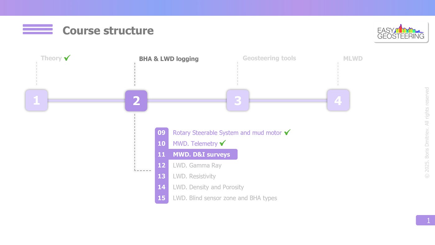
We are currently in the second part of the course — BHA components and in the previous video, we covered telemetry signal and data density.
And today we will continue with MWD surveys.
Let’s get started!
MWD Surveys
As we mentioned in the first video, MWD survey consists of measured depth, which is tracked on the surface, and INCL and AZIM, which are measured by the downhole tool.
Let’s focus on INCL and AZIM, starting with the survey procedure.
The most common survey frequency is one stand or 20–30 meters MD. However, it can be more frequent, such as every 10 or 15 meters, depending on the survey program for a specific well.
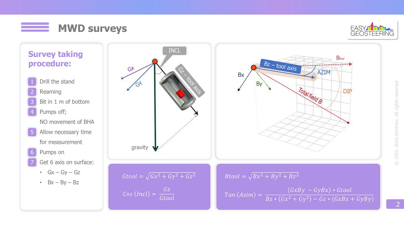
After drilling one stand (or one pipe), we need to perform the reaming procedure.
First, BHA with rotation is moved up and down several times to clean out drilling cuttings from the bottom.
Then, we stop the top drive and move the BHA without rotation to release the spring effect — a phenomenon where the drill string accumulates elastic deformation and then releases it in the form of unpredictable BHA movements at a random moment.
Since the accelerometers require the BHA to remain completely still during taking a survey, this step is critical for survey quality.
Then, we need to position BHA 1 meter from the bottom to reduce the blind zone.
Step number 4 – turn off the pumps. MWD tool measures the bottom pressure, and a pressure decrease signals that it is time to take a survey.
Here, the tool uses accelerometers and magnetometers to obtain six raw axes — Gx, Gy, Gz, and Bx, By, and Bz — which are used for INCL and AZIM calculations.
Then, we need to allow necessary time for the survey measurement. Some tools complete it in a few seconds, while others require about a minute without mud circulation.
After that, we turn the pumps on, and the pressure increase signals that it is time to transmit the six raw axes to the surface where software will calculate INCL and AZIM based on them.
So, every time when we turn off the pumps and then turn them on, MWD tool will send us the survey data.
After that, the tool will continue transmitting client curves until the next time the pumps are turned off.
Ok, we have covered the survey procedure and now let’s dive deeper into the six raw axes.
The DNI sensor of MWD tool has three mutually perpendicular accelerometers and three mutually perpendicular magnetometers. Let’s start with INCL measurement.
One accelerometer coincides with the tool axis, while the other two lie in the plane perpendicular to it. In our example, the axis vector is Gz, but in other cases, it can vary.
So the basis for INCL measurement is the Earth’s gravity field.
In space, the gravity vector is uniquely decomposed into three vectors, giving us three values — Gx, Gy, and Gz. The value of Gtool is then calculated as the square root of the sum of the squares.
After that we can calculate cosine of INCL as the ratio of Gz to Gtool.
All these formulas are contained in the software, and all calculations are performed automatically.
We just need to understand that INCL depends solely on the three accelerometer vectors, and this measurement is relatively precise since only one correction may be applied, such as SAG — correction for tool bending.
Ok, with AZIM, we have a more complicated situation because the basis for measurement is the Earth magnetic field with a more complex structure. While the gravity vector is always directed downward, the magnetic field resembles the shape of toroid.
At a given point, the magnetic field is described by two components: B total or magnetic vector itself, and DIP angle or the angle in the vertical plane between B total and its horizontal projection. Please don’t confuse it with the formation dip.
Actually AZIM is the angle in the horizontal plane between Bz axis and the horizontal projection of B total.
Determining AZIM requires complex trigonometric formulas. However, you don’t need to memorize them — just note that AZIM depends on all six raw axes.
And this is the first reason why AZIM measurement is not as precise as INCL — the more inputs, the lower the accuracy.
The second point is that many factors affect AZIM — BHA interference, solar activity, magnetic rocks, magnetic drilling mud, nearby wells with metal casing, and so on. Some of these can be modeled and corrected, such as BHA interference and solar activity, while others, like magnetic rocks, cannot.
Alright, we have covered MWD surveys, hope you liked this article! Please feel free to leave your thoughts in the comments and don’t forget to follow my profile for upcoming lessons!
메타데이터
- post_id
- ff4fdaed3f52
- slug
- easy-geosteering-11-bha-components-mwd-telemetry-ff4fdaed3f52
- url
- https://medium.com/@bsdmitriev88/easy-geosteering-11-bha-components-mwd-telemetry-ff4fdaed3f52
- canonical_url
- https://medium.com/@bsdmitriev88/easy-geosteering-11-bha-components-mwd-telemetry-ff4fdaed3f52
- author_url
- https://medium.com/@bsdmitriev88
- status
- ok
- fetched_at
- 2026-06-20 20:29:01